Category: Snow/Ice Cover

Things Progressing As Planned; Double Shot Of Snow Love…

It’s great to be back in the good ole weather office and craft a post about the upcoming weather pattern- a pattern that should be pointed out to be progressing along as planned.  Simply put, if you like winter weather, this is the pattern for you.

If you haven’t had a chance to read the posts from the past couple weeks, please be sure to do so as we laid the ground work as to why we were buying a cold, wintry pattern returning:

As we look ahead over the upcoming (7) days we’re tracking two accumulating snow opportunities and one big slug of downright bitter (and dangerously cold) air.

First things first and that’s the snow event ahead Wednesday night into Thursday.

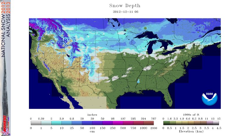
We currently think snow overspreads central Indiana late Wednesday night into the wee morning hours Thursday.  Snowfall accumulations with system numero uno will likely be in the 2-4″ range for many neighborhoods across central Indiana.

The latest high-resolution NAM model shows the snow moving in and becoming moderate to briefly heavy during the wee morning hours Thursday:

hires_ref_indy_35


Heaviest snow with system #1 falls prior to noon Thursday with light snow and gusty winds lingering for the PM.

That said, we don’t have much down time as system #2 is set to arrive late Saturday night into the wee morning hours Sunday.  The weather situation is one that features an arctic boundary sinking south over the region Sunday morning with a wave of low pressure organizing along the middle Mississippi River Valley. The surface low is expected to move northeast Sunday and help spread precipitation into the greater Indianapolis and central Indiana region. With cold air in place, this precipitation is likely to fall in the form of snow.

While we have a couple of days to keep an eye on the Saturday night-Sunday time period, the likelihood of additional accumulating snow is growing with each and every model run.  The “ridiculously” early call on the Saturday night-Sunday time period, based on a variety of raw numbers, medium range models, and ensembles would suggest 3-6″ of additional snow is ahead during the aforementioned time period.  Again, we caution confidence ins’t as high as with system #1, due to the time period, but please be sure to stay tuned.

The GFS shows widespread snow falling across the region Sunday, with a favorable surface low track for accumulating snow across central Indiana:

gfs_ptype_slp_east_20


Following the second snow system, model data continues to suggest we have to deal with some downright dangerous air. In fact, this would be the coldest air in many a year across central Indiana and many other locations of the Mid West and even into the Deep South.  Forecast lows in the double digit below zero range are possible following the second snow maker and associated arctic front early next week….

Needless to say, I hope you like winter weather!

Permanent link to this article: https://indywx.com/things-progressing-as-planned-double-shot-of-snow-love/

Thursday Morning Weather Rambles

As always, your latest 7-Day Video Forecast can be found to the right in the video player.   1.) A milder southerly air flow allowed us to remain above freezing…

You must be logged in to view this content. Click Here to become a member of IndyWX.com for full access.  Already a member of IndyWx.com All-Access?  Log-in here.

Permanent link to this article: https://indywx.com/thursday-morning-weather-rambles/

A Lot Of Weather To Talk About…

Mother Nature seems determined to put us weather forecasters to hard work as we get set to head into the Christmas season and welcome in 2014.  We’re tracking a major flood situation that will unfold across central Indiana over the upcoming weekend, followed by a reload of the cold and potentially a storm with a more wintry component as we get closer to the New Year.

First things first and that’s the significant flood threat in the short-term period.  Without trying to go into scare tactic mode, current model data would result in a downright dangerous flooding event for many low lying and flood prone areas this weekend.  Rainfall numbers are extremely impressive with this event and with a deep tropical connection, widespread 3-4″ totals are certainly likely, including some localized higher amounts.  Note the latest European chart, courtesy of the model suite off Weatherbell Analytics.  Needless to say, the Gulf of Mexico is officially “open for business” and will help contribute to excessive rainfall totals and, as stated above, potentially a dangerous flooding event this weekend across central Indiana.

ecmwf_uvz850_noram_16

Latest numbers averaged off a variety of computer models would place just under 4″ of rainfall down by noon Sunday, most of which falls between Friday and Sunday morning.  We note (2) waves of enhanced rainfall intensity set to impact the region.  As of now we’re targeting Saturday afternoon and again late Saturday night/ Sunday morning for extremely heavy rain, shown below.

ecmwf_slp_precip_mc_14ecmwf_slp_precip_mc_17

We still have time to watch the data and monitor the track of the storm.  It’s possible the “heaviest of the heavy” axis of rain shifts somewhat in the days ahead,  but it’s also important to note that even a light to moderate rain event combined with a frozen ground and a solid snow pack still in place will lead to flooding problems here across central Indiana.  The question of whether or not we’ll deal with flooding here this weekend shouldn’t be asked, but instead the question that remains is just how severe will the flooding be?  Stay tuned and if you live or work in a flood prone area, we would recommend preparing now for flooding.

Now, as we look ahead and focus on the Christmas to New Years period our thoughts will shift from a flood threat in the near term to one that’s more wintry.  We’ll turn dramatically colder Sunday afternoon behind the big rain storm and that will set the stage for a colder-than-average run up to Christmas. In fact, latest raw numbers off some forecast model guidance has some frigid readings ahead next week (upper single digits not ruled out for lows).

The upcoming 10 days off the European forecast model charts show an interesting scenario with the coming thaw, but the key word is brief.  Note days 6-10 are back into a colder-than-normal regime.

tavg_anom_ecmwf_conus_1

Additionally, we think we’ll have to deal with another storm prior to the New Year period and with the colder air back in place, there’s the threat we could have to contend with a wintry side to the next storm.  The details with storm number two will have to wait until we finish dealing with the first storm and associated serious flood threat it’s presenting.

Permanent link to this article: https://indywx.com/a-lot-of-weather-to-talk-about/

What A Difference A Year Makes!

Our colder than normal pattern has really been in place since mid October.  Looking ahead, despite some potential brief “relaxation” from the cold a few days next week, the mid to long range pattern continues to look colder than normal.  Here’s a look at December so far, temperature-wise.  Note the presence of the southeast ridge keeping that particular portion of the lower 48 warmer than normal, so far.  Everywhere else, the freezer door has been left open!

4

What a difference a year makes, snow-wise, as well!  Here’s a look at the snow cover on this date last year compared to present.  Amazingly, this year, nearly 64% of the country is snow covered compared to 31% on this date last year.

The combination of more than normal snow and colder air for the majority of the country can be traced back to the expanding snow pack across Canada earlier this fall.  Now, the cold and snow are essentially in “feed back” mode with one another, as the overall pattern ahead is one that’s plenty cold…and snowy.

21

Permanent link to this article: https://indywx.com/what-a-difference-a-year-makes/

Data Suggests Cold Pattern Keeps On Keepin’ On…

As we approach the all-important holiday travel season, I thought it would be nice to review what some of the data suggests in the long range sense.  While nothing is “set in stone” talking about weather 2-3 weeks out, we feel pretty confident in the overall idea of a colder than normal pattern and one that’s also potentially wintry- from a precipitation perspective.  The specifics with each storm will have to be handled as they come.

Let’s look at some of the data.  BTW, I want to give full credit to the awesome model suite that can be found at Weatherbell Analytics for some of these images.  Be sure to check them out at weather bell.com.

First, we’ll take a look at the Canadian ensembles, centered on the 8-16 day period.  Note the tongue of cold coming out of western Canada, extending southeast and encompassing the Ohio Valley region.  Folks, this is significant cold forecast off the Canadian ensembles as temperatures are suggested to average 5-7 degrees (C) below normal.

can_t2m_mean_conus_d8_16


The latest GFS ensembles also suggest widespread colder than normal temperatures over the upcoming couple weeks.  Similar to the Canadian (above), the GFS suggests temperatures average 5-7 degrees celsius below normal.

gefs_t2m_mean_noram_d0_16


Latest European ensemble data suggests a cold look as well, but one that also may feature a day or two above normal (over the next couple weeks). The latest ensemble control run highlights the threat of some bitterly cold arctic air plunging south towards the second week of December (posted below).  We’ll continue to monitor this in the days to come.

eps_t850a_c_nh_57


Here’s a look at the latest CFSv2. While it’s in stark contrast to only a couple of weeks ago (in its December forecast), the model is now onboard with most other data in forecasting a colder than normal December for our region.

CFSv2.NaT2m.20131124.201312


It has to be pointed out that all of the cold data is forecast during a time where the three “major” teleconnections really aren’t in the most ideal spots for eastern cold.  Typically, cold lovers across the eastern United States want a negative AO and NAO with a positive PNA. The NAO and AO are forecast to be very “sporadic” over the course of the upcoming 7-10 days while the PNA is forecast to go back negative.  That said, the NAO has the biggest influence on our weather from January through March (we’ve covered this in posts in the archives).  The expansive early season snow and ice pack through western Canada is having it’s say with a couple of early season “brutal” cold shots here (it’s very rare to get this kind of cold so early in the season).  We’ll continue to monitor these teleconnections moving forward for any sort of a more defined signal that may begin to come to fruition.

Speaking of snow and ice cover; look at how much more territory across the Lower 48 is covered with snow and ice compared to this date (November 24th) last year.  Impressive, huh?

November 24, 2012 (11.8% covered in snow)

nsm_depth_2012112405_National

November 24, 2013 (37.8% covered in snow)

nsm_depth_2013112405_National

As we look closer at the near term, there’s a chance of some light snow moving in Monday evening (not a huge deal, but some light accumulations of a dusting to half an inch are possible).  Scattered snow showers will also blow into central Indiana Wednesday as a reinforcing shot of fresh arctic air blows in prior to Thanksgiving.

In the mid range, both the GFS and European ensembles (below) suggest an “intriguing” look for the first 10 days of December for the potential of a more widespread winter weather maker.  It’s far too early for details, but with arctic air being supplied into a pattern that looks to have a southern branch beginning to flex it’s muscle, we’ll have to remain on our toes as we go into December…  Here’s wishing you a very happy and healthy Thanksgiving, complete with safe travels!

Geopotential32at32500hPa_North32America_240gefs_z500anom_nh_65

Permanent link to this article: https://indywx.com/data-suggests-cold-pattern-keeps-on-keepin-on/