Category: Snow/Ice Cover

Buckle In…

Updated 02.05.21 @ 7:18a

Where to begin?! Simply put, the pattern over the next 2 weeks is a winter weather lover’s dream setup. Does that mean central Indiana has to “cash in” on every event? Negative. In fact, by next weekend, we believe the Deep South will even get in on the wintry fun (outside of the higher elevations that have been doing quite well this year). That said, systems will be targeting our general area fast and furious and require us to remain on our toes. Given that a more prolonged period of cold is developing, we should be able to build a nice snowpack for outdoor winter enthusiasts over the next 7-14 days.

The setup is all thanks to a persistent negative to deeply negative AO and the associated high latitude blocking. The Pacific pattern is also changing to allow more meaningful cold (truly arctic air is getting involved in the pattern) into the East with staying power. We can thank the now negative EPO for that. That leads us to the PNA. A negative to even neutral PNA will continue to put resistance on the pattern and result in southern ridging at times. That’s especially true early on in this regime. That puts the Ohio Valley in the cross hairs of these systems. As the arctic air takes hold, I still believe eventually we’ll see a more suppressed storm track for a time but that likely doesn’t develop until late next week. Before that, we have multiple storms to track and a snowpack to build. 🙂

First up is an arctic wave that arrives Saturday evening. This is a system that should deposit 1” to 3” of snow, mainly from Indianapolis and points north (dusting up to 1” across the southern half of the state). This will be a fast moving system that will arrive around 5p across western parts of the state and will be out of here during the predawn hours Sunday.

Temperatures will crash Sunday morning into the single digits and highs will likely only climb into the middle teens. Good thing there’s a Super Bowl to focus on.

Additional upper level energy will result in light snow moving back in here Monday afternoon and night. With cold, arctic air in place, this system should be able to squeeze out an additional dusting to inch of snow (even as weak as it is).

That leads us to Tuesday night and Wednesday. A surface wave is expected to develop in the Ark-la-tex region and lift northeast. This will be a “juicier” event and result in widespread wintry precipitation across the state. Early thinking here is that across central and northern parts of the state, this will be mainly a snow event. Southern portions of the state may mix with sleet and/ or freezing rain. While we can’t throw out numbers this early, where it stays all snow, several inches seem likely.

If that’s not enough, more “fun and games” are dialed up with yet another system next Thursday and Friday. This, too, could be a meaningful winter event, locally, and will require close attention moving forward.

From a temperature perspective, it continues to look like a case of “delayed but not denied” on the topic of truly dangerous arctic air. As the pattern evolves and a snowpack is established, the concern here is that we’re looking at a period of severe cold (double digit below zero temperatures and wind chill values exceeding 20° below zero) by late next week/ next weekend.

More later today! Have a great Friday, friends!

Permanent link to this article: https://indywx.com/2021/02/05/buckle-in/

VIDEO: Timing Out Additional Heavy Rain; A Busy Pattern Will Take Us Into November…

You must be logged in to view this content. Click Here to become a member of IndyWX.com for full access.  Already a member of IndyWx.com All-Access?  Log-in here.

Permanent link to this article: https://indywx.com/2020/10/19/video-timing-out-additional-heavy-rain-a-busy-pattern-will-take-us-into-november/

Icy Concerns Grow Again Tonight…

After a night of freezing rain, many roadways throughout central IN remain glazed over and hazardous as of this update.  If you absolutely don’t have to travel today, please don’t.  Allow road crews to do their job.  Additionally, we have growing concerns of a new round of freezing rain to sleet and eventually snow tonight.  Lingering moisture on roadways will result in “flash freeze” conditions and treacherous travel tonight into Sunday.

First, a tip of the hat to short-term modeling, including the NAM, for suggesting we’d have a very difficult time eroding the shallow arctic air at the surface across most of central IN today.  While we never bought into the mid/ upper 50s idea the GFS and Euro were once suggesting, we did initially think 40s were in store today.  Forget about it.  Mid to potentially upper 30s are the best we can do today and temperatures will crash this evening as not one, but two, arctic fronts push through central IN.  Even if we didn’t have additional precipitation inbound tonight, “flash freeze” conditions would develop from lingering moisture and lead to renewed problems on area roadways.  Throw in another wave of low pressure riding along the pressing arctic front and a whole slew of problems will develop yet again from a freezing and frozen precipitation perspective.

Note the incredible temperature gradient from downstate to central and northern Indiana early this afternoon.

hrrr_t2m_indy_6The heavy, dense, arctic air will win out as evening turns into nighttime.  Indianapolis is back to the freezing mark around 6p and into the 20s by 9p.

hrrr_t2m_indy_10

hrrr_t2m_indy_13Temperatures will continue to fall through the day Sunday and by Monday morning central Indiana will be in the single digits, with below zero readings across northern parts of the state.

hires_t2m_indy_49Wind chill values of 10 to 20 degrees below zero will be common by Sunday night into Monday morning across central Indiana.

gfs_windchill_indy_8Areas of drizzle and freezing drizzle will continue across the region into the early afternoon, but begin to expand in coverage and intensity once again by evening.  Note the area of freezing rain expand across central IN, including Indianapolis, between 4p and 7p.

4p

6p

7pFreezing rain will eventually begin to mix with sleet and eventually transition to light snow during the overnight from northwest to southeast.  A coating of snow to less than 1″ is a good bet on the new icy glaze that develops tonight.

When you factor in the current hazardous conditions in place along with the fresh push of arctic air and precipitation tonight, it’s a good idea to hunker down inside and remain off area roadways.  We have big concerns of new travel problems developing by evening across central Indiana.  By this time tomorrow, our attention will turn to the bitterly cold air and dangerous wind chill values developing.

More later, including prospects of snow around Christmas.  As always, you can follow our updates on social media by following us on Twitter (@indywx) and Facebook.  Stay safe!


Permanent link to this article: https://indywx.com/2016/12/17/icy-concerns-grow-again-tonight/

Frigid Start; Looking Ahead To Thanksgiving…

Screen Shot 2015-11-22 at 9.27.08 AMHighlights:

  • Arctic air begins to moderate
  • Next storm system arrives late Thanksgiving
  • Another punch of cold air next weekend

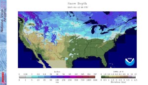
Before we discuss what lies ahead, let’s look back at yesterday’s snow event that “overachieved” for many.  Particularly just northwest of the city where 2″-4″ fell.  Snowfall rates were heavy enough to overcome the initially warm surface temperatures, and it was very impressive to see the way the snow accumulated considering this was a November event that took place from late morning into the early afternoon (when the sun angle does the majority of it’s work).  This was an impressive first snow of the season and this morning’s snowpack is widespread throughout the Mid West.

nsm_depth_2015112205_MidwestThe visible satellite this morning shows the snow cover across the central and northern portions of the state, where single digits and teens were common.

SnowpackThe next few days will feature dry and cold conditions.  While we’ll remain below average, temperatures will slowly begin to moderate from the arctic intrusion of today.

We’ll get into a SW (milder air flow) regime for a brief period of time Thanksgiving Day out ahead of our next storm system that will move in Thanksgiving Night and Black Friday.  Clouds will increase and moisture will spread into the region during the aforementioned time period.  Most of the rain will fall Friday, so plan on taking the rain gear with you as you venture out to begin that Christmas shopping.

Thanksgiving

BlackFridayMuch colder air will pour into the region Thanksgiving weekend and we’ll have to maintain a close eye on the evolution of things late next weekend into early December.  Models will continue to waiver on specific solutions over the next few days, but there will be an attempt of a southern stream storm system coming out and “attacking” the cold air in place…

Permanent link to this article: https://indywx.com/2015/11/22/frigid-start-looking-ahead-to-thanksgiving/

Looking Ahead…

January is off to a colder than average start across a large portion of the country, including the Hoosier state:
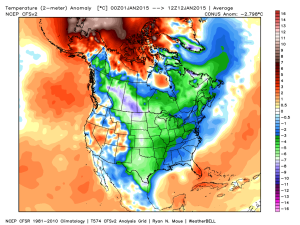
ncep_cfsr_noram_t2m_anomThe snow and ice pack has expanded over the past couple of weeks in rather significant fashion:

nsm_depth_2015011205_National

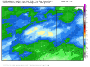
Two storm systems have offered up busy times over the Ohio Valley the past week. Note liquid equivalent numbers the past (7) days- most significant over central Indiana.  Most of this has been in the form of wintry precipitation (snow and ice).

nws_precip_indy_7

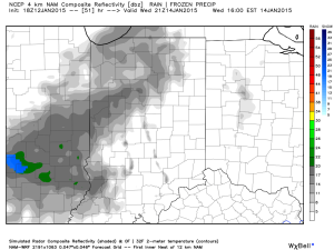
A weak weather system may offer up light snow chances mid week.  The high resolution NAM and European print off light snow while other models “see” us mainly dry mid week.

hires_ref_indy_52

The other big story in the short term will be more bitterly cold arctic air (single digits tonight and close to zero Wednesday morning).

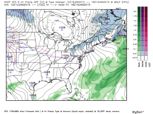
While we’ll certainly “warm” compared to the freezer we’ve been in the first two weeks of January, sneaky arctic highs remain on the field and will put a dent in the air masses from reaching unseasonably mild levels for any length of time this weekend and Week 2.  See Friday’s GFS output and the sneaky arctic high north:

gfs_ptype_slp_east_18

The next significant storm system brews around the 20th (give or take a day, or two) and could offer up rain or a more wintry option.  Keep a close eye on the period 01.20 – 01.23.

Thereafter, the arctic hounds likely come calling again as the period quickly returns to “lock and load” cold late January into February.  The European and GFS ensembles both show a rebuilding blocking AK ridge and suggest arctic air floods the country yet again as cross-polar flow gets involved:

GFSensembleslateJan

It’s all part of a package that should be the beginning of a colder than average and stormy mid and late winter stretch.  Sea surface temperature anomalies are a textbook setup for a very wintry time of things for our neck of the woods.  Note the Modoki El Nino and warm waters sitting off the PAC NW- both cold/ stormy indicators here:

SSTLateWinterSetUp

Permanent link to this article: https://indywx.com/2015/01/12/looking-ahead/

Wintry Sandwich Sunday Evening-Monday; More Bitter Cold Follows.

Busy times continue in the good ole weather office as we get set to deal with yet another winter storm during the upcoming weekend.

First, we’ll deal with more below zero temperatures tonight and Saturday morning as overnight lows bottom out between 5 and 10 degrees below zero tonight area-wide.  Wind chill values, of course, will be even colder (-15 to -25).  Dangerous cold continues with considerable blowing and drifting in the open country.  Saturday will be the “calm before the storm” with unseasonably cold conditions continuing, but with lighter winds and sunshine.

Clouds will increase Saturday night into Sunday and we’ll begin to introduce precipitation into your forecast as early as Sunday afternoon (not a bad day for two classic back-to-back playoff games if you ask me).  Here’s our best idea of what you can expect statewide after reviewing all guidance today:

011115event


Some initial thinking would place the following numbers (a bit early to be too specific), and we caution this will have to be fine tuned as we move forward.

Snow accumulation of 2″-4″ across north-central Indiana, particularly just north of Indianapolis.  In the “mainly snow” zone, expect amounts of 3″-6″.  Ice storm criteria accumulation of freezing rain is possible (0.25″, or greater) across central Indiana, as well.  South of the city, early ideas suggest roughly 1″-2″ of snow and glaze potential closer to that potentially damaging 0.25″ amount.  Again, we state that these numbers are very early ideas and will have to be fine tuned.

Precipitation should initially overspread central Indiana Sunday afternoon in the form of sleet and snow (more sleet south-central, more snow north-central) before transitioning to more of a sleet and freezing rain event.  Finally, we anticipate the wintry mixture of precipitation to end as snow before moving out Monday morning.  Timing and duration of precipitation types will obviously determine how much ice and snow a given location sees.

Another big item we want to be sure to mention is that yet ANOTHER push of bitter arctic air will invade behind this storm and set the stage for another dangerously cold period Tuesday into Wednesday (back below zero we go)!

Stay tuned as we continue to fine tune the forecast over the weekend!

Permanent link to this article: https://indywx.com/2015/01/09/wintry-sandwich-sunday-evening-monday/

Catching Up On Where We’ve Been And What Lies Ahead…

January is off to a frigid start. After a mild December, January is certainly reminding folks that there’s a lot of winter in this pattern. Precipitation is running above normal…

You must be logged in to view this content. Click Here to become a member of IndyWX.com for full access.  Already a member of IndyWx.com All-Access?  Log-in here.

Permanent link to this article: https://indywx.com/2015/01/09/catching-up-on-where-weve-been-and-what-lies-ahead/

Tracking A Late Weekend Winter Storm

Wed.

Thr.

Fri.

Sat.

Sun.

Mon.

Tue.

 Status-weather-clouds-icon

 Status-weather-clouds-icon

 Status-weather-snow-scattered-day-icon

 Status-weather-snow-scattered-day-icon

 Status-weather-snow-scattered-icon

 Status-weather-snow-scattered-day-icon

 Status-weather-snow-scattered-day-icon

5/ 18

8/ 14

2/ 23

22/ 37

20/ 30

10/ 20

5/ 18 

– – –

– – –

Light

Light

Heavy

Light

Light

Forecast Updated 02.26.14 @ 7:43a

Frigid Midweek…A brutally cold air mass is blowing into the region this morning, especially considering we’re nearly into March!  This is laying the groundwork for a snowy weekend, but we’ll get to that in a bit.  Forecast highs average at 44 degrees this time of the year and today’s high will be lucky to reach 18.  EVEN COLDER air blows in late tonight into early Thursday and will result in continued dangerous below zero wind chill values.  Needless to say, plan to bundle up upon heading outdoors.  While the calendar may suggest spring is near, Mother Nature and Old Man Winter have other ideas.

Late Week Light Snow…A warm front will lift north through the region Saturday morning and will be responsible for producing a round of light snow Friday night into Saturday AM.  As of now, early numbers suggest around an inch of snow is possible, but we’ll continue to monitor things and update as needed.

Late Weekend Winter Storm…While details are still far from etched in stone, there’s no doubt behind a significant winter storm brewing for the second half of the weekend.  This storm will have significant snow for portions of central Indiana and significant icing potential for others.  As of now, we anticipate air cold enough to support frozen, or freezing, precipitation across our immediate viewing area of central Indiana.  All of that said, we caution that the track and intensity of the storm will likely change between now and Sunday and we’ll continue to keep close tabs on this event.  Early numbers are impressive as far as precipitation goes with liquid equivalent amounts around 1″ churned out, on average, from a variety of computers models.

Arctic Air Reloads…We may be into meteorological spring next week, but Old Man Winter continues his relentless ways that we’ve grown so accustomed to over the past several months. Fresh arctic air will plunge into central Indiana’s potentially snow packed ground early next week and could ultimately help yield below zero air by the middle of next week.  What an impressive winter.

Upcoming 7-Day Precipitation Forecast

  • 7-Day Snowfall Forecast: 4-8″
  • 7-Day Rainfall Forecast: 0.00″

twic

For weather updates and more “behind the scenes” data on the go, be sure to Follow Us on Twitter @indywx or become a Friend of IndyWx.com on Facebook!

images

Permanent link to this article: https://indywx.com/2014/02/25/tracking-a-late-weekend-winter-storm/

Sunday Afternoon Thoughts…

1.) A scan over the latest data continues to point towards an absolute mess of a Monday afternoon.  Our accumulation ideas remain relatively unchanged from this morning’s update, aside from “beefing” expected snow totals for Indy’s northern ‘burbs by 1″.  Most of this falls from noon to 6pm and will be followed by a dry, cold, and blustery Monday night.  After likely a white-nuckle evening commute Monday, the combination of sub-freezing temperatures and gusty northwest winds Monday night will likely lead to another rough commute for Tuesday morning.

** We caution that this will be another “now cast” situation when it comes to precipitation types and their respected precise zones tomorrow afternoon.  Stay tuned here or to your favorite local weather media for updates and potential changes.**

  • Indianapolis northern ‘burbs, including Zionsville: 2-4″ snow and sleet with less than 0.10 of freezing rain.
  • Indianapolis proper: 2″ snow and sleet with around 0.10 of freezing rain
  • Indianapolis southern ‘burbs, including Greenwood: 1″ snow and sleet with up to 0.25 freezing rain.

Snow:IceForecast021714

2.) We continue to monitor what will be a brief thaw and associated flood risk mid week.  Even without rain, water rise would occur and urban flooding from the combination of melting snow and blocked (from all of the snow) drainage zones.  When you add 0.50-1″ of rain atop the melting then problems could arise Wednesday into Thursday.  Additionally, we’ll need to prepare for the likelihood of dense fog Wednesday as milder air surges north over a deep snow pack.

3.) For anyone thinking spring is setting in during our mid week thaw will need to think again. Latest model data continues to suggest we reverse things quickly later this week and for the upcoming weekend.  In fact, some model data, including the European, suggests central Indiana is under the gun for a weekend winter storm.  We’ll continue to monitor closely…

021614ECSatWinterStorm022214

4.)  Additionally, prospects continue to grow for another extended period of well below normal cold and renewed wintry precipitation chances in the long term (into March).  Both the GFS and European models are in agreement on the mid to long range pattern with a trough settling back into the eastern half of the country.

02161412zGFSEC

Permanent link to this article: https://indywx.com/2014/02/16/sunday-afternoon-thoughts/

Cold Today; Messy Monday Ahead.

Sun.

Mon.

Tue.

Wed.

Thr.

Fri.

Sat.

 Status-weather-clouds-icon

 Status-weather-freezing-rain-icon

 Status-weather-clouds-icon

 images

 Status-weather-storm-night-icon

 Status-weather-clouds-icon

 images

16/ 25

15/ 33

20/ 39

24/ 42

35/ 57

28/ 45

28/ 50 

0.00”

1-3″ (and ice)

0.00”

Trace

0.50″-1.00″

0.00″

0.00”

Forecast Updated 02.16.14 @ 11:15a

Cold Sunday…Fresh off celebrating our snowiest winter on record (surpassed last night at IND at 51.6″ and the Record Event Report can be found here), we’ll enjoy a dry day, but blowing and drifting snow will remain an issue in the open country. A few breaks in the cloud cover can be expected this afternoon on what will otherwise be a rather cloudy day.  Highs will only climb into the lower to middle 20s (well below the average high of 40 and closer to the normal low of 24).  Yes, our cold, snowy winter just keeps on keepin’ on!

Snow And Ice Issues Monday…A storm system will move through the region Monday and deliver a mixture of precipitation types across central Indiana.  The way we see things unfolding as of this forecast update brings a wintry mix of sleet and snow into the city around noon with periods of moderate to even heavy wintry precipitation falling into the mid to late afternoon hours before we begin to see the shield of moisture push northeast.  This will be a “thump and go” type event.

As for precipitation type, this remains a challenge and will require much fine tuning later tonight and through the day tomorrow (another now cast scenario).  We’re thinking mostly snow is the dominant form of precipitation from the northern suburbs of Indianapolis and points north.  Here, 2-3″ of wet snow is possible, polished off with a light glaze of a freezing rain/sleet mixture before precipitation ends.  For the city, itself, we think around 1-2″ of snow is possible with a glaze of freezing rain of around a tenth of an inch. Farther south, to include the southern Indianapolis suburbs, an icy mixture of sleet and freezing rain will be the concern with glaze potential approaching one quarter inch.  Again, we caution this is our best idea at this point and we’ll post some fresh thoughts later this evening.

Needless to say, tomorrow stands to include treacherous driving conditions in and around central Indiana and the National Weather Service will likely issue Winter Weather/ Freezing Rain Advisories later this afternoon to account for the wintry conditions anticipated tomorrow afternoon.

Flooding Concerns On The Rise…With such a deep snowpack across central Indiana, combined with a frozen ground, flooding concerns will be on the rise as early as the middle to latter part of the week.  We think dry and chilly (albeit milder) conditions will be with us Tuesday, but low clouds, fog, and drizzle likely develop by Wednesday as milder air streams north over the snowpack locked in across the region.

By Thursday, our attention turns to the potential of heavy rain and a couple of thunderstorms as a cold front blows through the region.  Early ideas of Thursday rainfall numbers would suggest anywhere from .50-1″ of rain is laid down and when combined with the heavy snow pack and milder air, flooding concerns will certainly be present.  Needless to say, if you live in a flood prone area, please monitor the situation closely later this week.

Winter Blows Back In…As promised, the briefly milder shot of air would be just that- brief.  We continue to monitor data that suggests a colder, more wintry, pattern blows right back into the region to wrap up February.

twic

For weather updates and more “behind the scenes” data on the go, be sure to Follow Us on Twitter @indywx or become a Friend of IndyWx.com on Facebook!

images

Permanent link to this article: https://indywx.com/2014/02/16/cold-today-messy-monday-ahead/

IndyWx.com