Category: snow

Clouds Today; Snow Showers For The Big Travel Day

Good morning and happy Tuesday, Hoosiers!  Yesterday’s forecast went as planned with most folks not receiving any snowfall accumulation and a couple reports of a dusting to half an inch type snow.  We saw a couple local weather sources forecasting 1″ of snow and never understood that call as a lot of dry air had to be overcome initially.

Today will feature lots of clouds and another cold day as we watch a big southern storm begin to “make the curve” and impact the interior east.  Places as close as eastern Ohio will deal with heavy snow tonight and early Wednesday.  Additionally, locations as far south as east Tennessee will have accumulating snow by late tonight and early Wednesday.

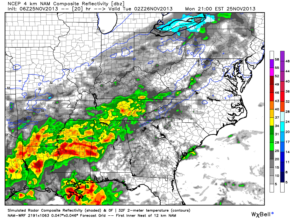
Back here on the “home front” we’re looking at our next chance of snow arriving Wednesday afternoon.  The wind trajectory off Lake Michigan should allow a couple of lake-enhanced snow bands to push south into north-central Indiana, primarily from IND and points north.  It’s impossible to pinpoint with any degree of certainty the precise locations of these snow bands, but should your neighborhood end up under one of these snow squalls, don’t be surprised if you pick up a quick coating to 1″ of snow Wednesday afternoon/ evening.

Most model data (below) shows the lake-enhanced snow showers and embedded heavier squalls arriving Wednesday afternoon.  We’ll have a complete forecast update (and probable video) here later tonight.  Make it a great day.

hires_ref_indy_30snow1snow2

Permanent link to this article: https://indywx.com/2013/11/26/clouds-today-snow-showers-for-the-big-travel-day/

Snow Talk

Good morning!  Some light snow is possible later this afternoon and tonight, but “light” is the key word and this shouldn’t amount to much, if any, accumulation across the majority of central Indiana. At most, we’re looking at a few communities that may see a dusting to half an inch type accumulation.  The latest high resolution data shows that we’re on the northern periphery of the storm system that will create all sorts of travel problems for our neighbors to our east and south in the days to come leading up to Thanksgiving.

hires_ref_ky_21

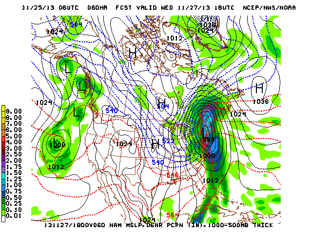
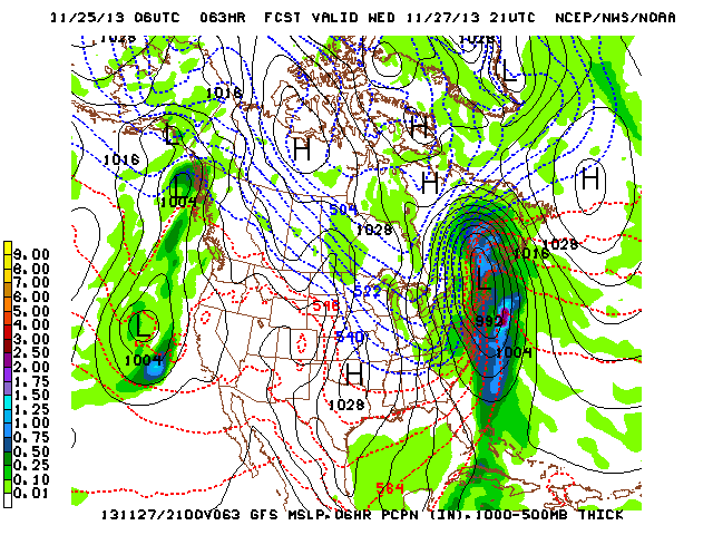
Additionally, we’ll keep a close eye on the wind trajectory coming off Lake Michigan Wednesday. It’s looking more and more likely that we’ll have to deal with some lake-enhanced snow showers and embedded heavier squalls here Wednesday as fresh arctic air pours south.  While we’re not expecting any sort of widespread, uniform, accumulation with this, the idea is that a few places (primarily from IND and points north) may see a quick coating to 1″ of snow Wednesday as some of these snow showers and locally heavier (but isolated) squalls drift south into north-central Indiana.  The latest GFS and NAM show the lake Michigan connection well and we’ll keep a close eye on the wind trajectory Wednesday.

nam_namer_060_1000_500_thick_sgfs_namer_063_1000_500_thick_s

Permanent link to this article: https://indywx.com/2013/11/25/snow-talk/

Data Suggests Cold Pattern Keeps On Keepin’ On…

As we approach the all-important holiday travel season, I thought it would be nice to review what some of the data suggests in the long range sense.  While nothing is “set in stone” talking about weather 2-3 weeks out, we feel pretty confident in the overall idea of a colder than normal pattern and one that’s also potentially wintry- from a precipitation perspective.  The specifics with each storm will have to be handled as they come.

Let’s look at some of the data.  BTW, I want to give full credit to the awesome model suite that can be found at Weatherbell Analytics for some of these images.  Be sure to check them out at weather bell.com.

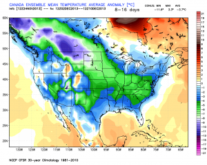
First, we’ll take a look at the Canadian ensembles, centered on the 8-16 day period.  Note the tongue of cold coming out of western Canada, extending southeast and encompassing the Ohio Valley region.  Folks, this is significant cold forecast off the Canadian ensembles as temperatures are suggested to average 5-7 degrees (C) below normal.

can_t2m_mean_conus_d8_16


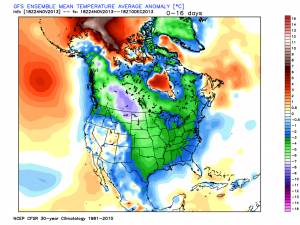
The latest GFS ensembles also suggest widespread colder than normal temperatures over the upcoming couple weeks.  Similar to the Canadian (above), the GFS suggests temperatures average 5-7 degrees celsius below normal.

gefs_t2m_mean_noram_d0_16


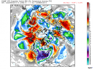
Latest European ensemble data suggests a cold look as well, but one that also may feature a day or two above normal (over the next couple weeks). The latest ensemble control run highlights the threat of some bitterly cold arctic air plunging south towards the second week of December (posted below).  We’ll continue to monitor this in the days to come.

eps_t850a_c_nh_57


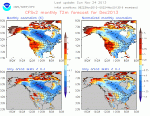
Here’s a look at the latest CFSv2. While it’s in stark contrast to only a couple of weeks ago (in its December forecast), the model is now onboard with most other data in forecasting a colder than normal December for our region.

CFSv2.NaT2m.20131124.201312


It has to be pointed out that all of the cold data is forecast during a time where the three “major” teleconnections really aren’t in the most ideal spots for eastern cold.  Typically, cold lovers across the eastern United States want a negative AO and NAO with a positive PNA. The NAO and AO are forecast to be very “sporadic” over the course of the upcoming 7-10 days while the PNA is forecast to go back negative.  That said, the NAO has the biggest influence on our weather from January through March (we’ve covered this in posts in the archives).  The expansive early season snow and ice pack through western Canada is having it’s say with a couple of early season “brutal” cold shots here (it’s very rare to get this kind of cold so early in the season).  We’ll continue to monitor these teleconnections moving forward for any sort of a more defined signal that may begin to come to fruition.

Speaking of snow and ice cover; look at how much more territory across the Lower 48 is covered with snow and ice compared to this date (November 24th) last year.  Impressive, huh?

November 24, 2012 (11.8% covered in snow)

nsm_depth_2012112405_National

November 24, 2013 (37.8% covered in snow)

nsm_depth_2013112405_National

As we look closer at the near term, there’s a chance of some light snow moving in Monday evening (not a huge deal, but some light accumulations of a dusting to half an inch are possible).  Scattered snow showers will also blow into central Indiana Wednesday as a reinforcing shot of fresh arctic air blows in prior to Thanksgiving.

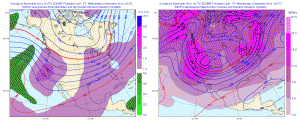
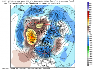
In the mid range, both the GFS and European ensembles (below) suggest an “intriguing” look for the first 10 days of December for the potential of a more widespread winter weather maker.  It’s far too early for details, but with arctic air being supplied into a pattern that looks to have a southern branch beginning to flex it’s muscle, we’ll have to remain on our toes as we go into December…  Here’s wishing you a very happy and healthy Thanksgiving, complete with safe travels!

Geopotential32at32500hPa_North32America_240gefs_z500anom_nh_65

Permanent link to this article: https://indywx.com/2013/11/24/data-suggests-cold-pattern-keeps-on-keepin-on/

A Closer Look At Thanksgiving Week

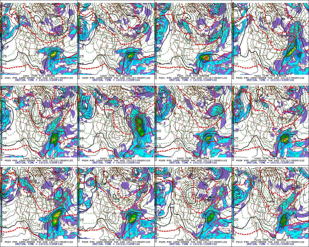
Today’s model data continues the theme of a southern and eastern storm for the days surrounding Thanksgiving.  We’ll continue to monitor for any potential shift northwest, but as of now, the trend remains for a “suppressed” storm track.  Here’s a look at the individual GFS ensemble members, off today’s 12z run.  Taken at face value, 3 out of 10 members show some light snow in the air.

f132

For now, the big story still appears to be the unseasonably cold air around for Thanksgiving.  The ECMWF, Canadian, and American models (GFS and NAM) continue to hammer home the idea of a frigid Thanksgiving ahead (relative to the time of year, of course).  I’m not convinced we won’t have to deal with some light snow next week at some point, but for now, the bigger story still appears to be  impressive early season cold, and this cold pattern isn’t going away anytime soon.

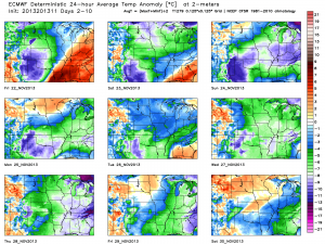
The latest European forecast data illustrates this well.  Note each and every day is well below normal, aside from tomorrow (cold air pushes in tomorrow PM).  This is a snap shot of the average temperature (in degrees C) over the upcoming 10 day period.  The blues, greens, and purples showcase the cold, relative to average.

tavg_anom_ecmwf_mc_1


Permanent link to this article: https://indywx.com/2013/11/21/a-closer-look-at-thanksgiving-week/

Wednesday Evening Video Update: Rain Moving In; Arctic Blast This Weekend

http:/ Tonight’s Video Highlights: We talk rain and amounts for Thursday and Friday. The coldest air of the season and coldest November day in some 13 years is ahead! A…

You must be logged in to view this content. Click Here to become a member of IndyWX.com for full access.  Already a member of IndyWx.com All-Access?  Log-in here.

Permanent link to this article: https://indywx.com/2013/11/20/wednesday-evening-video-update-rain-moving-in-arctic-blast-this-weekend/

Video Update On The Remainder Of This Week And At Some Thanksgiving Week “Wintry Mischief”

http:/

You must be logged in to view this content. Click Here to become a member of IndyWX.com for full access.  Already a member of IndyWx.com All-Access?  Log-in here.

Permanent link to this article: https://indywx.com/2013/11/19/video-update-on-the-remainder-of-this-week-and-at-some-thanksgiving-week-wintry-mischief/

A Closer Look At Tuesday

Hoosiers are awaking to roughly half an inch of snow across the majority of central Indiana. The forecast went as planned overnight and we’ll keep a close eye on the lake effect band of snow hammering the Indiana snow belt.  Short term, high resolution, data (below) suggests snow showers move back into north-central Indiana by late morning/ early afternoon- primarily north of the Indianapolis metro.

hires_ref_indy_14

Otherwise, it’s going to be a cold day with temperatures only rising into the middle 30s. This is much more like December as opposed to mid November and a solid 20 degrees below the average high of 54.

hrrr_t2m_max_indy_13

We have another “fun time” ahead in the mid range and we’ll begin to discuss the next storm potential later tonight.  As you can see, the GFS and ECMWF are in all sorts of disagreement below…

test8

Permanent link to this article: https://indywx.com/2013/11/12/a-closer-look-at-tuesday/

Monday Forecast: Snow Develops By Evening

Updated 11.11.13 @ 8:30a

Zionsville, IN Despite some wind (top wind gusts this weekend reached around 30 MPH) and a chilly Sunday, the weekend was a beautiful one, complete with lots-o-sunshine!  A more active time of things is ahead to kick off the work week.  We discuss below…

Status-weather-snow-scattered-day-iconMonday: Increasing cloudiness with PM rain showers transitioning to light snow (0.50″); 28/ 46

The day will dawn with some sunshine, but clouds will be on the increase and showers won’t be far behind. This is all part of the early season arctic cold front we’ve been talking about.  We think showers (initially rain) arrive into north-central Indiana as early as the early to mid afternoon hours before pushing fairly rapidly south. It’s towards late afternoon/ early evening rain begins to transition to snow. Light snow will continue into the nighttime hours and potentially accumulate to around half an inch across most of central Indiana.

There are a couple of items we’ll have to monitor closely through the overnight and that’s the exact placement of what should be some impressive bands of lake effect snow streaming off Lake Michigan.  While the more significant accumulations, upwards of half a foot for the Indiana snow belt, will remain well north of us, there is the chance a more concentrated band of snow could reach as far south to impact portions of north-central Indiana late Monday night into Tuesday morning and result in accumulations of an inch or two for localized communities. Again, this will have to be handled as a “NowCast” scenario and isn’t set in stone.  If locally heavier snow accumulations do develop with the localized lake enhancement, the majority of this would be north of our immediate coverage area.

Temperatures will plummet Monday night into the lower to middle 20s on a gusty northwest wind.  Needless to say, slick spots could develop on area roadways Monday night.

Status-weather-snow-scattered-day-iconTuesday: Scattered AM snow showers (localized 0.50″); 22/ 35

We’ll keep an eye to area radars Tuesday, particularly in the morning hours as scattered snow showers (potential lake enhanced snow for localized spots) continue.  Conditions will be much more like winter than fall so plan to bundle up. In fact, temperatures will average close to 20 degrees below average for afternoon highs. Any lingering snow showers or flurries will begin to dissipate during the afternoon, paving way for a clear and very cold Tuesday night.

Status-weather-clear-iconWednesday: Sunny; 19/ 42

High pressure will be overhead Wednesday and help supply a day filled with sunshine, although it’ll remain MUCH colder than normal.  We’ll awake to the upper teens followed by highs reaching the lower 40s Wednesday afternoon.

Status-weather-clouds-iconThursday: Partly cloudy; 28/ 49

Temperatures will begin to moderate slowly Thursday as high pressure moves to our east. This will set the stage for a return southwesterly air flow and corresponding milder regime, albeit slowly.  After yet another cold and frosty night, temperatures will make a run at 50 degrees Thursday afternoon.

imagesFriday: Mostly cloudy; 35/ 49

A weak weather system will scoot through the region Friday and lead to an increase in cloud cover. Thinking, at least for now, has the area trying to recover from the cold, dry air mass in place so any sort of precipitation will, most likely, be tough to come by. That said, we’ll continue to monitor to see if we need to introduce a scattered light shower into our Friday forecast.

Status-weather-showers-scattered-iconSaturday: Cloudy with developing light rain; (0.25″) 39/ 52

The early look at next weekend places the region under a southerly flow of air with moisture making a return north, potentially out ahead of a rather significant storm system we’ll have to deal with early next week. The end result will initially be a rather cloudy, gloomy time of things, including developing light rain Saturday.

Permanent link to this article: https://indywx.com/2013/11/10/monday-forecast-snow-develops-this-evening/

Video Update On Snow Accumulation & The Cold

Here’s a quick video update taking a look more closely at the forecast data for accumulating snow ahead Monday evening, as well as the impressive early season shot of cold…

You must be logged in to view this content. Click Here to become a member of IndyWX.com for full access.  Already a member of IndyWx.com All-Access?  Log-in here.

Permanent link to this article: https://indywx.com/2013/11/10/video-updated-on-snow-accumulation-the-cold/

Friday Forecast: Cold Start To The Day!

Updated 11.07.13 @ 10:47p Zionsville, IN Strong northwest winds are howling in the open country this evening and creating downright cold conditions out. Temperatures in the lower 30s are combining…

You must be logged in to view this content. Click Here to become a member of IndyWX.com for full access.  Already a member of IndyWx.com All-Access?  Log-in here.

Permanent link to this article: https://indywx.com/2013/11/07/friday-forecast-cold-start-to-the-day/

IndyWx.com