Client Brief: Conditions Deteriorate By Late Afternoon…
Type: Impactful Wintry Weather
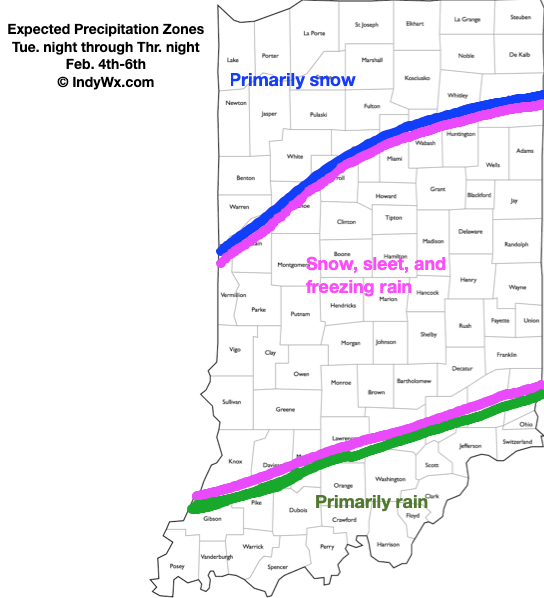
What: Accumulating snow, sleet, and freezing rain
When: This evening and Thursday morning
Temperatures: Upper 20s to around 30°
Wind: Northeast 10 to 20 MPH
Blowing/ Drifting: Light to moderate across northern Indiana
Pavement Impacts: Salting/ plowing also will be required in the “snow zone.”
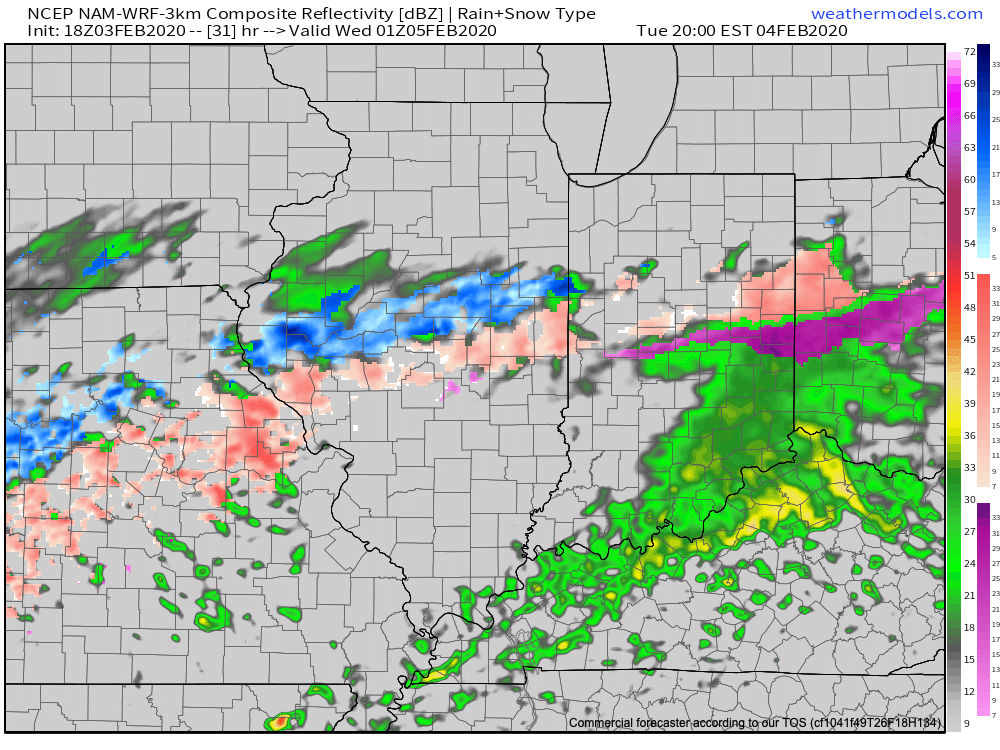
A surface wave will move from the middle MS River Valley into the TN and lower Ohio Valley region tonight and Thursday morning. Eventually this system will push into the Mid-Atlantic states Friday.
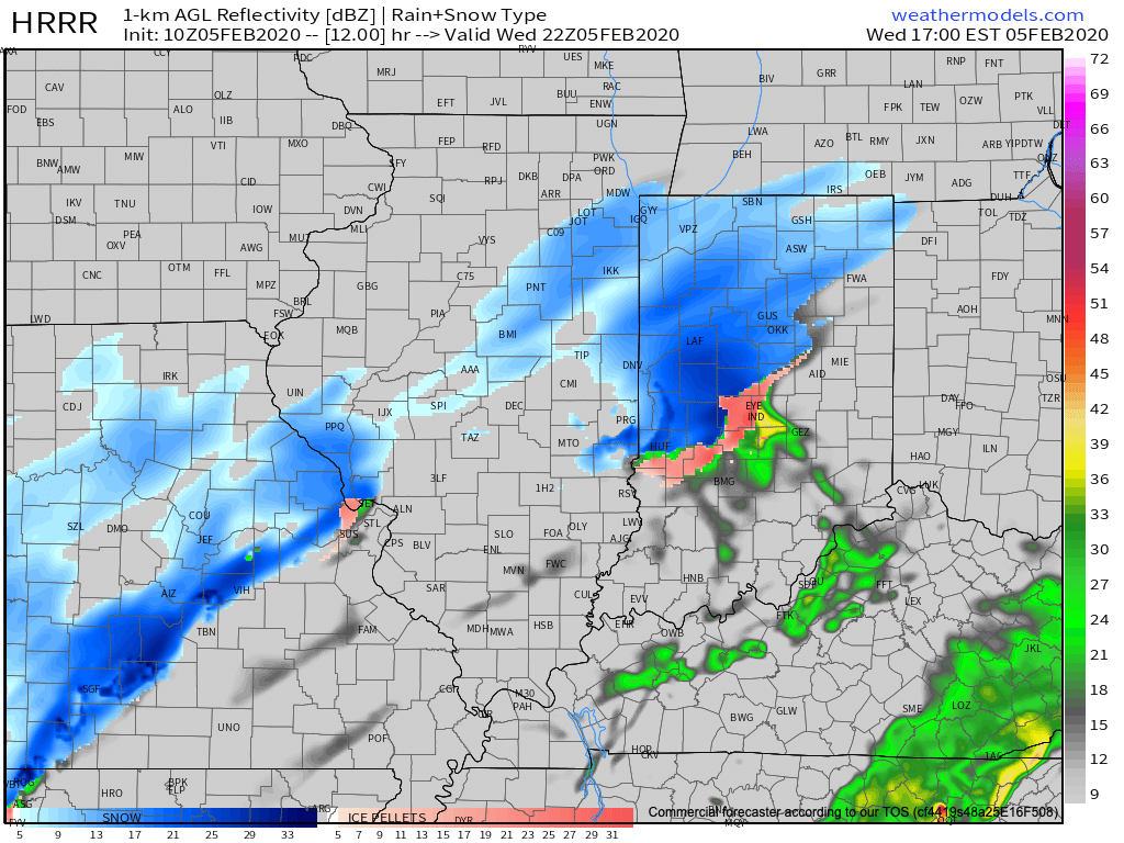
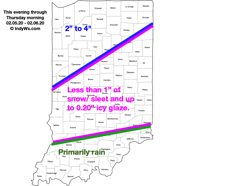
After a mostly dry daytime, precipitation will become more widespread by late afternoon and early evening. More specifically, we anticipate a wintry mix of sleet and snow to move into Indianapolis and a greater chunk of central Indiana between 4p and 5p. Waves of moisture will continue to impact the region into tonight, but as warmer air aloft moves overhead, precipitation is expected to transition to a mixture of sleet and freezing rain during this time frame. Up to 2 tenths of an inch of glaze is possible across the I-70 corridor this evening. We recommend avoiding travel if possible tonight across central Indiana with icy spots expected to develop on area roadways. Across most of central Indiana, snow and sleet accumulation should remain less than 1″. Further north, precipitation will remain predominantly snow with 2″ to 4″ expected.
Colder air aloft will return Thursday allowing precipitation to transition back to light snow across central Indiana. As upper level support swings through the state, snow should become more widespread Thursday night into Friday morning with additional light accumulation possible.
Confidence: High
Next Update: This evening