Category: Sleet

Period Of Snow Moving In…

As mentioned below, bust potential was/ is high with today’s forecast.  The further north trends in the NAM and GFS will ultimately trump the normally reliable Canadian and European solutions.  As such, slushy snowfall accumulations will be light (1″-2″) for the city, itself, increasing to between 2″-5″ for northern Indianapolis suburbs (Zionsville, Carmel, Westfield, Noblesville, etc.).  Double digit totals will fall across the northern third of the state.

For the most part, snowfall accumulations will come from this area of precipitation moving through the region.

Screen Shot 2015-02-01 at 9.30.06 AM


Heavy wet snow will likely fall for a period of time, especially from northern portions of Indianapolis and points north late morning into the early afternoon.

hires_ref_indy_6


Temperatures will then likely creep up a few degrees through the mid afternoon hours before falling this evening.  Snow will mix with, or change to, snow across central regions this afternoon with the northward track of the low.  Note the stark temperature contrast across the region this evening.

hrrr_t2m_indy_16


The week will get off to a cold start as highs Monday only top out in the lower 20s.  Enjoy your Super Bowl Sunday and keep the reports coming!

Permanent link to this article: https://indywx.com/period-of-snow-moving-in/

Weekend Snow Storm…

Screen Shot 2015-01-30 at 7.10.35 AMWeekend Snow Storm On Deck…Scattered snow flurries and snow showers will come to an end this morning with increasing sunshine following.  Despite seeing a little vitamin D this afternoon, it won’t do anything to help us in the temperature department.  In fact, we already experienced our high around midnight.  Temperatures this afternoon will remain in the middle to upper 20s with a gusty wind.

Most of Saturday will be quiet (calm before the storm) with dry conditions and afternoon highs around 40.  Clouds will lower and thicken as we go through the afternoon and evening and snow will develop (rain or a wintry mix down state initially) across central Indiana during the overnight.  Snow will increase in intensity Sunday morning and grow heavy at times during the day as low pressure tracks along the Ohio River (a classic track for central Indiana snow storms).  See our initial accumulation map below, which is still subject to change.  We’ll introduce a gusty east and northeast wind into the mix Sunday evening and night and this will lead to blowing and drifting snow Sunday night.  Stay tuned.

The big story next week will be the cold, but we’re also watching two potential snow makers, as well.  More on that after we deal with Sunday’s snow storm.

Upcoming 7-Day Precipitation Forecast:

  • 7-Day Snowfall Forecast: 5″ – 10″
  • 7-Day Rainfall Forecast: Trace

2115SnowfallMap

Permanent link to this article: https://indywx.com/weekend-snow-storm/

Now This Is More Like It…

Screen Shot 2015-01-28 at 7.30.19 AMMaking Up For Lost Time…Many snow lovers out there have been disappointed by the lack of the white stuff winter to date.  The cool thing is that the next 7-10 days (most likely longer) will offer up multiple opportunities to serve up accumulating snow.

First things first and that’s today- look for bright sunshine and a frosty start.  Temperatures will “warm” to just under seasonal levels this afternoon.  A fast moving storm system will scoot through here late tonight and Thursday morning with light rain, possibly transitioning to light snow showers before precipitation ends Tuesday (not a big deal).  Far eastern areas may experience a brief period of light freezing rain or light sleet during the onset of precipitation, but things should switch over to light rain rather rapidly even for you.  We’ll turn dry and cold to wrap up the work week.

All eyes are on the weekend as a storm system moves towards the region.  We have a ways to go and we’ll have to fine tune the details over the next few days, but this has potential to be the most widespread significant wintry event of the season.  Stay tuned.  MUCH colder air will punch in here early next week and may set the stage for more wintry “mischief” by the middle of next week.

ISRlogo2-280x121IU at Purdue: 9p tonight

Good news is that for those driving to West Lafayette tonight, you should be dealing with dry conditions.  Precipitation chances will begin to go up as we near 11p, or after, for western portions of the state.

Upcoming 7-Day Precipitation Forecast:

  • 7-Day Rainfall Forecast: 0.25″
  • 7-Day Snowfall Forecast: 3″ – 6″

Permanent link to this article: https://indywx.com/now-this-is-more-like-it-2/

Turning Colder; Icy Mix To Light Snow Before Ending…

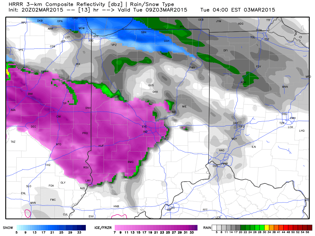
Greatest ice accumulations set up from Indianapolis and points north last night and this morning.  Glaze reached just under one quarter inch here across southern Boone County.

The icy mixture will transition to light snow before ending mid morning.

hrrr_ref_indy_2

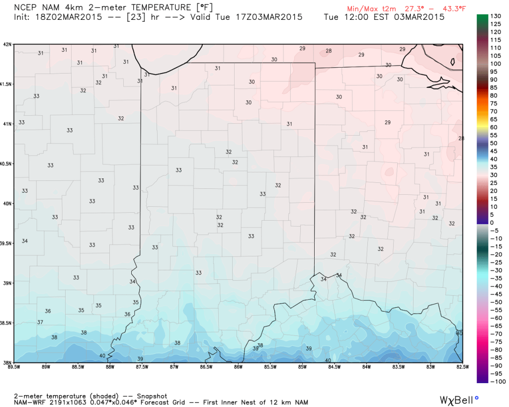
Temperatures will also be sliding backwards through the day.  Morning highs in the lower 30s will fall into the 20s this afternoon.

hires_t2m_indy_9

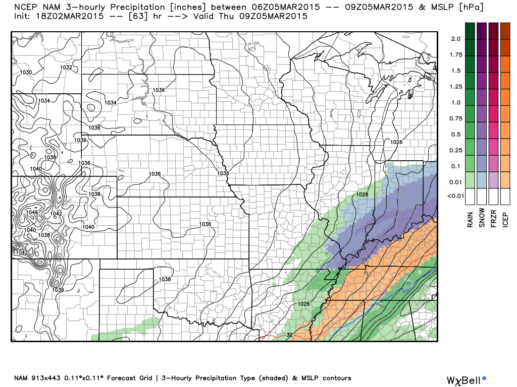
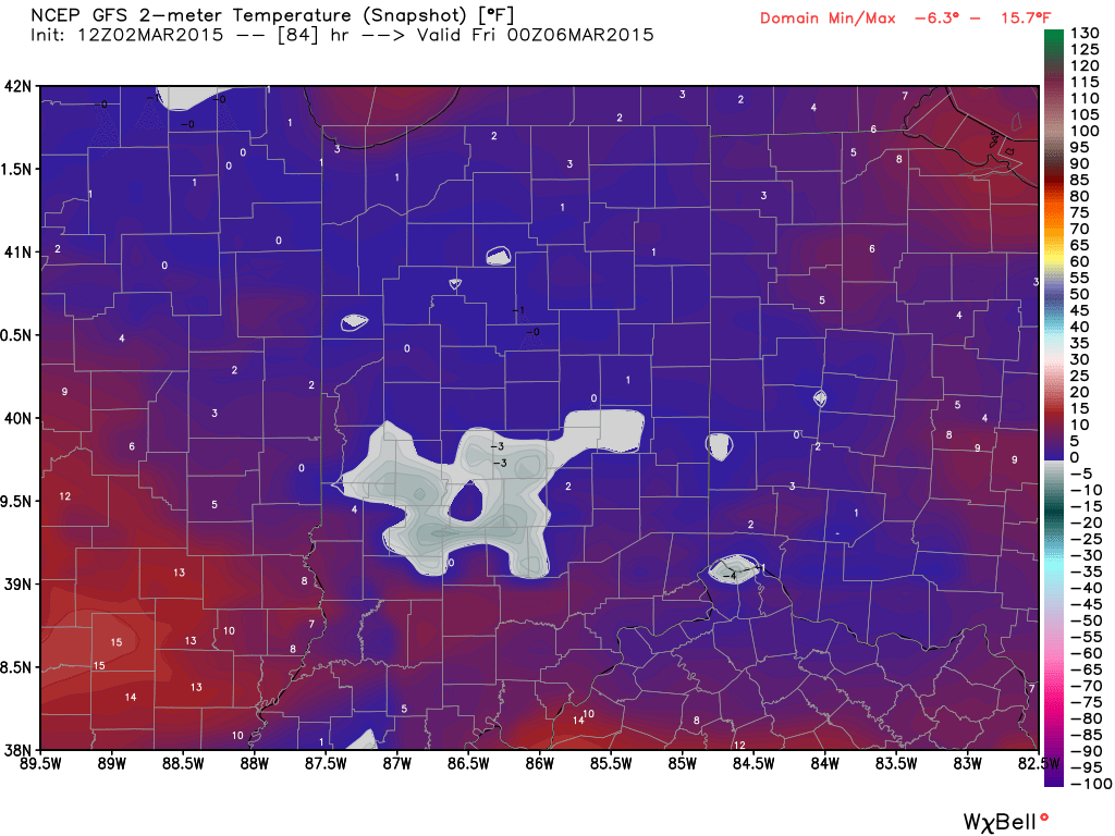
The big push of arctic air arrives tonight into Tuesday and sets the stage for widespread sub-zero lows Wednesday morning.  Wind chills will, of course, be even colder (10 to 20 below zero).

hires_t2m_indy_55

We’ll be back later tonight to talk about what lies ahead in the longer term.  Stay safe out there!

Permanent link to this article: https://indywx.com/turning-colder-icy-mix-to-light-snow-before-ending/

Ice Storm Warning…

Freezing rain (initially may be mixed with sleet) overspreads central Indiana between 1p-3p. We advise to get any and all travel done prior to 1p and plan to stay in…

You must be logged in to view this content. Click Here to become a member of IndyWX.com for full access.  Already a member of IndyWx.com All-Access?  Log-in here.

Permanent link to this article: https://indywx.com/ice-storm-warning/