Category: Sleet

VIDEO: Pleasant Open To The Week Takes On A More Wintry 2nd Half…

You must be logged in to view this content. Click Here to become a member of IndyWX.com for full access.  Already a member of IndyWx.com All-Access?  Log-in here.

Permanent link to this article: https://indywx.com/video-pleasant-open-to-the-week-takes-on-a-more-wintry-2nd-half/

VIDEO: Multiple Complex Storms To Deal With In The Week Ahead…

You must be logged in to view this content. Click Here to become a member of IndyWX.com for full access.  Already a member of IndyWx.com All-Access?  Log-in here.

Permanent link to this article: https://indywx.com/video-multiple-complex-storms-to-deal-with-in-the-week-ahead/

Time To Beat The Drum A Little Louder On Next Week?

After a surge of warmth engulfs the region during the early part of the week, a cold front will sag south into the central Ohio Valley Tuesday night into Wednesday.

An upper level ridge will provide a brief taste of spring to open the week.

This front will result in an expanding shield of rain Monday night into Tuesday across all of central Indiana.

Rain will increase across the area Monday evening.

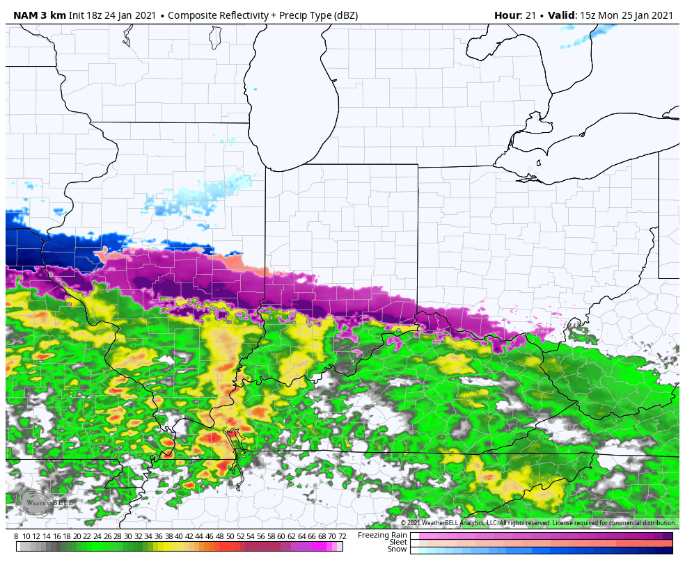
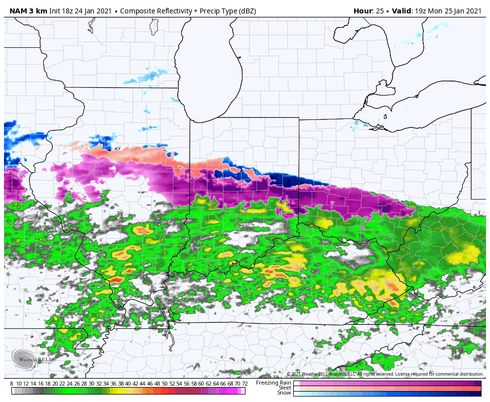
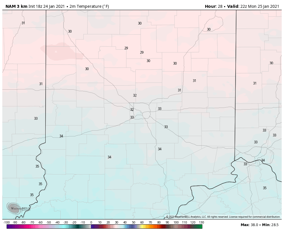
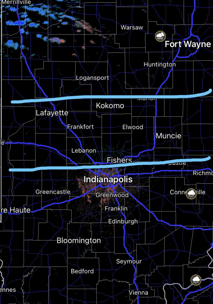
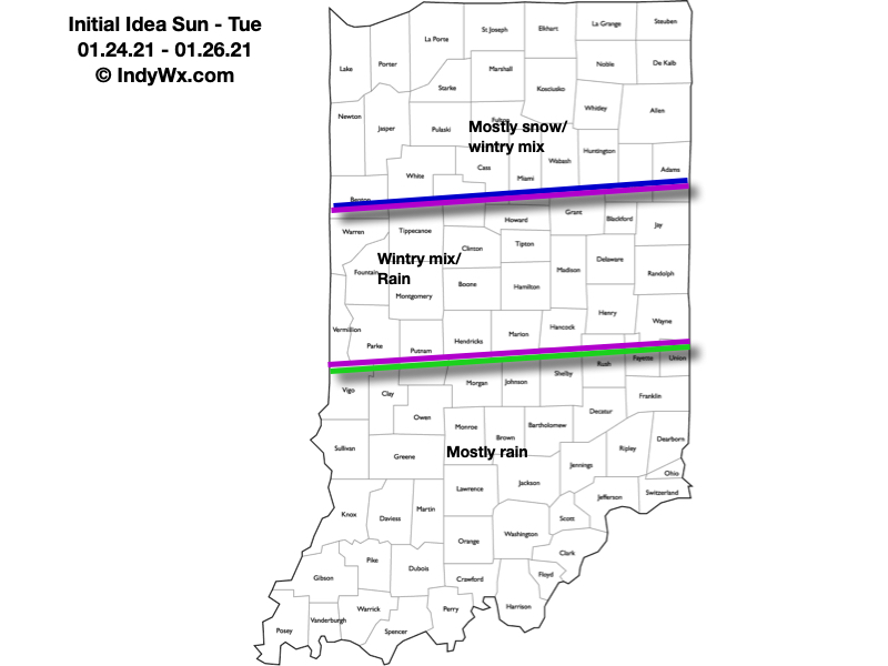
As we progress through Tuesday evening, the frontal boundary will likely sag south, allowing colder air to filter in (at least at the lowest levels of the atmosphere) across north-central parts of the Ohio Valley. As another slug of moisture moves northeast along the frontal boundary, precipitation is expected to once again become widespread Tuesday night into Wednesday. With the colder air oozing in, a mixture of sleet and freezing rain is a possibility across northern IL, IN, and OH. The precise placement of the front will determine whether or not more of central Indiana can get in on the “excitement” of this icy mixture during the aforementioned time period.

It’ll be wise to pay attention to forecast details during the weekend for the Tuesday and Wednesday time period- especially if you have travel plans north.

As this takes place, the upper ridge will get “beaten back” into the 2nd half of the work week. It’s important to note, however, that there will likely still be enough resistance from the upper level ridge that the cold front will get hung up along or just east of the spine of the Appalachians in the Thursday-Friday time frame.

As this transpires, yet another wave of energy will move up along the pressing boundary. Accordingly, precipitation should once again blossom in response of this wave of low pressure moving northeast. While the European (shown below) wants to keep things east of the immediate region, it’s wise not to write this system off from this distance. Not only does other data show the threat locally, but it’s all too often where storm systems “correct” further west as time draws closer to said event…

While this week has been relatively boring in the weather department, things will change in significant fashion next week. Whether or not those changes can deliver “wintry goods” is TBD…

Stay tuned.

Permanent link to this article: https://indywx.com/time-to-beat-the-drum-a-little-louder-on-next-week/

VIDEO: Short-Term Update On Tonight’s Sleet And Freezing Rain…

You must be logged in to view this content. Click Here to become a member of IndyWX.com for full access.  Already a member of IndyWx.com All-Access?  Log-in here.

Permanent link to this article: https://indywx.com/video-short-term-update-on-tonights-sleet-and-freezing-rain/

Client Brief: Wintry Mix Arrives This Evening; Slick Travel Expected Across A Portion Of The Region…

Type: Impactful Wintry Weather

A burst of snow will move into central Indiana between 5p and 7p.

What: Coating of snow and light glaze of ice

When: This evening into tonight

Temperatures: Upper 20s to around 30° before rising into the upper 30s after sunrise

Wind: Southeast tonight 20-30 MPH, shifting to the south Saturday morning and gusting to 40 MPH before shifting to the west behind the cold front Saturday evening.

Blowing/ Drifting: Non-existent

Pavement Impacts: Salting will be required today.

An area of low pressure will track across the central Plains today into the lower Great Lakes and into New England Saturday into Sunday. An associated cold front will sweep through the region Saturday PM resulting in a return of very cold air Saturday night into early next week.

The majority of the day will remain precipitation-free across the state with a lowering and thickening cloud deck by afternoon. As our attention shifts to late afternoon and evening, an initial burst of snow will make it’s way into west-central Indiana (around Terre Haute) before arriving into the city, itself, towards 6p to 7p. For a good chunk of central Indiana, this snow will transition rather quickly to a mix of sleet and freezing rain as evening gives way to nighttime. In and around Indianapolis and northern suburbs, expect a snow/ sleet accumulation of up to 1″ followed by a light glaze of ice. Further north, snow will hang on longer as the predominant precipitation type, resulting in accumulations of 2″ to 4″. If traveling this evening into tonight, icy roads are likely across central Indiana. Temperatures will warm above freezing prior to sunrise Saturday with significant improvement expected on area roadways. This will help precipitation transition to a cold rain Saturday morning before a cold front whips across the state and sends temperatures into a nose dive Saturday evening. Gusty winds will accompany this frontal passage (40 MPH gusts) and any leftover moisture will refreeze Saturday evening resulting in patchy black ice issues on untreated surfaces.

Confidence: High

Next Update: Tonight

Permanent link to this article: https://indywx.com/client-brief-wintry-mix-arrives-this-evening-slick-travel-expected-across-a-portion-of-the-region/