Initial Thoughts On Spring 2022…
Updated 02.09.22 @ 7:36a
With only a few weeks left in meteorological winter, our thoughts are beginning to shift to spring. A weak La Niña is expected to persist through spring 2022.
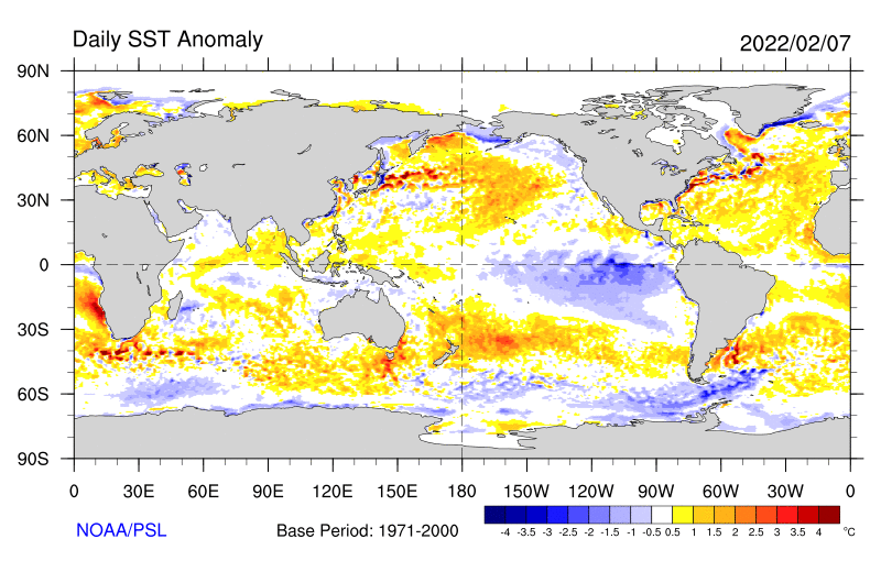
See the cooler than normal central and eastern PAC sea surface temperatures below, courtesy of NOAA’s Physical Science Laboratory.
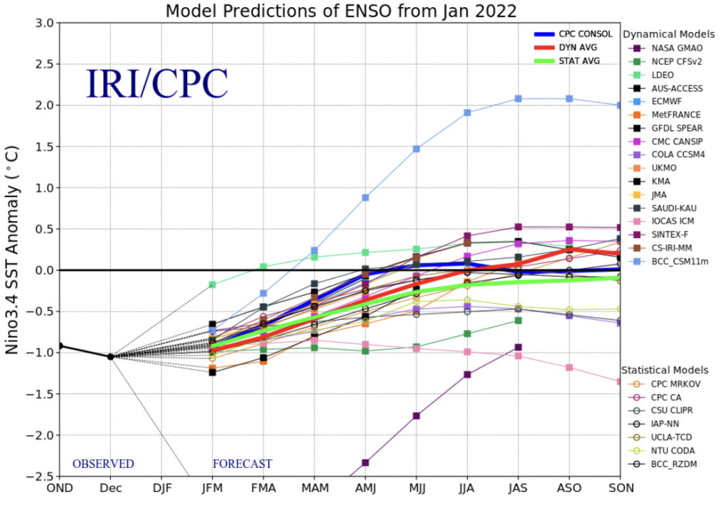
The IRI/ CPC plume shows the idea of a weak Nina continuing March, April, and May (meteorological spring season).
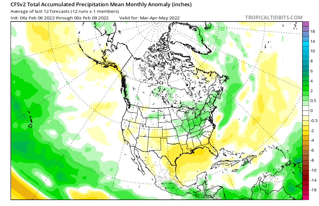
We also like to pay close attention to the SST configuration in the Gulf of Mexico. As the mean trough position pulls into the west, an active storm track is likely to emerge across the Mid West. With warmer than normal SSTs in the Gulf, these storms will be able to tap into the Gulf moisture and this could help spawn bigger rain/ severe weather episodes from the mid-south into the Ohio Valley as the season matures (don’t worry snow lovers, we aren’t finished with the white stuff just yet).

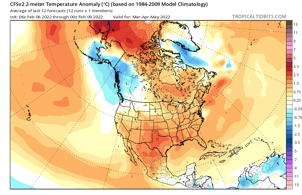
The idea here is for an active spring- complete with a busy storm track through our neck of the woods, slightly above normal temperatures, and a fast start to the severe weather season (especially given those Gulf SSTs). We don’t have any reason to disagree with the overall idea that both the American climate model and European seasonal products are displaying.
Of course the MJO and NAO will play a factor in the shorter term period as spring gets underway. We’ll most certainly monitor closely.
Much more as we get closer!