 Highlights:
- Needed quiet time today
- Stormy mid week; high-impact severe event possible
- Drier to close the week
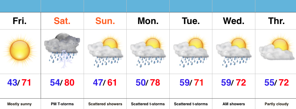
All Eyes On Wednesday…Today is an easy one. Drier air will move into central parts of the state as we progress into the afternoon and evening hours, and we’ll also enjoy lots of sunshine. It’ll feel fantastic out come evening!
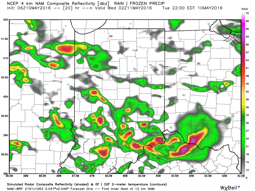
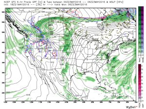
All eyes will remain locked in on Wednesday as we monitor the prospects of potentially two rounds of thunderstorms. Timing and track will have to be fine tuned, but we think the day offers up the possibility of morning thunderstorms, followed by a second round of storms during the afternoon and evening hours. All modes of severe weather are in play, locally, Wednesday- particularly damaging wind. Additionally, localized flash flooding will be likely where storms train. It’ll be an important day to have a means to get the latest watches and warnings. It wouldn’t be a bad idea to review your severe weather safety plan with your family at some point today.
After morning storms Thursday we should dry things out during the second half of the day and on into the first half of the weekend. Storm chances return Sunday-Monday.
Upcoming 7-Day Precipitation Forecast:
- Snowfall: 0.00″
- Rainfall: 1.5″-2.5″ (locally heavier totals)
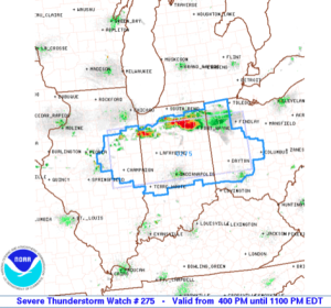 Damaging straight line winds and large hail are of biggest concern as these scattered strong to severe storms continue to advance southeast. This is all in association with a cold front moving into a very warm, moist, and unstable air mass.
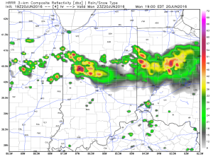
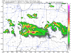 In addition to the hail and wind threat, locally torrential downpours are a good bet as precipitable water values (PWATs) approach 2″+ in some areas.
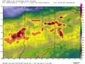 We’ll turn much quieter during the overnight as the cold front passes through the region. A northwest wind shift will allow a drier air mass to slip into central IN come Tuesday morning.
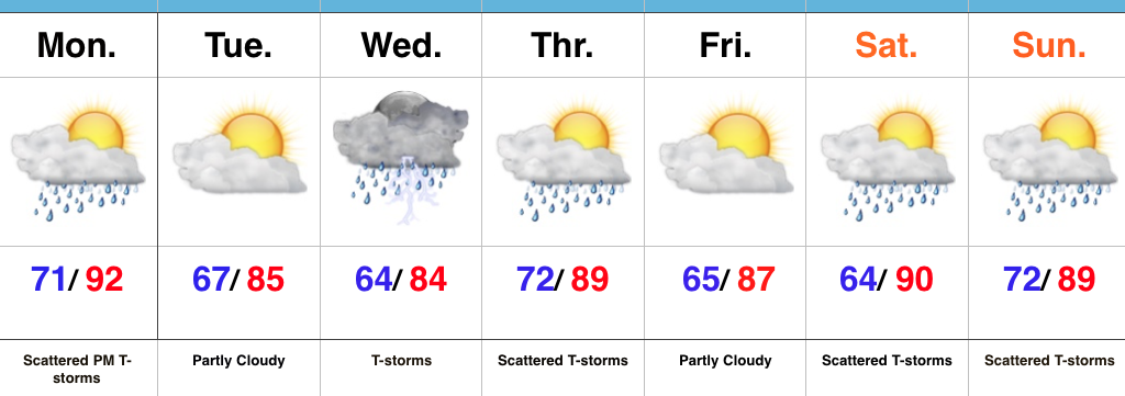
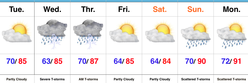
 Dry and sunny weather will greet us to open the new work week, along with temperatures that will approach the 80 degree mark by Tuesday. Have yard work to get caught up on? Take advantage of the early week weather.
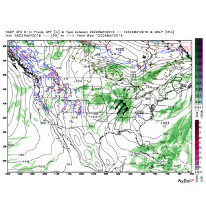 As such, we’ll increase the chances of showers and thunderstorms in our mid week forecast. It’ll also be a much more humid feel of things (really for the first time this year) as surface dew points surge into the upper 60s to lower 70s. (In other words, “oppressive”).
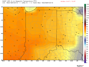 Factor in PWATs (precipitable water values) zooming to 1.5″-1.8″ and the threat is there for localized heavy downpours around mid week.
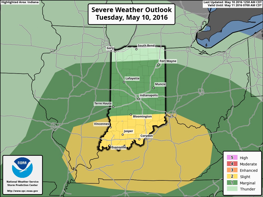
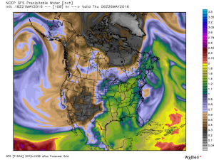 Additionally, we also note the Storm Prediction Center (SPC) has placed western sections of our forecast area in a risk of severe weather Wednesday. We’ll keep a close eye on things.
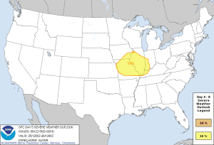 As we progress into the late week period and on into the long holiday/ race weekend, a warm, humid, and unsettled time of things is expected to continue. It’s tough to pinpoint specifics from this distance, but just keep note of the threat of thunderstorms into and through the upcoming busy weekend, along with warm (highs in the lower to middle 80s; lows in the upper 60s) and humid conditions.