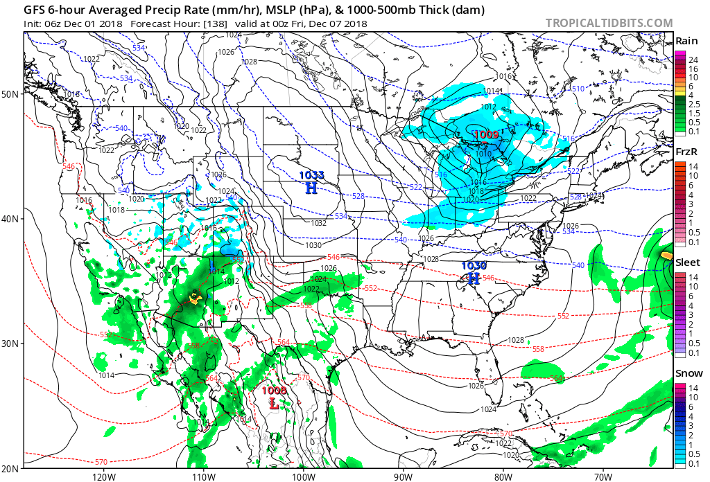
Our week-ahead outlook is focused on everything from storms to a return of unseasonably cold conditions and snow. As a strong storm system lifts north into the Great Lakes Sunday, it’ll swing a cold front through the Ohio Valley Sunday night. This will sweep the briefly milder air out of here and allow much colder air to settle back into the region through the balance of the week ahead. With the colder air in place, snow chances will return, as well. First up is a clipper system late week followed by the potential of something “more important” next weekend…
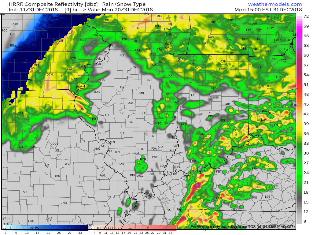
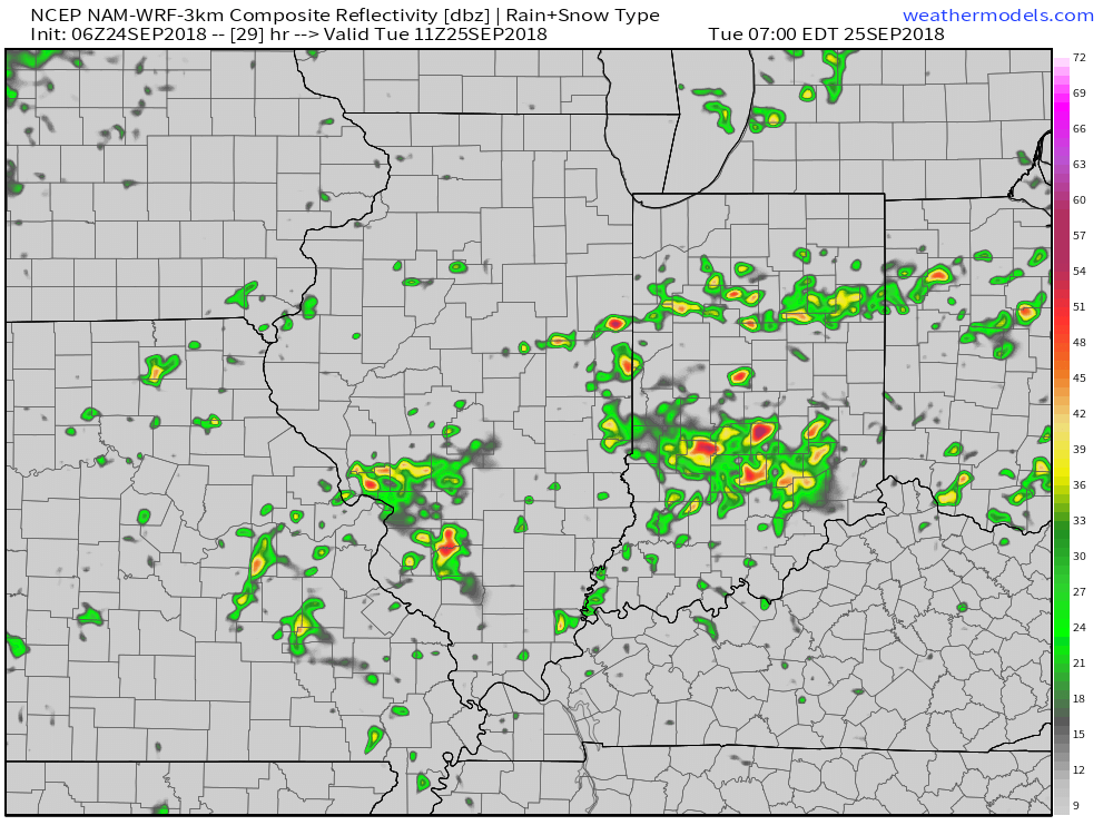
I. Steady rains will come to an end this morning and we’ll replace the soaking rain will widely scattered showers and embedded thunder later this afternoon and evening. Several dry hours can be expected for the majority of central Indiana beforehand. While the greatest threat of strong to severe storms will remain to our west in IL, we’ll keep an eye out for the potential of a gusty storm or two- especially west of the I-65 corridor later this evening.

 II. Highs today will come tonight (mid-to-upper 50s) ahead of the cold front. Once the front moves through, colder air will return for the second half of the weekend. As wrap-around moisture combines with the colder air, light snow showers will develop late Sunday night into Monday morning (shown below). This won’t be a huge deal.
 III. The next item of interest will come from a clipper system Thursday. This won’t only serve up another round of light snow, but also help to reinforce the unseasonably cold air. Highs will return to around freezing to close the week with lows in the 20s.
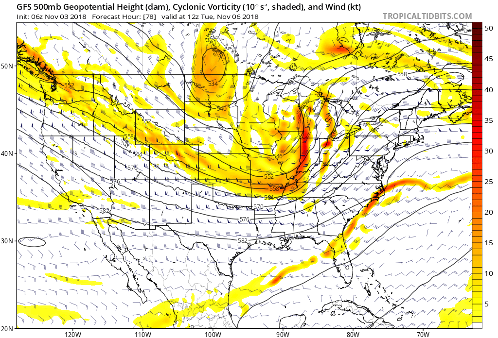
 IV. That leads us to what comes next weekend. While it’s still far too early for any sort of specifics, we’ll simply say to keep a mental note in the back of your mind for the potential of a more disruptive winter event coming out from the southern Plains into the Ohio Valley. We’ll certainly have to fine tune things and “hone in” as we progress through the upcoming week. From this distance, prospects range from nothing more than a light snow to a “plowable” storm. Unlike this weekend’s storm, there will be a limit to how far north next weekend’s storm will be able to track…

 We’re also still monitoring the potential of strong to severe thunderstorms across southern portions of the state. The Storm Prediction Center now includes far southern Indiana in a Slight Risk for severe weather today. The primary concerns remain strong, damaging winds with a line of thunderstorms that may develop between 2p and 4p. If your travels take you south towards Louisville today remain weather-aware.
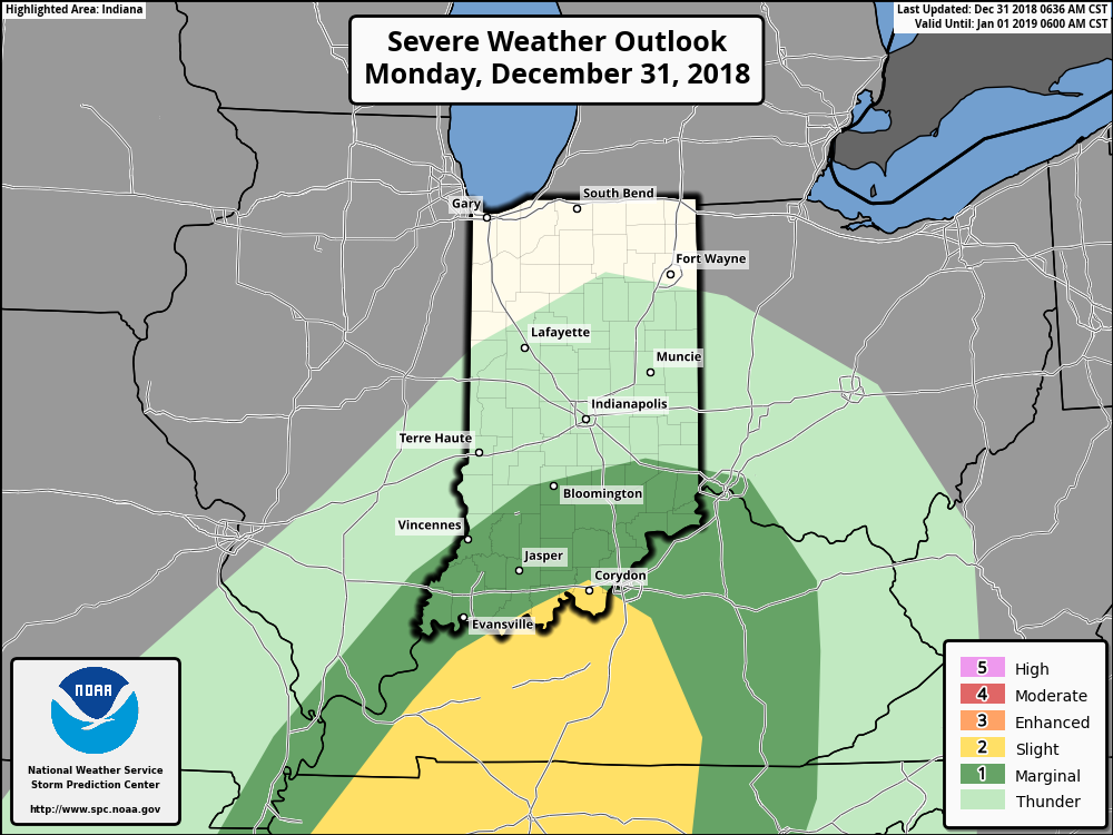
 Temperatures will run 25° to 30° colder New Year’s Day and a couple of scattered snow showers may fly- especially across the favored snowbelt areas to our north.
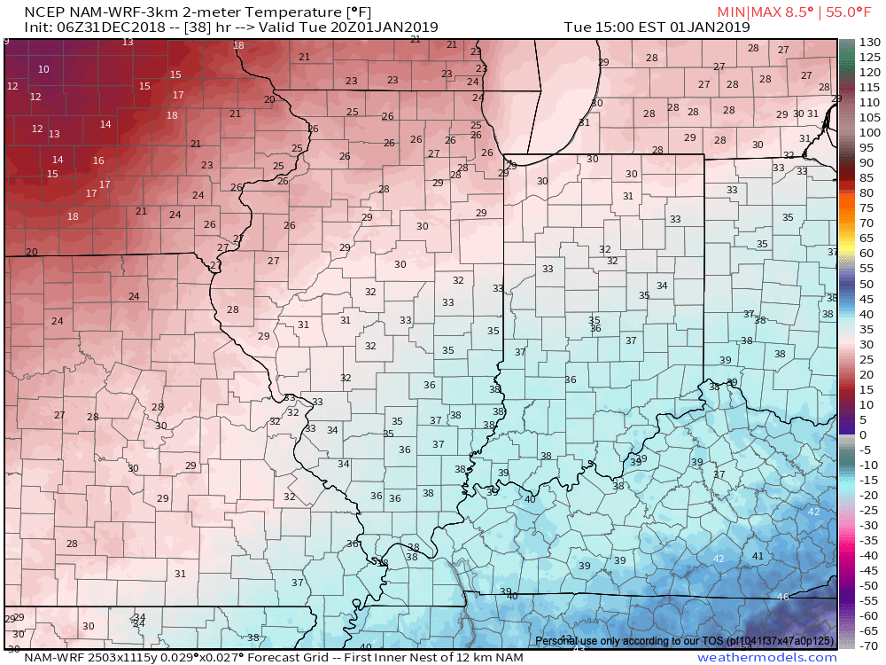 Have a happy and safe New Year’s Eve, friends!
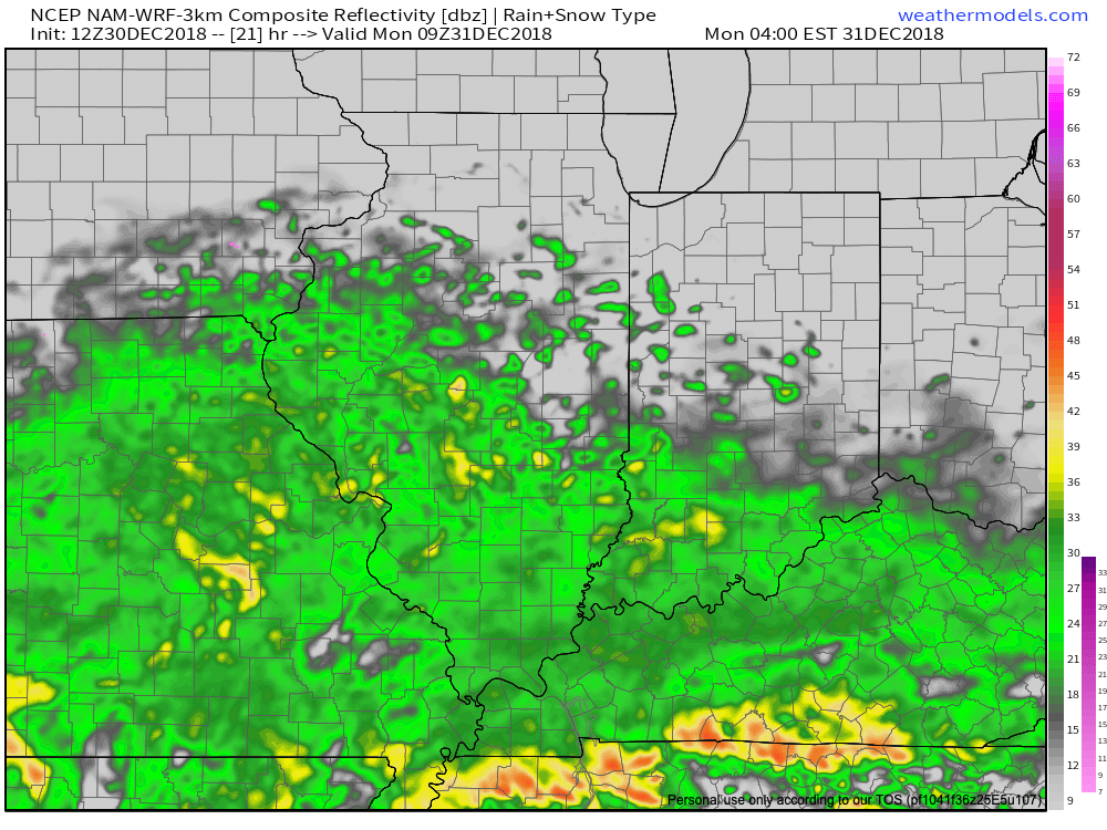

 Colder air will whip in here late tomorrow night and help lingering moisture fall as scattered snow showers New Year’s Day. More later on the potential of wintry “mischief” later in the week…
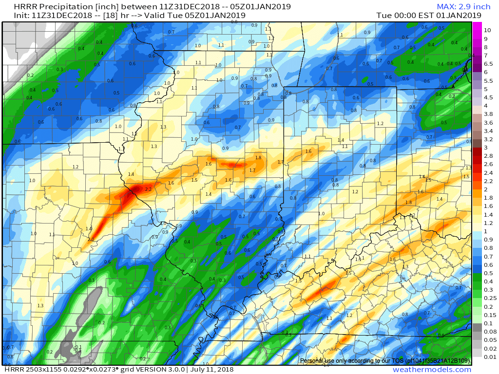
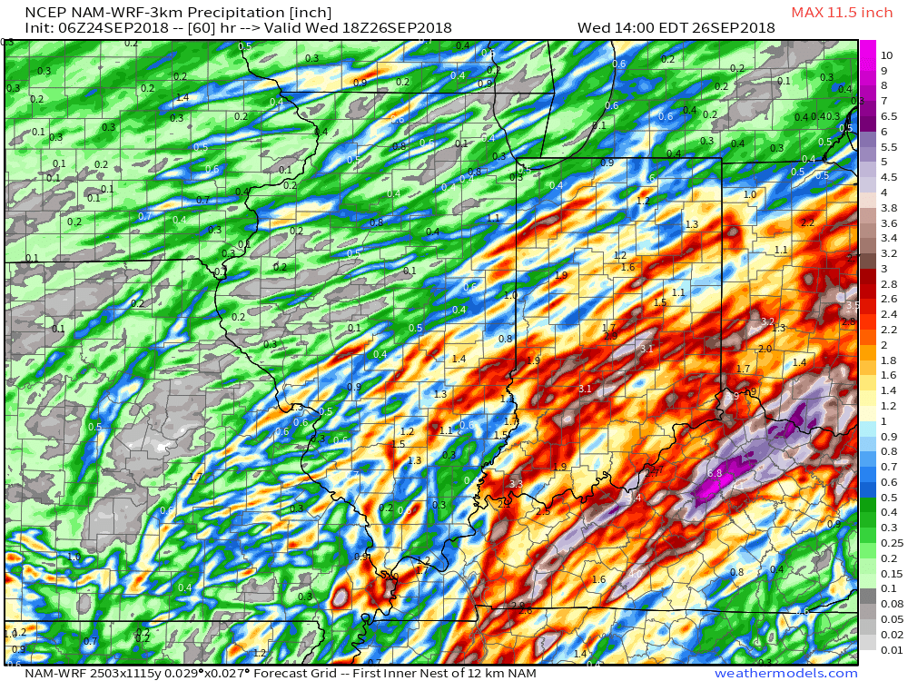
 Additional rainfall totals of 1″ to 2″ with locally heavier amounts are a good bet in that Monday night – Tuesday time frame.
 While we’ll certainly turn colder behind this storm system, the true early season push of arctic air will wait a couple of days to arrive- Thursday afternoon into Friday. Not only will this be the coldest air of the season (lower-middle 20s Friday morning and likely colder next Saturday), but the first flakes of the season are also likely to fly across central Indiana to wrap up the work week. Furthermore,
  Don’t look now, but more “fun and games” await the following week…
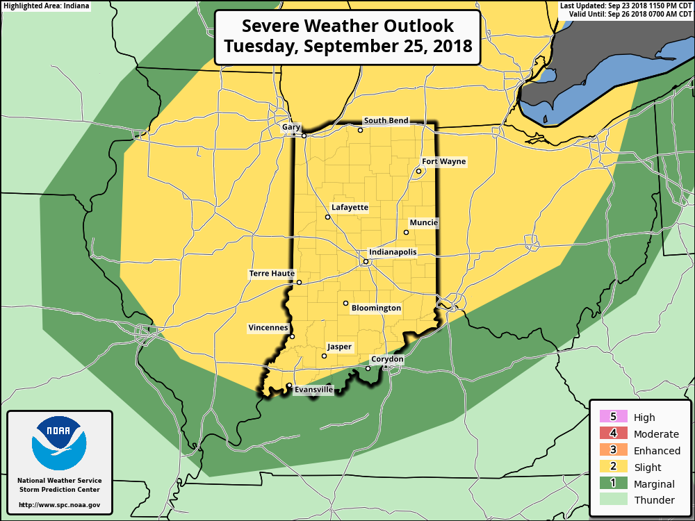
 The frontal boundary will sweep through the state late Tuesday and allow a cooler and drier air mass to filter into the region Wednesday. You’ll notice a true fall feel out the door Wednesday morning- low to mid 50s. Highs Wednesday afternoon will remain in the 60s.