You must be logged in to view this content. Click Here to become a member of IndyWX.com for full access. Already a member of IndyWx.com All-Access? Log-in here.
Category: Severe Weather
Permanent link to this article: https://indywx.com/2019/06/05/video-damaging-wind-potential-with-storms-this-evening-quiet-close-to-the-week/
Jun 04
Evening All-Access Video: It’s Not All “Doom And Gloom;” Updated Thoughts Around Late Week-This Weekend…
You must be logged in to view this content. Click Here to become a member of IndyWX.com for full access. Already a member of IndyWx.com All-Access? Log-in here.
Permanent link to this article: https://indywx.com/2019/06/04/evening-all-access-video-its-not-all-doom-and-gloom-updated-thoughts-around-late-week-this-weekend/
Jun 04
VIDEO: Detailed Look At The Pattern And Associated Heavy Rain Timing Into Early Next Week…
You must be logged in to view this content. Click Here to become a member of IndyWX.com for full access. Already a member of IndyWx.com All-Access? Log-in here.
Permanent link to this article: https://indywx.com/2019/06/04/video-detailed-look-at-the-pattern-and-associated-heavy-rain-timing-into-early-next-week/
Jun 03
VIDEO: Unsettled Weather Returns After A Pleasant Open To The Work Week…
You must be logged in to view this content. Click Here to become a member of IndyWX.com for full access. Already a member of IndyWx.com All-Access? Log-in here.
Permanent link to this article: https://indywx.com/2019/06/03/video-unsettled-weather-returns-after-a-pleasant-open-to-the-work-week/
Jun 02
Weekly #AGwx And Severe Weather Outlook…
Forecast Period: 06.02.19 through 06.09.19
7-Day Precipitation: Rainfall is expected to run above average through the period.

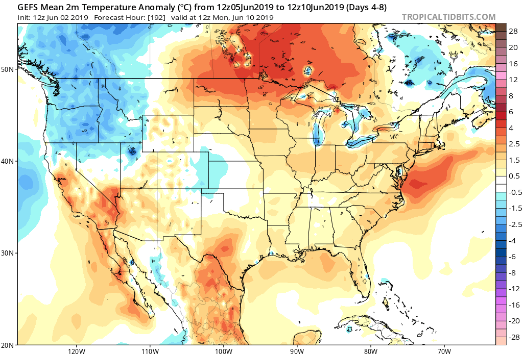
7-Day Temperatures: Above normal temperatures are expected through the period, mostly thanks to warmer than average overnight lows.

Severe Weather: We’ll remain quiet through early week before things begin to turn more active by midweek. The Storm Prediction Center is including the southern half of the region in a risk of severe weather by Wednesday (noted in the Day 4 Outlook below).

Summary: After a pleasant and quiet open to the period (today and Monday), thinks will begin to turn more active thereafter. Initially, it’ll take some time to “moisten” things up on Tuesday, but at the very least, light to moderate rain should work across central Indiana late Tuesday morning into the afternoon. Things will be fully saturated by Wednesday and periods of more concentrated rain, occasionally heavy, can be expected into the weekend. Unfortunately, guidance is in rather remarkable agreement of widespread 1.5″ to 2.5″ with locally heavier totals over the upcoming 7-day period.
Permanent link to this article: https://indywx.com/2019/06/02/weekly-agwx-and-severe-weather-outlook/
Jun 01
VIDEO: Severe Weather Potential Later Today; Discussing The June Pattern…
You must be logged in to view this content. Click Here to become a member of IndyWX.com for full access. Already a member of IndyWx.com All-Access? Log-in here.
Permanent link to this article: https://indywx.com/2019/06/01/video-severe-weather-potential-later-today-discussing-the-june-pattern/
May 31
Gusty Storms Blow Into Town Saturday PM…
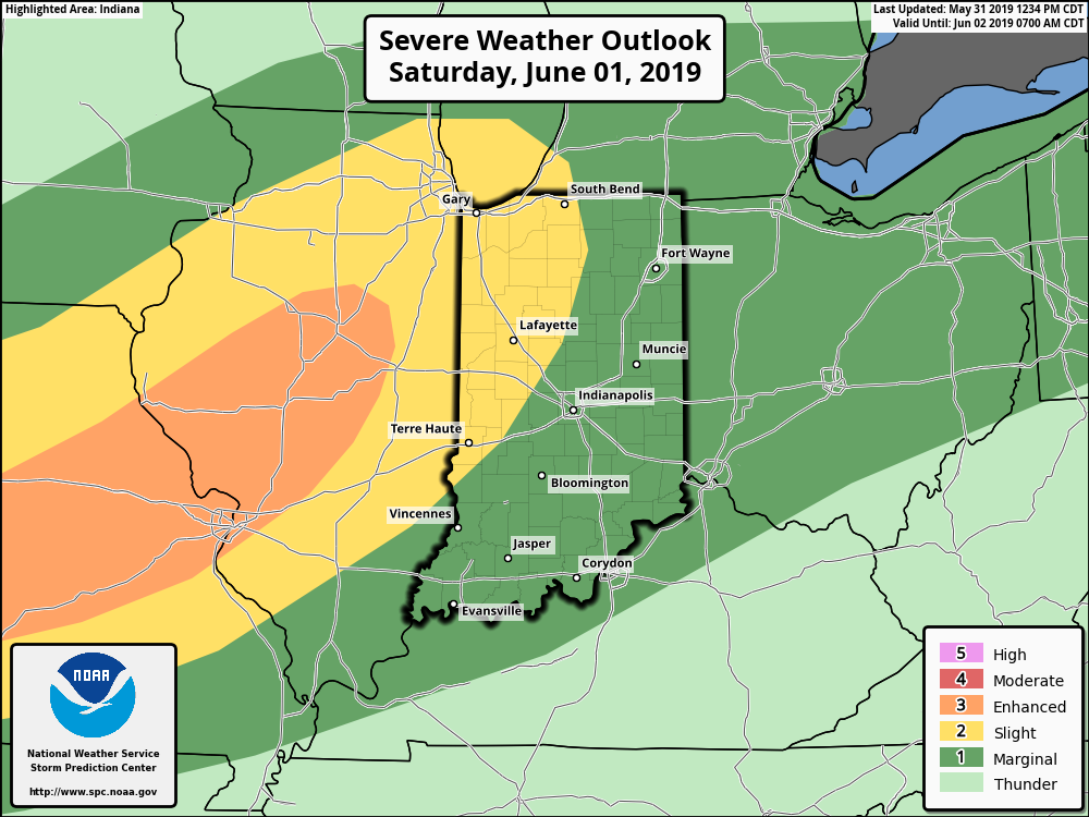
The Storm Prediction Center has pulled the “Slight” Risk area more into Indiana with their most recent update for Saturday and we believe this may encompass more of the immediate area with subsequent updates.

The biggest concern has to do with straight line wind potential with one, or multiple lines of storms that will rumble through the state Saturday afternoon and evening.
The day will dawn bright and sunny with pleasant temperatures, but as the morning gives way to afternoon, conditions will destabilize and we’ll have our eyes focused to the northwest for thunderstorm initiation early afternoon across northern Indiana and Illinois. We then anticipate these individual storms to morph into a couple of lines of storms and push south into central Indiana during the mid and late afternoon/ early evening hours.

If you have outdoor plans tomorrow, please plan to have a means of receiving the latest information around potential severe thunderstorm watch/ warning information that may be required.
The 2nd half of the weekend will include fantastic weather (drier, less humid, and cooler) that will carry us into the first couple of days of the work week!
Permanent link to this article: https://indywx.com/2019/05/31/gusty-storms-blow-into-town-saturday-pm/
May 31
VIDEO: Gusty Saturday Storms; Wet Pattern Returns Next Week After 3-Day Break…
You must be logged in to view this content. Click Here to become a member of IndyWX.com for full access. Already a member of IndyWx.com All-Access? Log-in here.
Permanent link to this article: https://indywx.com/2019/05/31/video-gusty-saturday-storms-wet-pattern-returns-next-week-after-3-day-break/
May 30
Short-Term Video Update: How Long Do Storms Last Tonight? Strong Storms Saturday PM?
You must be logged in to view this content. Click Here to become a member of IndyWX.com for full access. Already a member of IndyWx.com All-Access? Log-in here.
Permanent link to this article: https://indywx.com/2019/05/30/short-term-video-update-how-long-do-storms-last-tonight-strong-storms-saturday-pm/
May 29
VIDEO: Storms Continue Today; Discussing MJO Influence As We Move Into Early June…
You must be logged in to view this content. Click Here to become a member of IndyWX.com for full access. Already a member of IndyWx.com All-Access? Log-in here.
Permanent link to this article: https://indywx.com/2019/05/29/video-storms-continue-today-discussing-mjo-influence-as-we-move-into-early-june/
