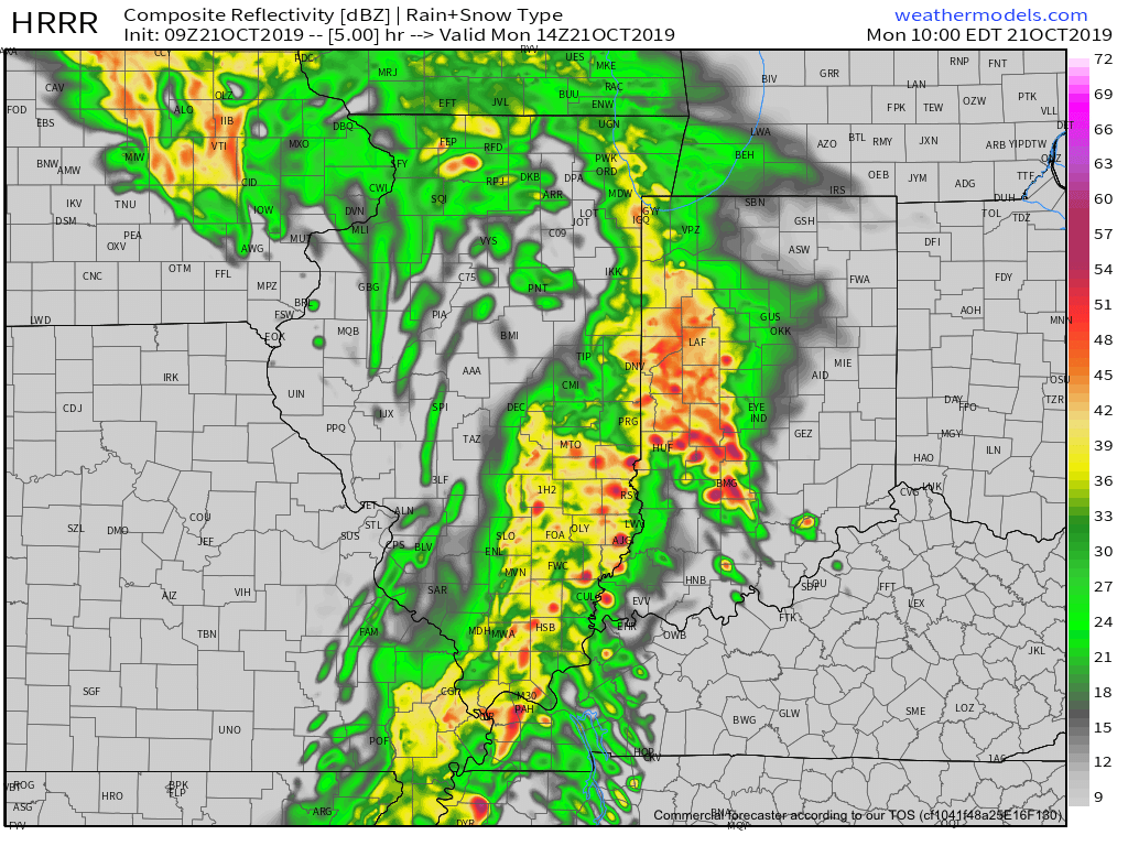
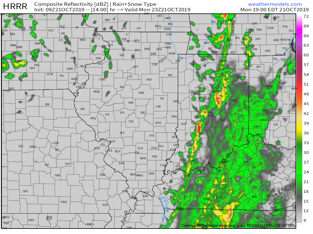
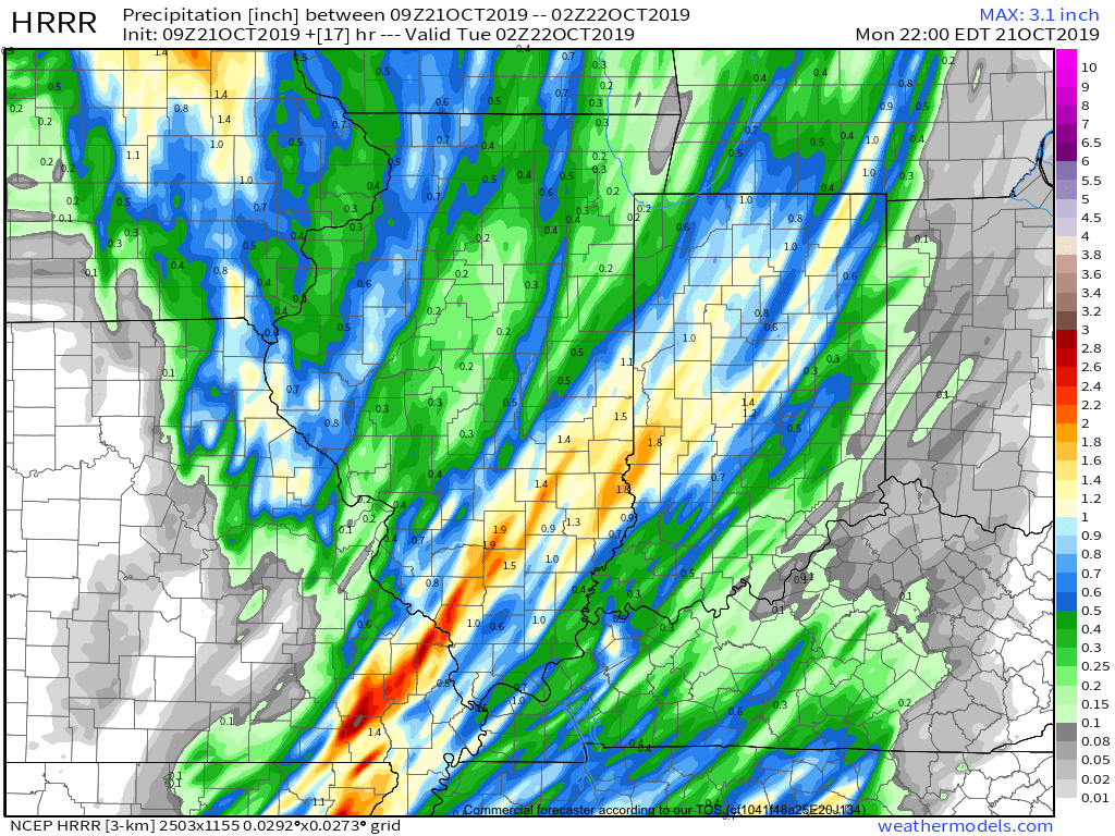
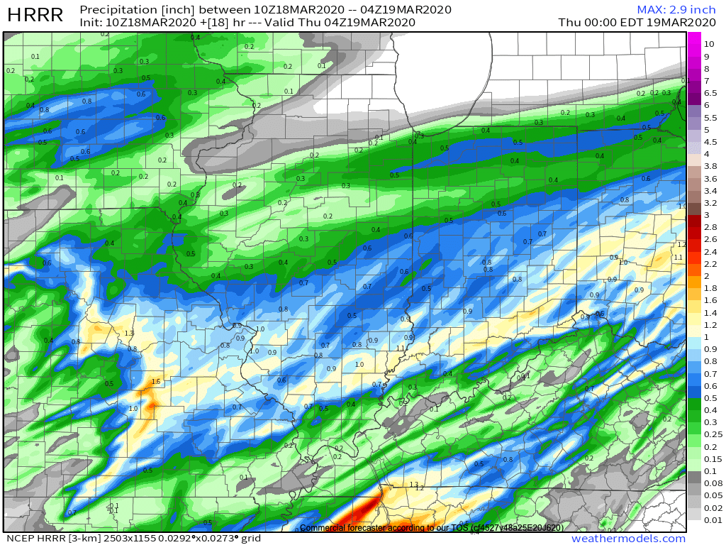
I. The morning is off to a quiet, chilly start, but clouds will lower and thicken through the morning and rain will soon follow. Periods of moderate to heavy rain can be expected this afternoon into the early evening hours, including widespread 0.50″ to 1″ with a few locally heavier amounts.
II. A changeable weather day is on tap Thursday with a couple of rounds of storms expected- late morning and again during the evening and night. The initial round of storms will lift northeast across the state Thursday morning into early afternoon, courtesy of a warm front. Highs will flirt with 70° tomorrow afternoon once the storms move out.
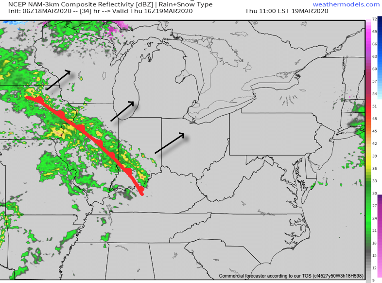
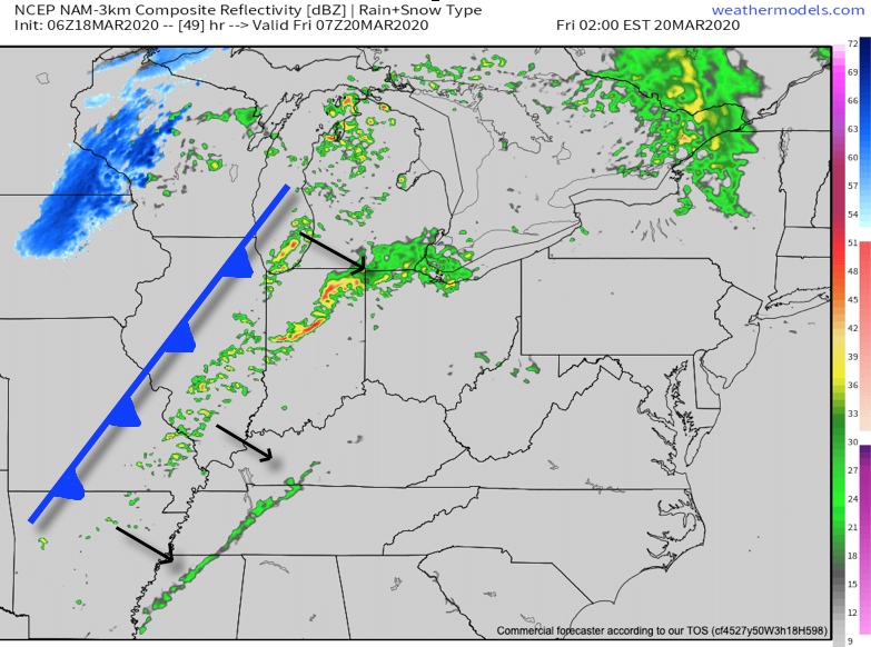
A cold front will then sweep through the region during the overnight. Additional storms (some potentially strong to severe) will take place as the front moves through the region.

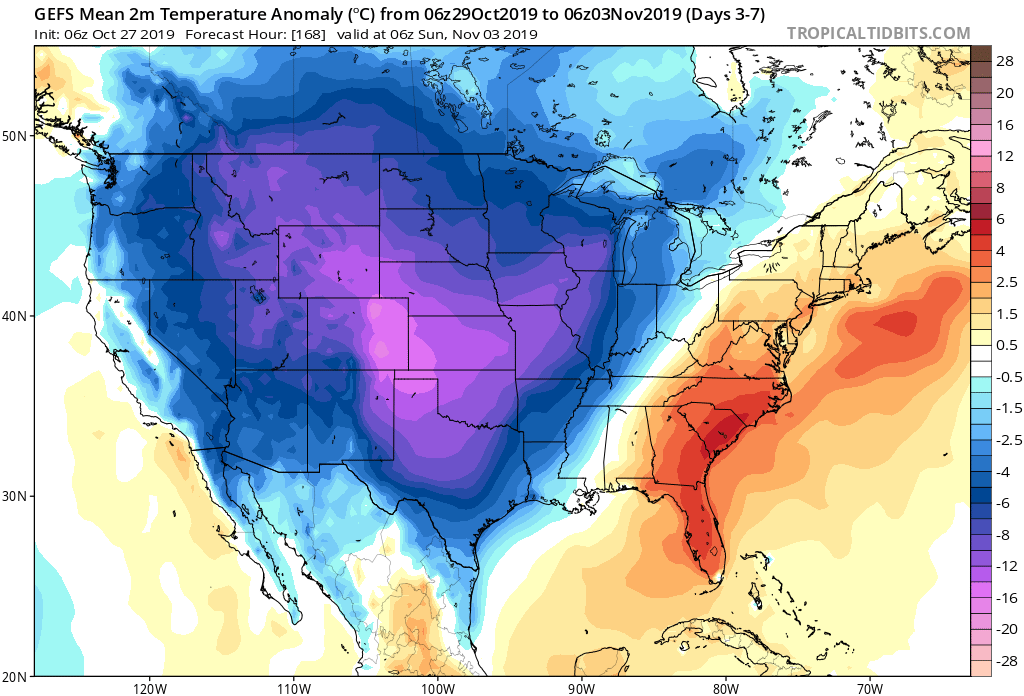
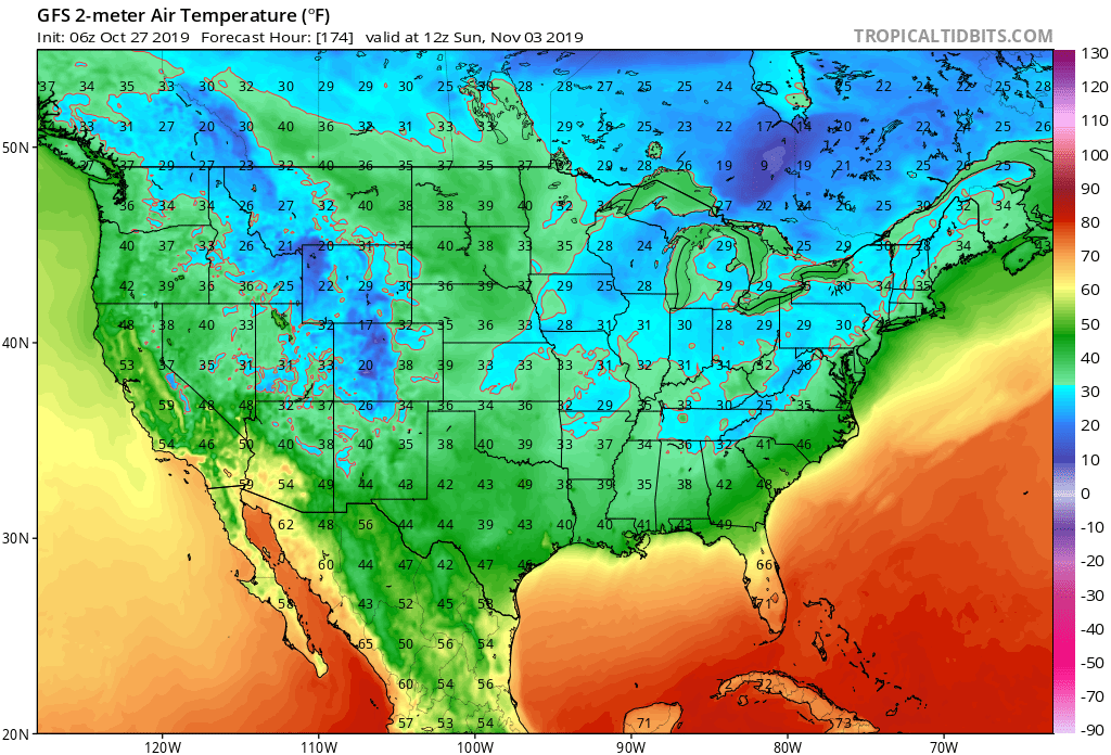
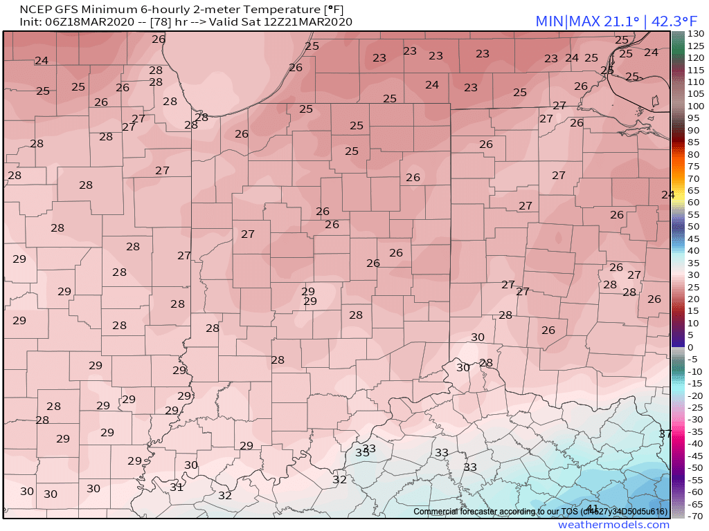
III. We’ll turn MUCH colder, but at least the sunshine will return as we move through the weekend. Lows in the 20s can be expected.
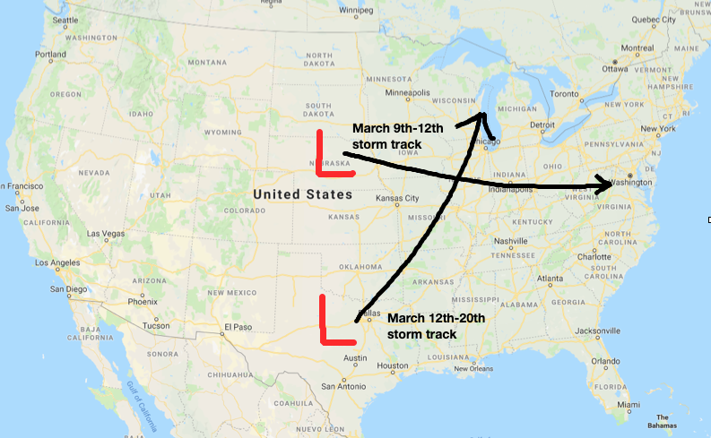
IV. Our next storm system looks to arrive Tuesday. From this distance, it appears this will be a potent system, including strong winds and heavy rain.

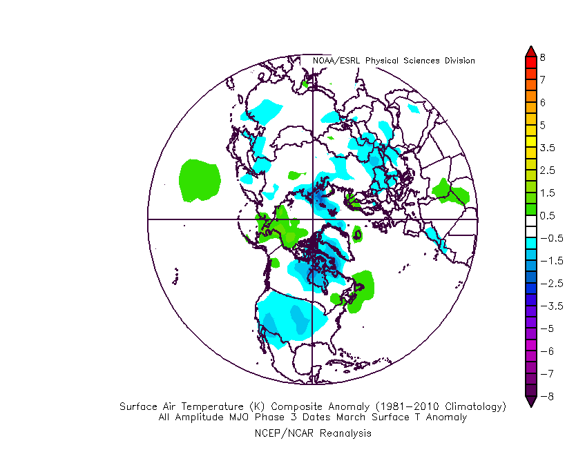
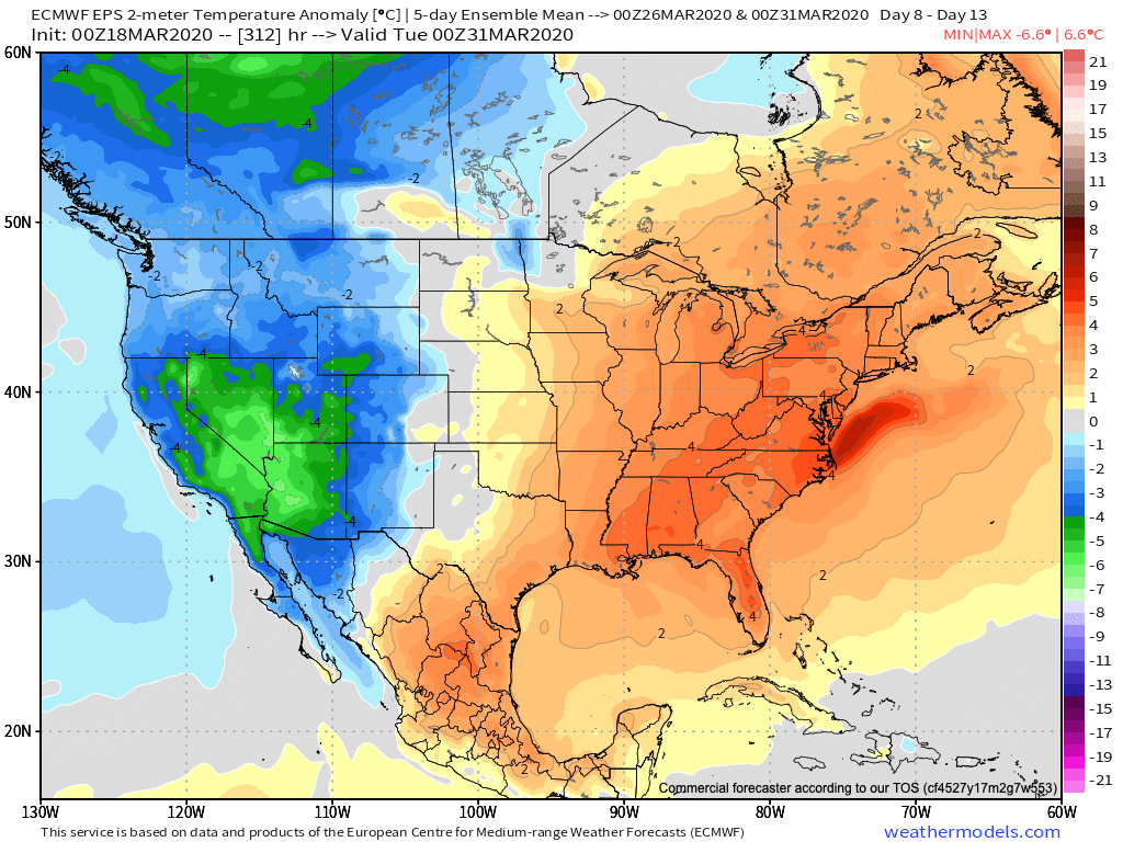
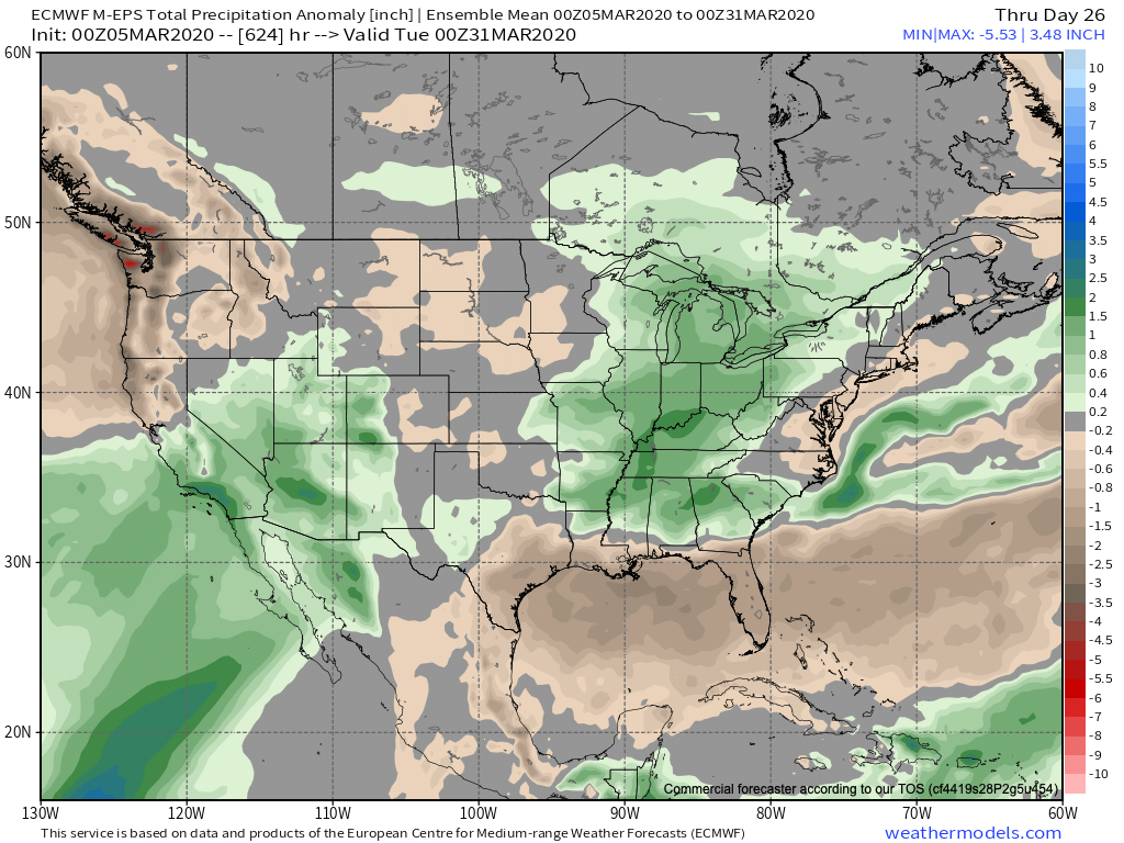
V. Longer term, we continue to watch the various players align. The MJO looks to amplify and rumble into Phase 3 by late March. The movement through Phases 1-2 can at least generate transient cold for our neck of the woods before Phase 3 favors the brunt of the cold across the West. Interestingly, this is what the latest European ensemble is also showing.