Severe Weather Video Brief Tonight-Wednesday

The region remains under fire for severe weather potential, primarily for damaging straight line wind and hail per latest thinking.  The video uncovers when you can expect this and looks ahead to the all-important Memorial Day and Indianapolis 500 weekend!

The region is under fire for severe potential Wednesday.

Eyeing Storms Wednesday; Beauty Of A Weekend On Deck!

Tue.

Wed.

Thr.

Fri.

Sat.

Sun.

Mon.

 Status-weather-showers-day-icon

 Status-weather-showers-day-icon

 Status-weather-clouds-icon

 Status-weather-clouds-icon

 Status-weather-clouds-icon

 Status-weather-clouds-icon

 Status-weather-showers-day-icon

57/ 80

64/ 80

58/ 74

51/ 72

49/ 74

52/ 78

61/ 84 

Light

Light

– – –

– – –

– – –

– – –

Light

The daytime hours into the evening will be very pleasant today- mostly sunny to partly cloudy, warm, and breezy!  A windy warm-up is underway as temperatures are running 17 degrees warmer than 8 o’clock Monday morning.  Highs both today and Wednesday will approach 80.  We’re eyeing a couple rounds of thunderstorms in our future- late tonight/ early Wednesday and then again Wednesday afternoon.  That said, we caution bust potential is high and while a slight risk of severe weather is up for the region for both potential thunderstorm complexes, conditions are far from a “lock.”  We’re confident portions of the Ohio Valley will deal with a couple rounds of severe thunderstorms, but there’s the chance the first wave of severe weather is across far eastern portions of the state and targeting more of Ohio and there’s also the chance that round two Wednesday is mostly across downstate Indiana.  We’ll keep an eye on things and update later this evening.  Regardless, large hail and damaging winds will be of greatest concern.  Stay tuned for further updates this evening.  Rainfall potential is around half an inch tonight through Wednesday, with locally heavier downpours.  As we move forward, we’re very confident on a glorious late week stretch and Memorial Day weekend- lots of sunshine and very pleasant temperatures!  A warm front will introduce a chance of an afternoon thunderstorm Monday afternoon, along with a much hotter, more humid feel.

Tuesday Evening Video Brief; The Cool Down Is On!

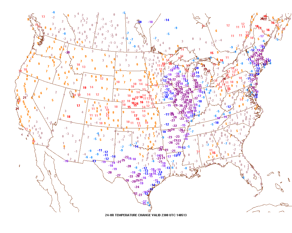
Note how dramatic of a temperature shift is occurring to our west- temperatures are down more than 30 degrees from this same time last night.

t0

That cool air will filter into our region tonight and Wednesday.  As a matter of fact, we still think Thursday has the potential to remain in the 40s for the better part of the day.  The video below has more details on this and a look ahead to continued rainy times.

Monday Evening Video Update

It’s a warm and muggy evening across central Indiana and showers and thunderstorms are in your forecast.  More on this and the long advertised BIG cool down looming inside the…

You must be logged in to view this content. Click Here to become a member of IndyWX.com for full access.  Already a member of IndyWx.com All-Access?  Log-in here.

Unsettled And Stormy; Turning MUCH Cooler!

Mon.

Tue.

Wed.

Thr.

Fri.

Sat.

Sun.

 Status-weather-showers-day-icon

 Status-weather-showers-day-icon

 Status-weather-storm-night-icon

 Status-weather-showers-scattered-icon

 Status-weather-showers-scattered-icon

 Status-weather-showers-day-icon

 Status-weather-showers-day-icon

63/ 82

66/ 77

52/ 60

44/ 56

42/ 55

37/ 60

38/ 60 

Light

Light

Moderate

Light

Light

Light

Light

The new work week will feature a very stormy and unsettled weather pattern.  While everyone won’t get wet today, we do note the likely chance of afternoon thunderstorms bubbling up during the heating of the day.  Like Sunday, any of these storms could feature torrential rain and could quickly pulse to severe levels.  More widespread rain chances will arrive Tuesday into Wednesday in direct association with a cold front.  The long advertised cooler pattern will arrive behind this front and set up an unseasonably cool time of things to close out the second half of the week and head on into the weekend.  Rainfall totals this week will average an additional 1.25″ to 1.50″ with locally higher totals.  As for temperatures, we’ll go from well above seasonal levels today (8-10 deg. above normal) to well below seasonal levels by mid week (20 deg. below normal).

Forecast radar at 2:00p today, via the short-term high resolution HRRR forecast model.