The region is still very much under the gun for potential severe weather this afternoon and tonight. That said, the severe threat across central Indiana is highly dependable on just how easy we’re able to shake the clouds and rain this morning. Sometimes modeling (even high resolution data) struggles with this.
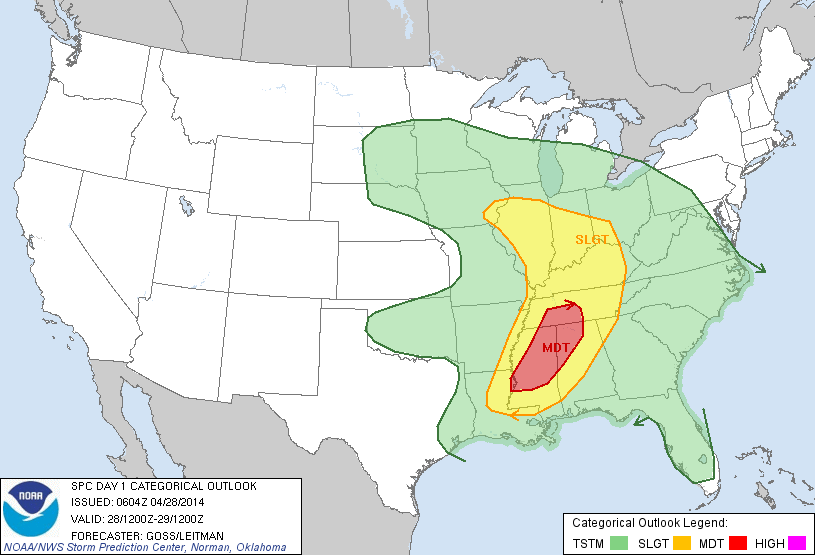
The Storm Prediction Center (SPC) outlines the region for a Slight Risk of severe weather- again the primary threat time lies this afternoon into tonight.
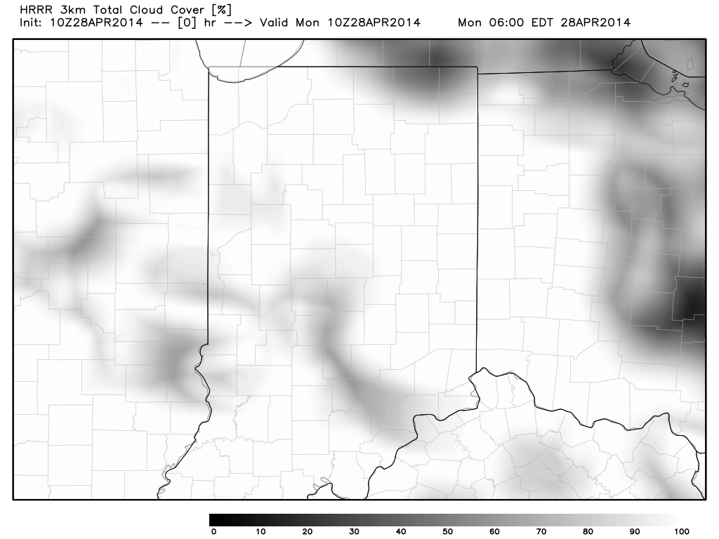
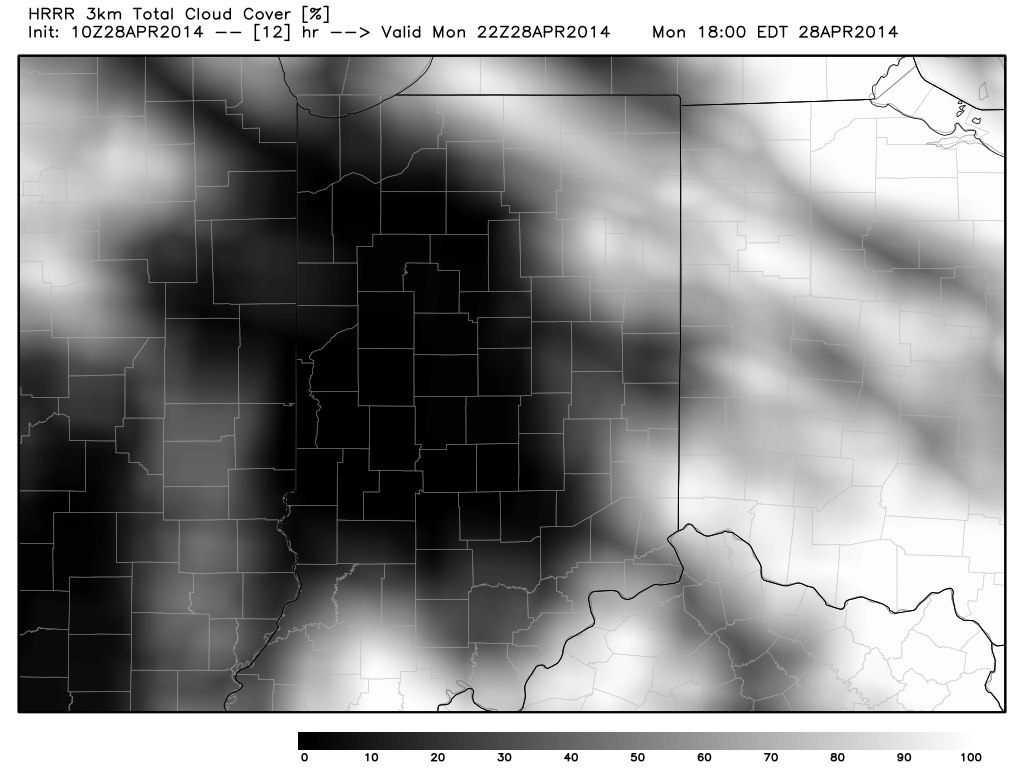
Latest high resolution data suggests we’re able to clear things out this afternoon and introduce sunshine to help add heat and further destabilize our local atmosphere (not a good thing), which would help lead to rather robust thunderstorm development.
Note the simulated satellite data showing the dreaded clearing from now through the afternoon:
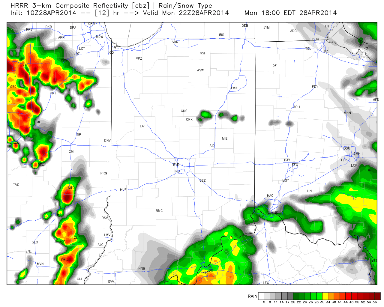
Latest high resolution data suggests potential super cell thunderstorms begin to fire to our west as early as 4-6pm. We’ll keep a close eye on things.

Bottom line, a significant severe weather threat is present this evening into tonight. We’ll hope the clouds and rain linger longer than modeling currently projects as this would greatly limit the potential heating and destabilization and subsequent severe risk. That said, it’s important to note current data does suggest we break into afternoon sunshine.
Greatest severe risks here appear to be large hail, damaging straight line winds, and a possible tornado. Be sure to have a way to get the latest weather information this afternoon and tonight. Stay safe out there!