Damaging Hail Threat Looms For Central, Southern Indiana This Afternoon.

The morning is dawning pleasant and quiet, but things appear to get quite noisy and active around these parts later this afternoon.  A cold front will slice into the warm and humid air mass in place across the region and thunderstorms will erupt in rather explosive fashion as early as the early to mid afternoon hours.  Damaging straight line winds and large hail are of greatest concern.

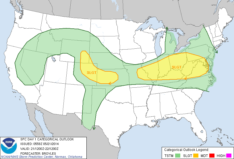
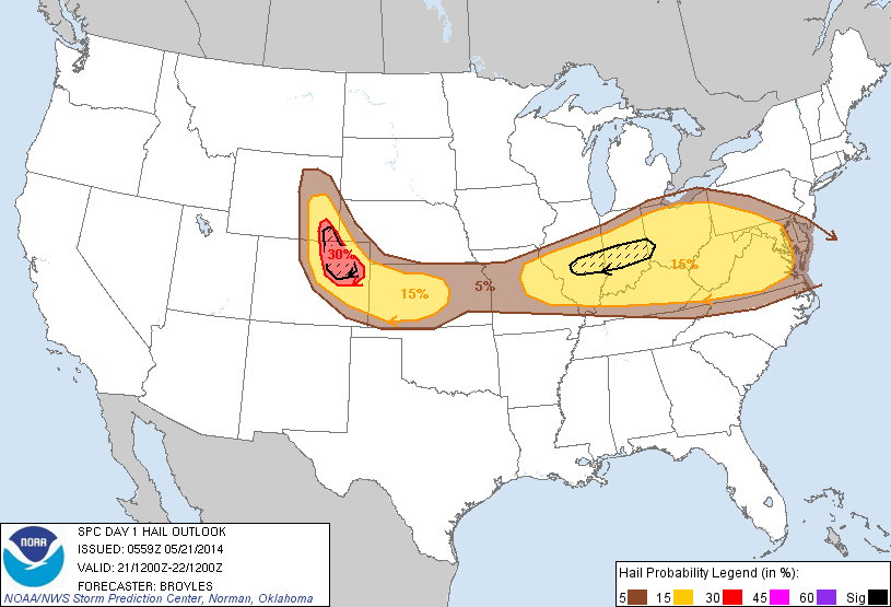
The Storm Prediction Center (SPC) highlights the region for an enhanced risk of large and destructive hail this afternoon.

day1otlk_1200


day1probotlk_1200_hail

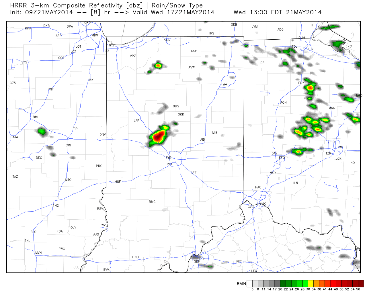
Here’s a look at what the simulated forecast radar may resemble this afternoon, as always, courtesy of Weatherbell Analytics:

Forecast Radar 1pm
Forecast Radar 1pm


Forecast Radar 4pm
Forecast Radar 4pm


Forecast radar 5pm
Forecast radar 5pm 
Forecast radar 7pm
Forecast radar 7pm

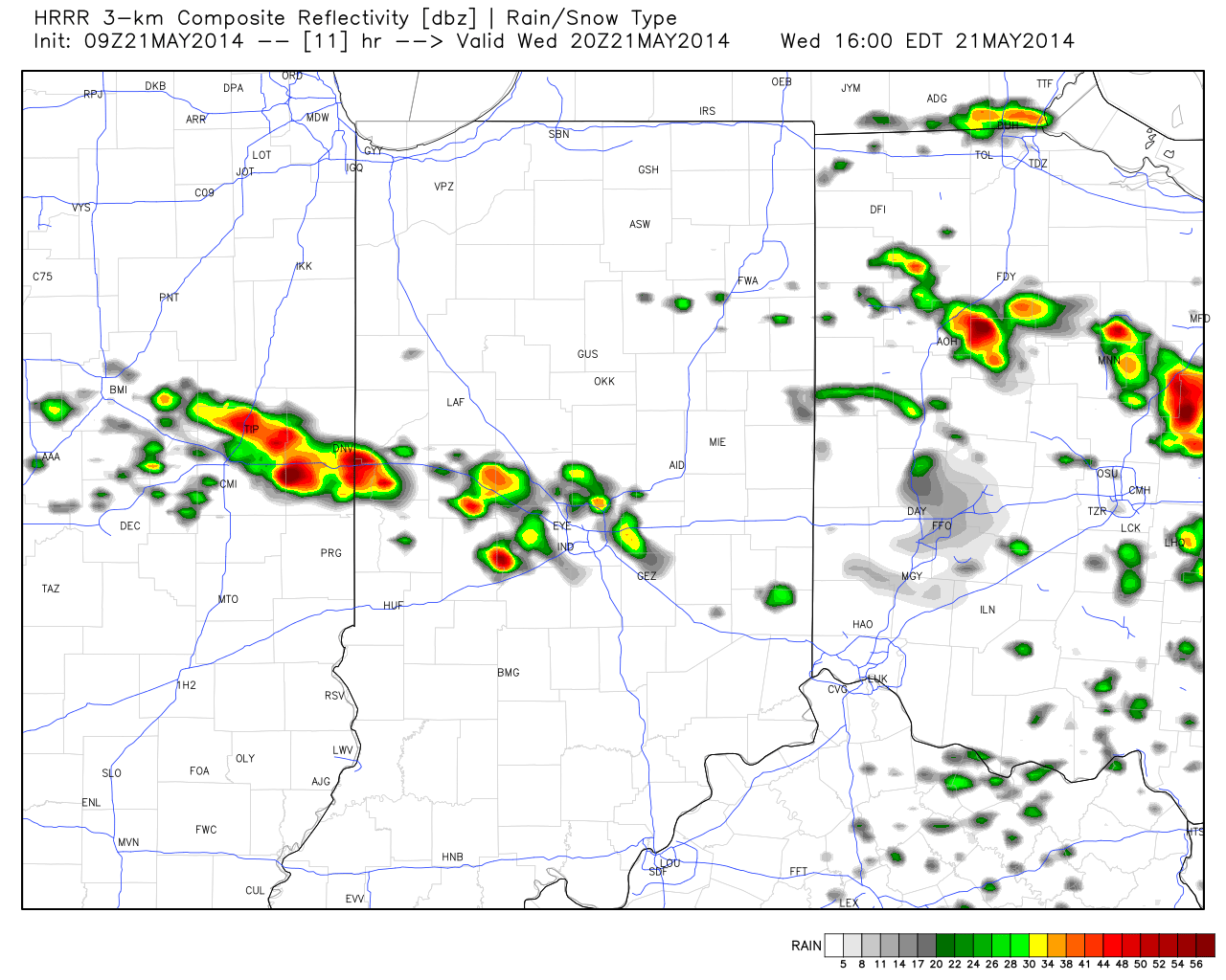
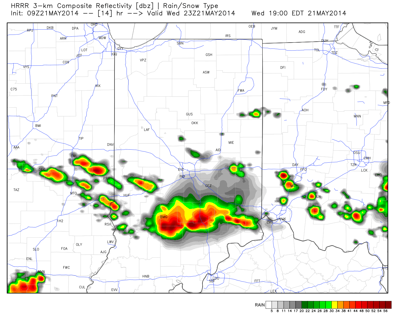
Now it’s important to note not everyone will see destructive severe weather (as is usually the case with any severe weather outbreak), but signals point towards the possibility of a rather significant and large scale severe hail event across central and southern portions of the state this afternoon and evening.  It’ll be very important to stay tuned to your favorite media and certainly heed all warnings that come out this afternoon.

We’ll clear things out nicely later tonight and Thursday and set the stage for an absolute beauty of a holiday and race weekend.  We forecast bright, sunny skies each day along with cool temperatures that slowly warm to the upper 70s for race day, itself.  We’ll introduce the next threat of storms for Memorial Day amidst bubbling true summer heat and humidity for next week.

Severe Weather Video Brief Tonight-Wednesday

The region remains under fire for severe weather potential, primarily for damaging straight line wind and hail per latest thinking.  The video uncovers when you can expect this and looks ahead to the all-important Memorial Day and Indianapolis 500 weekend!

The region is under fire for severe potential Wednesday.

Eyeing Storms Wednesday; Beauty Of A Weekend On Deck!

Tue.

Wed.

Thr.

Fri.

Sat.

Sun.

Mon.

 Status-weather-showers-day-icon

 Status-weather-showers-day-icon

 Status-weather-clouds-icon

 Status-weather-clouds-icon

 Status-weather-clouds-icon

 Status-weather-clouds-icon

 Status-weather-showers-day-icon

57/ 80

64/ 80

58/ 74

51/ 72

49/ 74

52/ 78

61/ 84 

Light

Light

– – –

– – –

– – –

– – –

Light

The daytime hours into the evening will be very pleasant today- mostly sunny to partly cloudy, warm, and breezy!  A windy warm-up is underway as temperatures are running 17 degrees warmer than 8 o’clock Monday morning.  Highs both today and Wednesday will approach 80.  We’re eyeing a couple rounds of thunderstorms in our future- late tonight/ early Wednesday and then again Wednesday afternoon.  That said, we caution bust potential is high and while a slight risk of severe weather is up for the region for both potential thunderstorm complexes, conditions are far from a “lock.”  We’re confident portions of the Ohio Valley will deal with a couple rounds of severe thunderstorms, but there’s the chance the first wave of severe weather is across far eastern portions of the state and targeting more of Ohio and there’s also the chance that round two Wednesday is mostly across downstate Indiana.  We’ll keep an eye on things and update later this evening.  Regardless, large hail and damaging winds will be of greatest concern.  Stay tuned for further updates this evening.  Rainfall potential is around half an inch tonight through Wednesday, with locally heavier downpours.  As we move forward, we’re very confident on a glorious late week stretch and Memorial Day weekend- lots of sunshine and very pleasant temperatures!  A warm front will introduce a chance of an afternoon thunderstorm Monday afternoon, along with a much hotter, more humid feel.

Tuesday Evening Video Brief; The Cool Down Is On!

Note how dramatic of a temperature shift is occurring to our west- temperatures are down more than 30 degrees from this same time last night.

t0

That cool air will filter into our region tonight and Wednesday.  As a matter of fact, we still think Thursday has the potential to remain in the 40s for the better part of the day.  The video below has more details on this and a look ahead to continued rainy times.

Monday Evening Video Update

It’s a warm and muggy evening across central Indiana and showers and thunderstorms are in your forecast.  More on this and the long advertised BIG cool down looming inside the…

You must be logged in to view this content. Click Here to become a member of IndyWX.com for full access.  Already a member of IndyWx.com All-Access?  Log-in here.