Focusing On Wednesday Evening Severe Potential…
Good afternoon! We wanted to cut a video discussing our thinking around timing and primary threats from any severe weather that gets going across central Indiana tomorrow evening.
Good afternoon! We wanted to cut a video discussing our thinking around timing and primary threats from any severe weather that gets going across central Indiana tomorrow evening.
Our nice weekend is set to continue for another 18-24 hours with another unseasonably cool night ahead. While humidity will increase during the afternoon Sunday, most of Sunday will be dry, albeit warmer. High temperatures will climb into the middle 80s for many central Indiana communities.
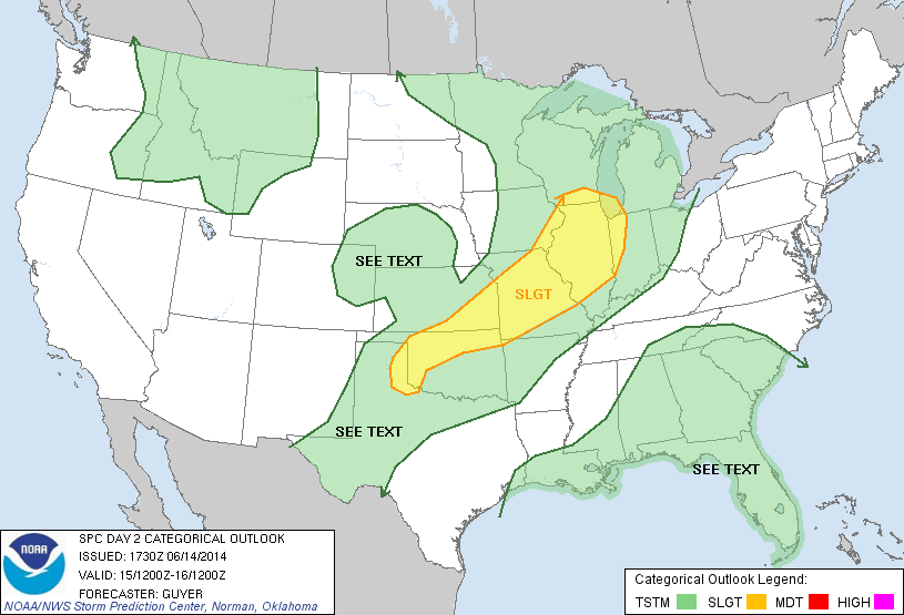
Times will begin to change as we go into Sunday night as just the beginning of a series of convective elements come together to impact the region through Tuesday. Thunderstorms will likely rumble into far western portions of the state as early as 4-5pm. Speaking of far western portions of Indiana, the updated severe weather outlook from the Storm Prediction Center highlights western Indiana for a slight risk of severe thunderstorms. Again, this is a late day severe weather risk with damaging wind and large hail of greatest concern.
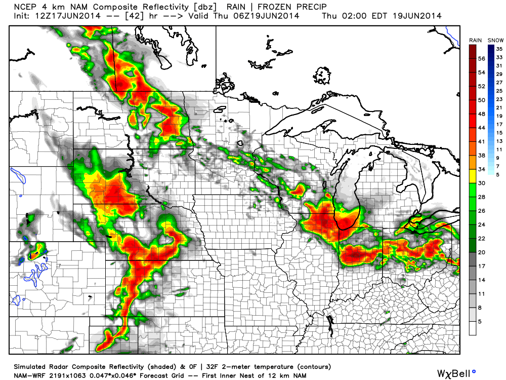
Forecast simulated radar shows the convection rumbling east Sunday night and most of central and eastern Indiana get in on the thundery action before Sunday is finished. Here’s a look at what the radar may look like from 8pm Sunday to midnight Monday morning.

While the storms will likely weaken as they track east, a strong thunderstorm or two is certainly possible for the greater Indianapolis region Sunday night. We’ll keep you posted with future updates. Have a relaxing Saturday night.
Quick video update this afternoon to discuss what we can expect this evening into the overnight.
You must be logged in to view this content. Click Here to become a member of IndyWX.com for full access. Already a member of IndyWx.com All-Access? Log-in here.
Good evening, friends. Here’s a video update as we get set to welcome a cooler, drier regime into central Indiana to wrap up the work week. Additionally, we’re also tracking another potential heavy rain maker for the second half of the weekend (not that we need more heavy rain)….
PS: The IndyWx.com mascots have attempted more times than not to interrupt my video updates, so I only thought it was time to give them a little face time. Meet Cameron (left) and Newton (right).

|
Wed. |
Thr. |
Fri. |
Sat. |
Sun. |
Mon. |
Tue. |
|
|
|
|
|
|
|
|
|
64/ 77 |
57/ 75 |
53/ 75 |
52/ 80 |
63/ 78 |
60/ 74 |
52/ 78 |
|
Moderate |
– – – |
– – – |
– – – |
Moderate |
– – – |
– – – |
An area of showers and thunderstorms will push through central Indiana in a much weaker state when compared to what this complex was like to our northwest 12 hours ago. All the while, heavy rain, small hail, and gusty winds can be expected as the storms rumble through central Indiana. We’ll go through a break in the action during the late morning hours, but caution that a second area of showers and thunderstorms will develop during the early afternoon. These storms will likely reach severe levels as they encounter a warmer, more unstable air mass across southern portions of the state. If you have travel plans say to areas such as Louisville this afternoon, certainly keep an eye to the sky and have a means of receiving the most updated weather information. All modes of severe weather will be in play across southern Indiana this afternoon, including hail, tornadoes, and straight line wind.
We’ll undergo a regime change tonight and that will set the stage for a delightful close to the work week, including lots of sunshine, low humidity and cooler temperatures. Our next storm system is slated for a Sunday arrival.