6-10 Day Outlook: Significant Winter Event Looms…
The 6-10 day period will likely be dominated by an air mass of arctic origin, and the potential is present for the period to begin with a rather significant winter event. Models have occasionally “teased” the idea of dropping the PV (Polar Vortex) over the Great Lakes during this period, and that’s not something that’s off the table given the pattern here. Suffice it to say, we expect this period to run much colder than average.
While there will be some specifics we’ll have to sort through as time gets closer, this is remarkable model agreement when looking at the GFS and European ensemble sets in the medium term.
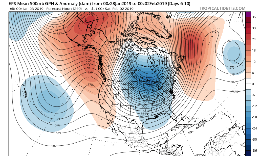
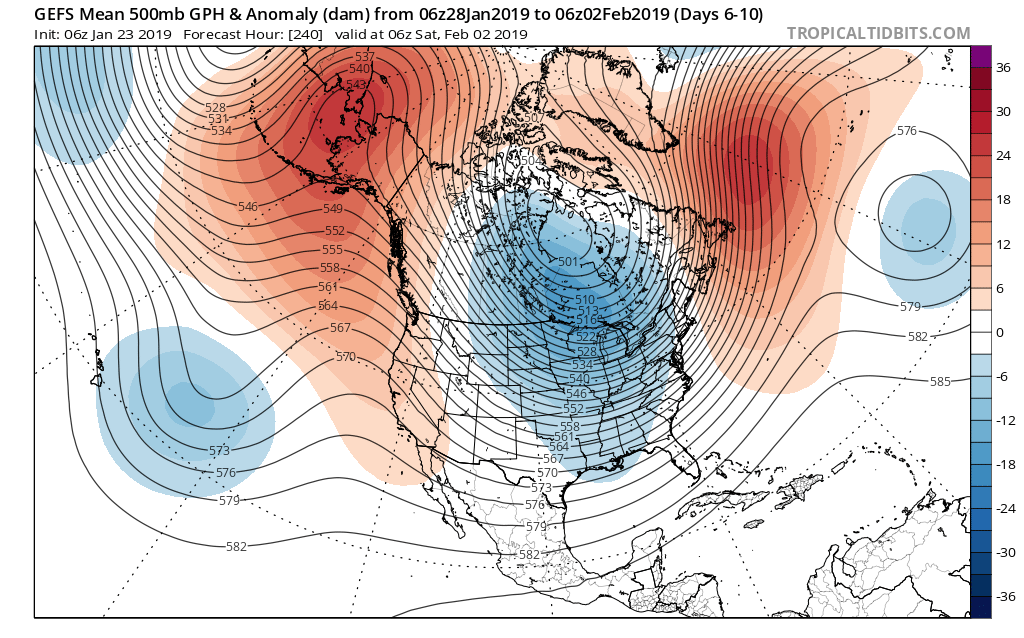 We’ve been discussing the opportunity where we see the flow slow enough to allow one or two of these clipper systems in the medium to longer range to deepen into a stronger storm system. That may be the case late weekend into early parts of next week and it’s something we’re keeping a close eye on. In addition to measurable snow, the potential is on the table for notable cold in the 6-10 day period, including multiple days below zero. In the extreme, this is the type pattern that could lead to double digit below zero cold across central Indiana- not including the wind chill.
Stay tuned.
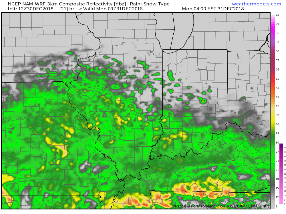
 As upper level energy tracks northeast this evening, strong frontogenesis will help a “
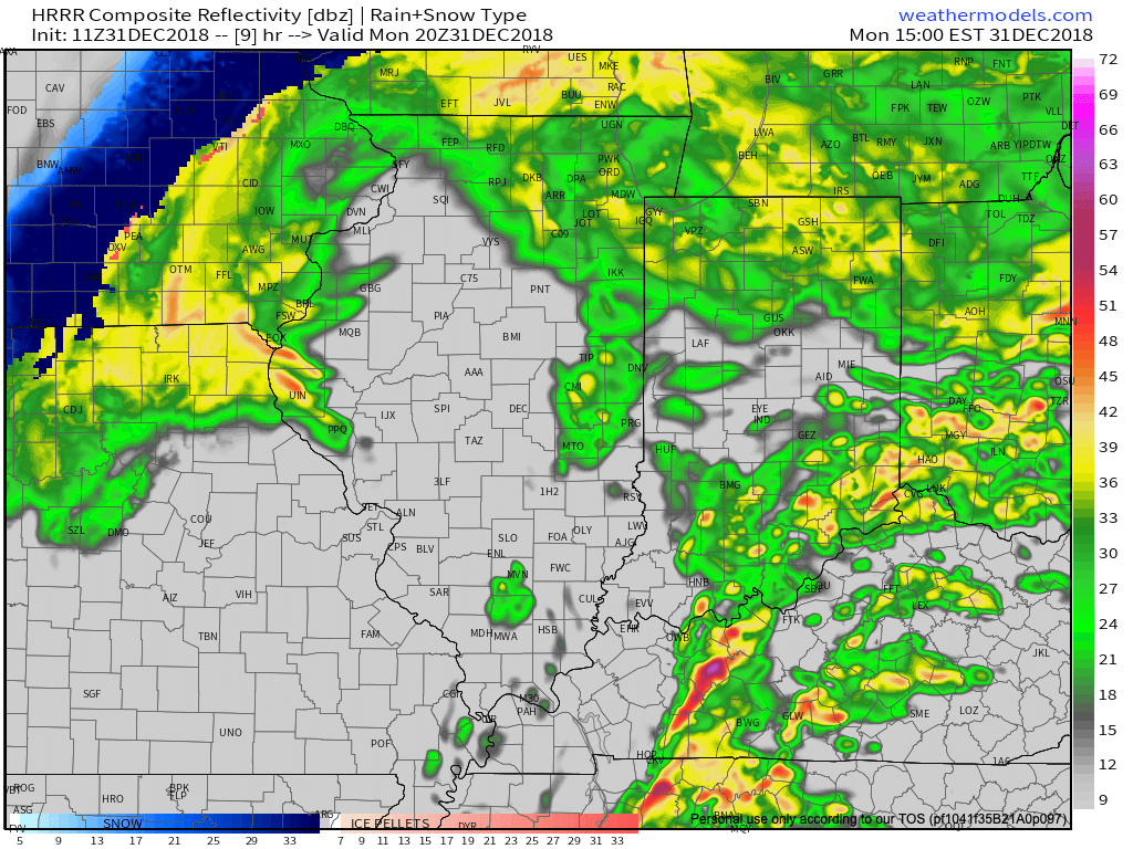
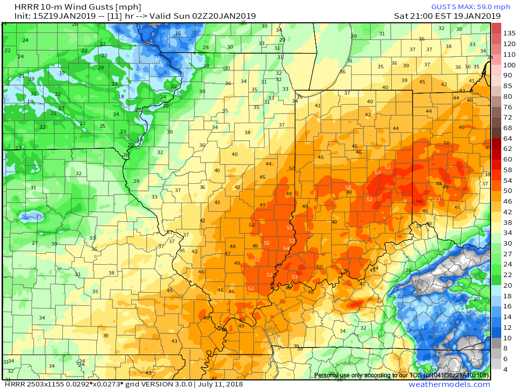 Obviously this will create concerns for power outages, but the other major worry is for developing blizzard-like conditions and whiteouts through the late afternoon into tonight.
 We’ll have additional updates later this afternoon here on IndyWx.com and on our social media accounts.
 We’re also still monitoring the potential of strong to severe thunderstorms across southern portions of the state. The Storm Prediction Center now includes far southern Indiana in a Slight Risk for severe weather today. The primary concerns remain strong, damaging winds with a line of thunderstorms that may develop between 2p and 4p. If your travels take you south towards Louisville today remain weather-aware.
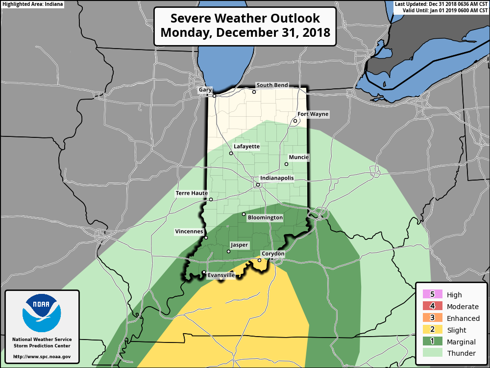
 Temperatures will run 25° to 30° colder New Year’s Day and a couple of scattered snow showers may fly- especially across the favored snowbelt areas to our north.
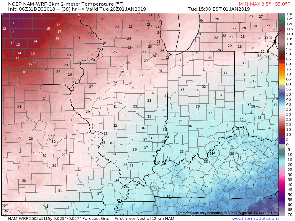 Have a happy and safe New Year’s Eve, friends!

 Colder air will whip in here late tomorrow night and help lingering moisture fall as scattered snow showers New Year’s Day. More later on the potential of wintry “mischief” later in the week…