April Turns Active: Timing Out Storms…

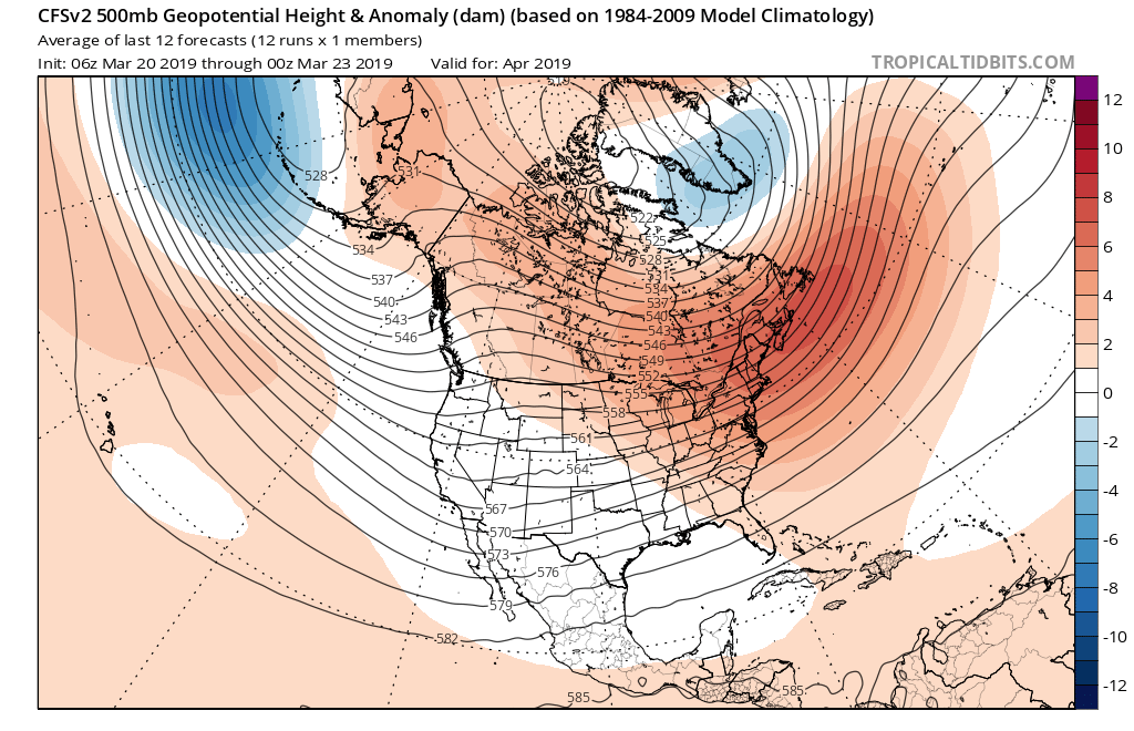
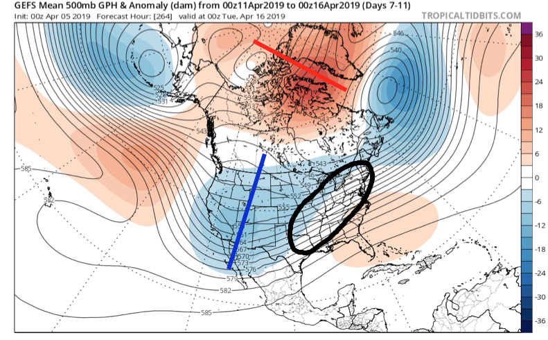
A series of storm systems will impact the OHV region over the next couple of weeks. As we look at the overall pattern, a negative NAO will begin to have significant influence on the overall pattern through mid-April. We note the mean trough position settles into the western portion of the country with a reflection of a southeast ridge in place. Accordingly, the Ohio Valley will find itself in the middle of the primary storm track as we progress through the middle part of the month.

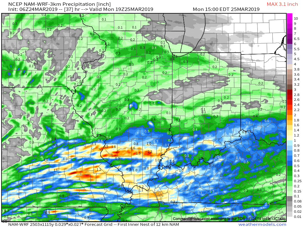
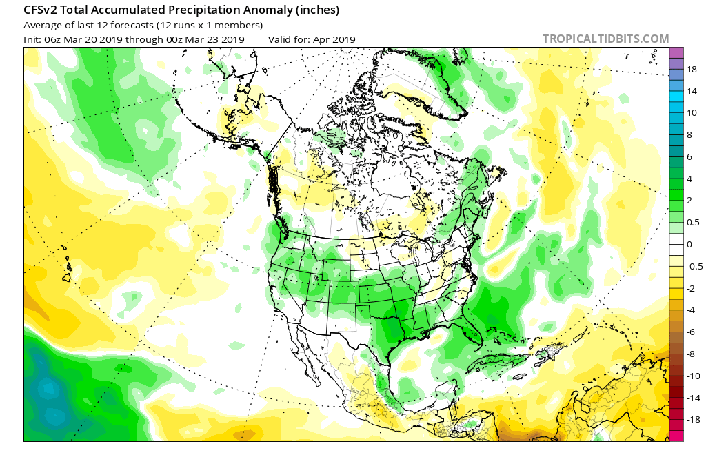
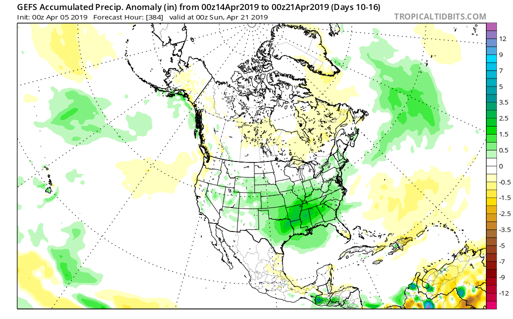
With said pattern in place, precipitation is expected to run above, to significantly above, normal during the mid-month stretch.

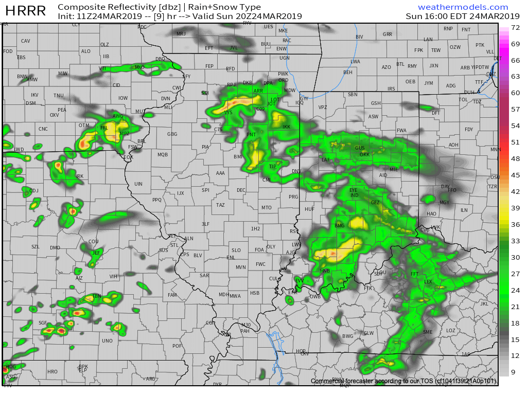
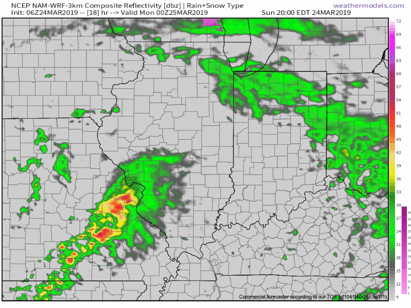
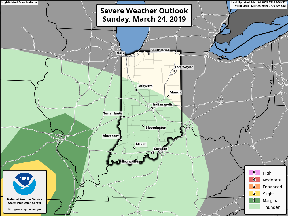
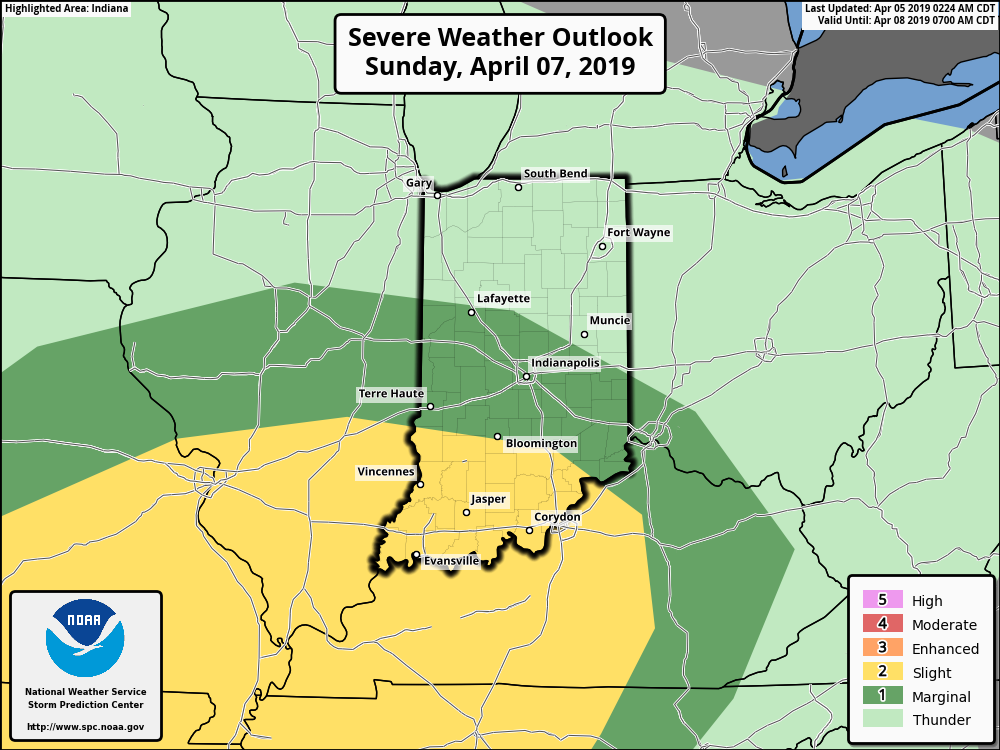
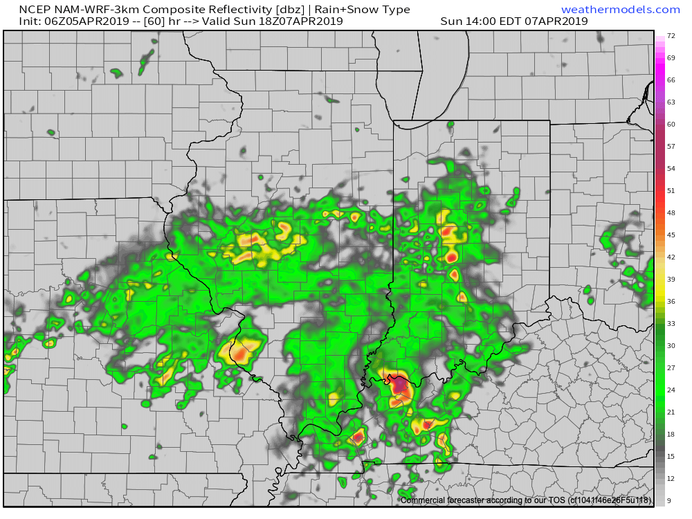
After a gorgeous Saturday (sunshine and lower 70s), the first of a series of storm systems will begin to impact the region Sunday. A couple of strong to severe thunderstorms are possible across southern and central IN- especially during the afternoon.

Thereafter, additional dates to monitor for storm impacts include the following:

Wednesday night and Thursday- April 10th and 11th

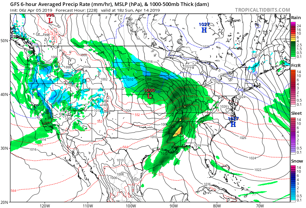
Saturday and Sunday- April 13th and 14th

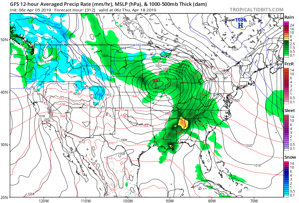
Wednesday and Thursday- April 17th and 18th

We’ll be able to get much more specific with these individual storms as we get closer! An updated video will hit this evening looking closer at Sunday’s storm threat. In the meantime, get set to kick off the weekend with superb weather!

Pattern Returns To An Active Time Of Things…

One word to describe the mid-April weather pattern? ACTIVE. Tonight’s medium and long range video update dives in further…

You must be logged in to view this content. Click Here to become a member of IndyWX.com for full access.  Already a member of IndyWx.com All-Access?  Log-in here.

Heavy Rain, Couple Strong Storms Possible Across Southern IN Tonight…

Scattered showers will spread across central Indiana at times through the day. Most of this rain will be light in nature through the afternoon hours, but a couple of moderate showers are also possible.

A surface low will track east across the lower Ohio Valley tonight and this will result in more concentrated heavy rain falling across the southern portion of the state this evening into early Monday morning. This is a bit further south than model guidance suggested yesterday. Additionally, a couple of strong thunderstorms are also possible tonight across far southern Indiana.

It wouldn’t surprise us to see the Storm Prediction Center (SPC) include portions of southern Indiana in a ‘Marginal’ or ‘Slight’ risk of severe weather tonight with future updates.

With the more southern track now expected from this storm system, the corridor of .50″ to 1″ rainfall totals will settle across the southern portions of Indiana, with 0.10″ to 0.25″ expected for central Indiana on average.

Rain will come to an end for all of the state by mid to late morning Monday with dry conditions returning Monday evening into the middle of the week, thanks to high pressure.

Dry and pleasant conditions will remain in place through the daytime hours Thursday before a storm system approaches Thursday night into Friday. The gusty southwesterly air flow in advance of this storm will help pull warmer conditions northeast into the Ohio Valley. Highs between 65-70 are on tap by Thursday afternoon. Unsettled weather is anticipated to remain through next weekend along with progressively colder conditions.

Spring Flood Outlook…

It’s been since 2013 since the Lower 48 has seen greater snow cover on the 23rd of March.

Officially, 25.4% of the Lower 48 is currently snow covered, including crucial areas that feed downstream rivers in the north-central Plains and upper Midwest.

NOAA released their Spring Flood Outlook Friday. This shows major to moderate flooding expected on area rivers from the northern Plains south along the MS River. Even moderate to minor river flooding is anticipated across the east, including the Ohio Valley.

The full report can be found here.

As we move into April, a ridge is expected to back west and result in an active storm track from the west into the Mid West and Great Lakes. The end result will be a favorable pattern for above average precipitation. Factor that in with the above average late season snowpack currently in place across the exact same region, and the stage is set for moderate to significant river flooding through the remainder of the spring.


More specific to central Indiana, we also expect an active spring storm track- including precipitation that is around “average” from the March through May (meteorological spring) period. As warmth expands as we move into mid-April, expect an uptick in severe weather episodes further north during the 2nd half of April into May.