Thursday Night Storm Update; Heavy Rain Maker Sunday…
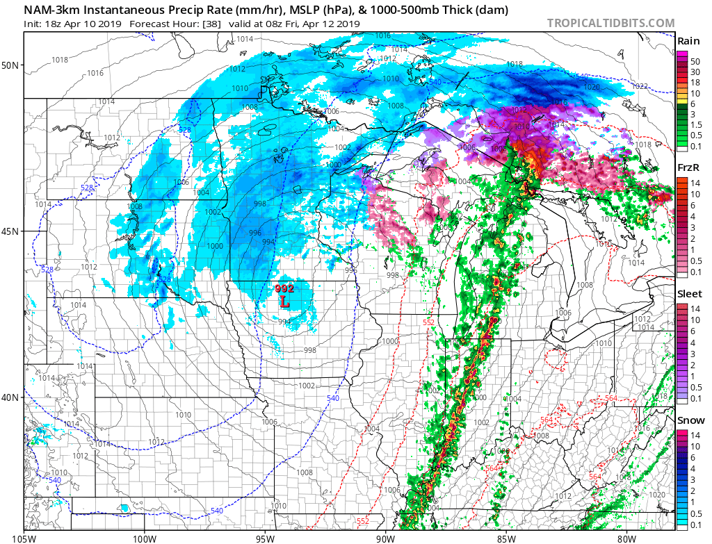
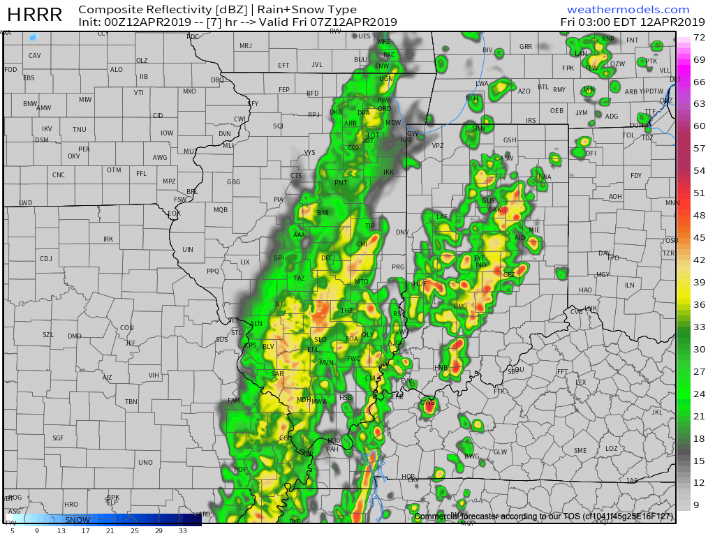
We’re still quiet across central Indiana just before 10:30p, but showers and thunderstorms will overspread the area during the overnight. Best chances of the potential of damaging straight line winds will be along the western IN state line, but a couple of embedded strong storms and locally heavy rain will encompass all of the central portion of the state after midnight. Greatest coverage of showers and thunderstorms will come during the window of 1a and 6a.
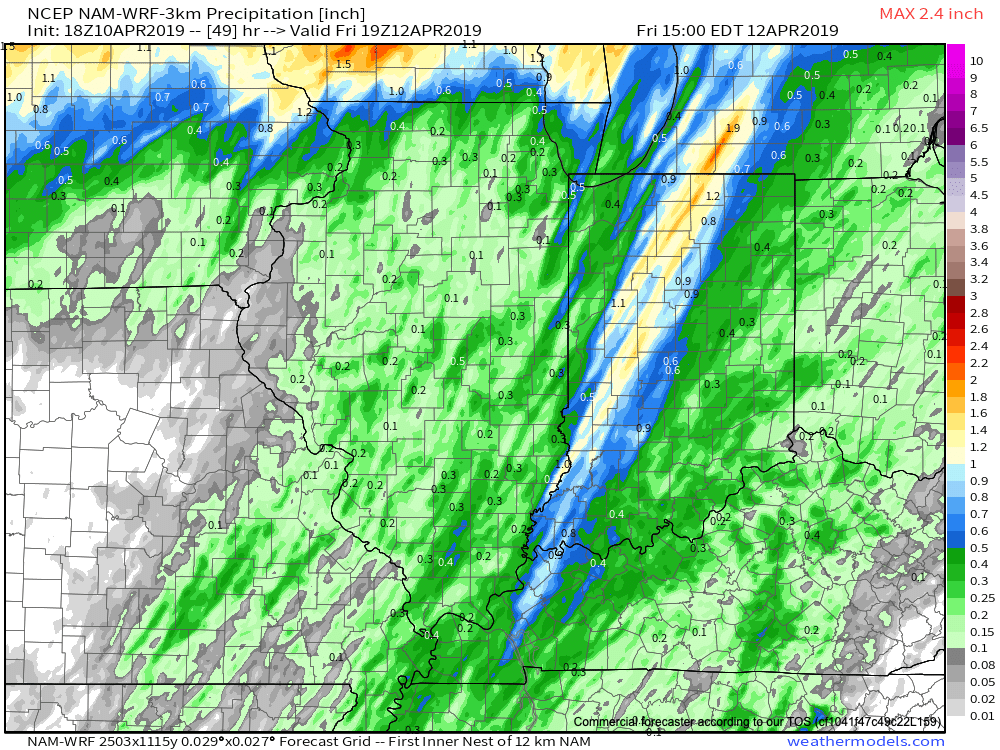
Total rainfall amounts will average between 0.50″ and 1″ with a couple of locally heavier totals.

We still expect the rain to exit stage right well before the lunchtime hour Friday with dry conditions prevailing as we get set to put a wrap on the work week.
After the warmest day so far this year, temperatures will be much cooler Friday behind the cold front (to the tune of 20-30 degrees)!

Dry conditions will continue through the daytime Saturday, but a big ole wet storm system will be taking shape to our southwest by that time and it’ll have its’ eyes set on our area for an overnight arrival Sunday. The second half of the weekend will be dominated by gusty winds and wet conditions.
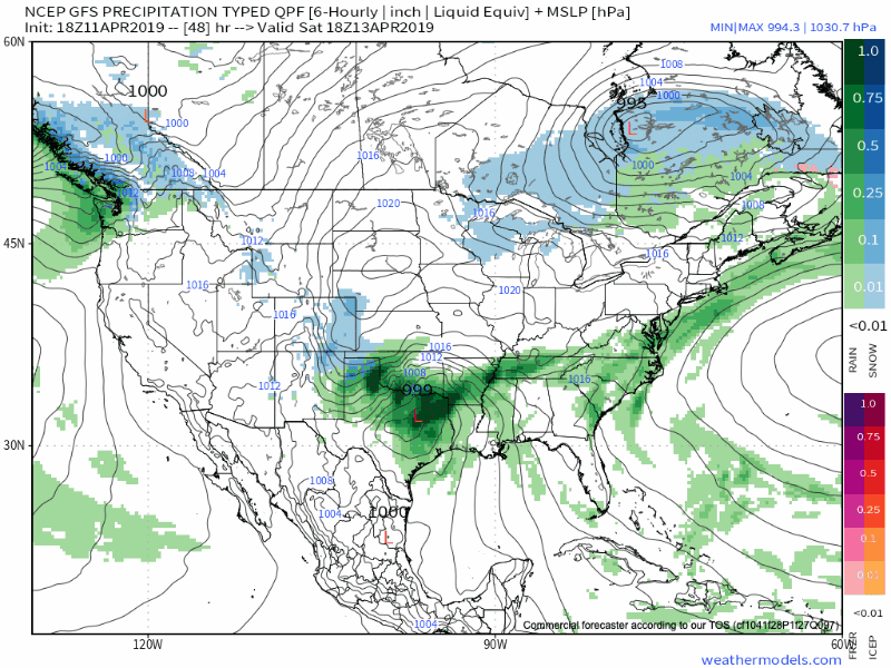
An all day soaker is expected with heavy rain at times. An additional 1″ to 2″ is a good bet Sunday.
After a dry open to April, we’re set to make up for the quiet times (and some) over the course of the next few days, and the hits don’t look to stop there as we head into next week.