VIDEO: Tuesday Evening Rambles…
You must be logged in to view this content. Click Here to become a member of IndyWX.com for full access. Already a member of IndyWx.com All-Access? Log-in here.
You must be logged in to view this content. Click Here to become a member of IndyWX.com for full access. Already a member of IndyWx.com All-Access? Log-in here.
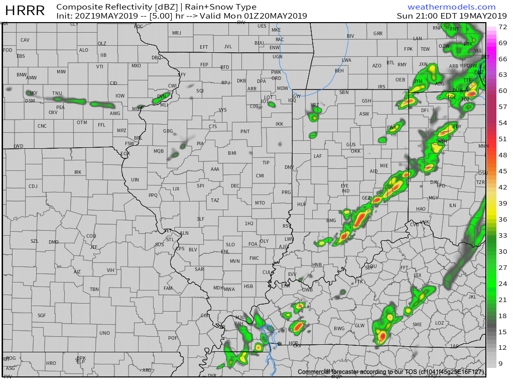
A line of strong to severe thunderstorms will continue to march east across the state this evening. As has already been the case, the primary concern with this line of storms will be damaging straight line winds and the NWS has been busy issuing warnings this evening.
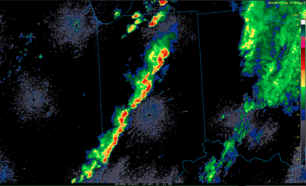
The line will pass into eastern Indiana over the next hour, or so, before weakening as it rumbles into Ohio.
Much cooler and drier air will work in overnight and you’ll certainly notice the difference out the door in the morning. Lows will fall into the lower 50s by morning. We’ll go even lower than that Tuesday morning with widespread middle 40s expected.

Resurgent warmth and humidity will make a return for the 2nd half of the week and with it will come that sultry feel. As a new heat ridge takes up residence across the region, storm systems will “flirt” with the area from time to time. Accordingly, we expect unsettled conditions not only for the 2nd half of the work week, but continuing into the Indy 500/ Memorial Day weekend. It certainly won’t rain and storm the entire time, but the threat for a passing storm at any time will be high.

More in the morning around the pattern evolution into early-June, but we continue to believe the MJO will have it’s say and that things will transition towards an eastern trough as we put a wrap on May and open June.
A sunny, but hot Saturday is on deck before we introduce strong thunderstorms into the picture for the second half of the weekend. We also look ahead to the pattern…
You must be logged in to view this content. Click Here to become a member of IndyWX.com for full access. Already a member of IndyWx.com All-Access? Log-in here.
You must be logged in to view this content. Click Here to become a member of IndyWX.com for full access. Already a member of IndyWx.com All-Access? Log-in here.
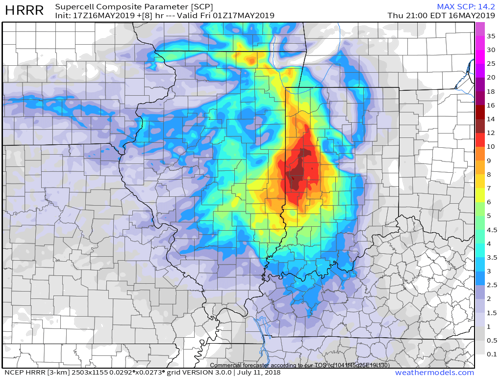
The Storm Prediction Center has issued a Severe Thunderstorm Watch in effect until 7p.
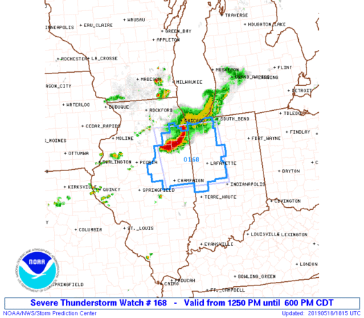
Greatest concern has to do with the Southwest flank of the thunderstorm complex that will continue to push southeast into the evening hours. (This is the same complex of storms that moved through MN and WI earlier this morning).
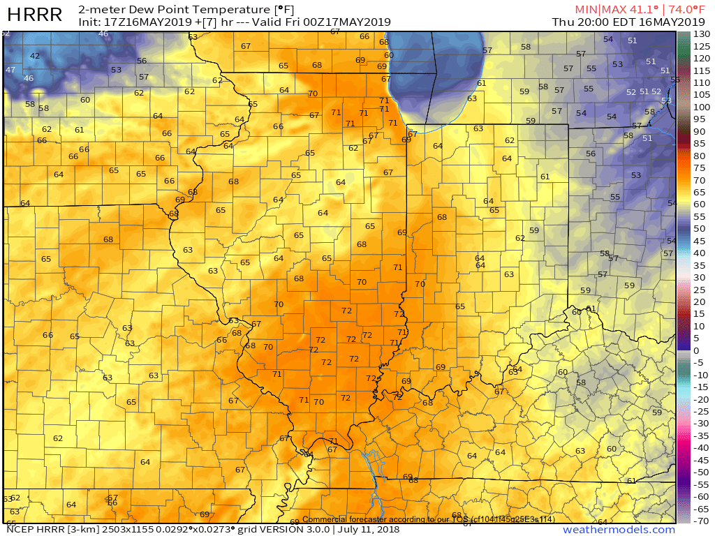
As we look at the ingredients needed for severe weather, there’s reason to believe this complex will hold together, including occasionally producing severe weather (large hail and damaging winds remain the biggest concerns) into portions of central Indiana by early to mid evening (5p-8p time frame).
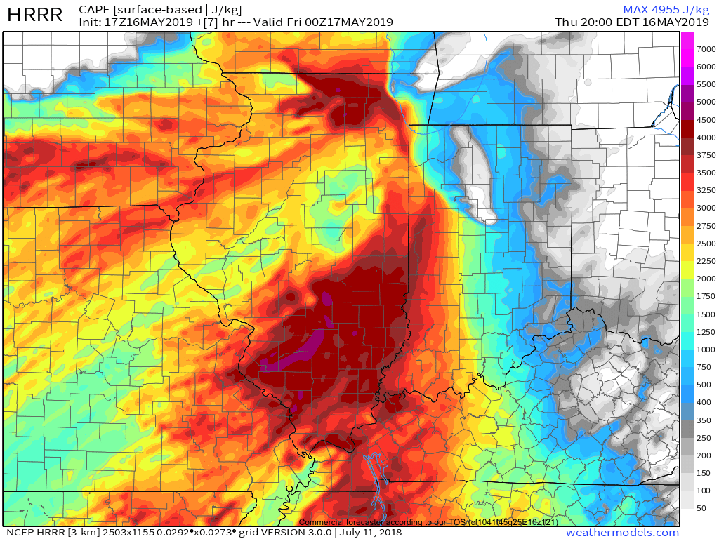
This shouldn’t have any impact on another, more widespread, complex of storms that will initiate well to our north late tonight before rumbling south into central Indiana around, or just after, midnight in a weakening state…
More later!