You must be logged in to view this content. Click Here to become a member of IndyWX.com for full access. Already a member of IndyWx.com All-Access? Log-in here.
7-Day Precipitation: Rainfall is expected to run above average through the period.
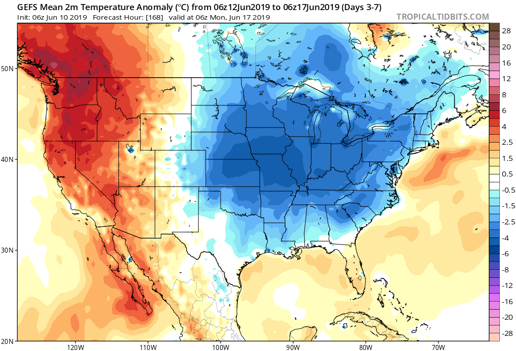
7-Day Temperature Outlook: Temperatures are expected to run well below average through the period.
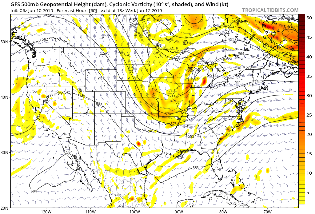
Severe Outlook: Widespread severe weather isn’t anticipated through the period. With that said, we’ll keep an eye on the potential of a couple gusty storms Wednesday as vigorous upper level energy and an associated cold front blow through the state.
Summary: After a wet close to the weekend, drier air will return today and Tuesday, along with increasing sunshine from west to east by this afternoon. Our next system of note arrives Wednesday in the form of a cold front. This will serve to reinforce the unseasonably cool air in place across the region for late week, but also may provide a few gusty storms as it moves through the area. Shower coverage will be scattered to widespread Wednesday. Another system will approach over the weekend with unsettled conditions expected both Saturday and Sunday.
While temperatures will run below normal throughout the period, the coolest day of the week appears to be Thursday with highs only in the mid to upper 60s and lows in the upper 40s to lower 50s.
You must be logged in to view this content. Click Here to become a member of IndyWX.com for full access. Already a member of IndyWx.com All-Access? Log-in here.
You must be logged in to view this content. Click Here to become a member of IndyWX.com for full access. Already a member of IndyWx.com All-Access? Log-in here.
You must be logged in to view this content. Click Here to become a member of IndyWX.com for full access. Already a member of IndyWx.com All-Access? Log-in here.