|
Wed.
|
Thr.
|
Fri.
|
Sat.
|
Sun.
|
Mon.
|
Tue.
|
|

|
|

|

|
|

|

|
|
43/ 52
|
50/ 66
|
43/ 62
|
32/ 50
|
30/ 57
|
38/ 56
|
33/ 46
|
|
Heavy
|
Heavy
|
Light
|
– – –
|
– – –
|
Moderate
|
– – –
|
Forecast Updated 04.02.14 @ 7:30a
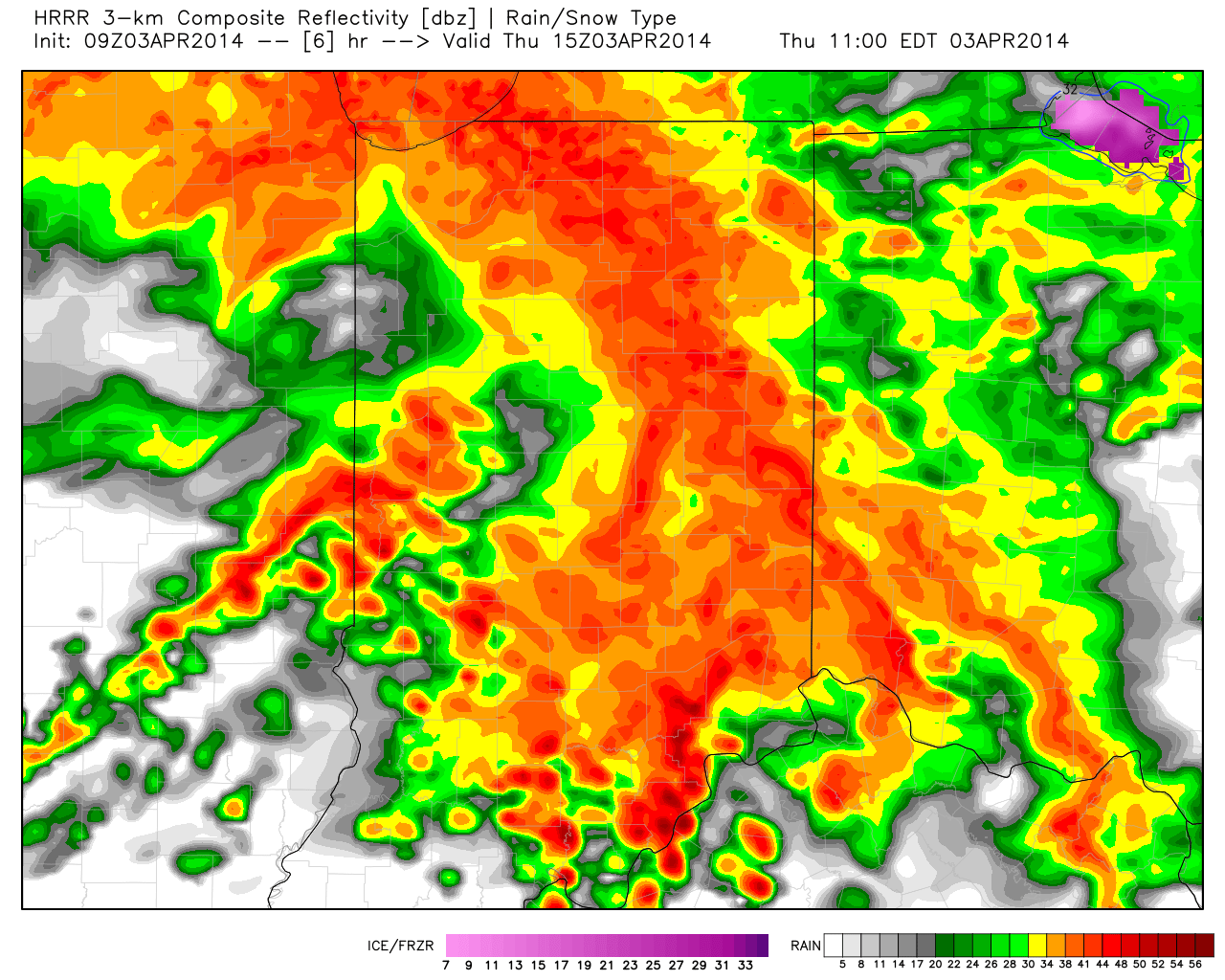
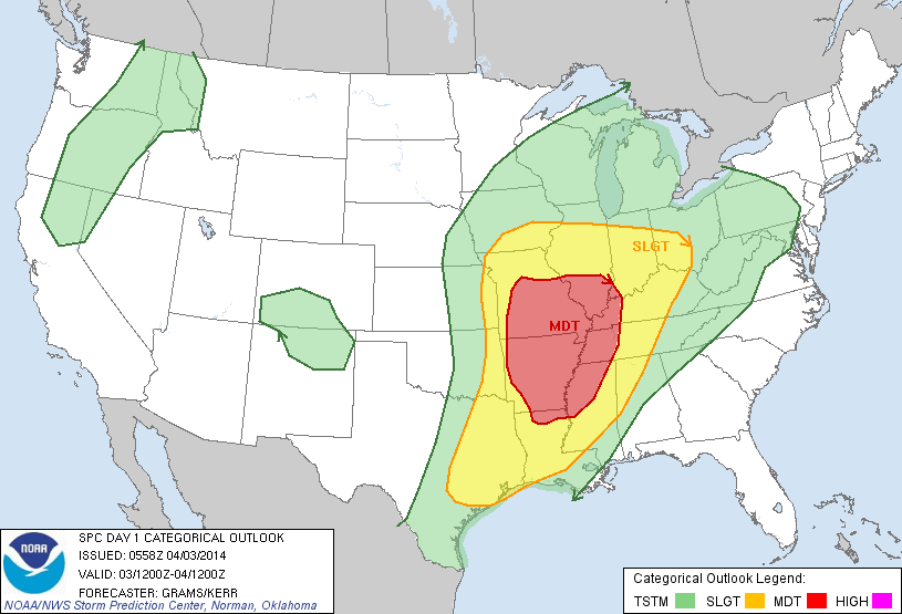
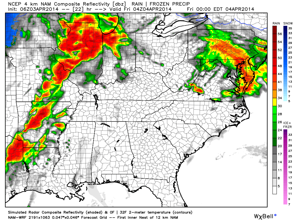
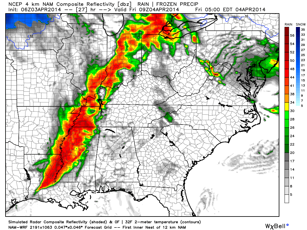
Heading Into A Stormy, Wet Period. . .While periods of showers and thunderstorms will be with us through Friday morning, we break things down and focus in on this afternoon/ evening into Thursday morning for the potential of heaviest rainfall. We then think we experience a bit of a “lull” in the action Thursday afternoon before we ramp things back up and introduce a severe weather component Thursday night into Friday morning. Renewed heavy rains would also accompany these thunderstorms. As for the severe risk, really all modes of severe weather are in play, including damaging hail, straight line winds, and even the possibility of a tornado or two. We’ll continue to closely monitor the ongoing weather situation and suggest you plan to keep abreast of the latest developments in the days ahead in terms of potentially flooding and severe weather. Severe weather outbreaks are always dangerous, but particularly so at night.
The cold front will sweep the state clean of heavy rain and severe thunderstorms Friday morning and this will set things up for a much quieter, calmer (although windy) close to the week.
When all is said and done, we forecast widespread 2-3″ rainfall through the heart of the state, including central Indiana, along with localized amounts between 3″ and 4″.
Much Needed, Calmer, Weekend. . .High pressure will build over head as we go through the weekend and this will supply a drier, calmer period Saturday and Sunday. We’ll note a cooler air mass in place, along with a gusty northwest wind Saturday, but winds will calm Sunday, ensuring a pleasant close to the weekend.
Eyeing Our Next Storm. . .Things are still much in the air in regards to the precise details with a new storm system early next week, but we’re confident something’s brewing. The European data suggests this is another heavy rain event for our neck of the woods Monday, while the GFS is further east, and takes the majority of the moisture up the eastern seaboard. We’ll continue to monitor things.
One more item of note, mid to long range guidance is in agreement on the return of a below normal temperature pattern here later next week… In fact, a few wet snow flurries may fly next Tuesday as the cold air pushes back in.
Upcoming 7-Day Precipitation Forecast:
- 7-Day Rainfall Forecast: 3″ – 4″
- 7-Day Snowfall Forecast: 0.00″
 For weather updates and more “behind the scenes” data on the go, be sure to Follow Us on Twitter @indywx or become a Friend of IndyWx.com on Facebook!