Warm Temperatures & Increasing Humidity…
 Highlights:
- Widely scattered storms Monday
- Very warm with increasing humidity this week
- Weekend storms
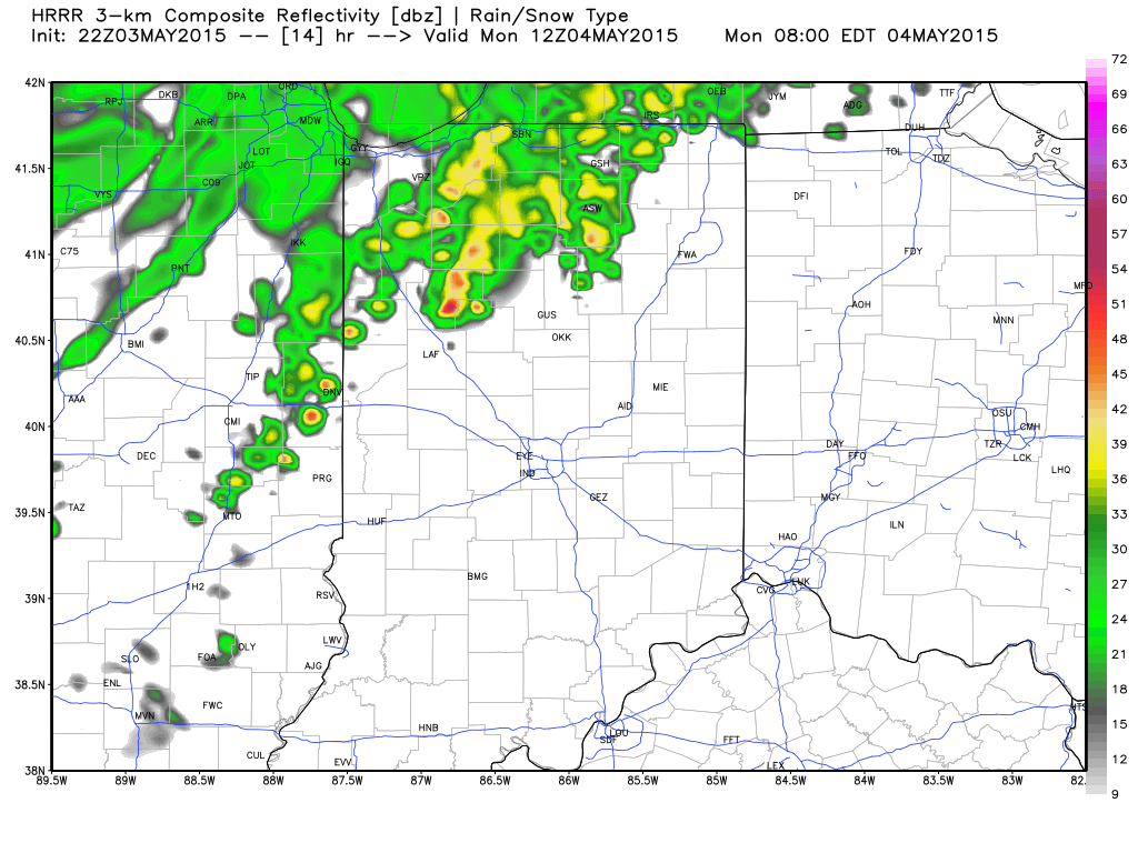 Forecast radar (above), courtesy of Weatherbell.com, shows showers and thunderstorms pressing into the state early Monday morning. This is all part of a frontal boundary that will slip into northern IN Monday before stalling through the mid week stretch. Most widespread coverage of showers and storms will be confined to northern portions of the state, but we’ll also include a mention of widely scattered showers and thunderstorms for central IN Monday. Traveling north this week? Plan on better rain chances as compared to that we’ll see.
The majority of the upcoming work week will feature dry conditions and unseasonably warm temperatures. A prolonged southerly and southwesterly air flow will provide an increasingly muggy feel to the air this week.
Better coverage of showers and thunderstorms will roll in over the weekend thanks to an approaching storm system.
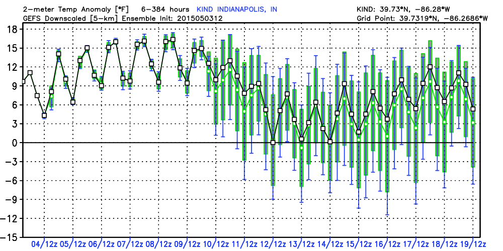 The majority of our mid to long range forecast data suggests the warm pattern we’ve enjoyed to kick off May will continue deep into the month. Ensemble guidance (above) shows a snap shot of temperature anomalies through the 19th of May. As you can see, temperatures will be significantly above normal through the first ten days, or so, of the month.


