Category: Rain

Cool Late Week Stretch…

Thr.

Fri.

Sat.

Sun.

Mon.

Tue.

Wed.

 Status-weather-showers-day-icon

 Status-weather-showers-day-icon

 Status-weather-showers-day-icon

 Status-weather-showers-day-icon

 Status-weather-showers-day-icon

 Status-weather-showers-day-icon

 Status-weather-clouds-icon

42/ 52

41/ 53

43/ 67

49/ 63

45/ 71

56/ 73

58/ 81 

Light

Light

Light

Light

Light

Light

– – –

The region will remain under the influence of a chilly and, at times, damp upper low as we wrap up the work week.  While we’ll keep mention of an isolated to scattered shower into the weekend, most of the weekend will remain rain-free. A warm front will lift north through the region early next week, helping temperatures reach the warmest of the season so far.  We think the years first 80 degree reading will be registered by the middle part of the week.  A new storm system promises another round of active weather beyond the forecast period.

– We’re experiencing technical issues with our video recorder software.  We’ve cut two videos for today’s forecast, but neither will publish correctly.  We’ll continue to work on this and try to post a video briefing later this evening.


Permanent link to this article: https://indywx.com/cool-late-week-stretch-more-on-the-longer-term/

Rinse And Repeat Pattern…

We’re in what we call a “rinse and repeat” pattern.  The region will be under the influence of a broad west to northwesterly flow courtesy of the upper low to our north- over the northwestern Great Lakes region.  This will continue as we put a wrap on the work week.

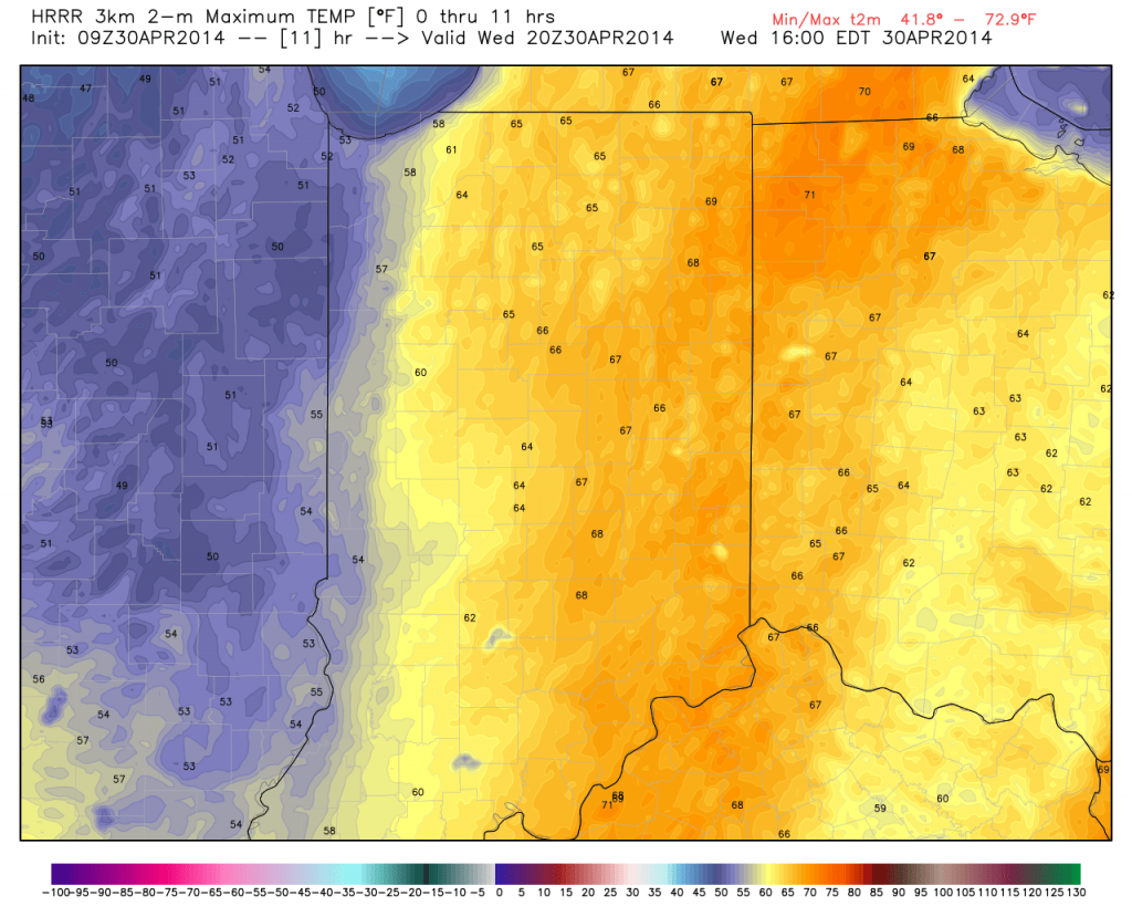
As a result, we’ll note a much cooler regime (highs today will reach the lower to middle 60s, but highs Thursday and Friday won’t make it out of the 50s). Note today’s highs will be warmest across the east and cooler west as the overall cool air mass moves in.

hrrr_t2m_max_indy_12

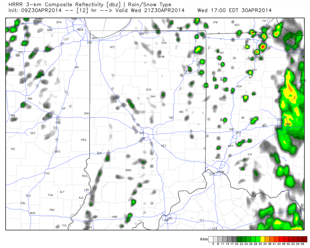
While everyone won’t get wet, instability-driven showers will be most numerous during the afternoon and evening hours.  These showers will dissipate at night only to reform the following afternoon.

hrrr_ref_indy_13

We’ll have a full forecast update posted tonight.  Make it a great Wednesday!

Permanent link to this article: https://indywx.com/rinse-and-repeat-pattern/

Tuesday Evening Update!

Quick evening update to discuss the overnight period and look at the cooler pattern moving in for late week.

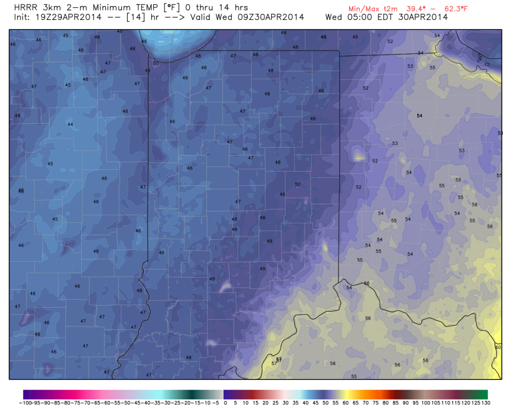
Showers will diminish during the overnight and gusty northwest winds will deliver a cooler air mass that will hang on as we put a wrap on the work week:

hrrr_t2m_min_indy_15

The video below has more details!  Have a great evening!

Permanent link to this article: https://indywx.com/tuesday-evening-update/

Severe Threat This Evening…

Tue.

Wed.

Thr.

Fri.

Sat.

Sun.

Mon.

 Status-weather-storm-night-icon

 Status-weather-showers-day-icon

 Status-weather-showers-day-icon

 Status-weather-showers-day-icon

 Status-weather-showers-day-icon

 Status-weather-clouds-icon

 Status-weather-showers-day-icon

49/ 71

47/ 58

39/ 53

42/ 56

43/ 65

46/ 65

42/ 66 

PM Severe

Light

Light

Light

Light

– – –

Light

Video discussing today’s custom built IndyWx.com Forecast issued at 8:51am:

Permanent link to this article: https://indywx.com/severe-threat-this-evening/

Keeping A Close Eye On Severe Potential This Evening…

The region is still very much under the gun for potential severe weather this afternoon and tonight.  That said, the severe threat across central Indiana is highly dependable on just how easy we’re able to shake the clouds and rain this morning.  Sometimes modeling (even high resolution data) struggles with this.

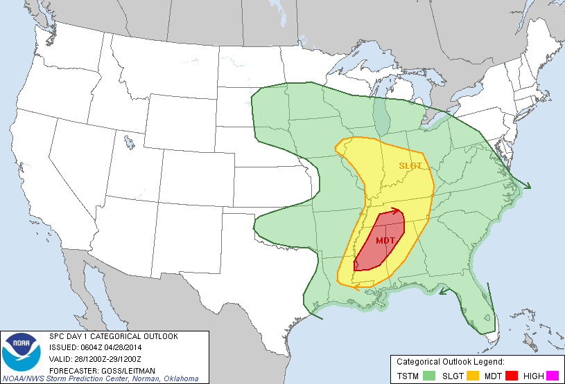
The Storm Prediction Center (SPC) outlines the region for a Slight Risk of severe weather- again the primary threat time lies this afternoon into tonight.

day1otlk_1200

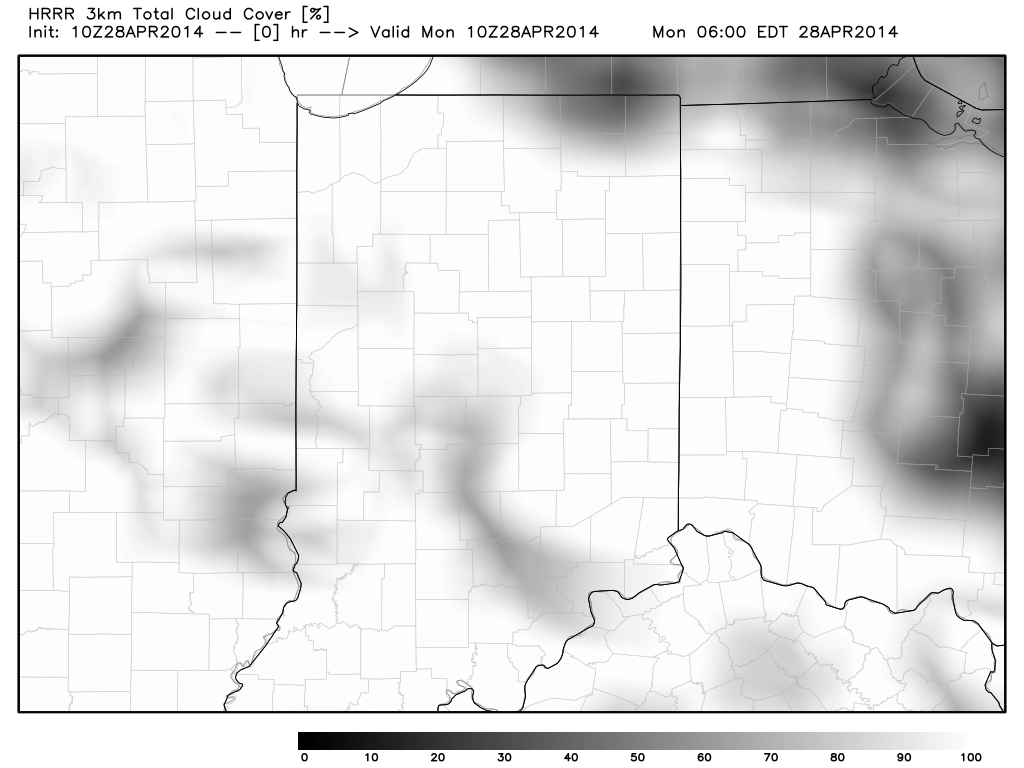
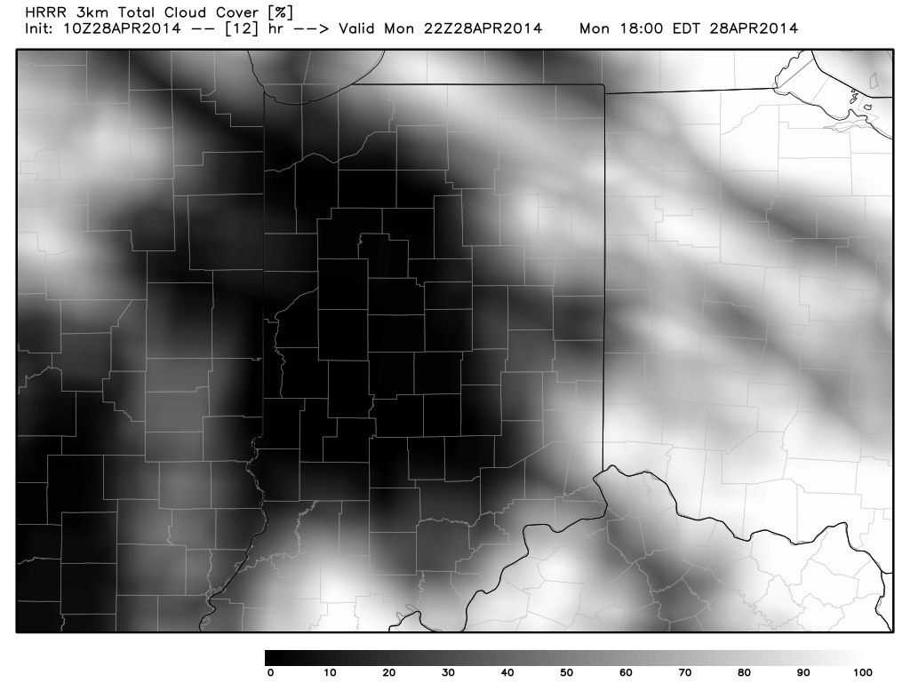
Latest high resolution data suggests we’re able to clear things out this afternoon and introduce sunshine to help add heat and further destabilize our local atmosphere (not a good thing), which would help lead to rather robust thunderstorm development.

Note the simulated satellite data showing the dreaded clearing from now through the afternoon:

hrrr_cloud_indy_1hrrr_cloud_indy_13

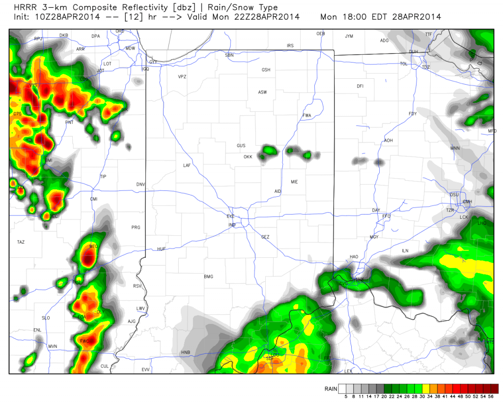
Latest high resolution data suggests potential super cell thunderstorms begin to fire to our west as early as 4-6pm.  We’ll keep a close eye on things.

hrrr_ref_indy_13

Bottom line, a significant severe weather threat is present this evening into tonight.  We’ll hope the clouds and rain linger longer than modeling currently projects as this would greatly limit the potential heating and destabilization and subsequent severe risk.  That said, it’s important to note current data does suggest we break into afternoon sunshine.

Greatest severe risks here appear to be large hail, damaging straight line winds, and a possible tornado.  Be sure to have a way to get the latest weather information this afternoon and tonight.  Stay safe out there!

Permanent link to this article: https://indywx.com/keeping-a-close-eye-on-severe-potential-this-evening/