Category: Rain
Good morning and happy Tuesday! We’re looking forward to a beautiful, and warm, few days ahead before unsettled conditions return by late week. The video covers those details below.
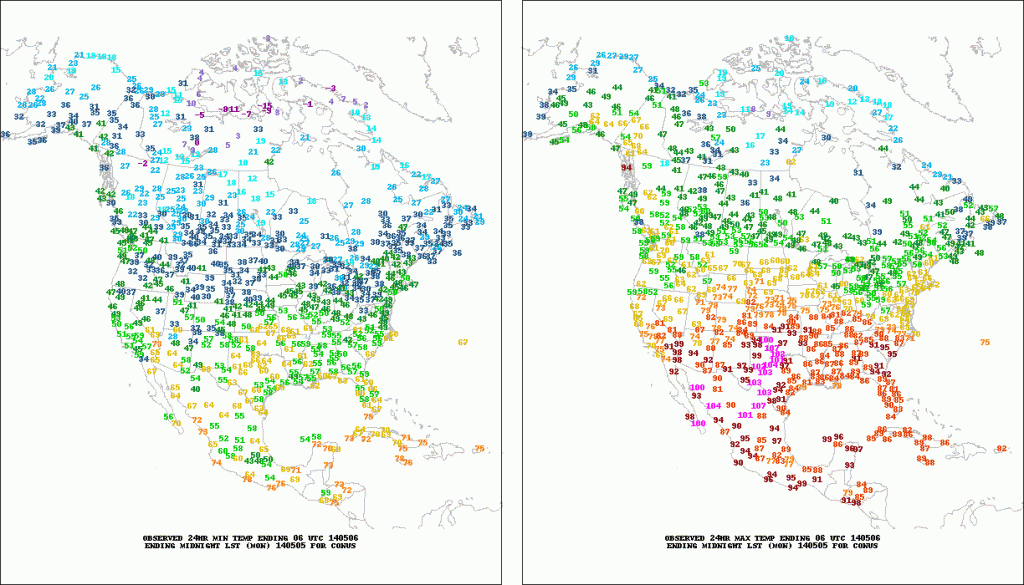
Monday’s highs displayed quite the spread across the state- ranging from near 90 down state to the upper 50s across far northeastern Indiana. Here across central Indiana, many enjoyed upper 60s to near 70 on Monday. (Click on the image to enlarge).

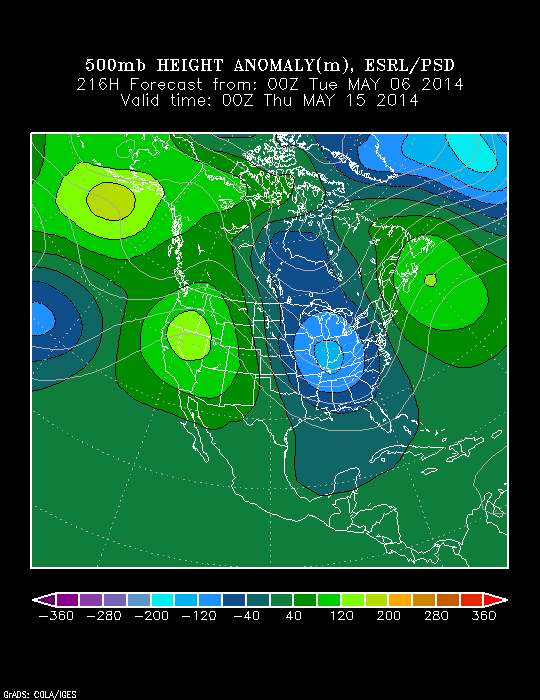
Despite the surge of warmth coming mid week, and likely again early next week, the overall theme is one that’s cooler than normal for mid May. Note the strong trough developing over the Great Lakes and Ohio Valley.

Video discussing today’s forecast and looking ahead to the weekend and beyond:
Permanent link to this article: https://indywx.com/catching-up-on-a-tuesday-morning/
|
Mon.
|
Tue.
|
Wed.
|
Thr.
|
Fri.
|
Sat.
|
Mother’s Day
|
|

|

|

|

|

|

|

|
|
45/ 66
|
48/ 71
|
56/ 80
|
59/ 82
|
63/ 72
|
62/ 72
|
55/ 72
|
|
Light
|
Light
|
– – –
|
– – –
|
Moderate
|
Moderate
|
Moderate
|
A couple of isolated (though loud) thunderstorms rumbled through the region during the overnight hours. The weather set up today shows a warm front to our south that will result in quite the temperature gradient this afternoon across southern Indiana (highs in the 80s) to central Indiana (upper 60s to around 70). Most of the day will be dry, but we’ll keep a scattered shower or storm in our forecast through mid to late morning. That aforementioned stalled frontal boundary will lift north Tuesday night and help result in the warmest air of the season for mid week. We then turn our attention to a very unsettled and potentially rainy pattern setting up late week into the Mother’s Day weekend. Rainfall numbers range anywhere from 1-2″ at this early juncture for many communities.
Permanent link to this article: https://indywx.com/cranking-the-thermometer-up-this-week/
Sat. Sun. Mon. Tue. Wed. Thr. Fri. 45/ 65 48/ 65 45/ 67 50/ 71 55/ 81 61/ 83 63/ 73 – –…
You must be logged in to view this content. Click Here to become a member of IndyWX.com for full access. Already a member of IndyWx.com All-Access? Log-in here.
Permanent link to this article: https://indywx.com/increasing-sunshine/
Scattered showers and areas of drizzle will dissipate tonight and cool conditions will remain. We’ll begin to moderate and introduce more in the way of sun as we go through the weekend. Have a great evening!
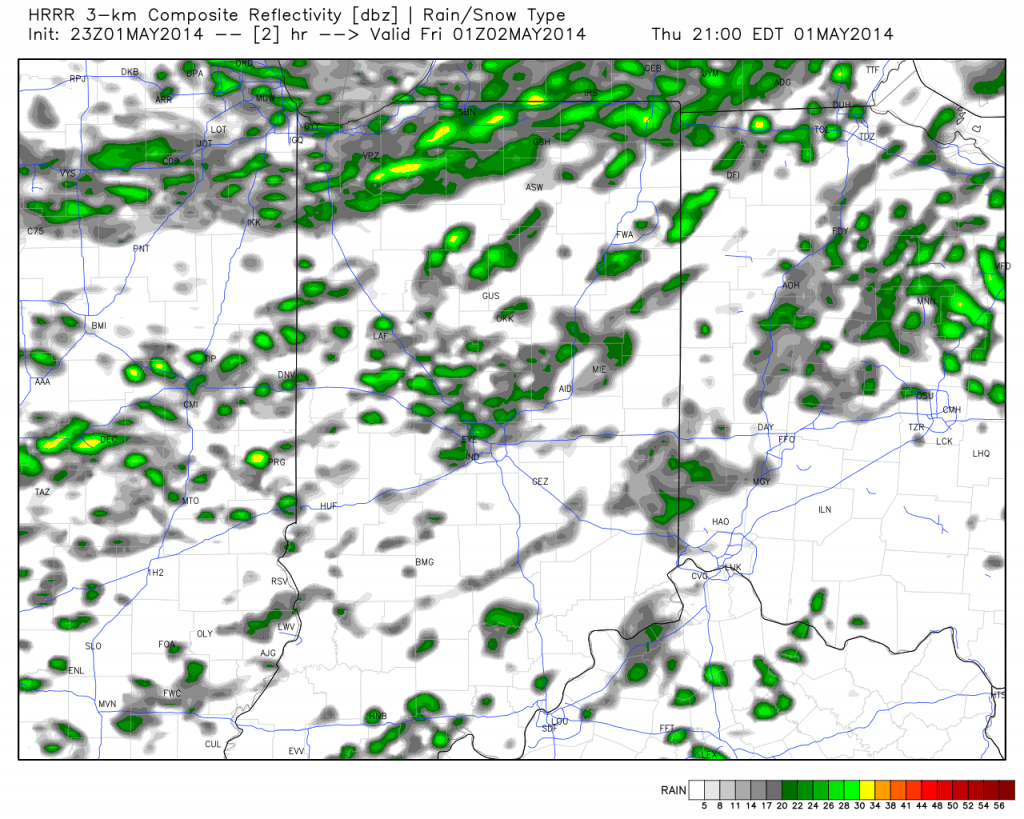
Simulated radar shows widely scattered showers around this evening.

Permanent link to this article: https://indywx.com/quick-friday-evening-weather-update/
Here’s the video that was supposed to go with this morning’s forecast package. We finally got the technical difficulties worked out. Have a great evening!
You must be logged in to view this content. Click Here to become a member of IndyWX.com for full access. Already a member of IndyWx.com All-Access? Log-in here.
Permanent link to this article: https://indywx.com/better-late-than-never/

