Highlights:
- Mostly dry close to the work week
- Rain to snow this weekend
- Quickly warmer early next week
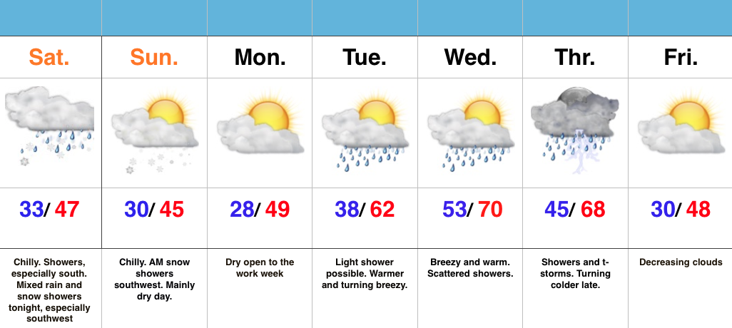
Keep The Jackets Nearby…We’ve enjoyed April and May-like temperatures over the past couple weeks, so you knew we had to make up for the warmth sooner or later. Thankfully, the pending weekend chill isn’t anything we can’t handle. That said, it will serve as a rather rude shock to the system for those craving sustained spring.
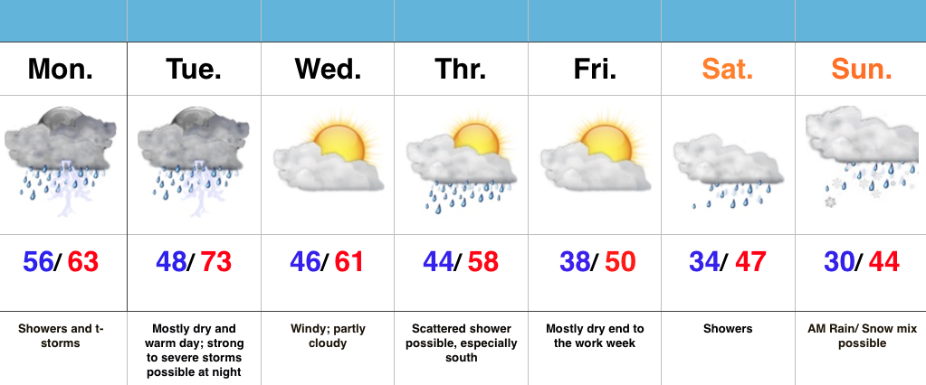
We’ll wrap up the work week on a mostly dry note (only a spotty shower chance), but we’ll increase overall coverage of shower activity Saturday. While it’ll be far from a wash out, when you combine the areal increase of shower coverage and much colder air, it may be a day to spend indoors watching basketball (any excuse will work, right? ;-)). As colder air gets involved, it’s possible rain ends as a wet snow flake, or two.
We’ll turn briefly milder early and middle parts of next week as a warm front passes with showers Tuesday. Steadier rains arrive Wednesday before colder air returns yet again heading into the Easter weekend.
7-Day Precipitation Forecast:
- Snowfall: Trace
- Rainfall: 0.50″ – 0.75″
Interested in more in-depth long range forecast discussions, video updates, ag. forecasts, and seasonal outlooks? E-mail bill@indywx.com for more information.