Dry Weekend; Clipper Snow Next Week?
 Highlights:
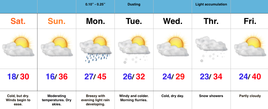
- Cold, but dry weekend
- Weak system delivers showers/ flurries early week
- Models disagree on clipper track
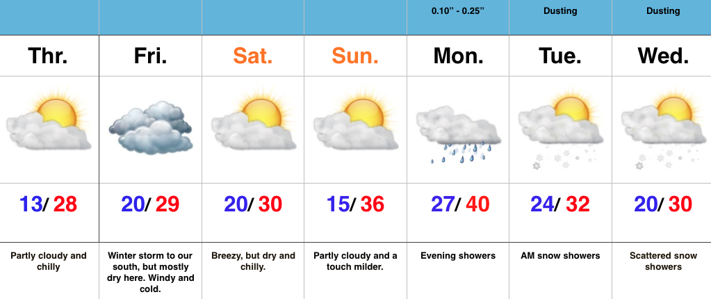
Cold, But Lots-O-Sunshine…A major winter storm is hammering areas still from the southern Appalachians into the Mid Atlantic and Northeast. Light flurries fell across central IN Friday evening, but drier air quickly built into the region overnight and sets the stage for a cold, but sunny weekend. Gusty NE winds that were felt Friday and overnight will also begin to diminish today.
Our next weather maker will blow into town Monday, but will be weak. Showers will accompany the frontal passage Monday evening before snow flurries/ light snow showers fly in the cold air advection Tuesday morning. All in all, this won’t be a big deal.
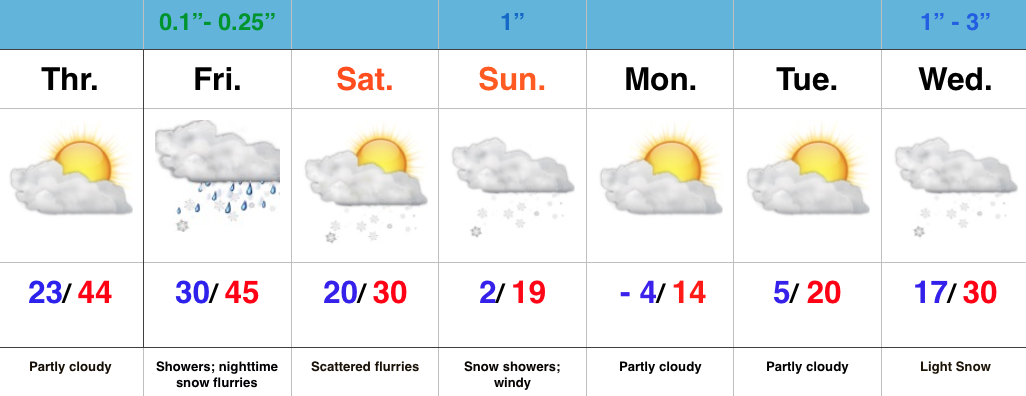
The next potential “trouble maker” awaits for the middle part of the week, but caution model data is all over the board on the eventual track of this clipper system. We’ll lean more towards the Canadian solution at this juncture (model of choice with clippers) and forecast snow showers to build into central IN Thursday. From this distance, model solutions range from snowy (light accumulation) to dry and mild. We wouldn’t have it any other way this winter. 😉