Saturday Morning Rambles…
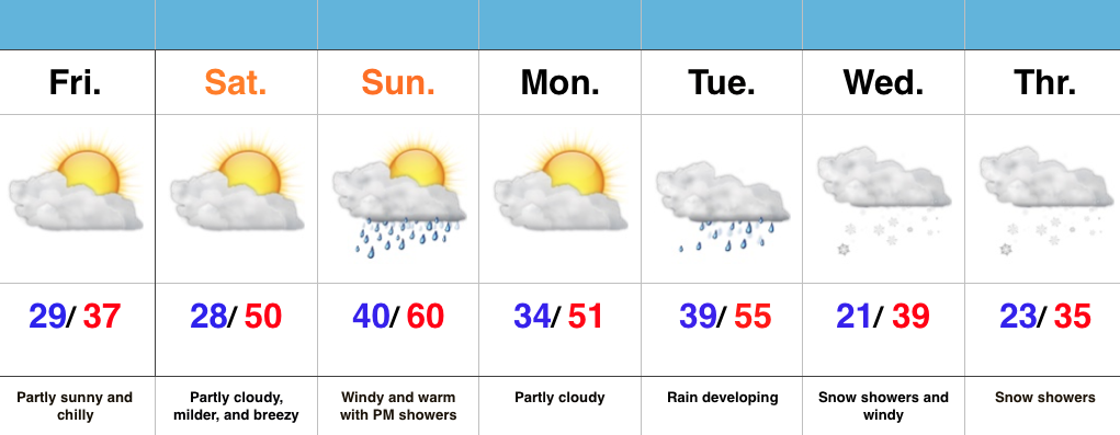
1.) An absolutely stunning late February day is dialed up, with lots of sunshine and moderating temperatures. We’re going mid 50s this afternoon.

2.) Though warm (lower 60s), Sunday will offer up showers by the afternoon/ evening.

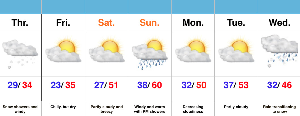
3.) Mid and late week remains a challenge. Do we have a leader-follower situation? Time will tell. We’re still leaning mostly wet for the Tuesday-Wednesday storm for now. The late week system could offer up accumulating snow prospects (ala. ECMWF, GEM).


4.) The period opens warm, but we shift much colder than average by the end of the week.


5.) We continue to look into spring and summer. With the dramatic shift expected to a La Nina, fun times will ensue. Hot, dry summer around these parts followed by a snowy winter? Hmmmm….