Drier Trend Continues This Weekend…
Highlights:

  • Dry close to the work week
  • Mostly dry weekend
  • Slightly cooler next week

Models Continue To Trend Drier…It was only a couple days ago that models were suggesting the threat of heavy rain and scattered strong storms this weekend- beginning Friday.  In this business, it doesn’t take long for things to change sometimes, but this is the first legitimate change for the “drier” that we’ve seen with storm systems since winter.  Time and time again as we draw closer to events, modeling has had to play “catch up” for the wetter over the past few months.

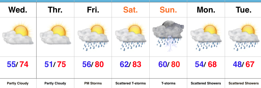
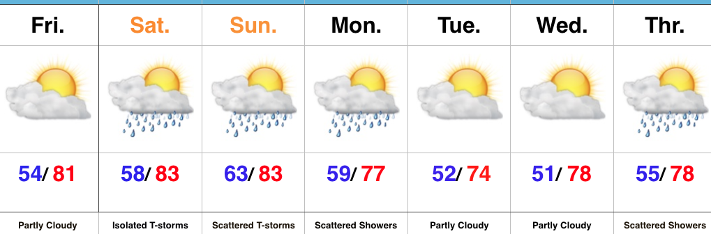
The end result is one that will feature a mostly dry weekend, including only isolated storm coverage Saturday afternoon and evening (most stay dry) and scattered coverage Sunday.  As a whole, many more dry hours are expected this weekend than stormy.

The other big takeaway over the past few days is the cool bias models have had.  This is noted and documented and we’re adjusting our forecast accordingly moving forward.  Drier and cooler air will arrive after Monday showers, but temperatures won’t run nearly as cool as once projected.  For the second week in a row, very pleasant and refreshing weather is ahead for the middle of the week.  Not bad, at all, by June standards.

Upcoming 7-Day Precipitation Forecast:

  • Snowfall: 0.00″
  • Rainfall: 0.50″ – 0.75″

JMA Weeklies: Cool Gives Way To More Seasonal Conditions…

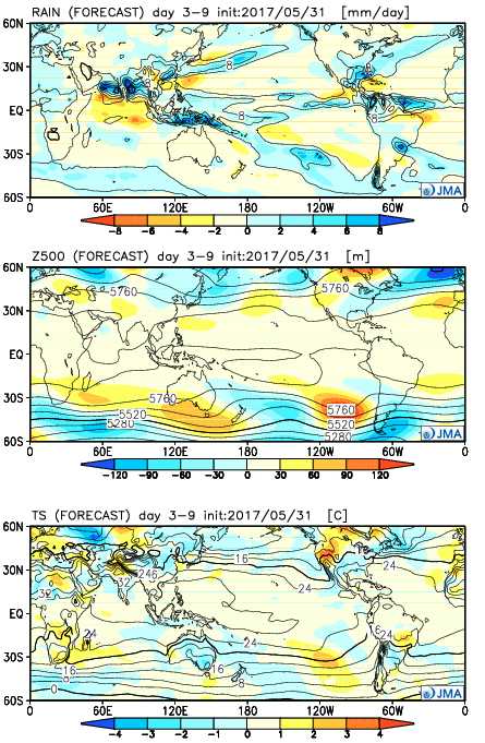
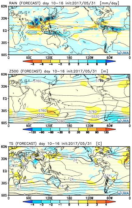
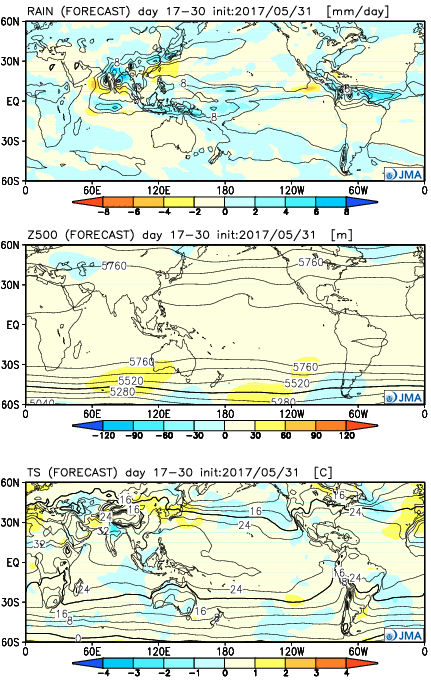
The new JMA Weeklies are in and the highlights include:

  • Unseasonably cool conditions Week 1
  • Anomalously wet across the Southeast
  • Warmer, more seasonal early-summer weather arrives

Week 1:

The pattern is dominated by an eastern trough and western ridge. Accordingly, cooler than average conditions will dominate the central and eastern portions of the country.  Very wet conditions should dominate the southern and eastern tier of the country (heaviest rains should fall east and south of Indiana).

Week 2:

The pattern begins to “relax” a bit, locally, with warmer conditions set to develop.  We note three areas of anomalously wet weather- west coast, northern Plains and Southeast.

Weeks 3-4

While the pattern doesn’t seem to promote any sort of significant heat or cool (relative to normal), this is certainly a warmer look, overall, to close the month than how we’re starting.  This look would suggest warm, seasonal, summer conditions locally with average precipitation.  Wet weather continues to dominate the pattern across the south and begins to emerge into the central.

Pleasant Now; Weekend Storm Chances Return…

Highlights:

  • Sunshine returns
  • Very pleasant
  • Weekend storms
  • Much cooler next week

Very Pleasant…After a couple of gusty thundershowers overnight we’re quickly back to dry and very pleasant weather conditions today.  Thankfully, sunshine and refreshing temperatures will continue Thursday.

Moisture begins to return as early as Friday afternoon and scattered late-day thunderstorms are possible.  While scattered thunderstorms will continue Saturday, there will be more dry time than wet and stormy.  The most widespread shower and thunderstorm activity will occur Sunday as a cold front moves in.

That cold front will be off to our east Sunday night and help usher in a much cooler feel early next week.  Gusty northwest winds and a couple showers are still possible at times through early week.  The bigger story will be the unseasonably cool temperatures as we expect highs in the upper 60s both Monday and Tuesday.

Upcoming 7-Day Precipitation Forecast:

  • Snowfall: 0.00″
  • Rainfall: 1.00″ – 2.00″

Challenging Northwest Flow Remains…

The region will remain in a challenging northwest flow for the balance of the upcoming 10-14 day period.  This can play havoc with forecast models, particularly from a timing standpoint.  In short, expect a continuation of active weather, including wetter and cooler than normal conditions.

Another weak disturbance will kick up a few scattered showers and potentially an embedded thunderstorm tonight.  Similar to Monday, this will come after a gorgeous day.

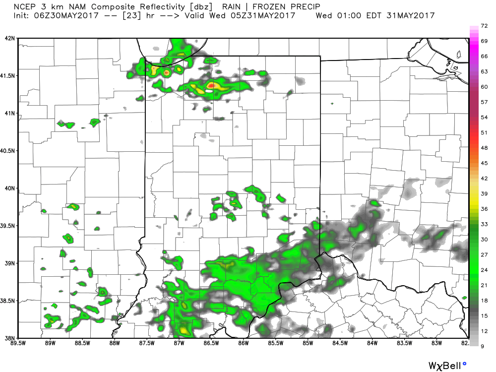
Forecast radar at 1a Wednesday shows scattered showers still impacting portions of the state:

The majority of our midweek stretch looks rain-free, but more widespread showers and thunderstorms will return as we push into the weekend.  Recent trends have also slowed the FROPA (frontal passage) down significantly- now perhaps not until late Sunday.
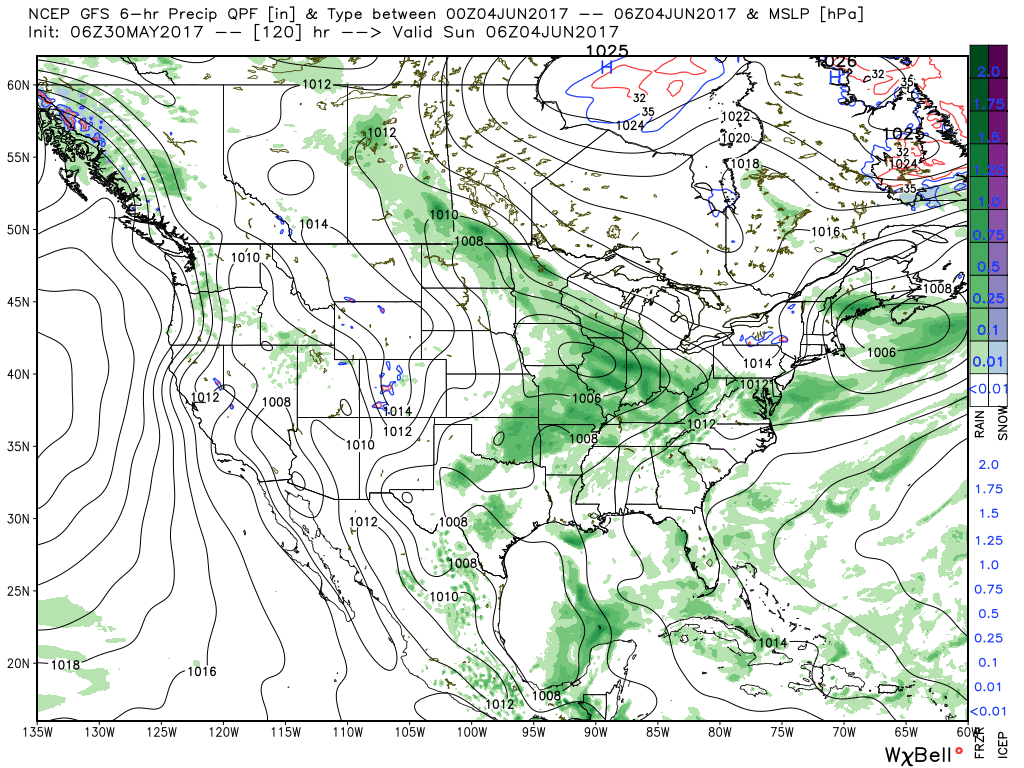
There will be dry time this weekend, but with a moisture laden air mass in place, locally heavy downpours can be expected, including rainfall potential of 1″+ this weekend for neighborhoods that get under a heavier storm.
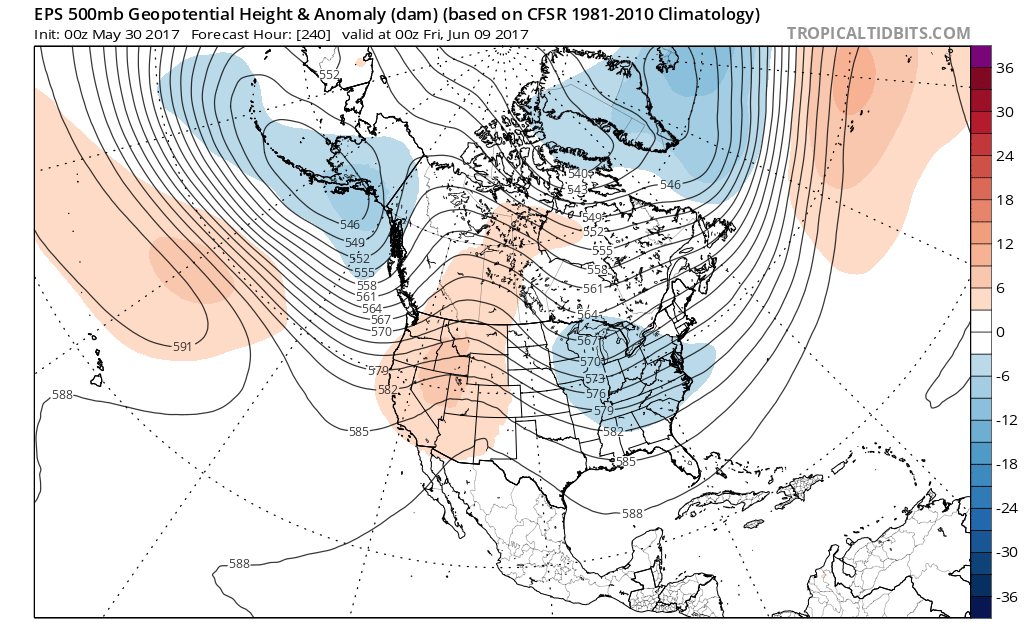
Longer-term, modeling continues to suggest a cooler than normal pattern persists as we push through the first half of June.

In fact, there may be a couple of days early next week where highs struggle to reach 70° with lows in the upper 40s to lower 50s.  Very refreshing, indeed, for early June.
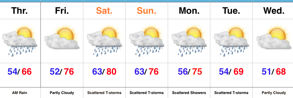
Pleasant Weather Later Today; Unsettled Conditions Return…

Highlights:

  • Rain ends and sunshine arrives later today
  • Pleasant Carb Day
  • Stormy at times this weekend

Trend Is Our Friend Today…Showers are “pinwheeling” around an area of low pressure to our east this morning, but these will begin to diminish as we move through the late morning and into the early afternoon.  In fact, we think sunshine works in here later this afternoon and provides a pleasant finish to the day!

The majority of Friday will feature sunshine and pleasantly warm conditions by afternoon.  We’ll keep a close eye on the radar Friday evening/ night, but currently believe thunderstorms will remain just north of here.

Unfortunately, the long race and Memorial Day weekend won’t be rain-free, but it also won’t be a wash-out.  Most widespread thunderstorm activity should arrive Saturday evening into Sunday morning and some of these could become strong to severe.  The current Day 3 (Saturday) Outlook from the Storm Prediction Center places central and southern portions of the state under a Slight Risk.

While we can’t completely rule out an afternoon shower or storm Sunday, the most widespread activity should occur during the morning hours- before race time. Stay tuned.  We’ll turn cooler early next week…

Upcoming 7-Day Precipitation Forecast:

  • Snowfall: 0.00″
  • Rainfall: 1.25″ – 1.75″