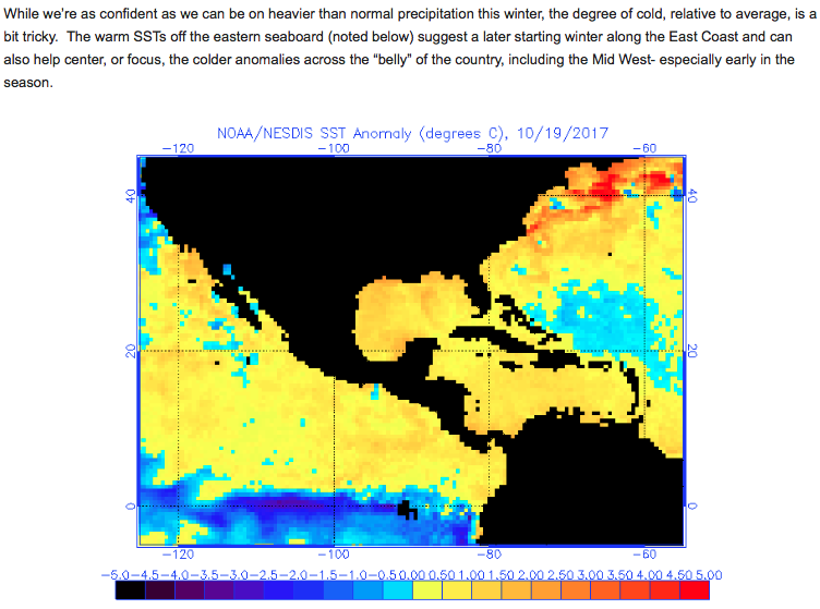
A Cold Halloween On Tap…
 Highlights:
- Cold and blustery Halloween
- Unsettled, milder weather builds in
- Stronger cold front arrives early next week
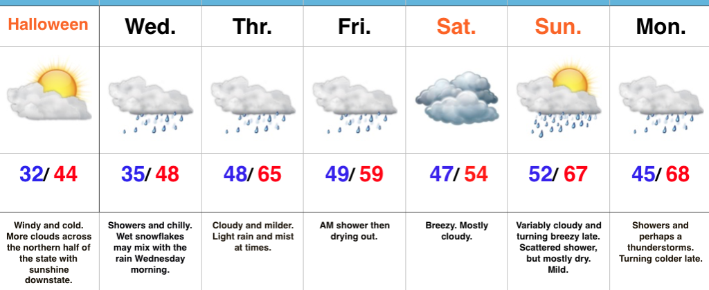
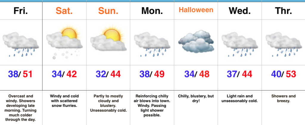
Spooky Winds…Northerly breezes are strong and gusty and leading to wind chills in the lower-middle 20s across central Indiana this morning. Heavier winter coats will be a smart choice out the door! Otherwise, we’re a state divided from a cloud perspective: the southern half of Indiana will get in on the sunny act much sooner than the northern half of the state. As we look towards the all-important trick-or-treat weather tonight, anticipate dry conditions, lighter winds, and unseasonably chilly conditions continuing.
Our next storm system will approach Wednesday with showers. Rain may be mixed with wet snow or sleet Wednesday morning, but with temperatures above freezing, don’t look for any accumulation. Periods of showers and light rain will continue Thursday into Friday morning. Heavy rain won’t occur, but it’ll be damp at times. Saturday is a bit tricky- some solutions keep rain around, but we’re choosing the more “optimistic” approach for the purpose of this forecast update. Stay tuned.
Saturday will feature considerable cloudiness, slightly cooler air, and breezy conditions before a warmer close to the weekend. A southwesterly flow will help boost highs into the upper 60s Sunday afternoon ahead of an approaching cold front. That cold front will slide through here with showers and a couple claps of thunder Monday. Much colder air returns Monday night into Tuesday.
Upcoming 7-Day Precipitation Forecast:
- Snowfall: Trace
- Rainfall: 0.50″ – 1.00″
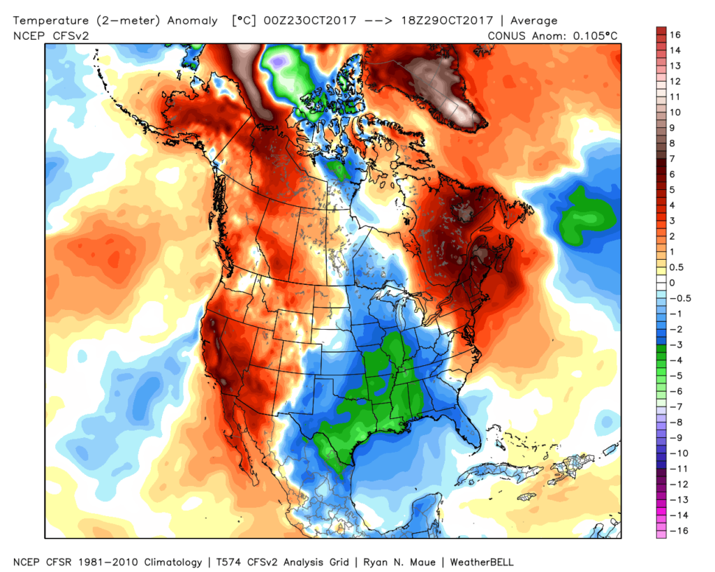 The upcoming few days will feature additional unseasonably chilly conditions before moderating through the second half of the week.
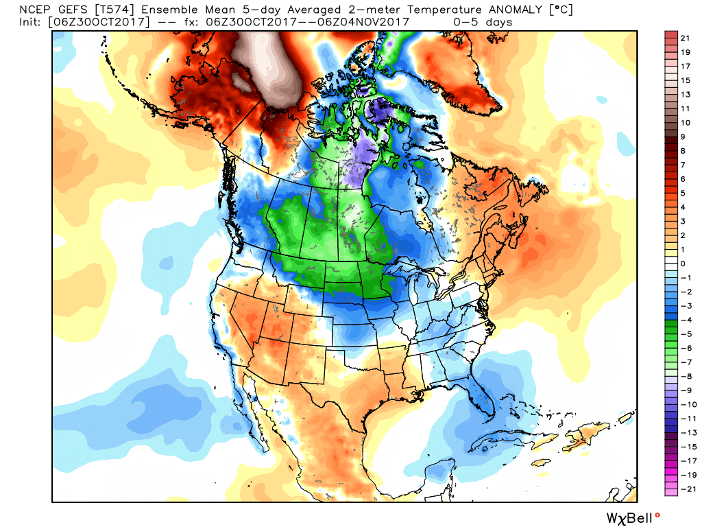 This will feature a hard freeze for central Indiana tonight. We dipped to the first 32° temperature of the season here at IndyWx.com HQ this morning and will likely beat that Halloween morning. Widespread upper 20s to around 30° can be expected.
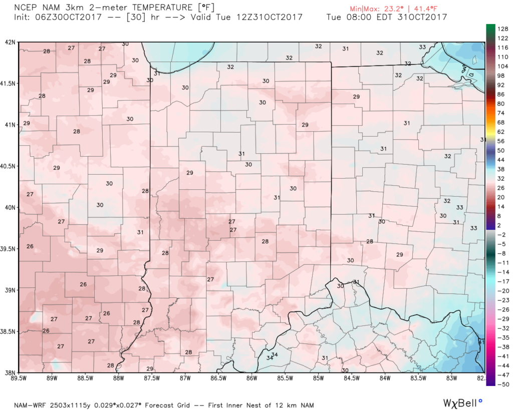 This cold air is thanks to a cold front and reinforcing chill that will feature a band of showers that scoots through the state late morning into the early afternoon.
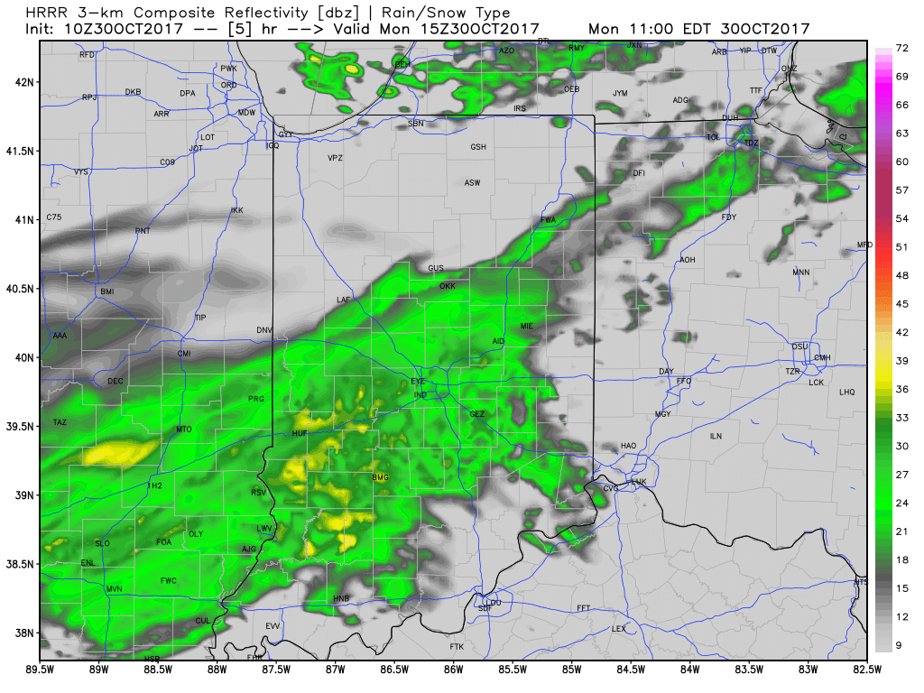 Rainfall amounts won’t be significant and feature totals between 0.10″ to 0.20″ through most of central Indiana.
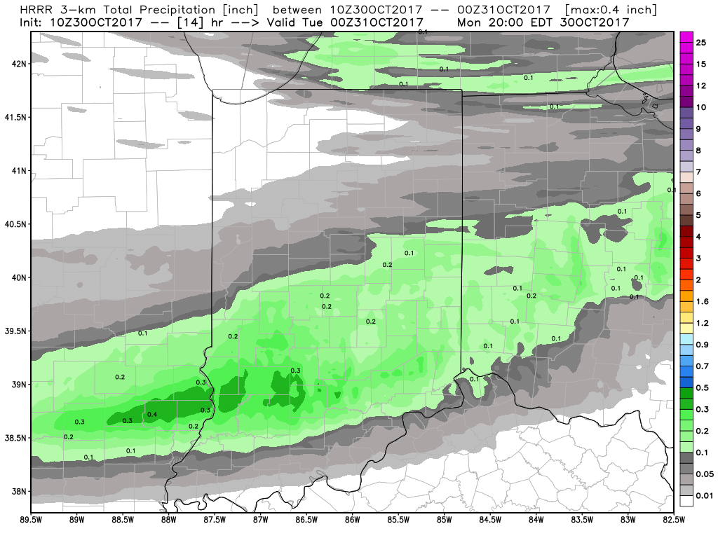 Unsettled weather will return late week and through the upcoming weekend, but temperatures will moderate and return to levels that are above average. There are indications cold will push again in the 8-10 day period, but a warmer pattern will engulf our region during the medium range period and feature temperatures that will reach the 60s by Thursday and Friday.
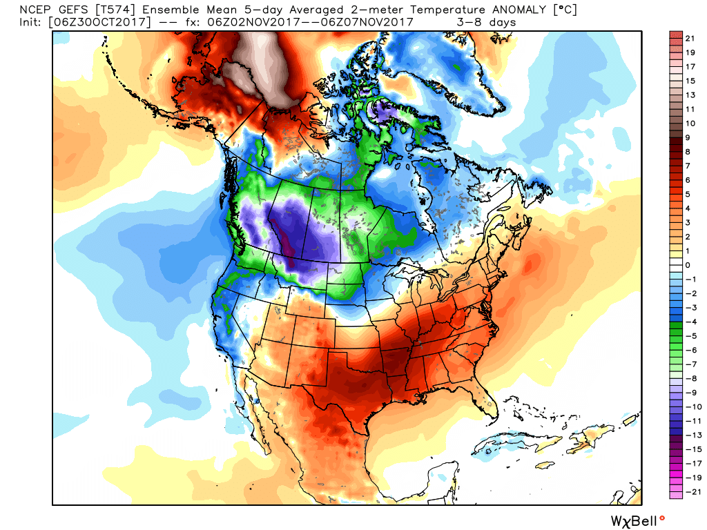 The warmer conditions will also come with rain. A “wavy” cold front will approach late week with showers before returning north as a warm front late in the weekend. Finally, this frontal boundary will push southeast early next week with cold air returning. With the movement and stubborn nature of the front, expect a prolonged duration of unsettled conditions. It won’t rain the entire time, but we’ll keep showers in our forecast beginning Wednesday into the weekend.
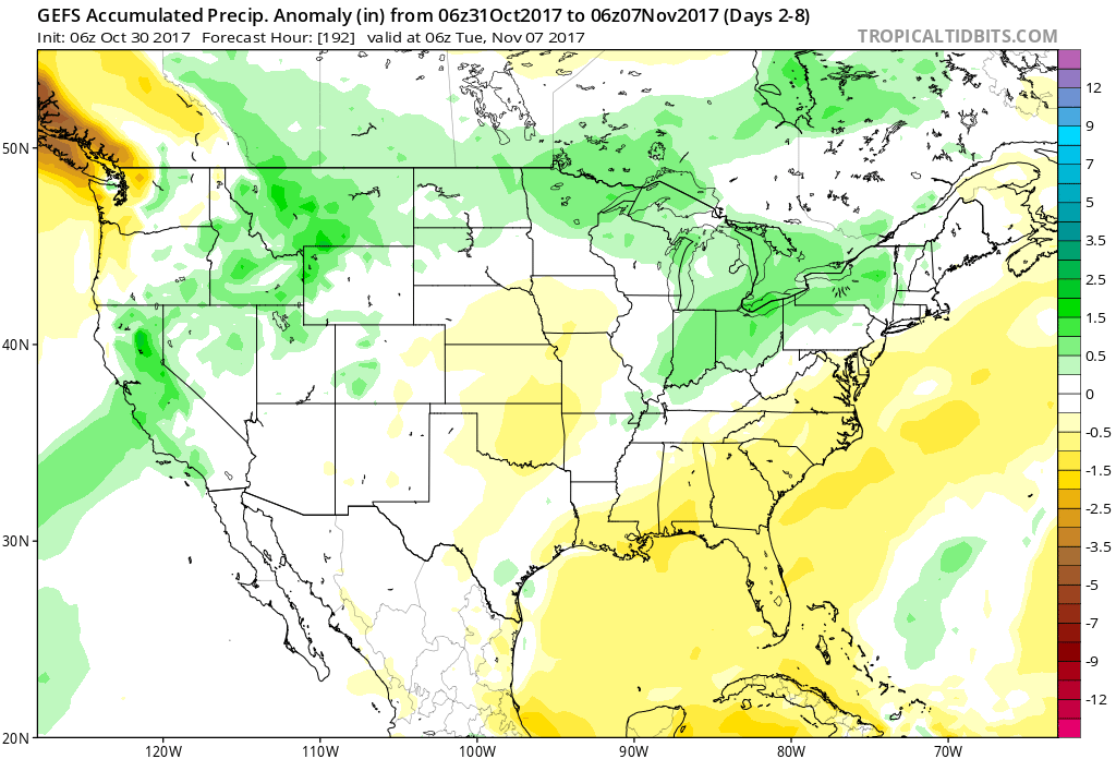
 Highlights:
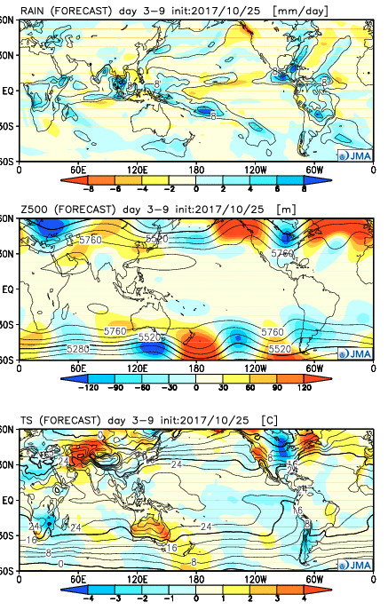 Week 2:
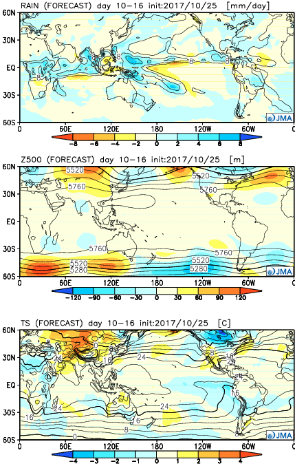 Weeks 3-4:
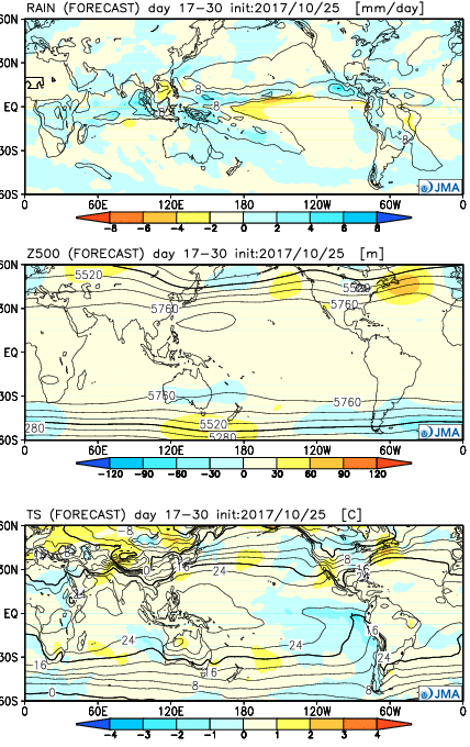 28 Day Mean:
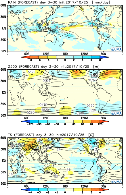 After the cold start to the month, the JMA Weeklies suggest ridges will “bookend” the country as November evolves, especially the Northeast region. This fits our research, as well, and fits the pattern, overall. If you haven’t had an opportunity to read our