Quiet Weather Continues…
 Highlights:
- Dry and quiet weather remains
- Shower chance Thursday
- Sunny weekend ahead
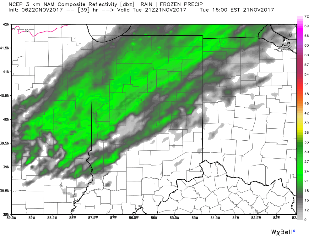
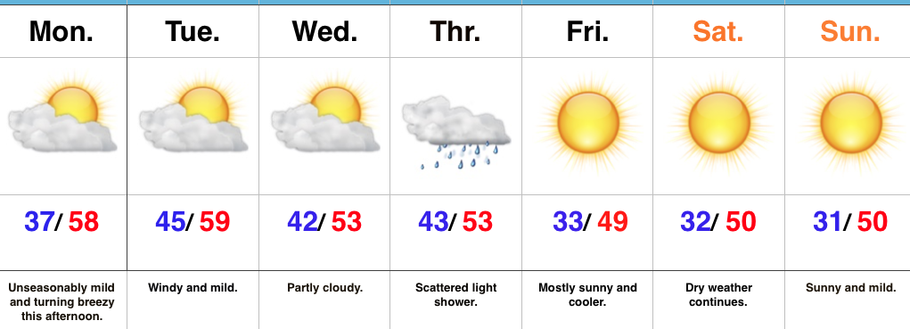
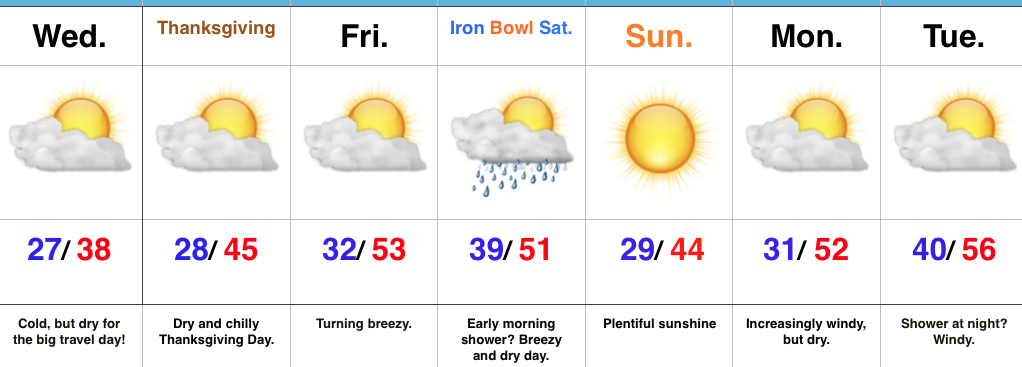
Boring Pattern Remains…An eerily quiet weather pattern will remain intact as we progress through the upcoming week. We’ll notice an increasingly gusty southwesterly breeze later today into Tuesday and this will help boost afternoon highs very near the 60° mark.
A weak cold front will pass through Thursday and while a shower will be possible as the front moves through the region, this won’t be a significant weather event. Slightly cooler air (not cold by any means) will arrive behind the cold front this weekend. The bigger news will be the continuation of extended quiet and sunny weather.
Upcoming 7-Day Precipitation Forecast:
- Snowfall: 0.00″
- Rainfall: 0.10″
 Highlights: