VIDEO: Gusty Winds & Showers This Afternoon; Accumulating Snow For Easter…
You must be logged in to view this content. Click Here to become a member of IndyWX.com for full access. Already a member of IndyWx.com All-Access? Log-in here.
You must be logged in to view this content. Click Here to become a member of IndyWX.com for full access. Already a member of IndyWx.com All-Access? Log-in here.
You must be logged in to view this content. Click Here to become a member of IndyWX.com for full access. Already a member of IndyWx.com All-Access? Log-in here.
You must be logged in to view this content. Click Here to become a member of IndyWX.com for full access. Already a member of IndyWx.com All-Access? Log-in here.
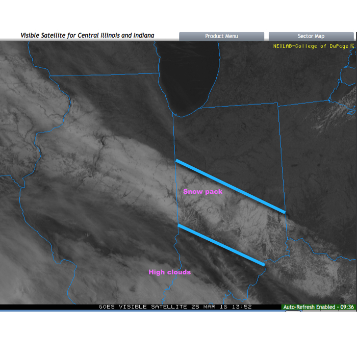
Before we discuss some of what has our attention as we move through the next couple of weeks, check out this cool visible satellite image from this morning. The snowpack shows up nicely. It’s also neat to see the high resolution modeling understand where that snow pack is and the associated cooler forecast highs compared to areas south and north that didn’t see the heavy snow Saturday.
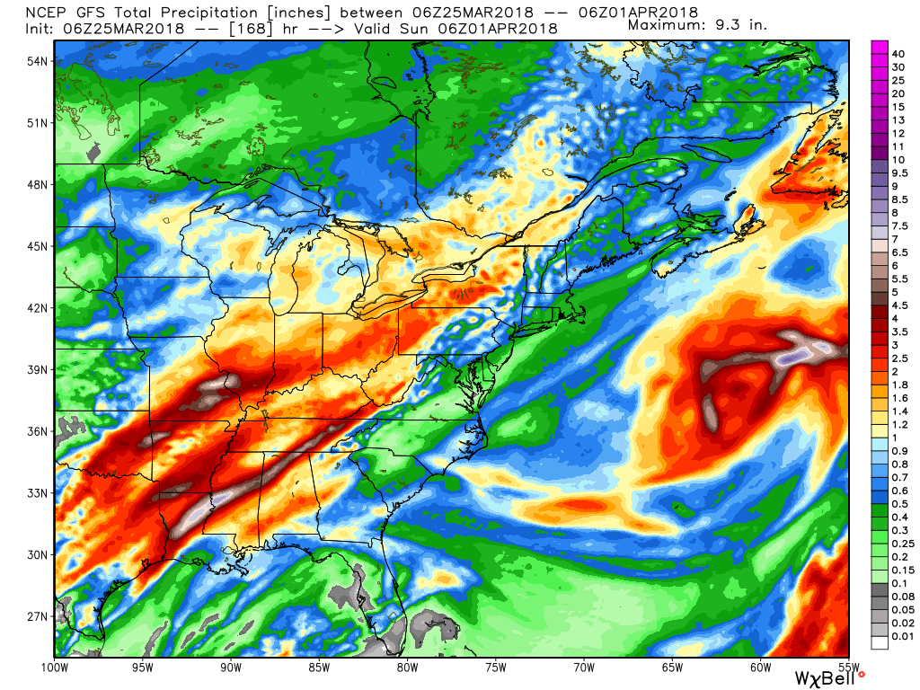
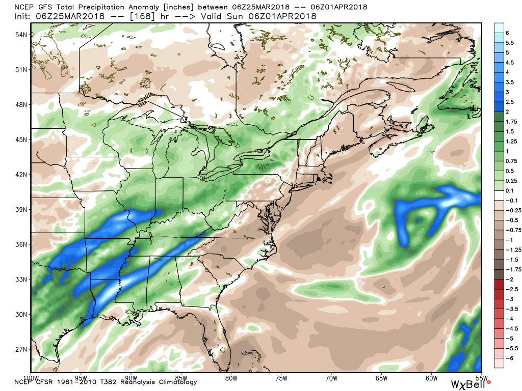
 As we look ahead, a wet week is in store for the region. Periods of widespread rain, heavy at times, will come at us in waves:
When totaled up, widespread 2″ totals can be expected, with locally heavier amounts.
 After a brief relaxation in the unseasonably cold regime, well below average temperatures are expected to return as we move through early April. It’ll feel more like winter than spring through the better part of the first half of the month.
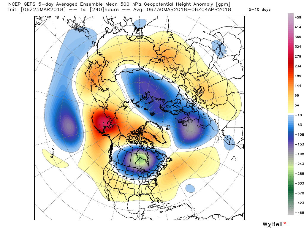
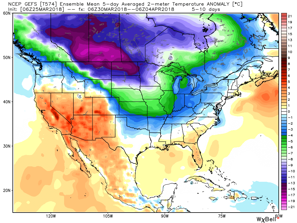
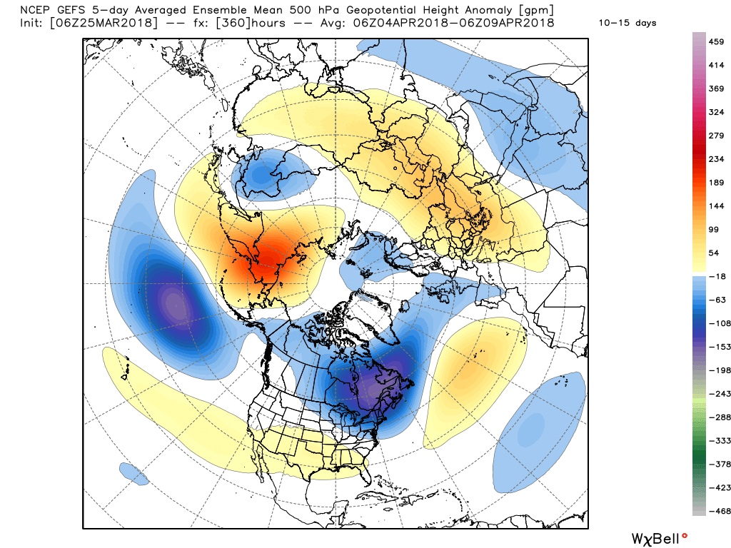
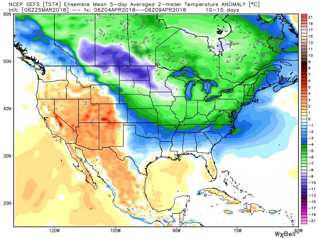 It’s also too early to think about yesterday as the last snow of the season. Given the early April look, it wouldn’t surprise us if an additional snow event or two came along…
(As a reminder, you can always catch our most up-to-date 7-day forecast in the top left of the homepage).
Right out of the gate, our ongoing snowfall forecast remains unchanged:
 Heavy, wet snow will continue through the majority of the day for central Indiana. At times, banding will produce snowfall rates in excess of 1″ per hour. On the southern periphery of the snow zone, a mixture of sleet and rain will mix in at times, but as precipitation rates increase, dynamic cooling will keep the predominant precipitation type as snow even on the southern tier.
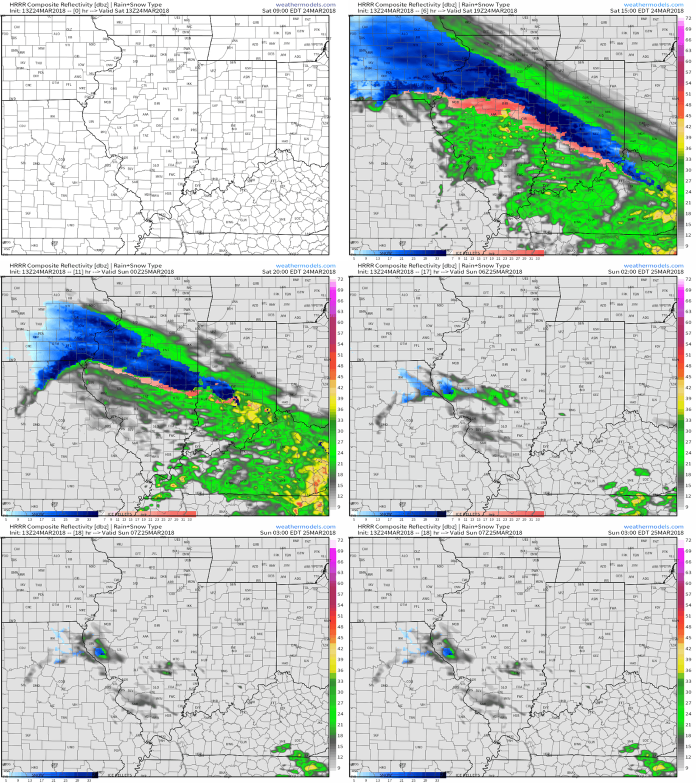 Despite marginally cold pavement temperatures, the heavy snowfall rate is having no problem accumulating on area roadways and multiple traffic hazards have already been reported this morning, particularly in Boone County. If you don’t have to travel today, it’s best to remain at home.
As temperatures fall into the lower to middle 20s tonight, refreezing will occur and areas of black ice will develop, especially on untreated, secondary roadways.
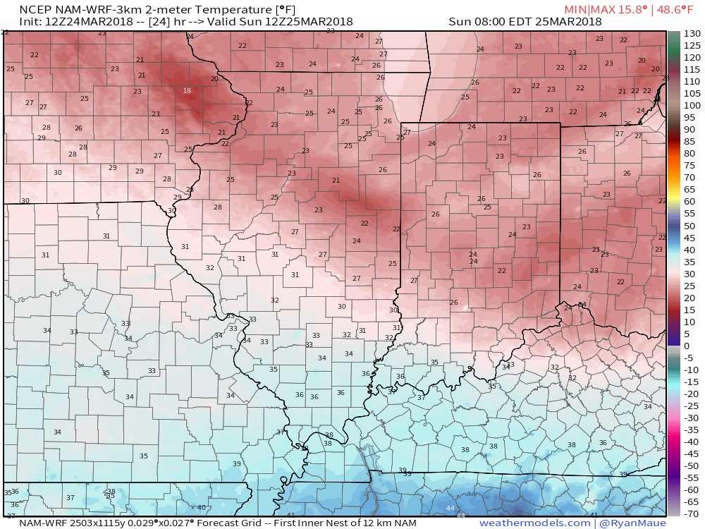 The “big dig” will begin in earnest Sunday morning as dry conditions return and the added increasingly strong March sun angle will also help in clean up efforts by afternoon.
By the way, please keep your snow reports and photos coming!