Looking Ahead…
With the first week of July in the books, we wanted to touch base on what we believe the remainder of the month has in store. In short, there’s no change to our ongoing idea of a transitional period July 10th through 20th followed by a more pronounced shift to cooler temperatures as we wrap up the month: roughly the 21st through 31st.
In some aspects, the transitional period has already begun- just a couple of days earlier than originally expected. Thankfully, the early month heat has subsided, giving way to a couple days of very refreshing conditions. After a slight rebound in humidity to open the work week, a cold front will slip through central Indiana Tuesday. This will offer up the potential of a thundershower followed by a return of the refreshing easterly flow we’re currently enjoying.
 Our latest 7-day forecast reflects this slightly cooler air mass and the associated “pull back” in humidity over the midweek stretch.
 Heat and humidity will then build again during the late week period ahead of an approaching cold front that will likely offer up more in the way of scattered to numerous storms next weekend. Note the “ups and downs” over the upcoming 7-10 day period. While sustained heat isn’t expected, there will be a few hot days thrown in the mix for good measure as the overall pattern works through its’ transition.
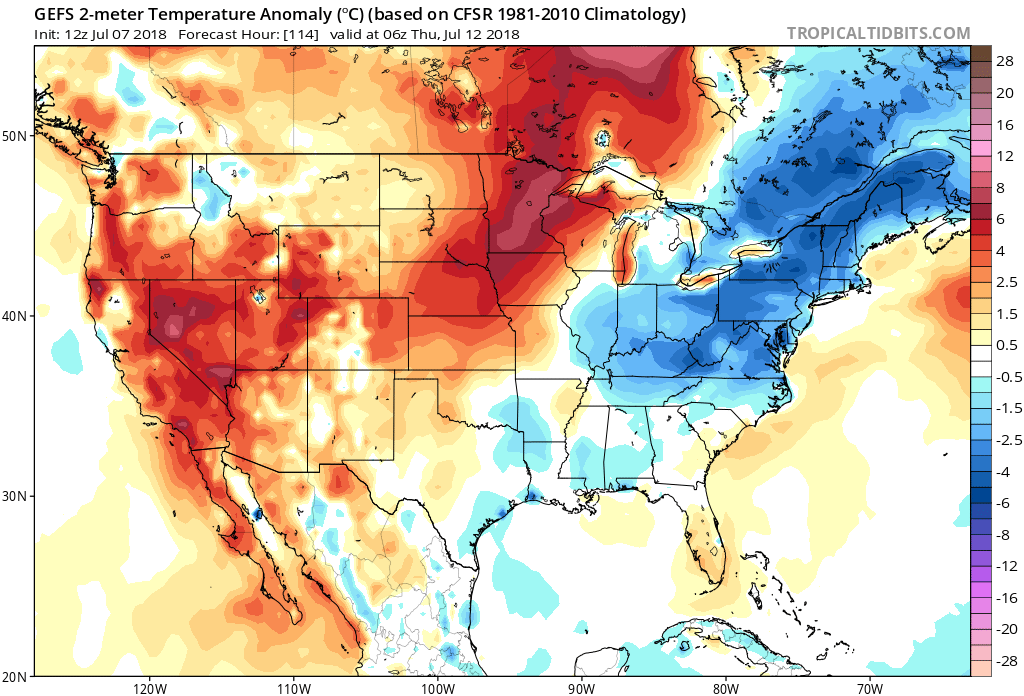
After the upcoming 10-day stretch, we notice the data becoming more aligned in a manner that will pull the worst of the heat, relative to average, west and put the Mid West and Ohio Valley in a position to turn cooler with more authority, as well as more active to close the month. We have to give a hat tip of the cap to the JMA Weeklies for first seeing this a couple of weeks back, and while we weren’t ready to jump on the idea of a sustained trough setting up over the Great Lakes in what will now be the Week 2-3 time period, the model did see the pull back before the majority of other data.
The new GEFS this afternoon sees something similar:
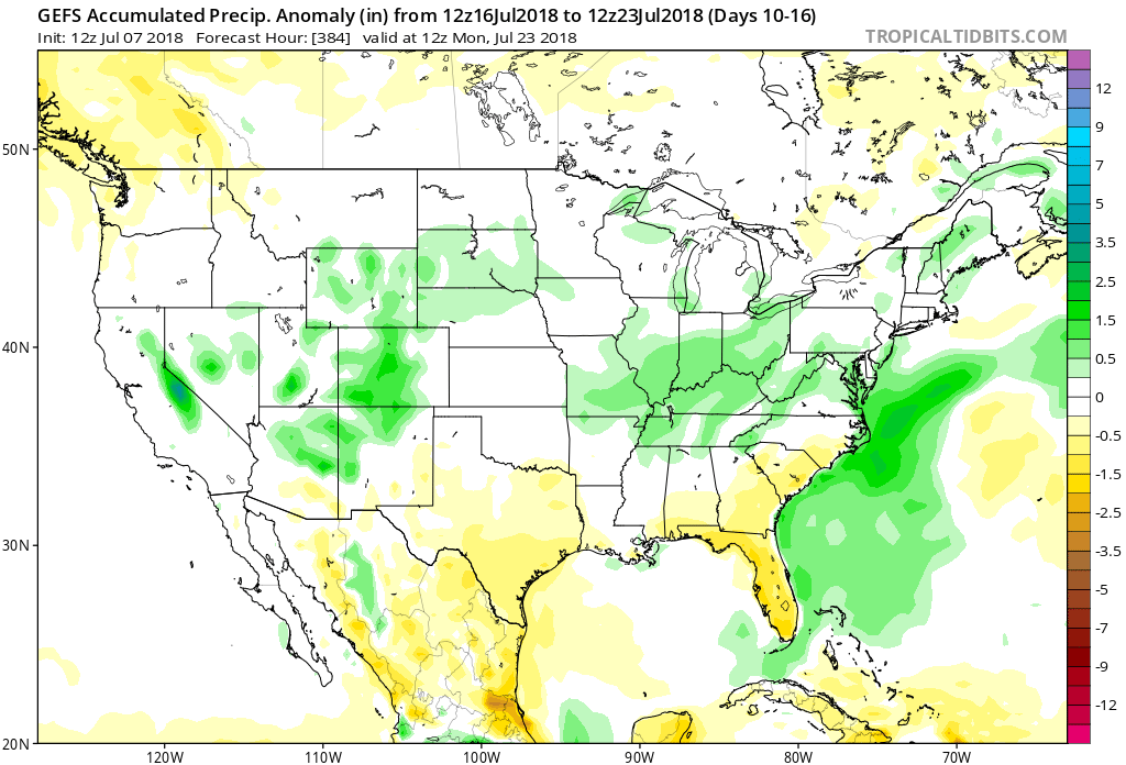
 Again, along with the expected cooler shift, the model is painting a wet pattern emerging as we put the wraps on the month of July. With the developing northwest flow aloft, it’s tough to disagree with this overall more active look.
 Enjoy this pleasant early-July weather and have a great weekend! Additional updates will arrive here and on our social media outlets throughout the weekend.
 The Storm Prediction Center currently has a ‘Marginal’ risk of severe weather for portions of the state. It wouldn’t surprise us if a portion of this risk area is upgraded to a ‘Slight’ risk with future updates. The primary concerns? Stronger storms may include damaging winds and large hail.
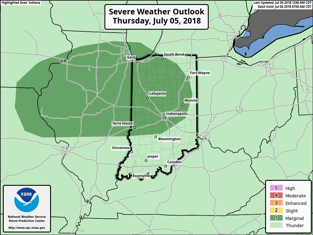 Storm coverage will diminish during the day Friday with a drier air mass taking hold by evening. We’ll really notice a reduction in humidity Friday night and that more refreshing feel will remain intact through the weekend. Dew points may even fall into the 40s by Saturday morning! Many central Indiana neighborhoods can expect to settle into the mid and upper 50s for overnight lows Saturday and Sunday mornings.
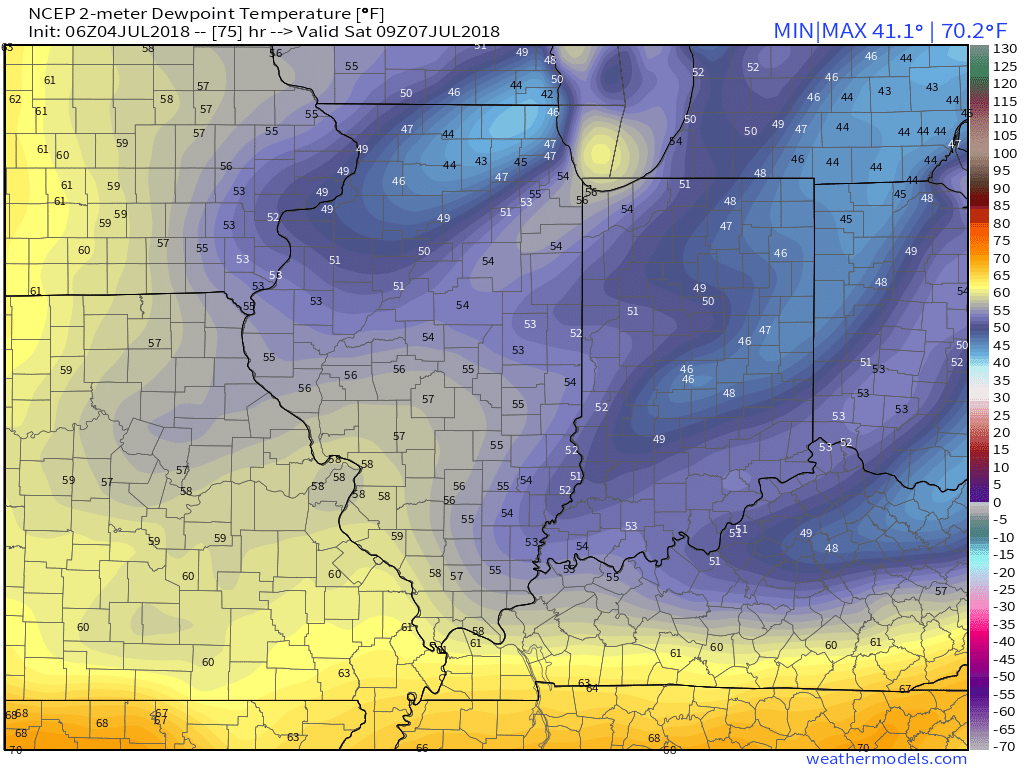 Dry weather will be with us as high pressure remains in control of the period this weekend into early next week.