Unsettled At Times; Pleasant Stretch Of Weather Next Week…

Highlights:

  • Unsettled at times to close the week
  • Rainfall reaches peak intensity/ coverage overnight Friday
  • Nice stretch of weather next week

Damp Few Days…A slow moving storm system will result in periods of showers today through Saturday, but there will also be plenty of dry time in the mix as well.  We expect heaviest and most widespread rain to roll in here late Friday night into the predawn hours Saturday.  Most can expect to pick up between 0.75″ and 1.25″ by noon Saturday.  Improving weather will develop Saturday afternoon and at least a little sunshine should work in here to close the weekend.

The week before Christmas will be unseasonably pleasant which is music to the ears of many rushing to complete their shopping and getting on the road to visit family and friends.  High pressure will supply a string of sunny days and temperatures will run milder than average, as well.  In fact, highs by the middle of next week will likely exceed the 50° mark in spots across central Indiana!

Stormy Pattern Ahead For The Heart Of The Holiday Season?

A “relaxation” of the well below normal cold is on the way.

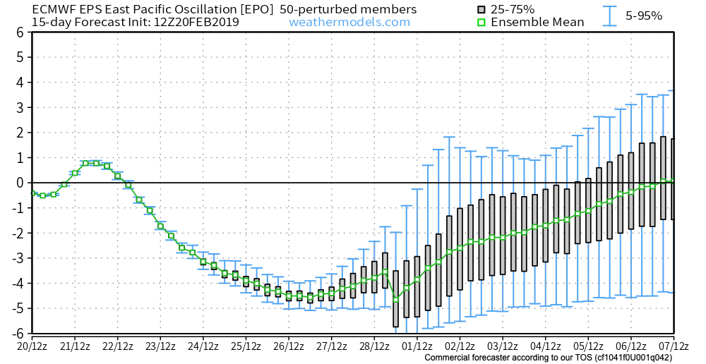
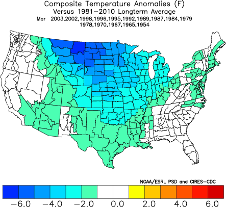
While this will support a 5-10 day period of temperatures of 5° to 10° above average (milder overnight lows, and a few days with highs at or above 50° are a good bet during the period, as well), the stage is already being set in motion for a return of colder conditions around the Christmas holiday.  While admittedly, transitional periods can be “finicky,” there’s support from other pattern drivers behind a wintry return between the 12.22 and 12.24 time period.  Furthermore, data suggests that there will be plenty of storminess to boot.

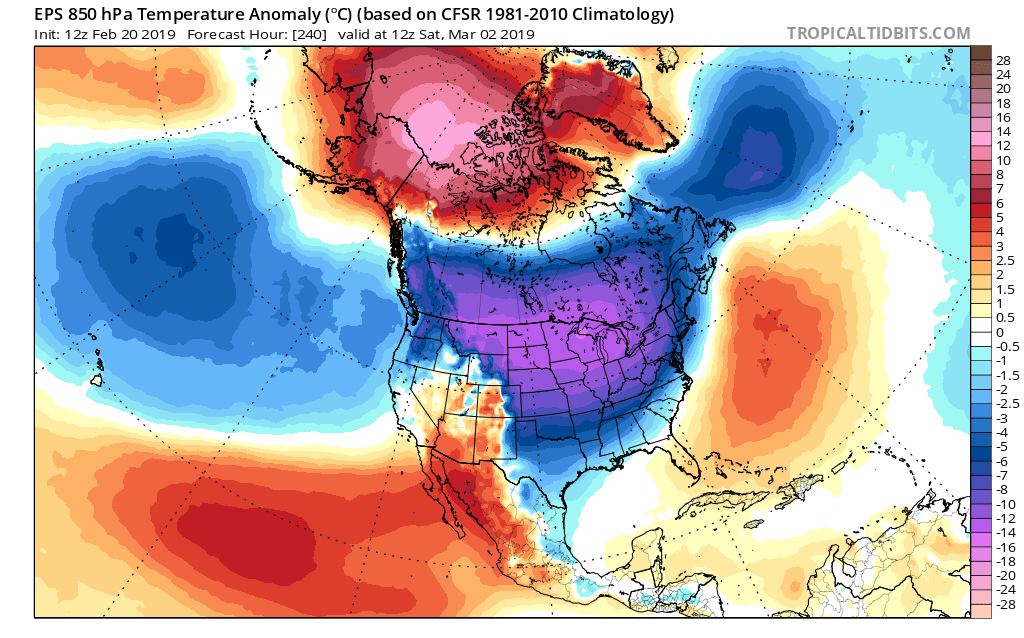
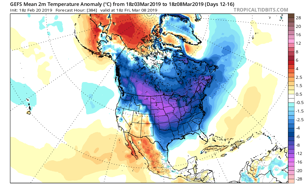
For those that love to review the operational model data as it rolls in (in some cases, up to 4 times per day), expect wild swings as the data begins to “hone in.”  Despite some of that model fluctuation, we expect the pattern to look something like this around Christmas.

We expect the mean ridge position to set up shop over the Pacific northwest.  This will result in a warmer than average regime across the west.  At the same time, the trough will be pushing back into the east. As the cold air settles back in, we expect a rather active time of things during the period.  This certainly doesn’t mean we’re talking snow storms, but it does appear likely that at least one or two systems of interest loom.  We’ll have to deal with the challenges that will come from one or both as time draws closer.

While a “transitional” pattern appears likely around Christmas, there are growing concerns of a return of sustained cold as we get into the new year.

Turning More Unsettled; Looking Ahead Towards Christmas…

A couple of storm systems will impact the region between Wednesday and the weekend, but neither look particularly impressive. What does look a little more “interesting” is the pattern evolution as we get closer to Christmas… Video discussion and updated 7-day below!

Freezing Fog This Morning; Unsettled Late Week Conditions…

Highlights:

  • Freezing fog this morning
  • Mid and late week rain
  • Briefly milder mid-month

Slow It Down…Freezing fog is creating slick travel in and around the city, itself, and points north.  Please allow extra time to reach your destination this morning and take it slow.  As we move into the afternoon, the low clouds and fog should slowly lift, but it’s likely not until we get to mid to late afternoon. With the longer period of fog and clouds, we’ve dropped forecast highs a few degrees today.

We should still get in on a sunny Tuesday before our first of a series of storm system begin to impact the area Wednesday.  Weak low pressure will result in increasing clouds and a narrow band of showers Wednesday afternoon.  Rain may mix with snow across north-central parts of the state.

As we look ahead, a slow moving (bigger) storm system spells periods of wet weather as we close the week and head into the weekend.  While it won’t rain the entire time, periods of moderate to heavy rain are possible during the period, along with gusty winds, and an overall “raw” feel.  Early thinking here is that we salvage the 2nd half of the weekend with at least a touch of sun.

Nice Quiet Stretch Of Weather…

Highlights:

  • Nice stretch of sunny days
  • Moderating temperatures
  • Late week storm system

Needed Vitamin D…It’s not often that we can string up consecutive sunny days in early and mid December, but that’s exactly what we’ll do this week- and we won’t complain!  With the clear, calm conditions, overnight lows will continue to plummet into the 10s before we slowly begin to moderate as we move into the middle of the week.

With the moderating temperatures will also come increasing moisture as a new storm system organizes to our southwest Wednesday night and Thursday.  Models continue to differ on specifics with respect to rainfall totals and we’ll fine tune things as we progress through the next couple of days. While late week turns unsettled, we don’t expect a wash-out any day.

Looking ahead, the longer term models continue to suggest we’re going to pull out of the predominantly cold pattern that we’ve been in with an overall milder shift in the pattern for the next couple of weeks.  There’s much debate around when the flip back to a cold pattern returns- is it in time for Christmas or closer to the New Year?