More Reason To Be Concerned With Overall Wet Pattern Long-Term…
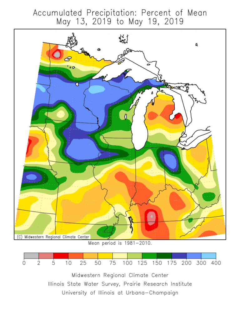
The month of May, though still active at times, has provided drier than normal conditions across a good chunk of the state. Officially, we’re (IND) running around half an inch below normal, month-to-date.
Precipitation departures from normal over the past week and month-to-date can be found below. Note the drier conditions, especially across the southern half of the state. Meanwhile, northern Indiana remains wetter then normal.

Unfortunately, a return of wet times looks likely. Latest data into the forecast office this evening, including the European Weeklies hot off the press, would suggest above normal rainfall can be expected for late-May, June, and a good portion of the summer for that matter.
There’s reason to believe this data is correct when we look at the latest MJO forecast. Note the MJO is expected to roll out of Phase 1 and into Phase 2 late-May and early-June- and potentially Phase 3 a bit later. Not only does this suggest the wet regime should pick back up in earnest across central Indiana, but also that the pattern will trend cooler (after what will be a hot and sultry stretch the 2nd half of this week into early portions of Week 2. The latest European Weeklies go right to this look for June, including a cooler than normal month overall.

Updated model data tonight still says a weak El Nino will continue through summer and this, too, argues for a wetter and cooler than average flavor to the 2019 Summer.