Halloween Snow Sets The Stage For What Lies Ahead…

Halloween morning will dawn with a cold rain. Coverage of rain will increase rather dramatically after midnight and continue through the morning rush before tapering off mid to late morning. An additional 0.50″ to 0.75″ will be common by the time this next round of rain moves out.

Rain will be widespread across central Indiana Halloween morning.

Colder air will begin to whip into central Indiana late morning into the early afternoon, accompanied by strong and gusty WNW winds. After a lull in the precipitation, snow flurries and scattered snow showers will develop across the area after lunch, potentially becoming a bit steadier (especially from Indianapolis and points north) during the 6p-8p time frame. Yes, trick-or-treaters (kids and adults alike) will need to be bundled up!
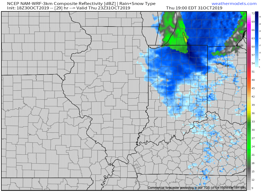
The first snowflakes of the season will fly Halloween afternoon-evening.

Snow will end rather abruptly between 9p and 10p and then the story will be the cold. By daybreak Friday, all of the region can expect to be in the middle 20s with wind chill values in the 10s.
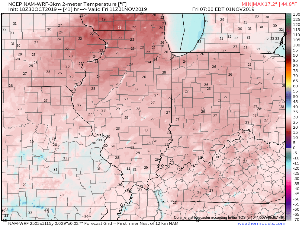
A very cold open to our Friday is on deck.

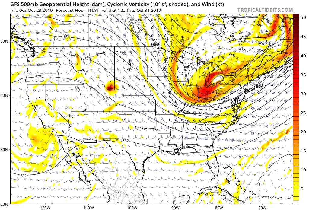
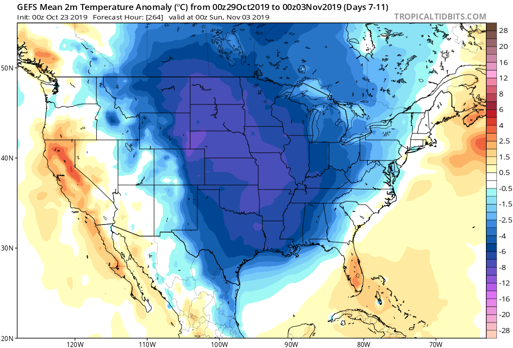
With the MJO focused on rumbling into Phase 5 (and eventually 6), along with a deeply negative EPO and slightly positive PNA, it’d be wise to gear up for more “out of season” cold and potentially wintry conditions as we move through the 1st half of November…

VIDEO: Halloween Snow; Unseasonably Cold & Stormy Pattern Sets Up For The 1st Half Of November…

You must be logged in to view this content. Click Here to become a member of IndyWX.com for full access.  Already a member of IndyWx.com All-Access?  Log-in here.

VIDEO: Saturday Washout And Reasons To Buy The Cold Early November Idea; Winter ’19-’20 Chatter…

You must be logged in to view this content. Click Here to become a member of IndyWX.com for full access.  Already a member of IndyWx.com All-Access?  Log-in here.

Rain Chances Going Up This Weekend; Taste Of Winter Blows Into Town Before Halloween…

Dry weather will prevail today and the majority of Thursday across central Indiana (a light passing shower is possible across northern Indiana, but this won’t be a big deal).

Scattered light showers are possible Thursday night into the day Friday, along with an increase in cloud cover, but again, significantly more dry time is anticipated than wet. Some won’t see a drop of rain Friday.

A scattered light shower is possible Thursday night-Friday across central IN.

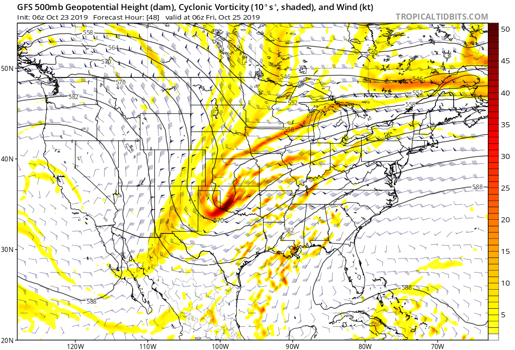
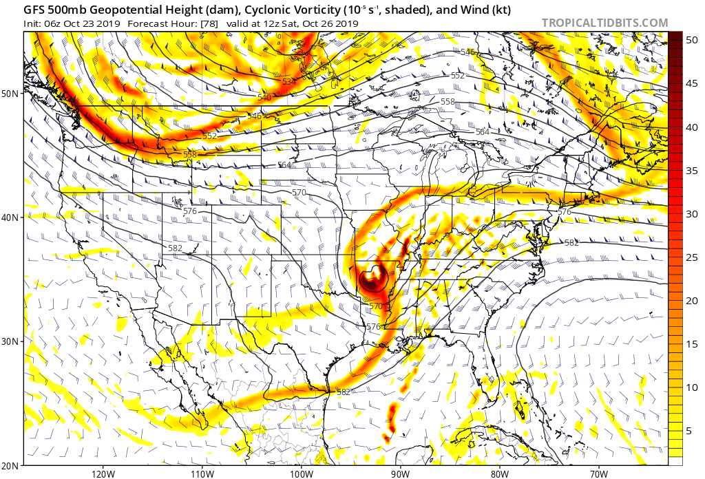
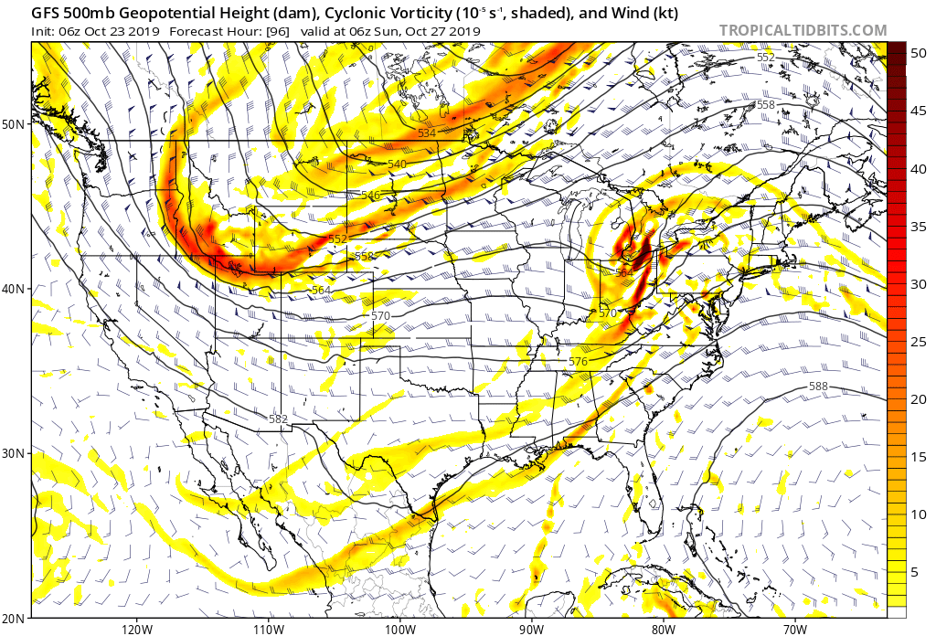
As we rumble into the weekend, a vigorous upper level low in Oklahoma will “bowl” east across Arkansas and then shoot northeast across the Ohio Valley Saturday into Sunday. (Hint, you may want to get used to this kind of storm track over the upcoming winter). This will result in increasing aerial coverage of rain Saturday.

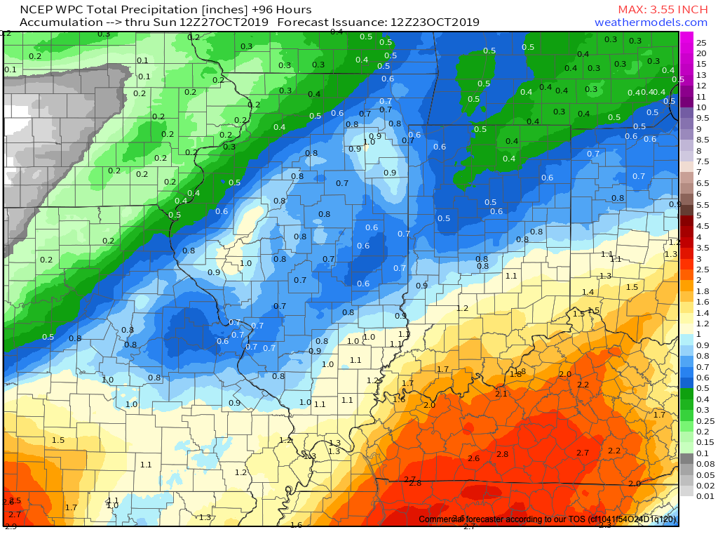
Rain will exit off to the northeast Saturday night and a drier second half of the weekend is expected. By the time all is said and done, a solid 0.50″ to 1″ of rain is expected (we’re currently siding with a blend of the aggressive European and lighter GFS).

After a wet 1st half of the weekend, all eyes will be set on a taste of winter that’s dialed up just before Halloween. A cold front will blow through the Ohio Valley early next week with the threat of rain followed by sharply colder air. As upper level energy rounds the base of the digging significant trough, the first flakes of the season can be expected across the region before Halloween (still will have to fine tune timing). This pattern will also serve up the first accumulating lake effect snow event of the season, including the Snow Belt regions of IN, MI, and OH.

A winter-like feel can be expected as we close October and open November.