Updated 03.01.22
You must be logged in to view this content. Click Here to become a member of IndyWX.com for full access. Already a member of IndyWx.com All-Access? Log-in here.

Mar 01
Updated 03.01.22
You must be logged in to view this content. Click Here to become a member of IndyWX.com for full access. Already a member of IndyWx.com All-Access? Log-in here.
Permanent link to this article: https://indywx.com/video-quiet-open-to-march-before-we-turn-active-next-week/
Feb 28
Updated 02.28.22 @ 8:30a
You must be logged in to view this content. Click Here to become a member of IndyWX.com for full access. Already a member of IndyWx.com All-Access? Log-in here.
Permanent link to this article: https://indywx.com/video-calm-quiet-work-week-begins-to-turn-much-more-active-down-the-road/
Feb 27
Updated 02.27.22 @ 7:17a
A fast moving northwesterly flow aloft will zip weak and moisture starved systems through the Great Lakes and into the northeast through the upcoming work week. We’ll remain just south of the path of these features, resulting in an extended period of quiet and milder conditions. We should remain precipitation-free at least until Saturday.
We’ll want to be sure to take advantage of this prolonged period of calmer conditions as things will become much more active by next weekend. By all indications, the regime looks to continue being quite busy into mid-March. In fact, the longer range charts suggest we have to deal with (4) separate storm systems between the 5th and 15th.
While the short-term will be milder, I don’t think we’ve seen the last of the wintry weather for the year either…
Permanent link to this article: https://indywx.com/enjoy-the-quiet-times-while-we-have-them/
Feb 25
Updated 02.25.22 @ 5a
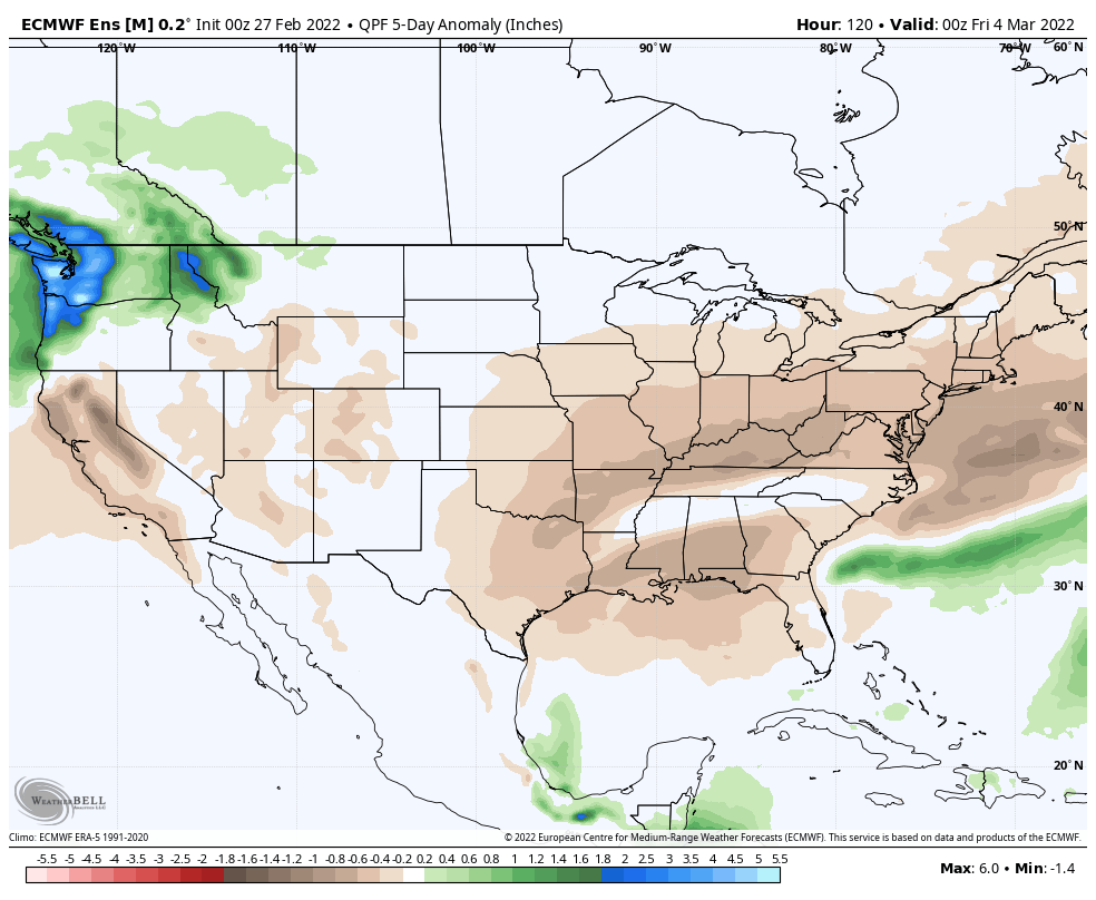
As another wintry event comes to an end, most Hoosiers are ready for spring. As we look ahead at the upcoming couple of weeks, there are signs that at least a “taste” of spring awaits. But, as is typically the case, there are contradicting signals.
The consensus from our big player teleconnections would suggest a warm-up (compared to normal) in the 5-10 day period, but note that the trends are favorable for cooler than normal temperatures thereafter.


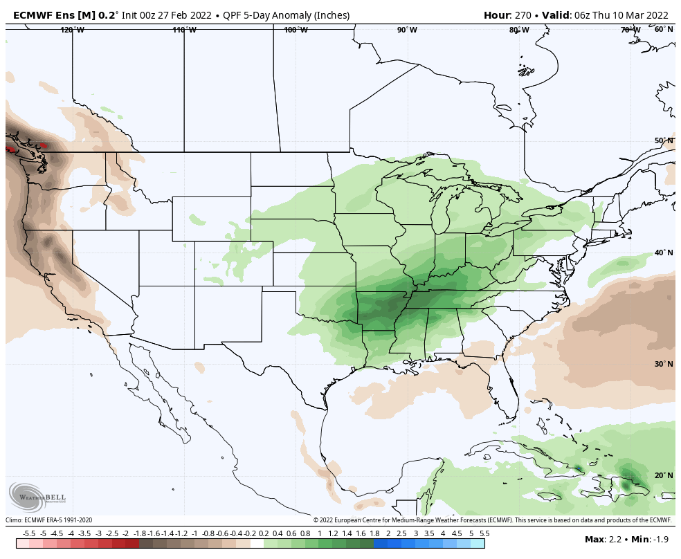
Ensemble guidance shows the transition over the upcoming couple weeks.

The Madden Julian Oscillation (MJO) argues that eastern warmth should come back with a vengeance towards mid-March after the potential of a brief cooler setback. We note guidance is in better alignment taking things into Phase 5 and that should result in an expanding eastern ridge between the 10th and 15th.


The JMA Week 2 500mb pattern looks pretty good to me based on the MJO activity. Meanwhile, unseasonably cold air is likely to dump into the West and we’ll have ti monitor thing the pattern drivers closely once passed mid-month for the possibility of colder air to ooze east.

The transitional theme to the overall pattern should promote wetter than normal conditions over the upcoming 14-16 days as a whole.

Permanent link to this article: https://indywx.com/long-range-update-spring-is-that-you/
Feb 24
Updated 02.24.22 @ 7:40a
Permanent link to this article: https://indywx.com/video-wintry-precipitation-overspreads-the-area-yet-again-this-afternoon-into-the-evening/