Updated 10.16.23 @ 7:38a
You must be logged in to view this content. Click Here to become a member of IndyWX.com for full access. Already a member of IndyWx.com All-Access? Log-in here.

Oct 16
Updated 10.16.23 @ 7:38a
You must be logged in to view this content. Click Here to become a member of IndyWX.com for full access. Already a member of IndyWx.com All-Access? Log-in here.
Permanent link to this article: https://indywx.com/video-early-and-midweek-improvements-ahead-of-a-new-storm-system/
Oct 15
Updated 10.15.23 @ 7:50a
You must be logged in to view this content. Click Here to become a member of IndyWX.com for full access. Already a member of IndyWx.com All-Access? Log-in here.
Permanent link to this article: https://indywx.com/video-throwing-it-on-repeat/
Oct 14
Updated 10.14.23 @ 7:43a I. An upper low and trough of low pressure will lead to a return of cloudiness, additional nuisance variety showers along with gusty winds and falling…
You must be logged in to view this content. Click Here to become a member of IndyWX.com for full access. Already a member of IndyWx.com All-Access? Log-in here.
Permanent link to this article: https://indywx.com/saturday-morning-rambles-12/
Oct 13
Updated 10.13.23 @ 7:25a
I’ve had the opportunity this week to spend time with family and loved ones in the gorgeous western NC and eastern TN mountains. Fall foliage is starting to pop above 2,000 feet, especially after the cooler air this week.


At any rate, thank you for your patience and flexibility this week as posts have been a bit off schedule. We’ll resume “normal programming” Saturday.
When we look ahead to this week, there are 2 storms of note. The easy and obvious first system will deliver a round of storms this evening. A few of these will have gusty winds and a few leftover “backlash” showers will continue through the weekend as the upper low swirls overhead. Once again, we’ll turn much cooler tonight and continue into the new week.
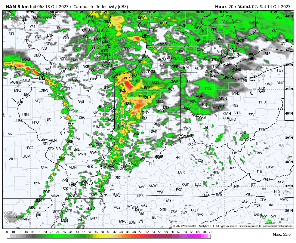
Rainfall totals of 0.25” to 0.75” will be common for central and southern Indiana with heavier amounts of 1” to 1.5” across the northern 1/3 of the state.
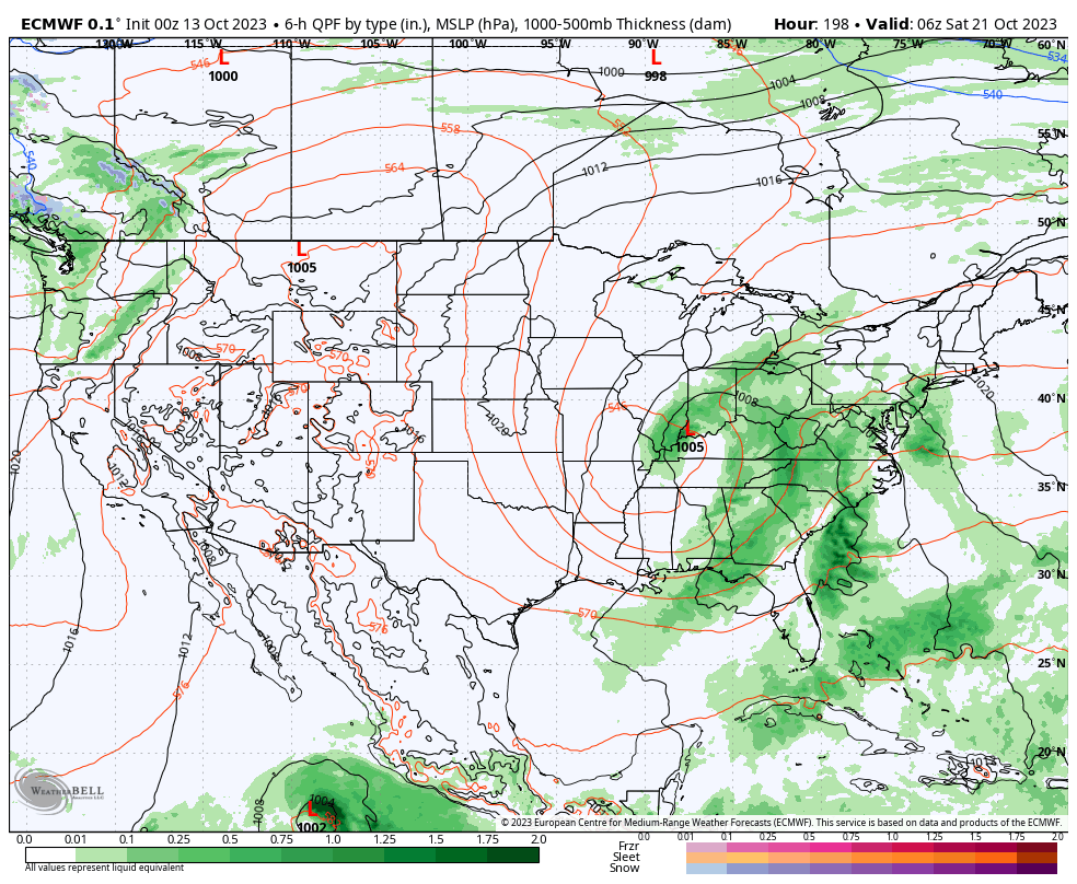
Our second system is much more complex and will come into the picture late week (next Friday/ Saturday time frame). Guidance agrees on the energy becoming cut off from the main steering flow but is far from etched in stone with the specifics at this distance. It’ll certainly be a topic of discussion in the days ahead.
Permanent link to this article: https://indywx.com/tracking-2-storms-in-the-week-ahead/
Oct 12
Updated 10.12.23 @ 10:50a
As we roll into the second half of October, a look at the primary pattern drivers suggests there should be a lack of any sort of sustained above normal temperatures.
The PNA (image 1) should remain mostly in a positive state over the next couple weeks while the EPO (image 2) is expected to be in a neutral to negative state.


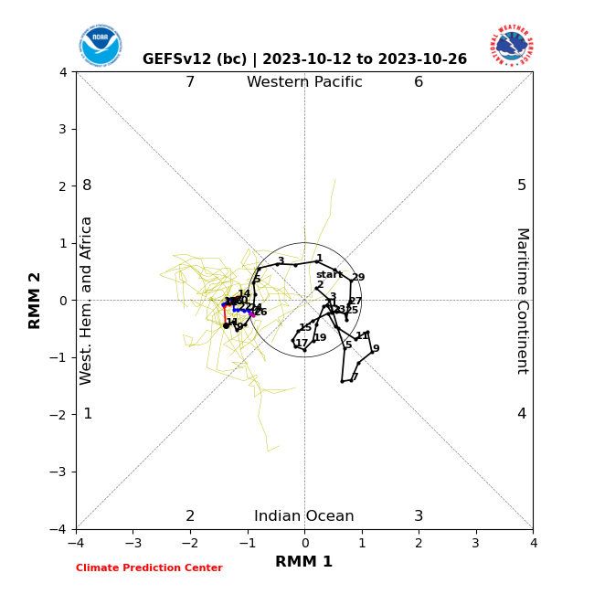
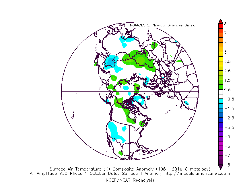
Furthermore, the MJO is forecast to sneak into Phase 1 late month. This is the correlation in October:
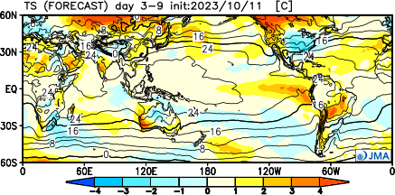
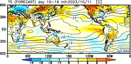
It’s hard to find much at fault with the NEW JMA Weeklies posted earlier today.
Temperatures
Week 1
Week 2
Weeks 3-4
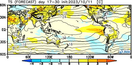
Precipitation should run average to slightly below normal over the span of the upcoming (2) weeks:

Permanent link to this article: https://indywx.com/lr-update-checking-in-on-the-pattern-drivers-to-close-october/