Category: Rain

Sunday Morning Rambles: Talking About Icing Monday Evening, Wet Week Ahead, And Potential Of A Wintry Return…

Updated 01.21.24 @ 7:51a

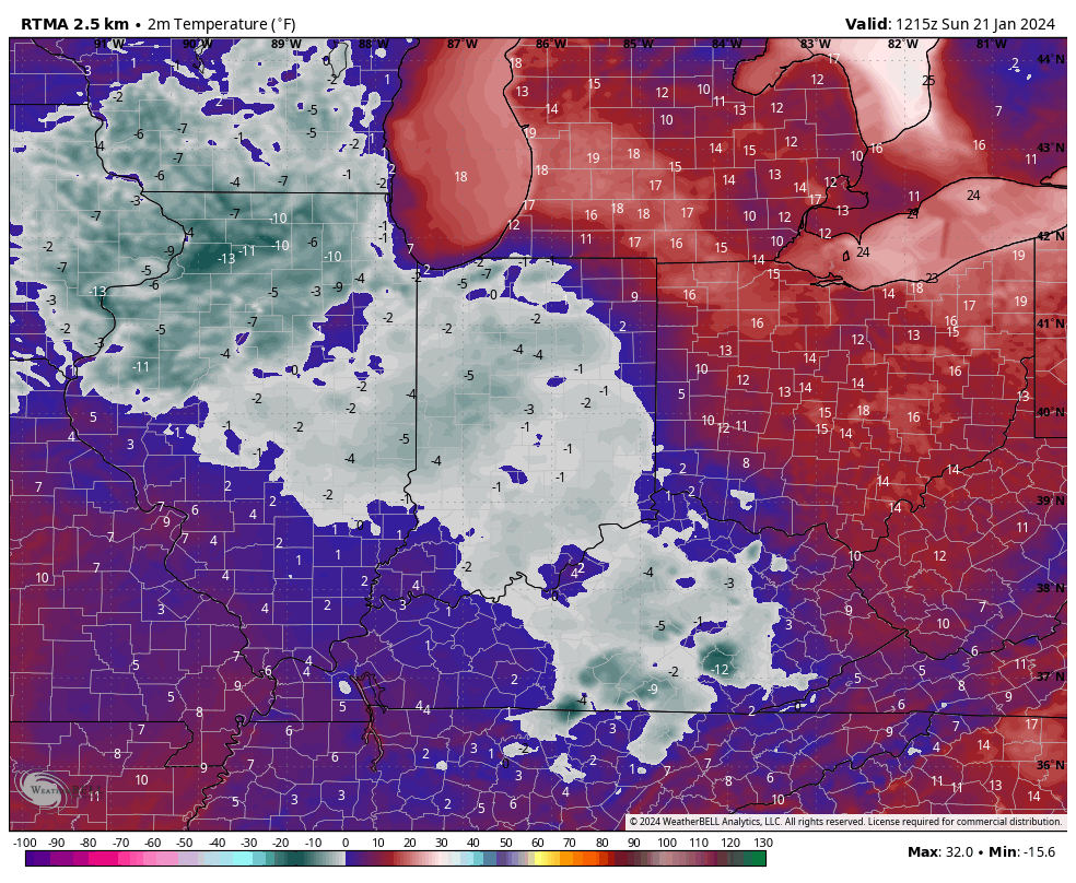
This is the 4th morning of the new year where most, if not all, of central Indiana is waking up to subzero temperatures.

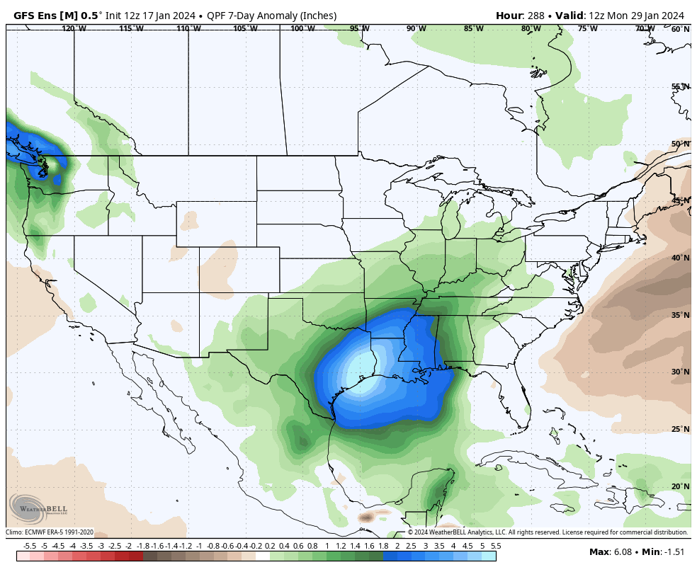
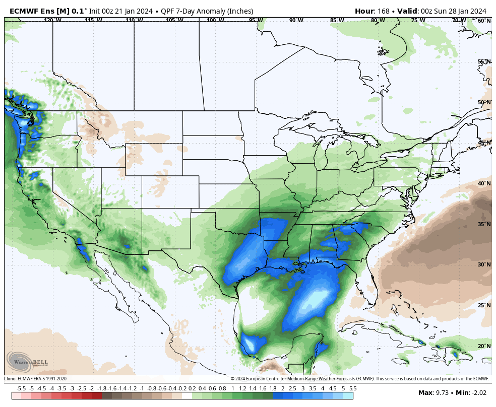
While temperatures will moderate this week, our January “thaw” won’t come without a few bumps in the road. A wet and active pattern will accompany the milder air, and we’re likely also going to be dealing with periods of dense fog early and mid week.

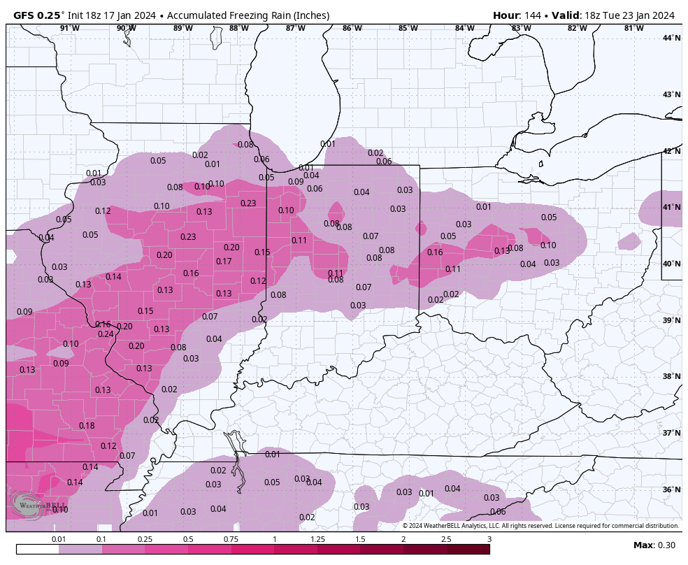
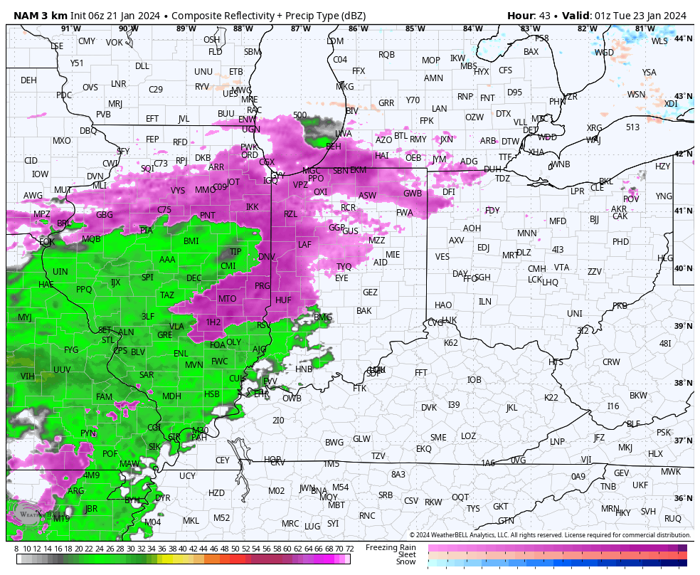
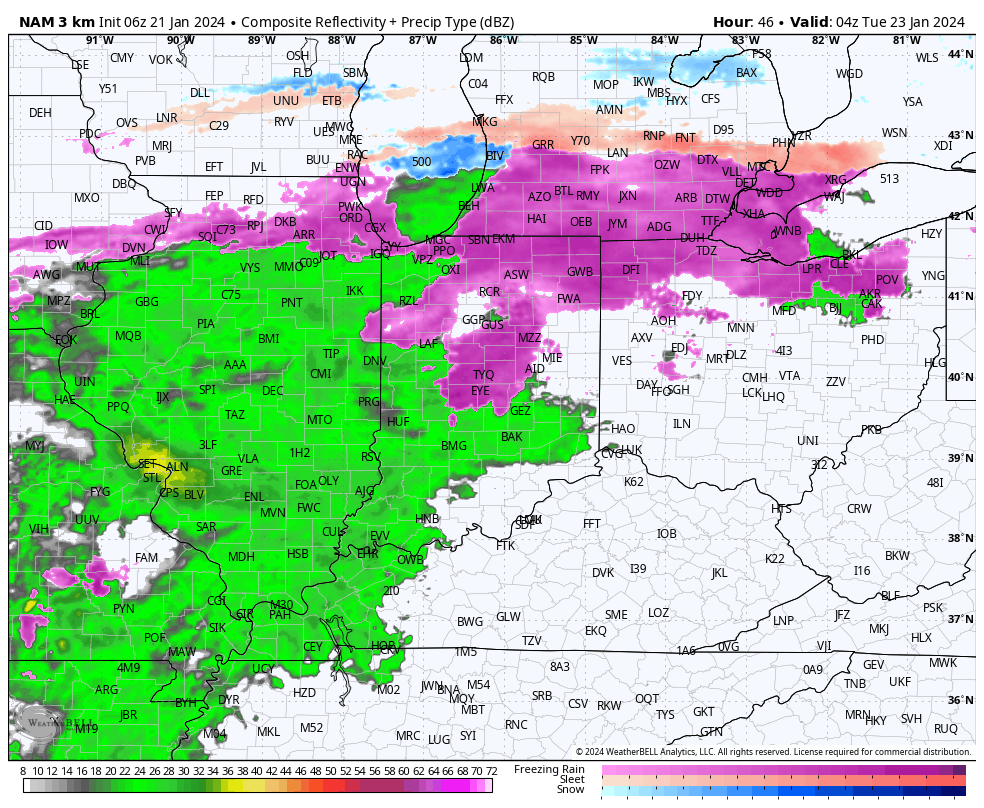
The onset of this wet shift will come with a period of freezing rain Monday evening into Tuesday morning. Due to the extremely cold surface, it’s icing on roadways and sidewalks that worry us most as opposed to elevated (tree limbs/ power lines) icing. Anticipate slick and hazardous travel Monday night into predawn Tuesday before temperatures “warm.” If possible, we highly recommend simply staying off area roadways during this time frame.

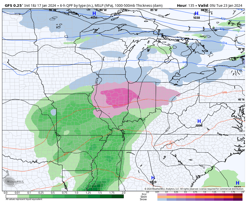
Our next round of moderate to locally heavy rain will push into the Ohio Valley and central Indiana Wednesday into Thursday.

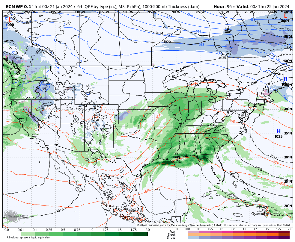
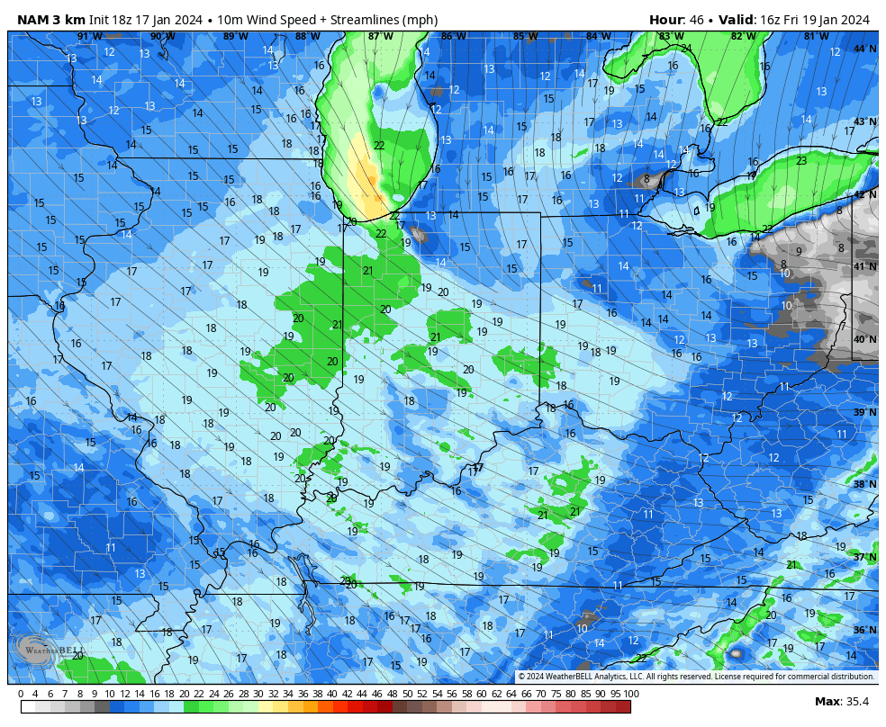
The late week storm may even take on a bit of a wintry flavor Friday into Saturday.

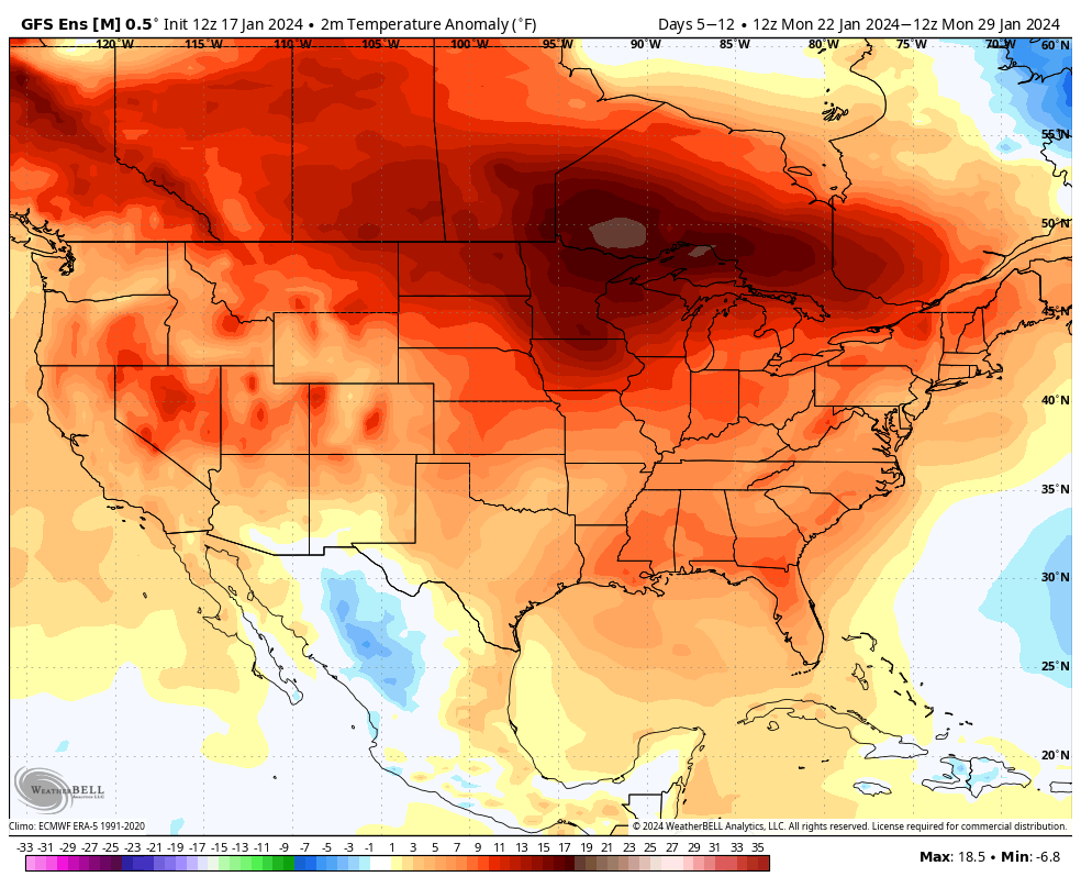
Despite this sneaky potential of a little wintry fun, it’ll be within what’s otherwise going to be a much warmer than normal period over the upcoming couple weeks (of course, once we get past tomorrow).

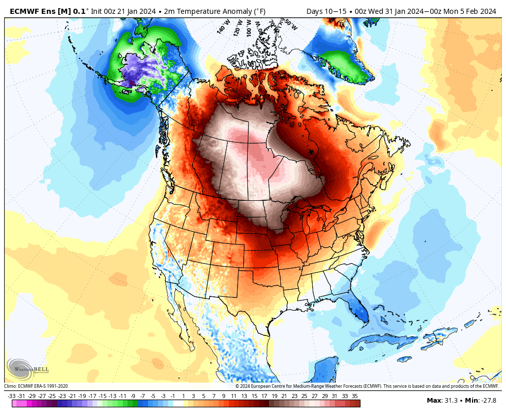
Not only is the MJO rolling into traditionally warm phases for this time of year, but our teleconnection suite is aligned in a manner that also strongly argues for milder to much milder than normal conditions across our neck of the woods.

Eventually, we anticipate a return of colder than normal temperatures and another opportunity for ice/ snow but likely not until we get to mid-February and beyond. If you didn’t have a chance to catch our Long Range update, we recommend listening here, including February and thoughts into meteorological spring.

Permanent link to this article: https://indywx.com/sunday-morning-rambles-talking-about-icing-monday-evening-wet-week-ahead-and-potential-of-a-wintry-return/

VIDEO: Gusty Snow Showers, Squalls Redevelop; Flipping The Switch To A Wetter, But Milder Week Ahead…

Updated 01.19.24 @ 7:58a As the “system” snow winds down, we’ll notice a renewed area of snow showers developing through the late morning and afternoon as another round of arctic…

You must be logged in to view this content. Click Here to become a member of IndyWX.com for full access.  Already a member of IndyWx.com All-Access?  Log-in here.

Permanent link to this article: https://indywx.com/video-gusty-snow-showers-squalls-redevelop-flipping-the-switch-to-a-wetter-but-milder-week-ahead/

Long Range Update: Pattern Evolution Through The Remainder Of Winter; Open To Meteorological Spring…

Updated 01.19.24 @ 7:35a

You must be logged in to view this content. Click Here to become a member of IndyWX.com for full access.  Already a member of IndyWx.com All-Access?  Log-in here.

Permanent link to this article: https://indywx.com/long-range-update-pattern-evolution-through-the-remainder-of-winter-open-to-meteorological-spring/

VIDEO: Snowy, Windy, And Turning Colder Yet Again; Big Warmup On Deck Next Week, But Comes With Unsettled Weather…

Updated 01.18.24 @ 7:22a We continue to eye an accumulating snow event to close out the work week and this will precede arctic reinforcements that once again will take us…

You must be logged in to view this content. Click Here to become a member of IndyWX.com for full access.  Already a member of IndyWx.com All-Access?  Log-in here.

Permanent link to this article: https://indywx.com/video-snowy-windy-and-turning-colder-yet-again-big-warmup-on-deck-next-week-but-comes-with-unsettled-weather/

Evening Update: Snow/ Wind Trends, Icy Setup Early Next Week, And More On The Pattern Flip Ahead…

Updated 01.17.24 @ 5:22p

While we’ll still contend with a couple of rounds of accumulating snow to close out the work week, latest model guidance is trending drier with both systems- at least across most of central Indiana. The Thursday morning snow band will lead to a couple inches of powder across north-central and northern IN tomorrow morning, but the majority of this band should fall apart before reaching Indianapolis. We’ll continue to keep close eyes on overnight trends, but travel impacts aren’t likely until once north of Kokomo as of now tomorrow morning.

The next round of snow will arrive Thursday night- now likely well after the evening rush hour. While this still doesn’t appear to be a particularly heavy event (2″-3″ north of Indianapolis, including northern ‘burbs and 1″ to 2″ from Indy and points south), the cold surface will allow this light snow event to create slick road conditions overnight and into our Friday. Snow removal clients, we still recommend planning to activate salting and plowing overnight and through Friday.

We also continue to closely monitor a localized, but heavier snow band that will likely oscillate through a portion of central Indiana through the afternoon Friday. Localized heavier snow accumulations and gusty winds will be associated within this snow band and we’ll have to treat this more as a “nowcast” situation once that LES band gets organized.

Even outside of this LES band, gusty northwesterly winds of 20-30 MPH will lead to considerable blowing and drifting snow, especially on west-east roadways and in the open country. Drifting and blowing snow will continue through Saturday in these areas.

After another bitterly cold weekend, a significant warming trend will get underway next week. That’s not before we likely have to deal with a round of freezing rain Monday night and into Tuesday. Many times, forecast guidance can be too aggressive in dislodging true arctic air and I’m afraid that will be the case in this instance. Today’s trends have likely started to pick up on this icy threat to open the work week and while we likely aren’t talking about a true ice storm, travel impacts should be expected Monday night into Tuesday morning before we transition to a plain ole rain event.

A freezing rain event is becoming increasingly likely Mon evening into Tuesday.

Thereafter it’s “game, set, match” for much milder, but wet times through the rest of the week and on into next weekend.

Permanent link to this article: https://indywx.com/evening-update-snow-wind-trends-icy-setup-early-next-week-and-more-on-the-pattern-flip-ahead/