Updated 04.11.24 @ 7:39a Masters Thursday will be a wash-out up this way. Thankfully, down at Augusta, GA we’re talking about better weather- at least relatively speaking. 🙂 Additional showers…
You must be logged in to view this content. Click Here to become a member of IndyWX.com for full access. Already a member of IndyWx.com All-Access? Log-in here.
We’ll have a lot of clouds around today but the lions share of our Tuesday will be dry. That changes this evening as we target better chances of showers and storms to develop across southern and southeastern Indiana- primarily south and east of the city, itself.
This is the beginning of another unsettled and dreary stretch as a surface low lifts north and tracks through the Ohio Valley midweek.
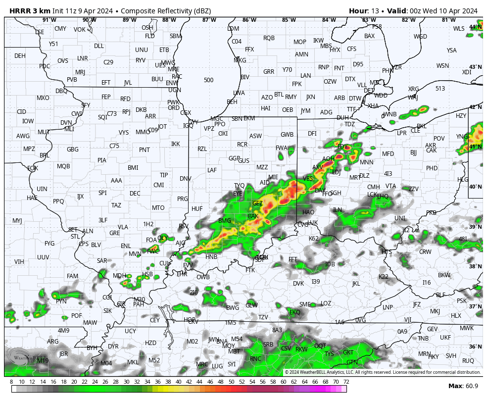
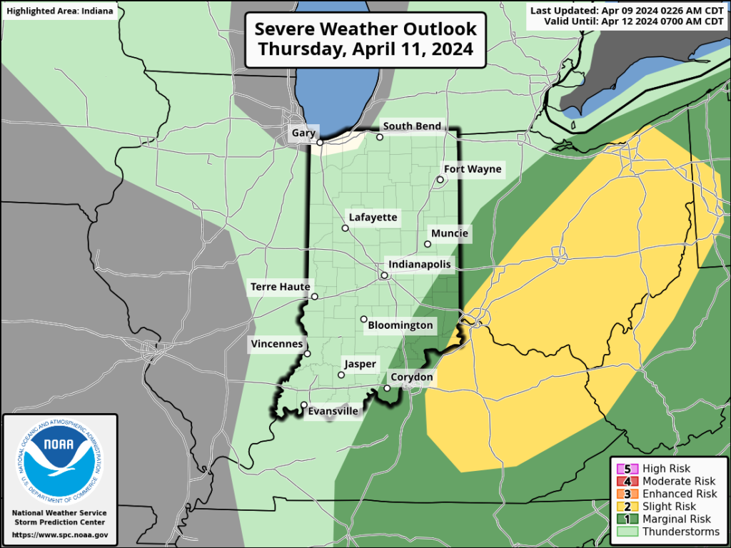
Periods of heavy rain can be expected Wednesday evening into Thursday and we continue to monitor the potential of strong to severe storms in the “warm sector” across Ohio Thursday.
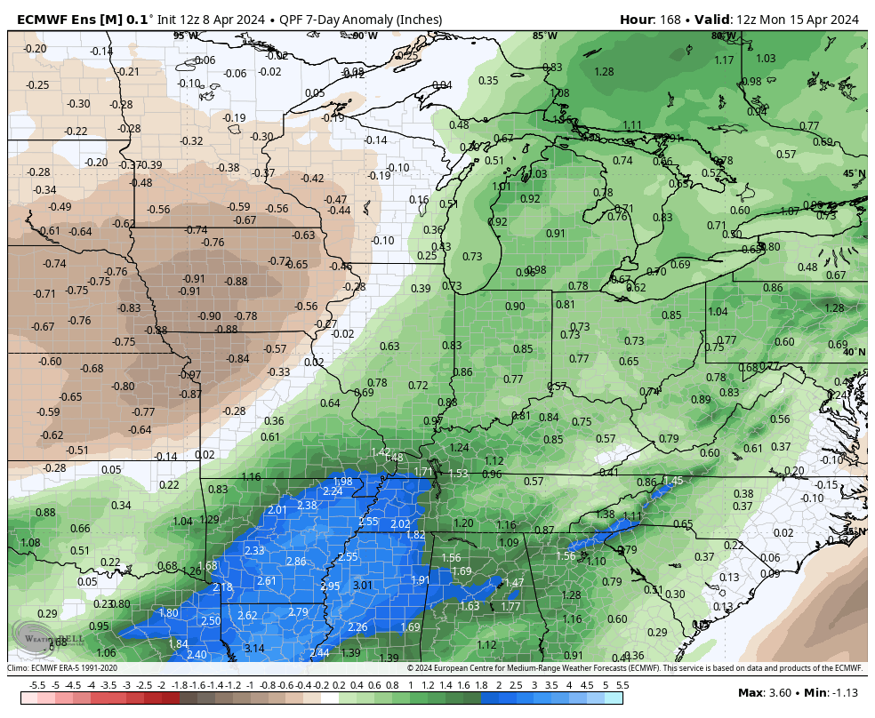
In general, most central IN rain gauges should accumulate 1.5” to 2.5” of rain but there will be locally heavier amounts.
Upper level energy will whip in behind the departing low keeping showers in play as we wrap the work week up on Friday.
The weekend still looks like it’ll open on a great note with increasingly sunny and mild conditions Saturday before another opportunity for scattered showers and embedded thunder Sunday.
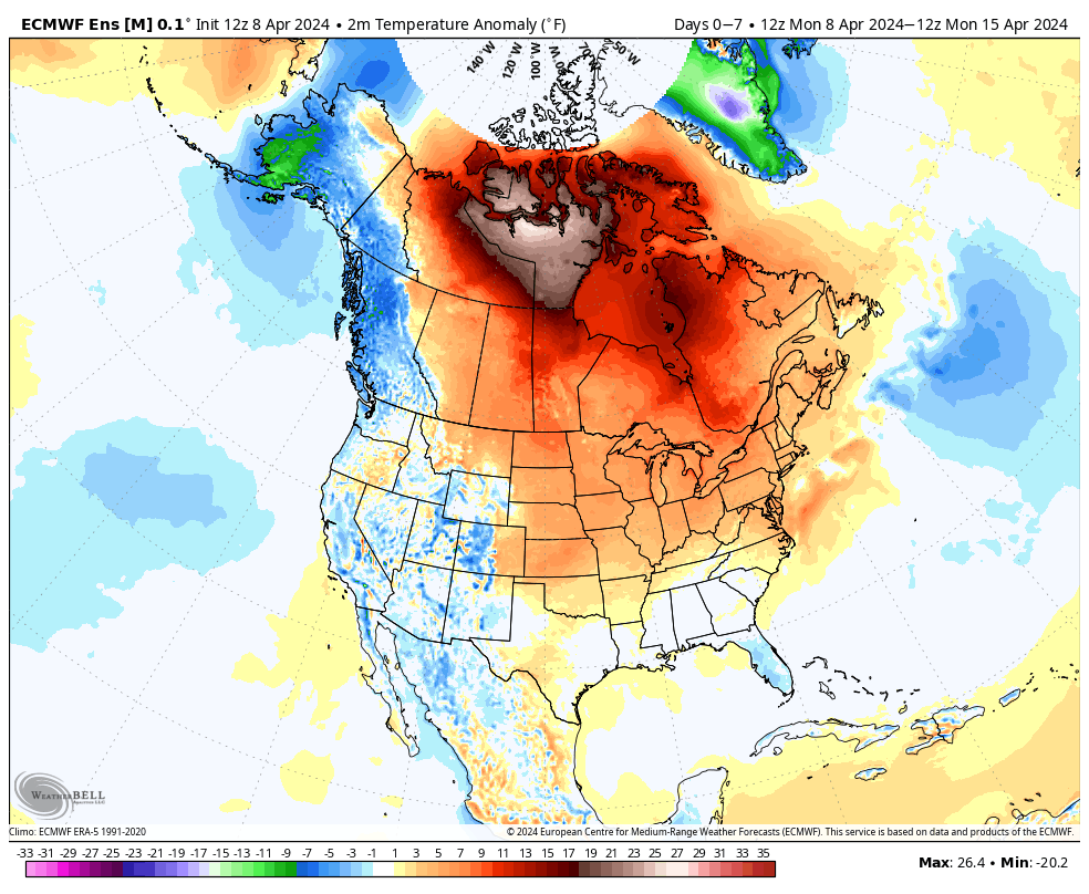
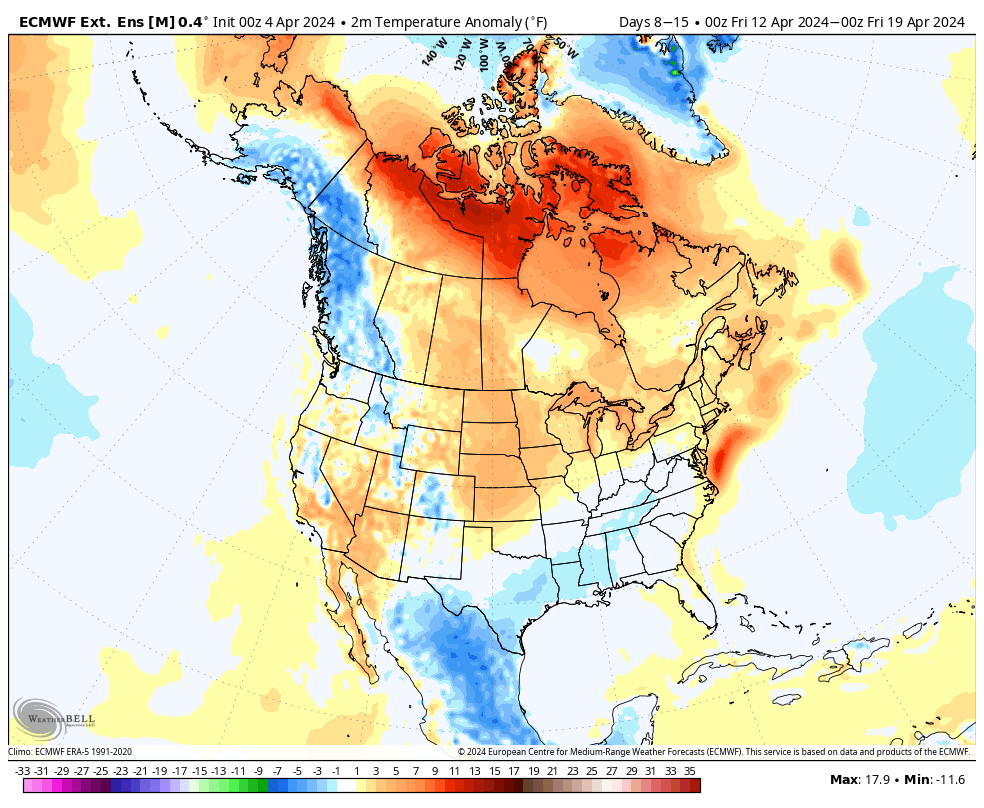
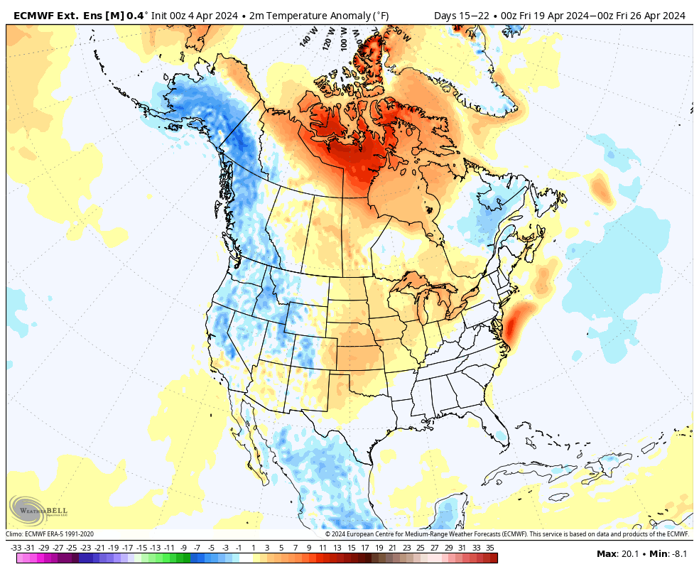
We’re running a little more than 3° below normal to open the month, but changes are in the offing. The majority of the upcoming 7-day period should feature seasonal to above normal temperatures and that will likely only strengthen into the Week 2 timeframe.
Unfortunately, we have a big rain event set to unfold as we roll through the middle of the week. Rain (more “showery” in nature) will continue as we close out the work week before a gorgeous Saturday.
The recent chilly open to April will begin to transition to a warmer look over the upcoming week. Slightly cooler air Friday will give way to a significant warm-up through the weekend and into Week 2.
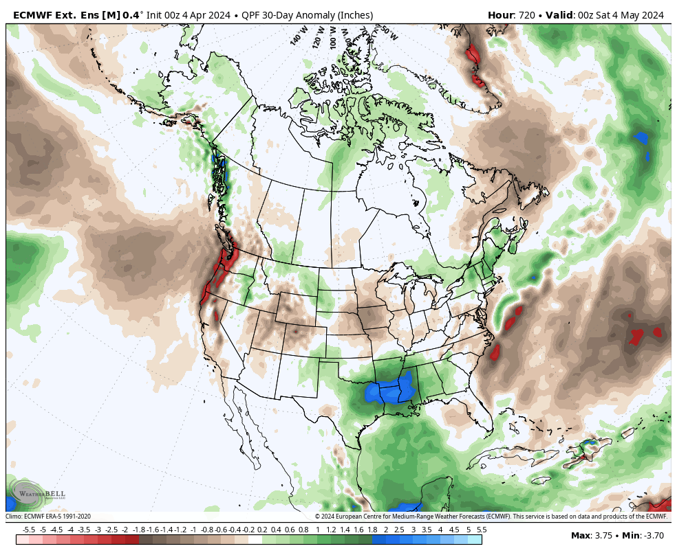
Our expected active spring will remain intact over the next couple weeks, including an overall above average look in the rainfall department.
In the short-term period, this is highlighted between what falls Wednesday-Friday.
Though severe weather won’t be a concern, heavy rain will during the aforementioned timeframe. We still think widespread 1.5”+ amounts are likely for many area rain gauges. As of now, severe weather isn’t expected, locally, based on the SLP track. Further east into Ohio, a few severe storms will be on the table. We’ll monitor for any last minute west adjustments leading into the system.
Widespread, soaking rains will turn more “showery” in nature Friday before dry air takes firm control and provides a pleasant Saturday.
Don’t get used to the dry weather. Despite the warmer trend, another round of rain and storms can be expected the 2nd half of the weekend into early next week.
Upcoming *10-Day Rainfall Projection: 1.5” to 2.5”
The overall chilly and unsettled pattern of late should show rather marked improvement not only over the short-term, but longer range, as well.
The teleconnection suite (AO, NAO, PNA, and EPO) over the next couple weeks is aligned in a manner that should promote less of an anomalous 500mb look, locally (deep eastern trough we’ve been dealing with).
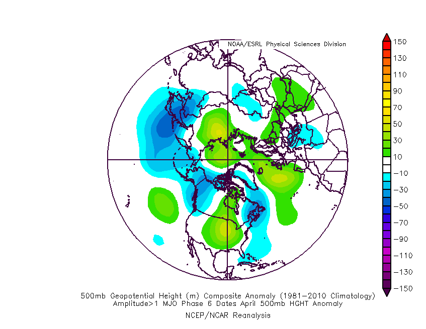
If we’re able to sneak into MJO Phase 6, then a warmer “lean” would be required by mid and late April. As always, we’ll keep an eye on those trends as the majority of data keeps the MJO in the neutral phase.
The thought here is that a milder and drier overall regime will take hold over the course of the next few weeks, certainly compared to late. That said, given the pattern drivers noted above, I also want to reiterate that we shouldn’t see rain or temperatures that differ significantly from average (rather only slightly above in the temperature department and slightly below in the precipitation department over the upcoming 4 week period). Further west, the better chance of more in the way of significantly above normal temperatures (primarily in the Plains).
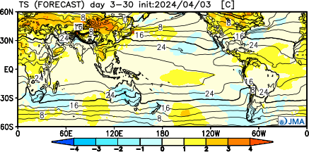
The latest European and JMA Weeklies agree on this overall idea.
Updated 04.04.24 @ 7:40a A big ole upper low will move only sluggishly over the next day or two, keeping clouds, light precipitation, and chilly temperatures around. The good news?…
You must be logged in to view this content. Click Here to become a member of IndyWX.com for full access. Already a member of IndyWx.com All-Access? Log-in here.
Permanent link to this article: https://indywx.com/video-trending-in-the-right-direction-as-we-open-the-weekend-but-still-have-to-get-through-a-couple-damp-chilly-days/