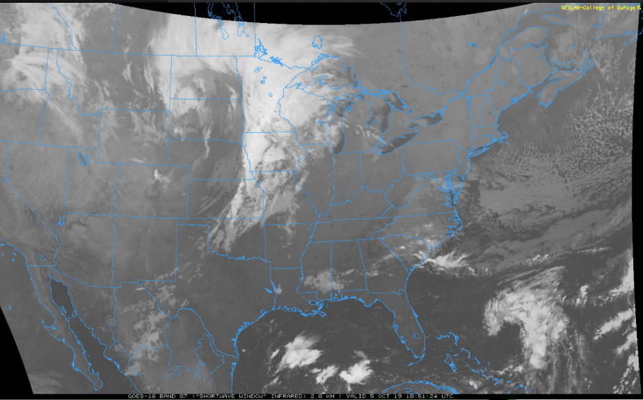
I. Our Saturday will get off to a stunning start. Despite some patchy fog here and there, look for plentiful sunshine and chilly temperatures in the low-mid 40s rising into the low-mid 70s for afternoon highs with increasing clouds.
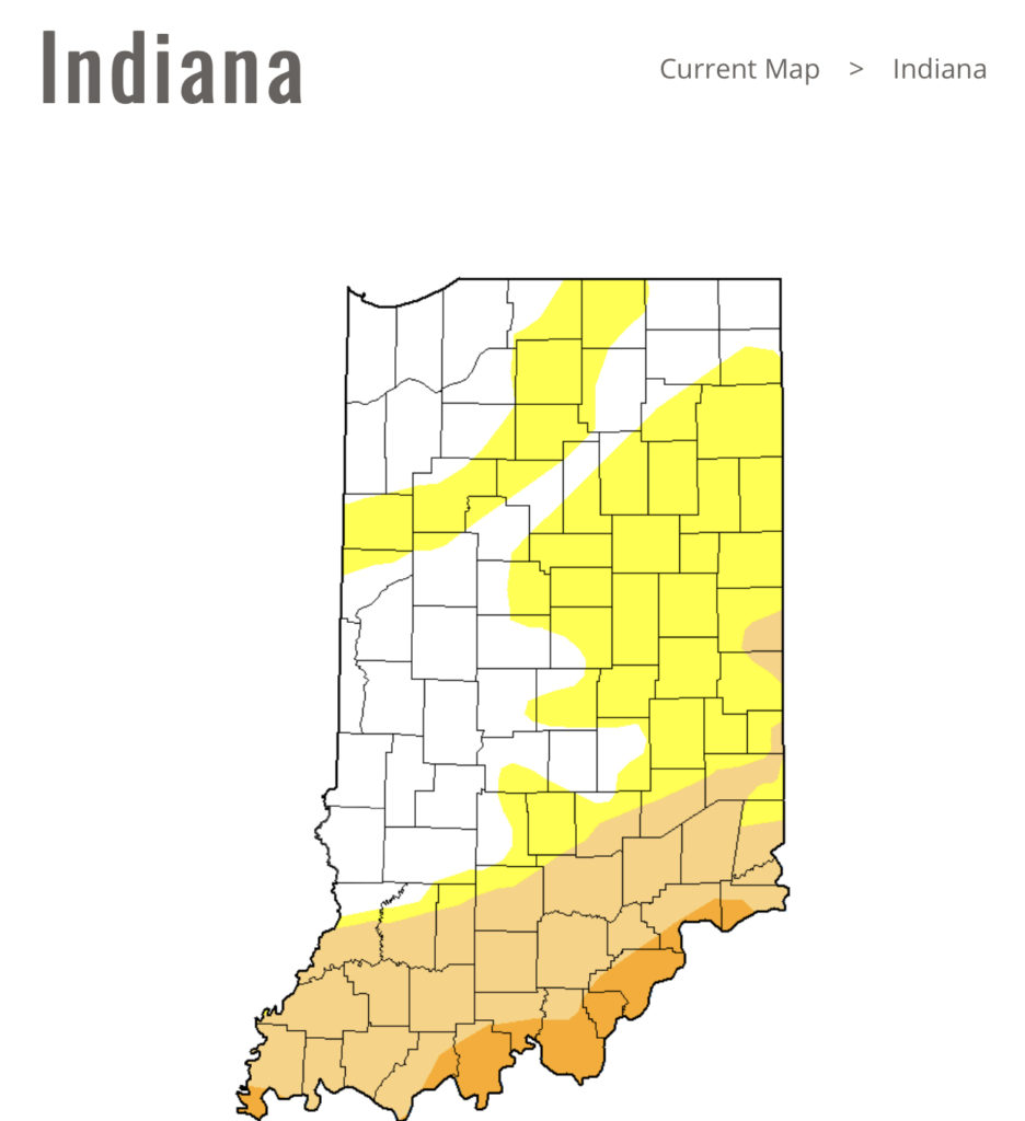
II. Those increasing clouds will deliver showers by tonight across central Indiana and then more concentrated heavier rain downstate Sunday evening into the predawn Monday. Southern Indiana is needing a good soaking in a bad way and this system will at least help things slowly begin to improve…
Forecast radar 11p Saturday.
Forecast radar 9a Sunday.
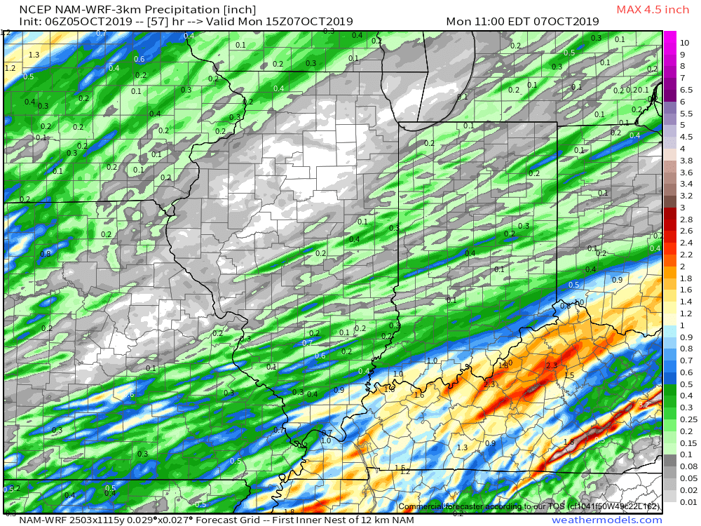
Rainfall totals with this system across central Indiana should accumulate to the tune of 0.20 to 0.40 for most with heavier amounts approaching 1” across the IN-KY border.
Note this is where things are driest across the state per Thursday’s drought update.
III. Our next storm system will swing through here late in the work week. We’re timing Thursday PM into early Friday for a round of showers and potentially gusty thunderstorms as a cold front pushes through.
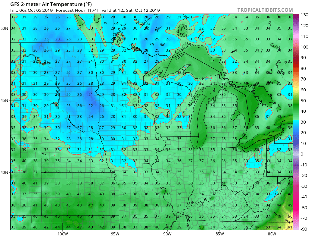
Behind this boundary, the coldest air of the fall so far will blow into town. We’re continuing to think many of the area can expect the first frost of the season next weekend.
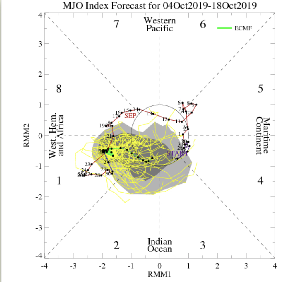
IV. As we look ahead, it’s time to start putting more stock into other tools in the box. Case in point, the MJO is showing signs of less amplitude over the upcoming couple weeks followed by a strongly positive PNA. This supports colder signals in the period. We’ll dig in further in the days ahead.
You must be logged in to view this content. Click Here to become a member of IndyWX.com for full access. Already a member of IndyWx.com All-Access? Log-in here.
I want to give a couple examples of significant conflicting signals- both short and long-term. The end result is a situation where long range, climate, and seasonal models are likely to have a very tough time not only in the medium to long range (2-4 week period), but thinking seasonally, as well (winter and next spring).
Short-term
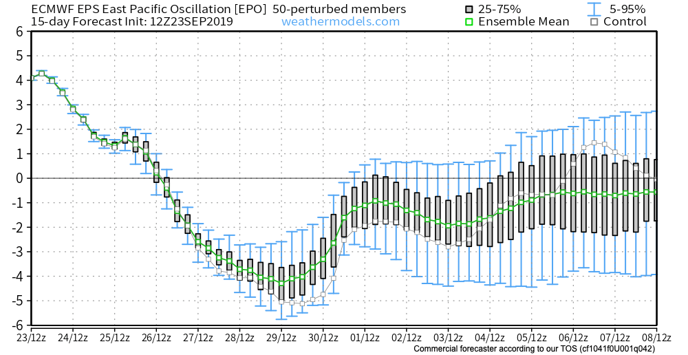
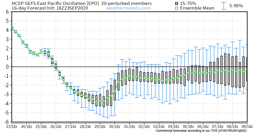
To start, let’s look at the EPO. While strongly positive at present, both the EPS and GEFS pictured below take the EPO, or East Pacific Oscillation, negative in the coming couple of weeks.
A negative EPO pattern favors a trough across the eastern portion of the country, especially here in our neck of the woods, with western ridging.
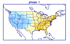
All well and good, right? WRONG. The MJO, or Madden Julian Oscillation, is forecast to stall out into early October in Phase 1.
This time of year, Phase 1 argues strongly for eastern ridging and well above normal warmth while the western portion of the country can experience early wintry conditions.
Talk about contradiction! That’s what makes weather so fun and fascinating. Expect to be humbled often and to always learn! At various times of the year, select teleconnections can mean a lot more than other times of the year. For example, during the summer and fall, we lean heavily on the EPO, PNA, and MJO (if amplified). During the winter and spring, it’s important to take into account what the AO and NAO have to say. It’s important to know when to “pick and choose” when to use particular teleconnections… Furthermore, the various MJO phases (1-8) mean drastically different things at different times of the year. While lovers of chilly fall conditions have grown to hate an amplified Phase 1, they have to love it come winter (shown below). Just look at that difference!
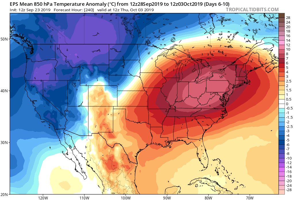
Before jumping ahead to another example of “contradicting signals,” we’re confident the amplified MJO Phase 1 will carry the day through the short to medium range period. Note the strong agreement between the EPS and GEFS below with respect to temperature anomalies in the 6-10 day period.
With that said, there will be challenges within (the big difference as early as this weekend between the GFS and European operational data). A lot of that has to do with the “fight” between the EPO and MJO to take control.
As all of this unfolds across the East, the west will begin to cash in on early winter. Well below average cold and snowy conditions will begin to make headlines over the weekend into next week across not only the Rockies, but some of the low ground, as well. Should the MJO swing into Phase 2 (and I think it will towards mid-Oct), then watch out. We’ll be looking at a rather significant shift towards a much colder feel- and it’ll sting even more so with the late season heat over the better part of the next couple of weeks.
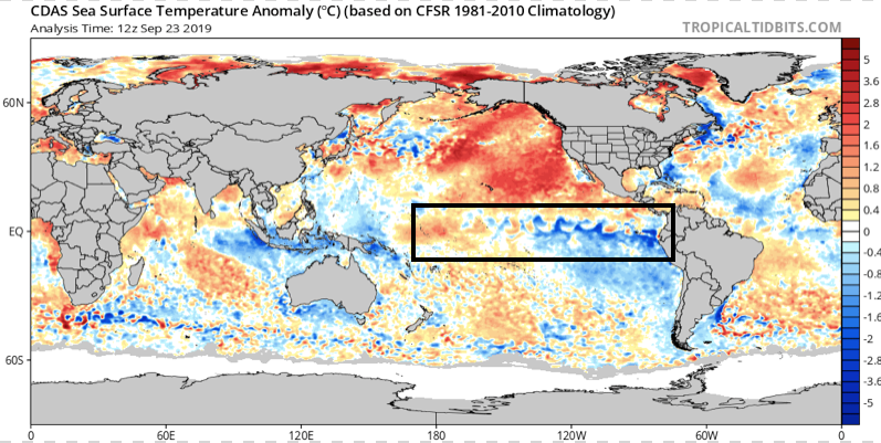
Flipping the page to winter (remember, our prelim. winter outlook will be posted later this week) and the contradiction continues. Upon looking at the current SST configuration, one could easily argue we’re talking about a La Nina winter unfolding ahead.
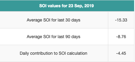
Meanwhile, the current SOI would suggest we’re in a moderate El Nino.
If you think this can’t wreck havoc even on the short-term forecast pattern, think again…
To close, while the conflicting data can create headaches at times, it’s more fascinating than ever trying to sift through the data and build our forecast(s). It’d be wise to expect more wild swings ahead- leave it to us to try and minimize the impacts of those swings in your day-to-day personal and professional lives. Accordingly, it’s also ultra-important to factor in additional items, such as solar and PDO into the equation for the upcoming winter.
Speaking of, without giving too much away, if I’m a winter weather fan (and I am), I wouldn’t worry in the least about the current warmth… 😉
Late July and August have been known to produce some serious heat around these parts from time to time. However, it continues to look like this will not be the case this year.
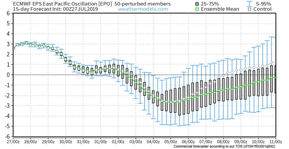
We’ve already discussed the impacts of the negative EPO. (By the way, modeling continues to take the EPO even more strongly negative with every passing update). This supports the cooler idea we have for early August.
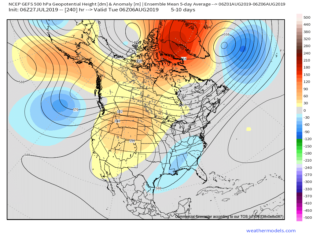
Now we see the PNA forecast to trend more positive through the better part of early August. This, too, supports the cooler pattern that will be with us through the period.
It should come as no surprise to see the models trend stronger with the eastern trough in the Weeks 2-3 time period. This period will likely feature a couple of strong frontal passages that serve as a reminder that the fall season is just around the corner.
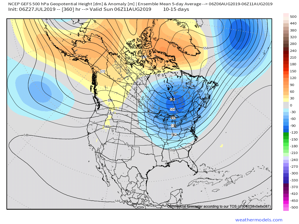
Note the latest GEFS deepen the trough from the Day 5-10 period to Days 10-15.
Not only will this serve to provide a rather lengthy period of cooler than normal temperatures through the 1st half of August, but should also help inject wetter conditions to boot (in large part due to the frequent nature of frontal passages).
At a time of year that can feature brutal periods of heat and/ or dry conditions, it sure continues to be the exact opposite this year!
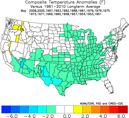
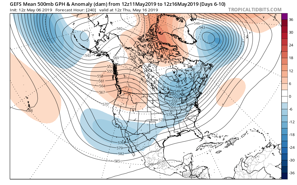
Though May has opened warmer than average (to the tune of 1 degree F above normal, month-to-date), there’s growing evidence behind a shift towards not only a cooler pattern for mid-month, but drier, as well.
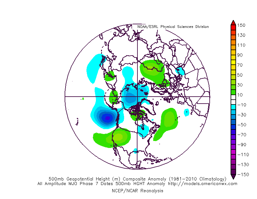
MJO:
The Madden Julian Oscillation is forecast to move through Phase 7 (a cooler phase in May across the eastern half of the country).
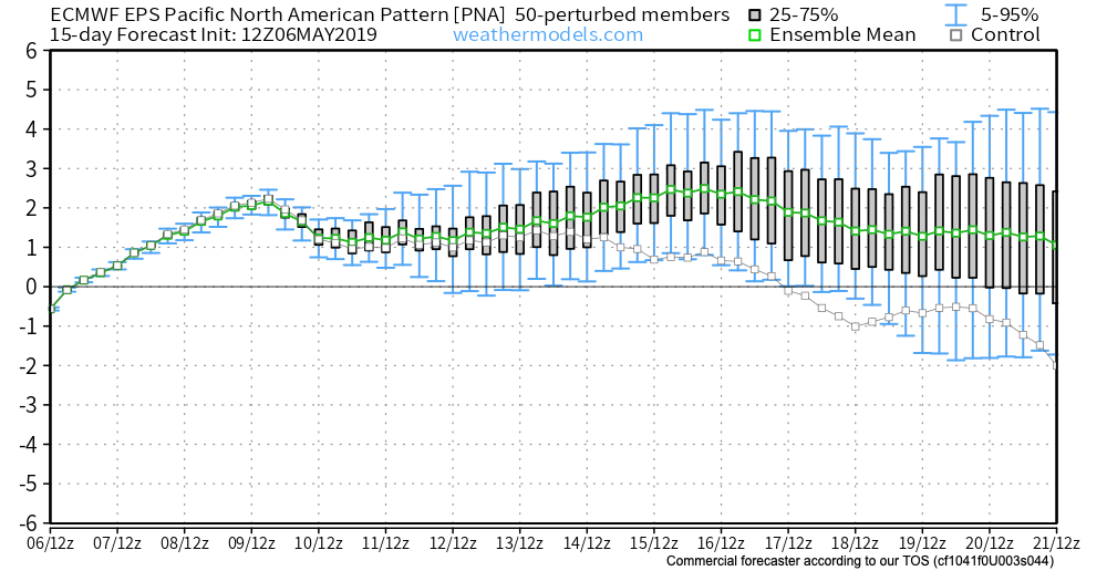
PNA:
The Pacific North America pattern is forecast to remain positive into mid-May. This favors a cooler than normal south-central into the eastern portion of the country, as well.
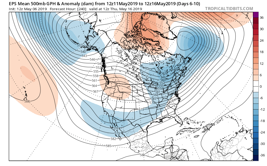
To no surprise, we see modeling now in excellent agreement of the cooler mid-month shift that awaits on deck. Recall that this wasn’t the case last week when the GFS and EPS were in vast disagreement.
The cooler shift also will provide relief from the seemingly unending wet regime we’ve been in as of late.
Hang in there; after a warm, wet open to the month, the pattern will begin to shift around in significant fashion as we move into the weekend and beyond…