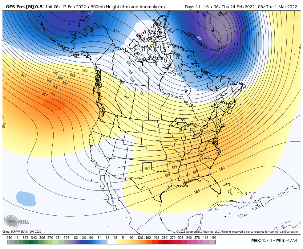
Category: PNA

VIDEO: All-Access Long Range Update…

This evening’s long range video update discusses the pattern drivers behind the late-March weather pattern…

You must be logged in to view this content. Click Here to become a member of IndyWX.com for full access.  Already a member of IndyWx.com All-Access?  Log-in here.

Permanent link to this article: https://indywx.com/2019/03/04/video-all-access-long-range-update/

All-Access Video Update On The Longer Range, And Honing In On Short-Term Systems…

You must be logged in to view this content. Click Here to become a member of IndyWX.com for full access.  Already a member of IndyWx.com All-Access?  Log-in here.

Permanent link to this article: https://indywx.com/2019/02/15/all-access-video-update-on-the-longer-range-and-honing-in-on-short-term-systems/

Reviewing The Latest European Weeklies And Updated Long Range Thoughts…

We’re growing closer and closer towards the period we’ve been thinking would present one last round of cold, wintry weather (relative to normal) for the ’18-’19 season.

While the stormy idea will likely end up being correct, the significant cold that we thought would “spread out” (as opposed to being confined to the NW and northern Plains) is in jeopardy.

The overall upper air pattern over the upcoming few weeks will likely continue to be dominated by a mean trough position across the central and west, along with the persistent southeast ridge.

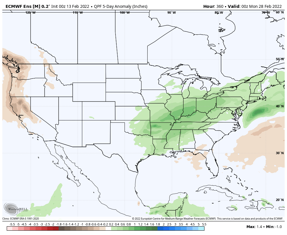
This will continue to result in above normal precipitation into the first week to 10 days of March, with a very active storm track.

From a temperature perspective, the baseline of our ideas being centered on the MJO appears to be the error in our forecast. It’s not that the MJO isn’t heading into Phase 8 (it’s officially there now, as noted below), but it appears other teleconnections are “trumping” this cold ingredient.

The combination of the positive Arctic Oscillation (AO) and negative Pacific North America pattern (PNA) are the drivers and are showing no signs of wanting to let go of the wheel.

The AO is forecast to remain strongly positive into early March.

The PNA is forecast to remain negative into early March.

Note how both of the above support that southeast ridge and associated relative warmth.

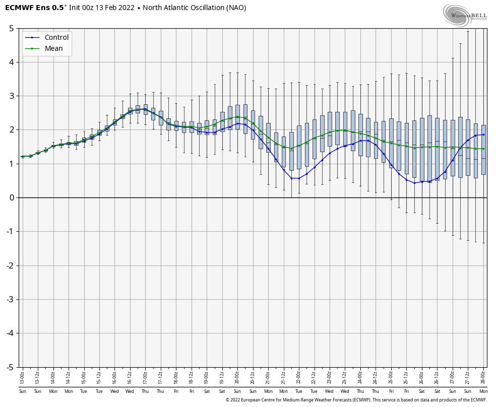
At one time, it appeared as if the North Atlantic Oscillation (NAO) would dip negative, however, that’s no longer the case.

While the active idea will come to fruition, the cold (at least to the magnitude we thought) will have a difficult time. That isn’t to say that enough cold air won’t get involved with a couple of these storms to result in wintry precipitation of significance, but rather that sustained cold will be tough to come by. Snowfall (of the heavy, wet variety) very well still could end up above normal with these moisture-laden systems over the next few weeks.

European Weekly Update

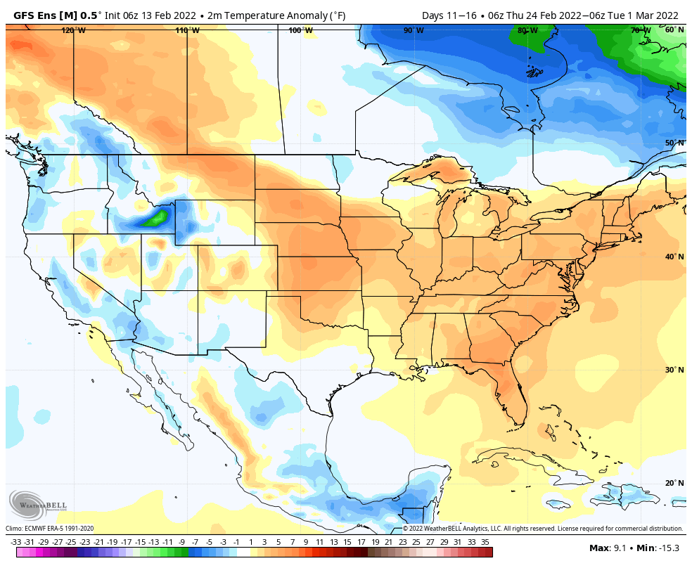
The new European Weeklies are in and follow the idea above nicely. They forecast a very stormy pattern to persist over the next few weeks with a battle ground between cold to our northwest and warmth to our southeast. We’ll have to be watchful for a couple of storm systems capable of delivering heavy amounts of precipitation. Given the teleconnection states over the next 6 weeks, it continues to look like any sort of significant wintry weather will need to take place before mid-March. Thereafter, warmer than normal times are expected, including true spring-like weather emerging. I know most can’t wait…


Permanent link to this article: https://indywx.com/2019/02/14/reviewing-the-latest-european-weeklies-and-updated-long-range-thoughts/

Long Range: Cold Pattern Isn’t Going Anywhere Fast…

We’ll save our short-term discussions for the severe and high-impact arctic outbreak on deck and focus our attention in this post to the upcoming several weeks. In short, we don’t expect the cold pattern to break anytime soon. Could there be a day or two of “relaxation?” Yes, but from an overall perspective, confidence is higher than normal on the colder than average pattern continuing through the month of February.

Let’s dig in to the teleconnections:

EPO

AO

NAO

PNA


Given the teleconnections in agreement pointing towards a cold pattern, it shouldn’t come as a surprise that the majority of data is also on the cold train as we flip the page into February:

CFSv2 Weeklies

Weeks 1 & 2

Weeks 3 & 4

JMA Weekly

GEFS

While we aren’t licensed to show the European Weeklies, the new update runs with a cold pattern into early March. This falls in line with the overall consensus of longer range data, backed up by teleconnections.

Though not nearly at the amplitude of a few weeks ago, the MJO (Madden-Julian Oscillation) is forecast to move through Phases 5 and 6 in the coming weeks before going back into the “null” phase.


Phases 5 and 6 this time of year would suggest colder anomalies are more likely around our neck of the woods:

Given the above, we continue to think a colder than average “2nd half” of winter looms for the region. We lean heavily on the NAO, EPO, and AO state(s) this time of year and all would point towards a cold time of things moving forward, overall. The latest European Weeklies are interesting from a couple of fronts- initially very cold and then progressively stormy. The idea here is that we remain quite wintry through February and into early March before this pattern breaks. While we may not see a “repeat” visit of the Vortex, it wouldn’t surprise us to see another major arctic outbreak again this winter (after next week), but that likely comes later, and towards the end of the game before we snap into spring.

Buckle up; we think we have a long way to go this winter…

Permanent link to this article: https://indywx.com/2019/01/24/long-range-cold-pattern-isnt-going-anywhere-fast/

VIDEO: Long Range Update; And Looking At This Weekend’s Snow Storm…

Tonight’s video update focuses on the long range and reviews some of the fresh short-term data churning on this weekend’s snow storm.

You must be logged in to view this content. Click Here to become a member of IndyWX.com for full access.  Already a member of IndyWx.com All-Access?  Log-in here.

Permanent link to this article: https://indywx.com/2019/01/10/video-long-range-update-and-looking-at-this-weekends-snow-storm/

Trying to Answer Questions When Winter Will Show Up…

Daily, we’re receiving questions around if and when winter will show up. While admittedly later than originally thought here, we’ve never been in the camp of “throwing the towel” in on winter. Our winter outlook that includes below normal cold and near average snowfall remains unchanged.

Before we get into some of our reasons why we think winter will show up (and likely make up for lost time), the upcoming week will remain much warmer than average.

We’re tracking (3) storm systems that will deal the region rain over the upcoming week:

  1. Southern IN this afternoon and evening
  2. All of the state Monday
  3. All of the state next Friday into Saturday

As a whole, rainfall amounts won’t be particularly impressive for most, with 7-day totals between 0.25″ to 0.75″ for central portions of the state. Heavier amounts can be expected across southern areas.

Now, let’s look ahead to some potentially colder times. Before moving forward, it’s important that we recognize models have attempted once already to drive in a wholesale pattern change to colder (originally thought to be underway now). Perhaps it’s a case of “delayed, but not denied.” There’s a lot going on behind the scenes:

  • Sudden stratospheric warming event and potential polar vortex displacement, etc.
  • SOI flipping from a Niña-like state to one we’d expect to see associated with an El Niño
  • Active MJO remains

There are significant changes brewing in the arctic/ higher latitudes that have to raise an eyebrow at the very least.

Today

Mid-January

Note the higher pressures building over the upcoming 10-14 days in the arctic regions.

Not surprisingly, the models begin to tank the AO.

The PNA rises…

Something that also lends credence to a potential pattern shift is the recent SOI drop.

This would tend to suggest that an active storm track may be in place as the more bonafide cold shift is underway.

The moral of the story? Despite the milder period being extended a couple weeks longer than originally thought, there’s still a lot on the table this winter. It’s far too early to think winter’s over before it’s really even begun for most. We expect to see increasingly wintry conditions show up around the middle of January…

Stay tuned.

Permanent link to this article: https://indywx.com/2019/01/04/trying-to-answer-questions-when-winter-will-show-up/

Looking at the Holiday Week and Ahead to January…

Tomorrow will be a rather uneventful weather day across central Indiana, but things will begin to change as we head into Thursday.

An area of low pressure will track out of the central Plains into the Great Lakes by Friday. The end result will be increasing coverage of showers Thursday afternoon and perhaps even a rumble of thunder Thursday evening.

Most of the concentrated rain should come to an end around dark Thursday. By that time we forecast a general 1/2″ to 1″ to fall in area rain gauges.

More seasonable air will blow in here behind the storm system and we’ll have to keep an eye on energy “attacking” from behind over the weekend. With colder weather in place, snow is possible next weekend.

Looking ahead, a combination of ingredients appears to be coming together to create a rather significant transition in the pattern as we head into January. Note the developing positive PNA…

This will result in more sustained below normal temperatures making a return early January to our neck of the woods…

Additionally, it also appears an active storm track will continue. While impossible to say this far in advance, prospects for above average snowfall (average is 8.6″) appear likely through the month of January.

Permanent link to this article: https://indywx.com/2018/12/25/looking-at-the-holiday-week-and-ahead-to-january/

Deeper Look Into The Long Range…

You must be logged in to view this content. Click Here to become a member of IndyWX.com for full access.  Already a member of IndyWx.com All-Access?  Log-in here.

Permanent link to this article: https://indywx.com/2018/12/20/deeper-look-into-the-long-range/

“Pulling The Curtain Back” On The Late December Pattern…

Late December through early January is a critical time period where most folks (even those maybe not normally interested in the weather) are glued in on the forecast.  For some, they’re rooting for a white Christmas, while others are preparing for holiday travel to see loved ones.  The idea here of a transitional pattern remains and this should promote active weather during the holidays this year.

Understanding things can change with respect to timing from this distance (in some cases 2+ weeks out), these are the dates we’re targeting for storm impacts across central Indiana:

  • Dec. 20-21
  • Dec. 24-25
  • Dec. 27
  • Dec. 30-31

Before we talk specifics, it’s important to look at some of the pattern drivers.  Some of these drivers include teleconnections such as the NAO, AO, PNA, and MJO.

Forecast indices with respect to the AO, NAO, and PNA are expected to be more or less neutral through the late month period.  This is what the respective teleconnection “state” would result in the temperature department across the country.

Arctic Oscillation

North Atlantic Oscillation

Pacific North American Pattern

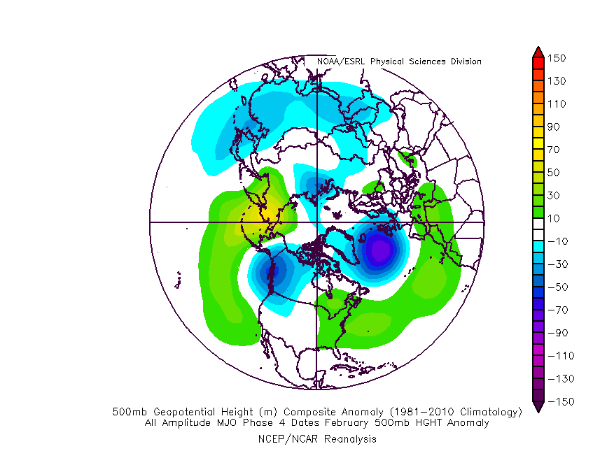
The basis of our late-December forecast is built from the MJO, or Madden-Julian Oscillation.  We note the MJO is expected to rumble through Phase 4 before heading into Phase 5 around Christmas.  Phase 4 (image 2 below) is a warm phase and correlates well to what the week ahead will provide.  However, Phase 5 (image 3 below) is a colder phase and could “up the ante” for the potential of wintry weather around Christmas.

If the MJO amplitude remains, it’ll roll into Phase 6 to close the month and open January.  Here’s how that would correlate in the temperature department:

The upcoming week will run milder than normal- lining up perfectly with MJO Phase 4.

The first of our targeted holiday storm systems will come at the tail end of the warm Phase 4 and will likely deliver a wind-whipped rain in here as early as Wednesday night and Thursday morning.  However, as the storm pulls northeast along the Ohio River, it’ll deepen on its journey into the eastern Great Lakes region.  This will help pull colder air into the region, likely resulting in rain transitioning to snow Friday.  Given the path of the storm, this doesn’t favor some sort of prolonged backlash snow event, but it could be enough to result in accumulating snow across eastern Ohio Valley sections and downwind of the snow belt regions of northern IN, OH, and MI.

The pattern, as a whole, appears to be one of transition to close the month and open January and it’s not really until we get to mid-January where we think all of the drivers “align” to create more of a lock and hold cold pattern.  With that said, a stormy late December pattern can present problems, even in the midst of relatively mild times.  We’ll be here to dissect the storms as they come throughout the holiday season…

Permanent link to this article: https://indywx.com/2018/12/16/pulling-the-curtain-back-on-the-late-december-pattern/

Chilly, But Overall Dry Pattern Until Perhaps Around Halloween…

The short and medium range weather pattern will be highlighted by a colder than average regime, but one that’s also drier than normal.

A cooler than average, but drier than normal pattern will remain in place through the upcoming (10) days. Image courtesy of Weathermodels.com.

A few weak weather makers will scoot through the region over the upcoming (10) days, but be moisture starved. Image courtesy of Weathermodels.com.

After a warm open to October, the sustained period of chilly air is welcome by many. Image courtesy of Weathermodels.com.

The positive PNA will continue to support the mean trough position in the central and eastern portion of the country as we rumble into late October.

As we look ahead, there are growing indications a more significant storm may impact the general region as we get closer to Halloween.  This is the next time frame we’re closely monitoring for the potential of an impactful storm system.  Given the overall setup, we would be surprised if this particular storm didn’t present a wintry side, as well, but it’s simply too early to know the details from a couple of weeks out.  Stay tuned.

Potential is present for “fun and games” around Halloween… Image courtesy of Weathermodels.com.

Permanent link to this article: https://indywx.com/2018/10/16/chilly-but-overall-dry-pattern-until-perhaps-around-halloween/

IndyWx.com