Category: Plant ‘20

Long Range Update: Warmth Once Again Takes A Back Seat To Cooler Times; Drier Open To June?

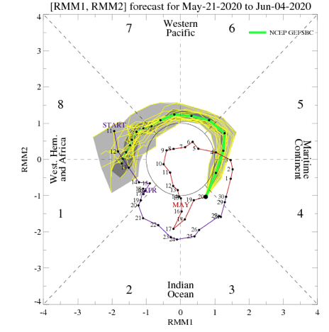
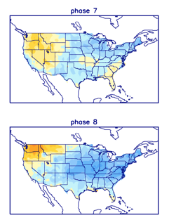
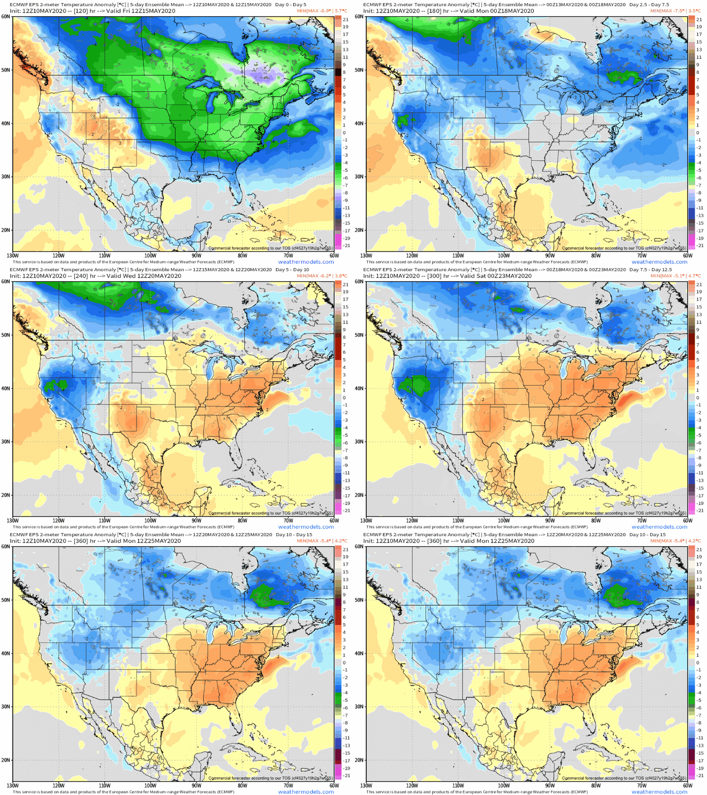
With meteorological summer looming around the corner, will the pattern follow suit? At least in the short-term, warmth and humidity will have things feeling very much like summer, but this warmer regime likely won’t hold. The culprit? You guessed it- developing negative EPO, strongly positive PNA, and the MJO re-amplifying with eyes sets on the cooler phases to open June.

After a chilly May (month-to-date), most will welcome this weekend’s heat and humidity with open arms! This is courtesy of finally kicking the “cut off” low to the curb and replacing its’ influence with an upper level ridge. Scattered shower and thunderstorm activity is possible through the short-term, but coverage will be of the “splash and dash” variety- very typical of summer-time!

This warmer regime will be fleeting as a combination of ingredients align in a manner to drive cooler, more refreshing air back into the region as we close May and open June. Most notably this is being driven by a negative EPO, strongly positive PNA, and the MJO set to roll through Phases 7 and 8 during said period.
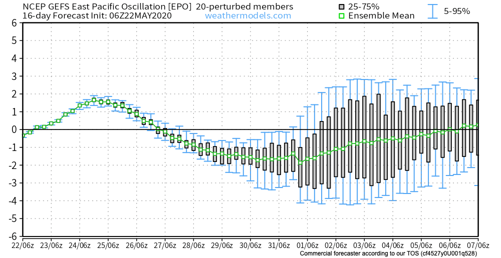
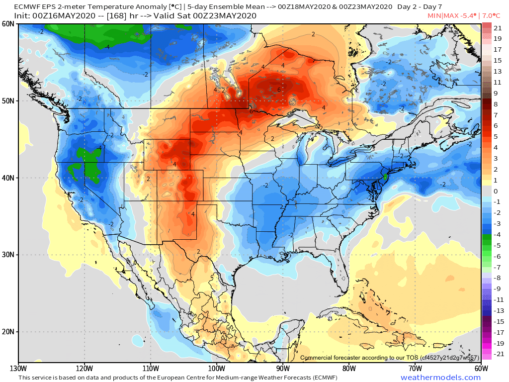
Accordingly, we note the models shifting things up quite significantly as we go into the Week 2 time period (May 29th-June 4th).

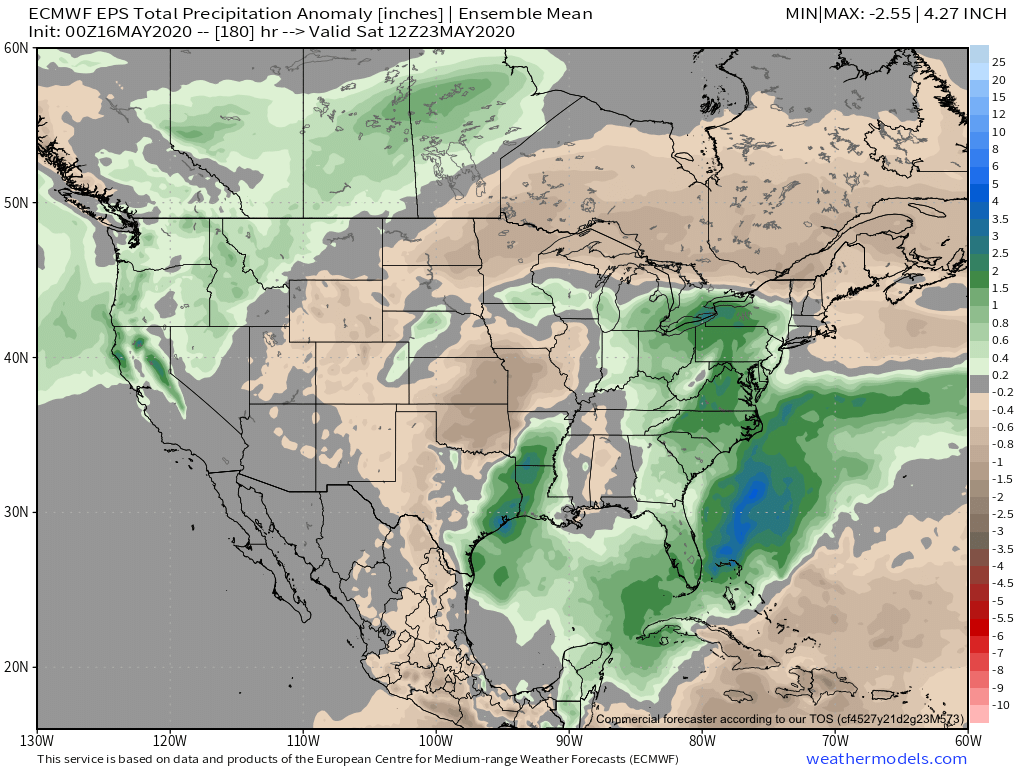
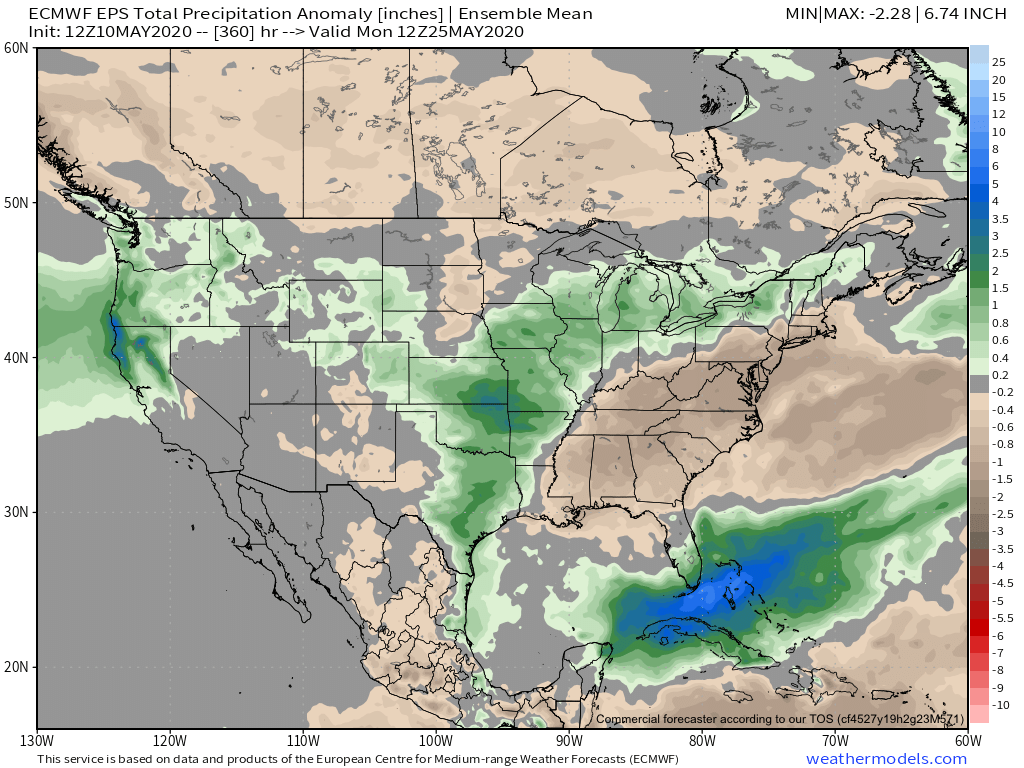
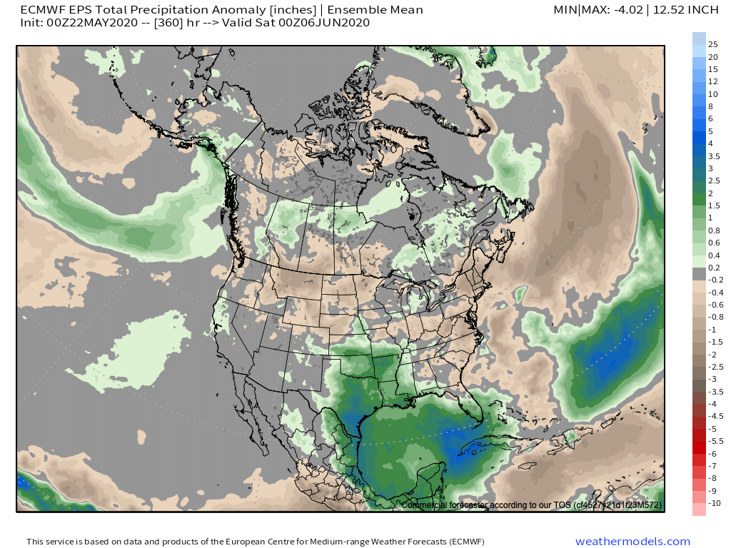
The cooler regime will likely also come with a drier overall pattern to open June, at least compared to average.
Permanent link to this article: https://indywx.com/long-range-update-warmth-once-again-takes-a-back-seat-to-cooler-times-drier-open-to-june/

Weekly #AGwx And #Severe Outlook…

Weekly Highlights:

I. Cut off upper low will keep things cool and unsettled for much of the upcoming week across the East.

II. Summer-like heat is poised to expand across a good chunk of the area around and just after Memorial Day weekend.

Below normal temperatures are expected across not only our area over the upcoming 7-day period, but a good portion of the East, courtesy of a “cut off” upper low.
The upper level low will also be responsible for generating a wet pattern along the eastern seaboard.
1.5” to 2” of rain is expected during the period across central Indiana. Most of this will fall tonight into Sunday.
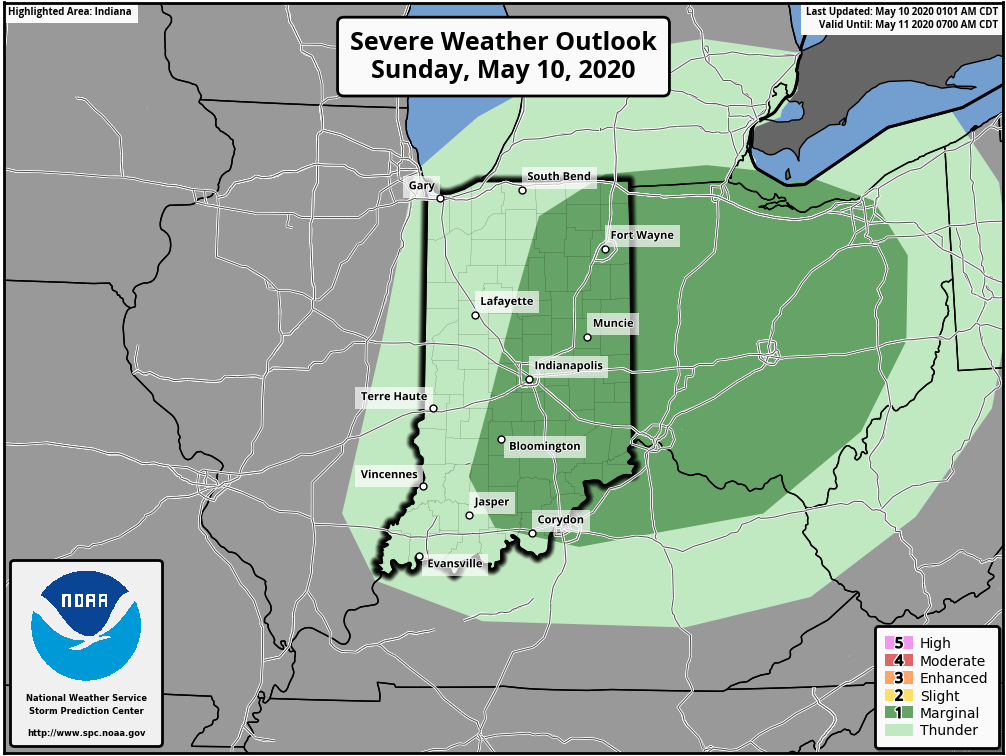
A couple gusty storms are possible across the area Sunday. Overall, widespread severe weather isn’t expected during the period.

Forecast Period: 05.16.20 through 05.23.20

Most of our Saturday will feature beautiful weather to spend time outdoors. In fact, we’re not expecting a drop of rain across central Indiana through the daytime. Add in highs around 80° and a gorgeous day is in the making! Get out and enjoy it!

Weather conditions will begin to go downhill tonight and Sunday as periods of showers and thunderstorms develop. Locally heavy rain is expected. This is all thanks to an area of low pressure and associated cold front that will help pull in a much cooler airmass as we progress through early week. After the heavy rain threat tonight into Sunday, the showers that fall early week (associated with the upper low) will be more of the nuisance variety.

That much cooler air mass will linger through a good portion of the week before an upper level ridge expands into the area around Memorial Day weekend. This will deliver a more summer-like airmass to the immediate area.

Permanent link to this article: https://indywx.com/weekly-agwx-and-severe-outlook-7/

From One Extreme To The Other…

The work week will get off to the same unusually chilly start we’ve begun to grow accustomed to. Additional frost and freeze threats are present Tuesday and Wednesday mornings if skies can clear (big if there). However, significant changes loom as we flip the page to the second half of the work week and longer term indications suggest we’re well on our way to a true summer-like feel by week 2.

Note how bullish the European ensemble is regarding the significant pattern flip over the next couple weeks.

A lot of this is driven by a change in the EPO. This is the kind of pattern that stands to at least threaten sending high temperatures soaring to between 85°-90° between Week 2 and month’s end. Talk about a contrast from the late winter and early spring-like chill to open the month!

The transition in the pattern is likely to be met with a much more active storm track through the area beginning midweek. There will be a threat of locally heavy rain and stronger storms that will continue at times into the weekend and beyond into next week, as well.

For a month that’s gotten off to a dry start, we’ll likely recover quickly with this wetter regime that accompanies the flip to warm.

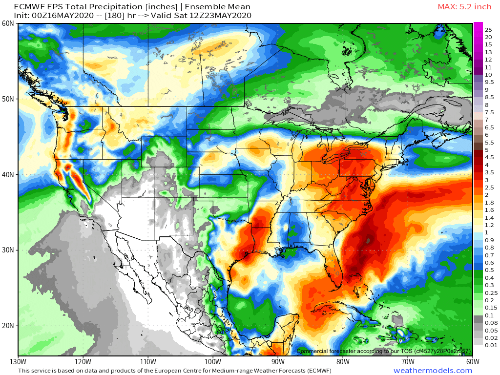
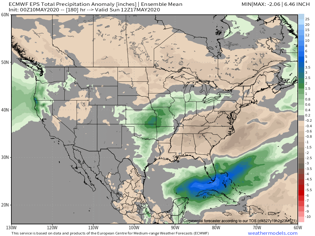
We continue to believe most central Indiana neighborhoods will see between 1.75”-2.25” late week into the weekend, but there will be locally heavier amounts. The majority of data also suggests a corridor of wetter than normal conditions sets up from the Plains into the northern Ohio Valley/ Great Lakes into Week 2.

Stay tuned.

Permanent link to this article: https://indywx.com/from-one-extreme-to-the-other/

Weekly #AGwx And #Severe Outlook…

Weekly Highlights:

I. Additional threat of late season frost/ freeze early in the forecast period.

II. Transition in the pattern midweek signals a significant flip from the record chill across the East to one much more typical for mid-late May. Meanwhile, the West will turn much cooler.

A transition in our overall weather pattern will lead to a return of wet weather mid-late week, including multiple rounds of t-storms from the Plains into the Ohio Valley.
7-day rainfall should run between 1.75″ and 2.25″ with locally heavier amounts across central Indiana.
While the period will run cooler than normal, it’s because the first few days this week will run so far below normal. We’ll actually warm significantly mid-late week, however, the deviation from normal won’t be enough to tip the scale from the week being cooler overall across the Plains and East.
A couple gusty storms are possible across central and eastern IN this afternoon. We’ll also have to closely monitor late week for the threat of additional strong thunderstorms.

Forecast Period: 05.10.20 through 05.17.20

An area of low pressure and associated cold front will blast across the Ohio Valley during the next 24 hours. Ahead of the front, scattered showers are already entering the state from the west this morning. As we progress into the afternoon, we’ll watch for the potential of a couple skinny lines of thunderstorms try to develop across central and eastern parts of the state. A couple of these storms could quickly pulse to strong – severe levels and pose a threat of damaging straight line winds and hail. Once the front scoots to our east, we’ll notice a much colder (yet again) northwesterly breeze and drier conditions to open the work week. There will be a threat of another frost and freeze by Tuesday morning. Patchy frost is also possible Wednesday morning, especially across east-central parts of the state.

Thereafter, our region will undergo a rather significant flip in the overall pattern. As a result, an airmass much more typical of mid-May will engulf the eastern portion of the country. With the significantly warmer conditions will also come a few rounds of rain and thunder during the mid-late week stretch. Locally heavy rain is likely towards the end of the period including the threat of additional strong thunderstorms in the Thursday-Saturday time frame.

Permanent link to this article: https://indywx.com/weekly-agwx-and-severe-outlook-6/

Welcome To May: Threat Of Record Cold Week 2…

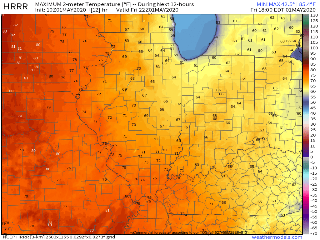
A gorgeous Friday is dialed up complete with plentiful sunshine and temperatures warming quickly from the mid and upper 30s into the mid and upper 60s.

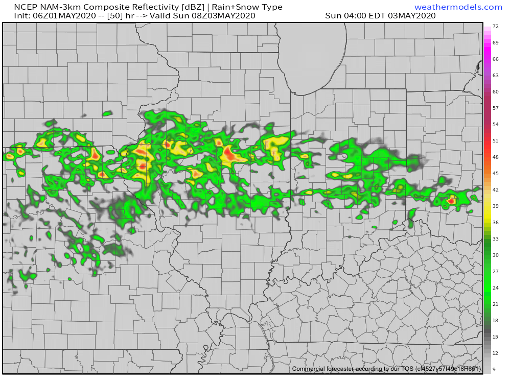
A couple weak impulses of energy will scoot through the Ohio Valley over the next 24 hours and while they will spark a few showers/ embedded thunder predawn Saturday and again Saturday night, most of the daytime hours Saturday will also feature dry conditions.

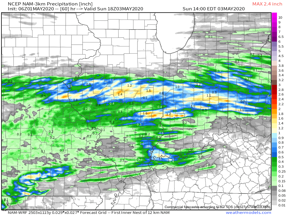
That begins to change Sunday as widespread showers and thunderstorms are expected to rumble across central Indiana, especially during the morning hours. Locally heavy downpours are likely.

A quick 1”-1.25” is a good bet across the heart of the state with this system Sunday morning.

Dry conditions will quickly return Sunday evening into Monday thanks to high pressure briefly building back into the region. This will lead to a pleasant open to the work week with highs topping out in the middle 60s.

Unsettled weather returns as early as Tuesday with increased chances of showers and thunderstorms ahead of a strong cold front.

Though we’ll certainly turn cooler for the middle to latter part of the week, this will only be a precursor to what lies ahead behind yet another strong cold front late next week.

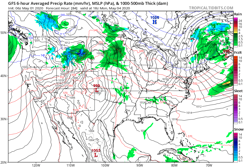
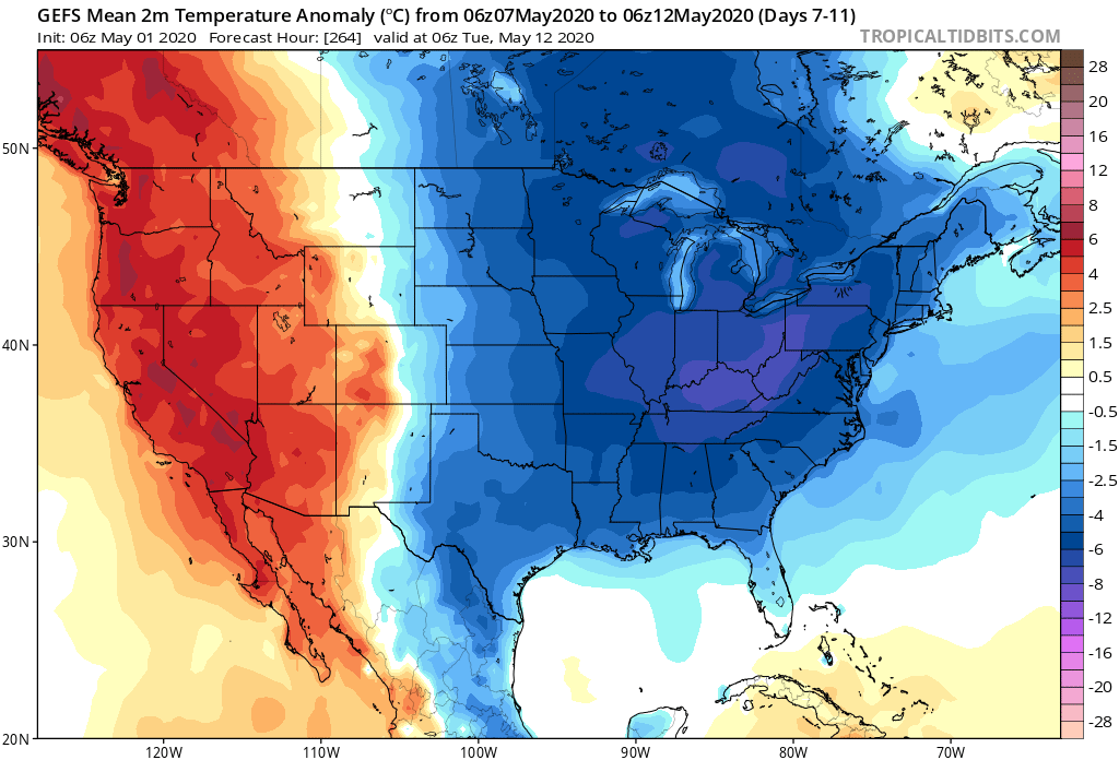
The air will likely challenge records into the Week 2 time frame (May 8th-14th), including the threat and increased likelihood of late season frost/ freezes. We also likely haven’t seen the last of the snow flakes for the season either…

Permanent link to this article: https://indywx.com/welcome-to-may-threat-of-record-cold-week-2/