You must be logged in to view this content. Click Here to become a member of IndyWX.com for full access. Already a member of IndyWx.com All-Access? Log-in here.
Category: Plant ’19
Permanent link to this article: https://indywx.com/video-gusty-saturday-storms-wet-pattern-returns-next-week-after-3-day-break/
May 30
VIDEO: Scattered Storms This Evening; Cooler Pattern To Open June…
You must be logged in to view this content. Click Here to become a member of IndyWX.com for full access. Already a member of IndyWx.com All-Access? Log-in here.
Permanent link to this article: https://indywx.com/video-scattered-storms-this-evening-cooler-pattern-to-open-june/
May 29
June Outlook: Does The Wet Pattern Continue?
Averages for June are as follows:
- Average Low: 62.1 (f)
- Avearge High: 81.9 (f)
- Average Rain: 4.25″
- Average Snow: 0.00″
As we head to the 50-yard line of 2019 (already?!), we’re of the belief we’re looking at a cooler than normal month of June with close to average rainfall. Before we get into our reasoning of such, let’s look at a few snap shots of the latest data:
CFSv2
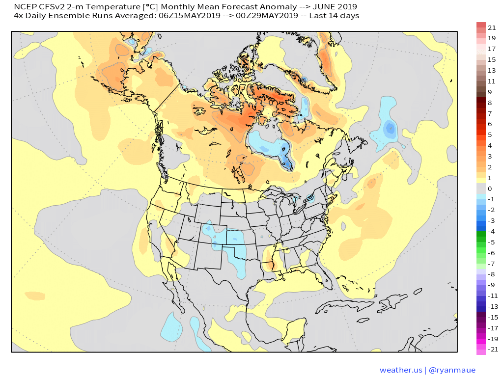
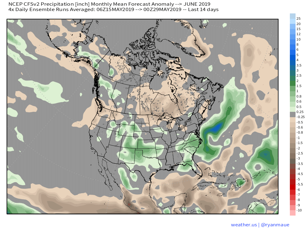
JMA

NMME
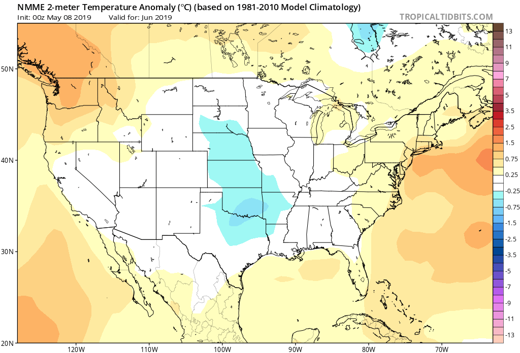

Though we can’t show it, the longer range European model paints a cool, wet picture from the south-central into the Plains and portions of the Northeast.
Given the analogs we’ve looked over with weak El Ninos along with similar MJO pulses, we’ve built a generally wet and cool June forecast nationally:
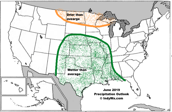

Ridging should support warmer than average conditions across the Southeast and Pacific Northwest, along with a rather widespread cooler than normal regime through the south-central Plains into the Great Lakes and New England. Unfortunately, we think wetter than normal conditions remain from the Delta into the central Plains. With that said, conditions seem more favorable for planting through a large portion of the OHV region.
Permanent link to this article: https://indywx.com/june-outlook-does-the-wet-pattern-continue/
May 29
VIDEO: Storms Continue Today; Discussing MJO Influence As We Move Into Early June…
You must be logged in to view this content. Click Here to become a member of IndyWX.com for full access. Already a member of IndyWx.com All-Access? Log-in here.
Permanent link to this article: https://indywx.com/video-storms-continue-today-discussing-mjo-influence-as-we-move-into-early-june/
May 28
No Rest For The Weary…
Active weather will continue as we move through mid and late week. A cold front currently north of the region will slowly move south into central Indiana before stalling out and lifting back north as a warm front Thursday. This will serve as a focal point for additional thunderstorm development over the next few days.
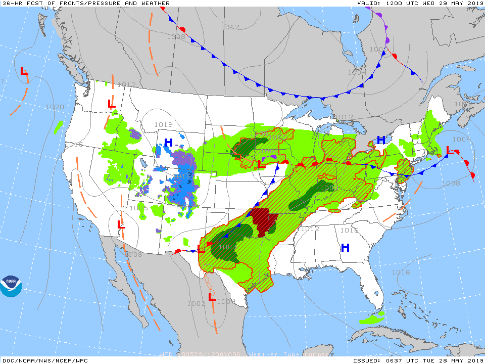
With a warm and moist environment in place, along with enough instability and forcing, storms may become strong to severe at times. While the setup the next couple of days doesn’t appear as favorable for tornadoes (when compared to yesterday), all modes of severe weather will be possible with the stronger storms. (Always have to be leery with a warm front nearby).
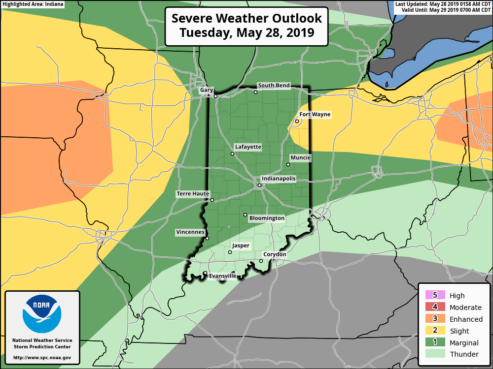
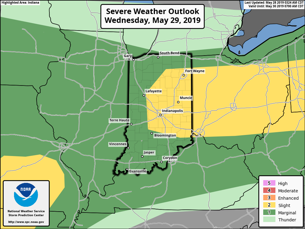
Periods of more concentrated storms can be expected this evening into Wednesday morning and again Wednesday evening into Thursday morning. In addition to a strong thunderstorm threat, locally heavy rain is a good bet.
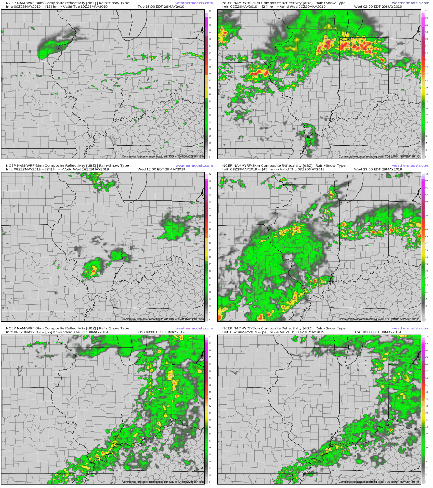

There is hope that we will be able to work drier air into the region over the upcoming weekend, helping to reduce rain chances between Sunday and next Tuesday. Let’s keep our fingers crossed…
Permanent link to this article: https://indywx.com/no-rest-for-the-weary/
