You must be logged in to view this content. Click Here to become a member of IndyWX.com for full access. Already a member of IndyWx.com All-Access? Log-in here.
Category: Plant ’19
Permanent link to this article: https://indywx.com/st-patricks-day-snow-week-ahead-outlook/
Mar 16
Now We’re Talking…
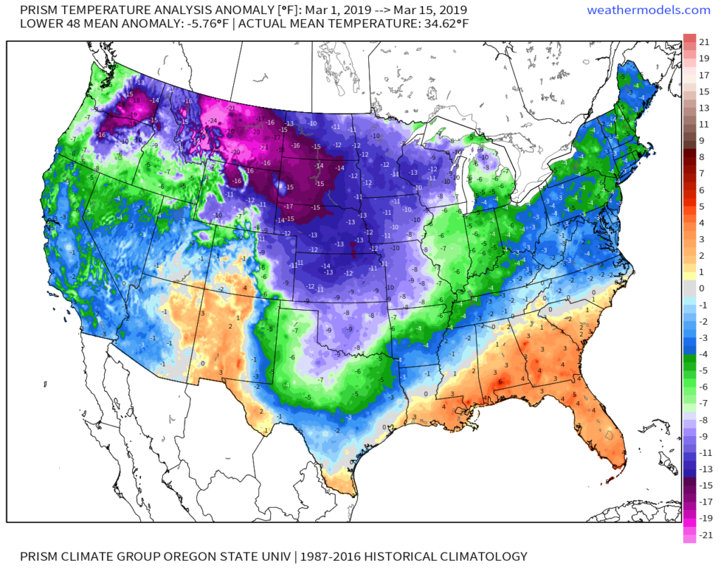
Meteorological Spring has gotten off to a cold start- to the tune of nearly 5 degrees below average at IND through 3/15.
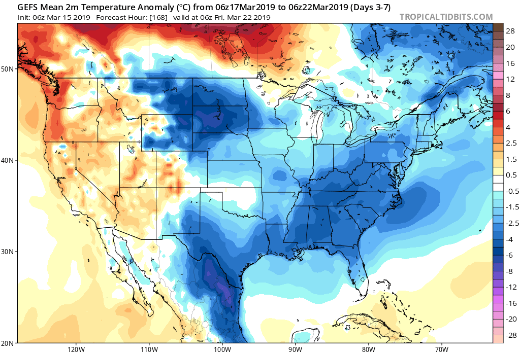
Note the brutal cold across the Northern Plains and Rockies.
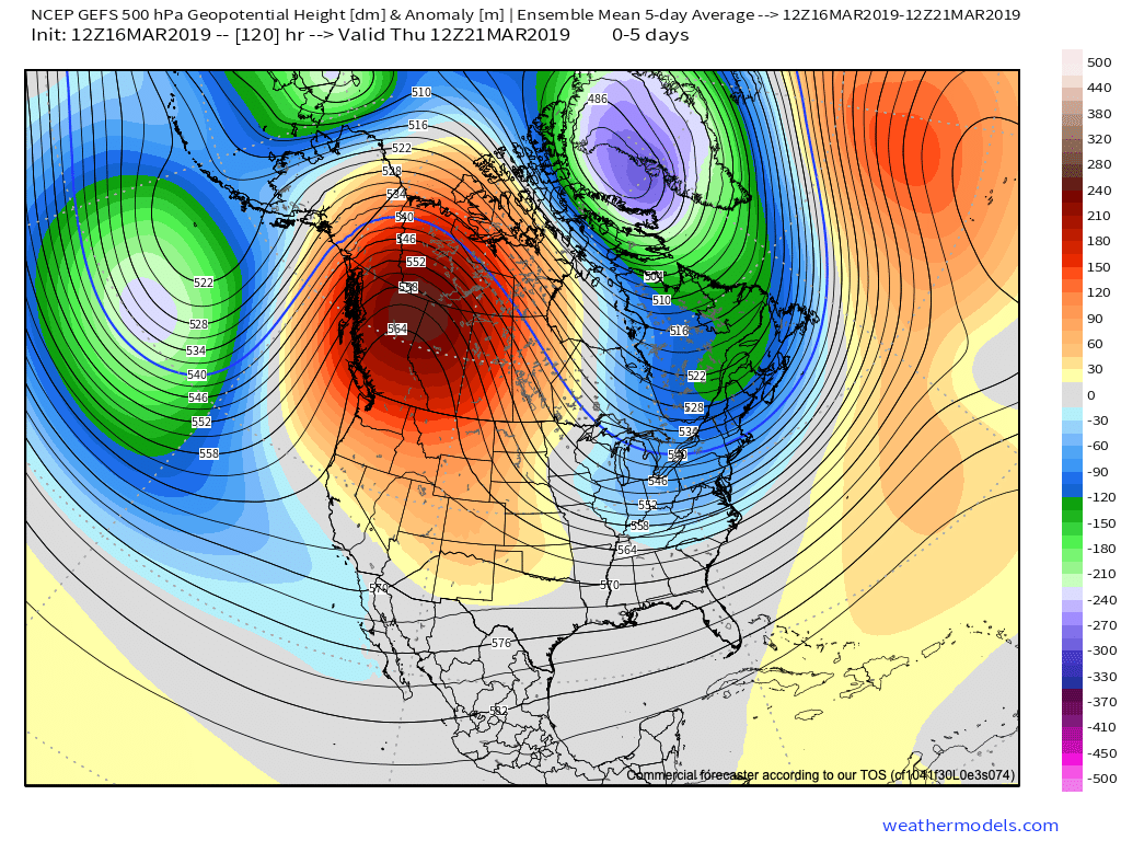
The upcoming week will feature a positive PNA pattern and associated cooler than average theme to open, before beginning to moderate mid-to-late in the work week.
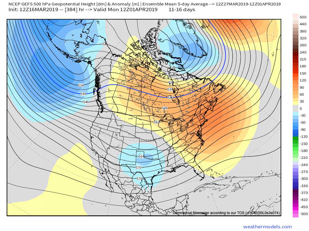
That said, time is limited on the chilly pattern and an overall significant shift to more of a sustained spring-like pattern awaits to close March and as we head into April.
Note the warmth that follows:
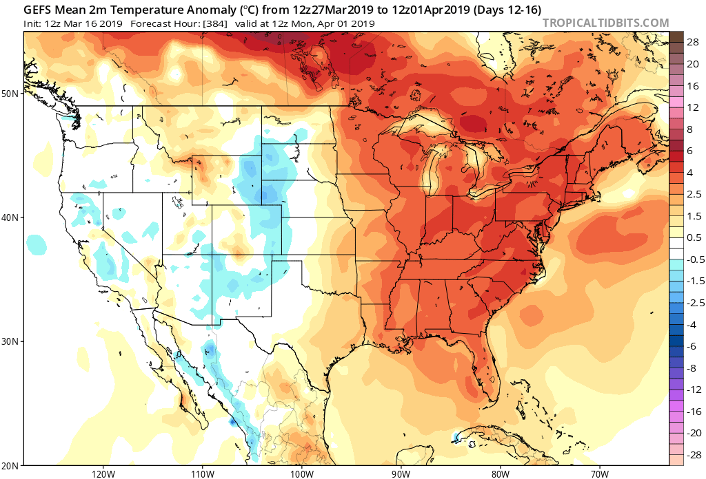
This will result in many more days in the 60s and 70s as we put a wrap on March and open April.
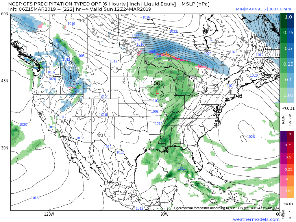
While weak systems will continue to impact the area (tomorrow, Wednesday, and again next Sunday), the deeper, moisture-laden storms will take a “backseat” during the fast-moving northwest flow. That begins to change during the last few days of the month and on into April. The latest ensemble guidance sees the return of a more active pattern, likely complete with heavier rain events and the potential of stronger storms.

Permanent link to this article: https://indywx.com/now-were-talking-4/
Mar 16
VIDEO: 50/50 Weekend; Closer Look At The Late March-Early April Pattern…
A quiet open to the weekend is replaced with accumulating snow for portions of the state Sunday…
You must be logged in to view this content. Click Here to become a member of IndyWX.com for full access. Already a member of IndyWx.com All-Access? Log-in here.
Permanent link to this article: https://indywx.com/video-50-50-weekend-closer-look-at-the-late-march-early-april-pattern/
Mar 15
Cooler, “Calmer” Weather Pattern Into Next Week…
Out the door, it feels much colder when compared to this time yesterday.
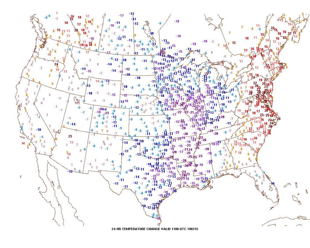
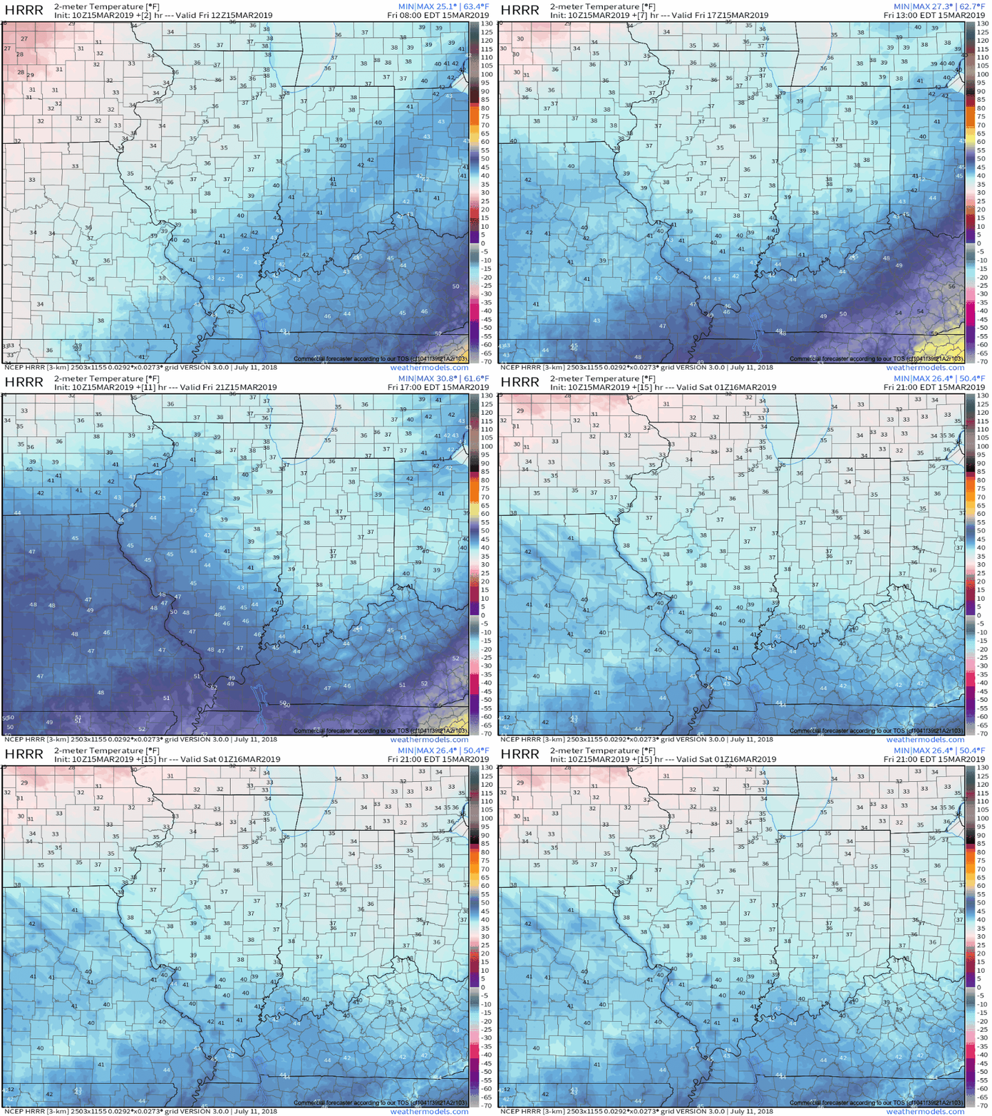
Temperatures will continue to fall through the day today, and eventually turn cold enough for a little wet snow to mix with the leftover showers this afternoon- especially from the city and points north.
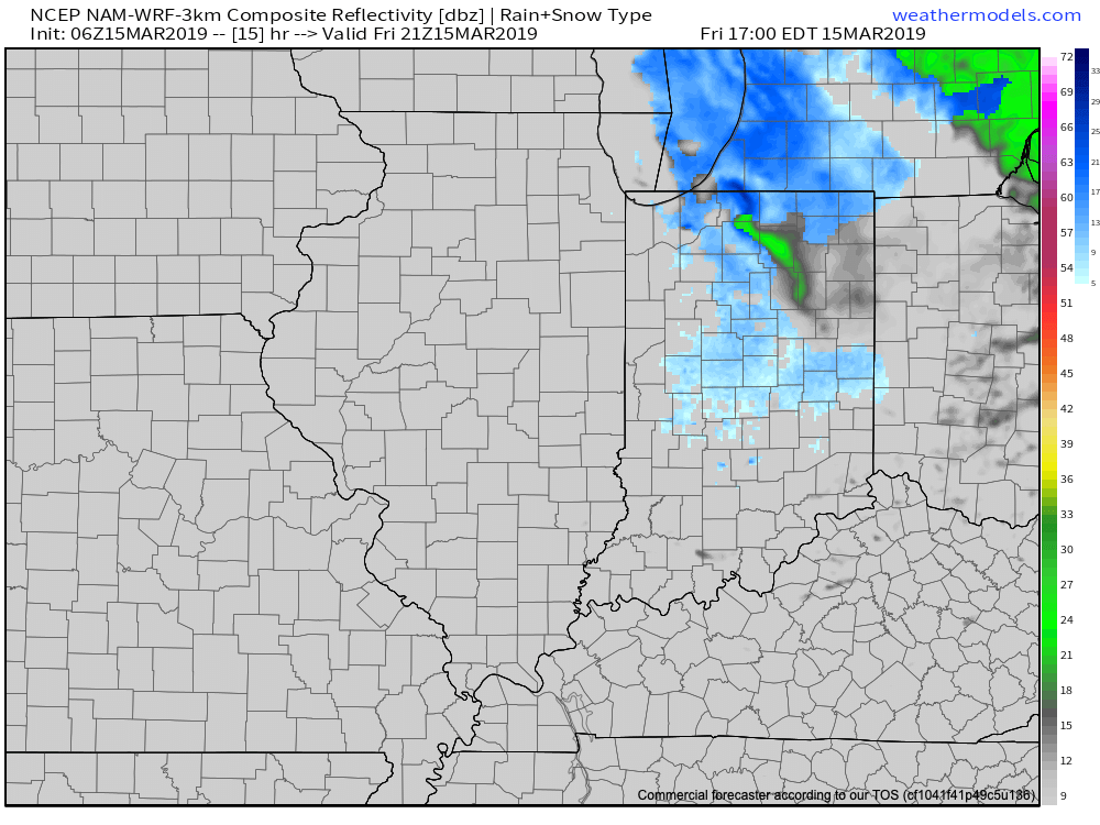
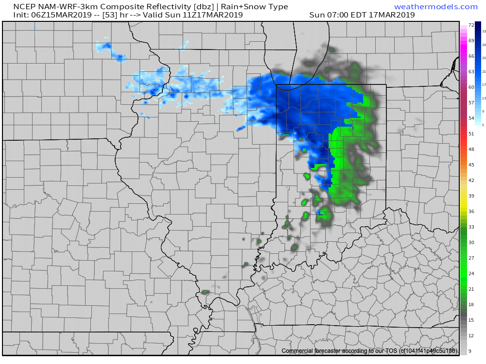
Looking ahead, after a dry Saturday, an upper level disturbance will dive southeast and lead to a mixture of rain and snow across the northern half of the state. Across northern Indiana, mostly snow is expected- where a light, slushy accumulation is possible.
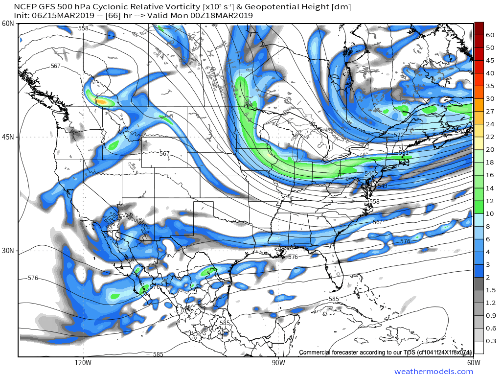
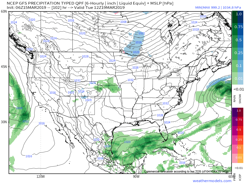
Thereafter, high pressure will build in for early portions of the new week, supplying dry and chilly conditions.
It’s not until late next weekend when the next weather system of significance begins to impact the region with rain.
Overall, the upcoming (7) days will run cooler than average and drier than average for a large portion of the region from the Northern Plains into the eastern portion of the country. After the “bumpy” past few days, we’ll certainly enjoy the overall calmer period.
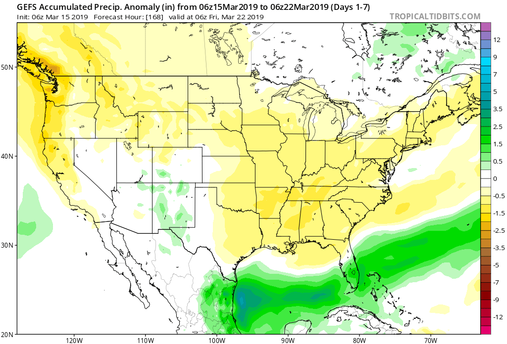
7-day precipitation numbers are paltry to say the least (on average only expecting around 1/10 of an inch of liquid for central Indiana). Most of what’s painted below is what is expected to fall with this Sunday’s system.
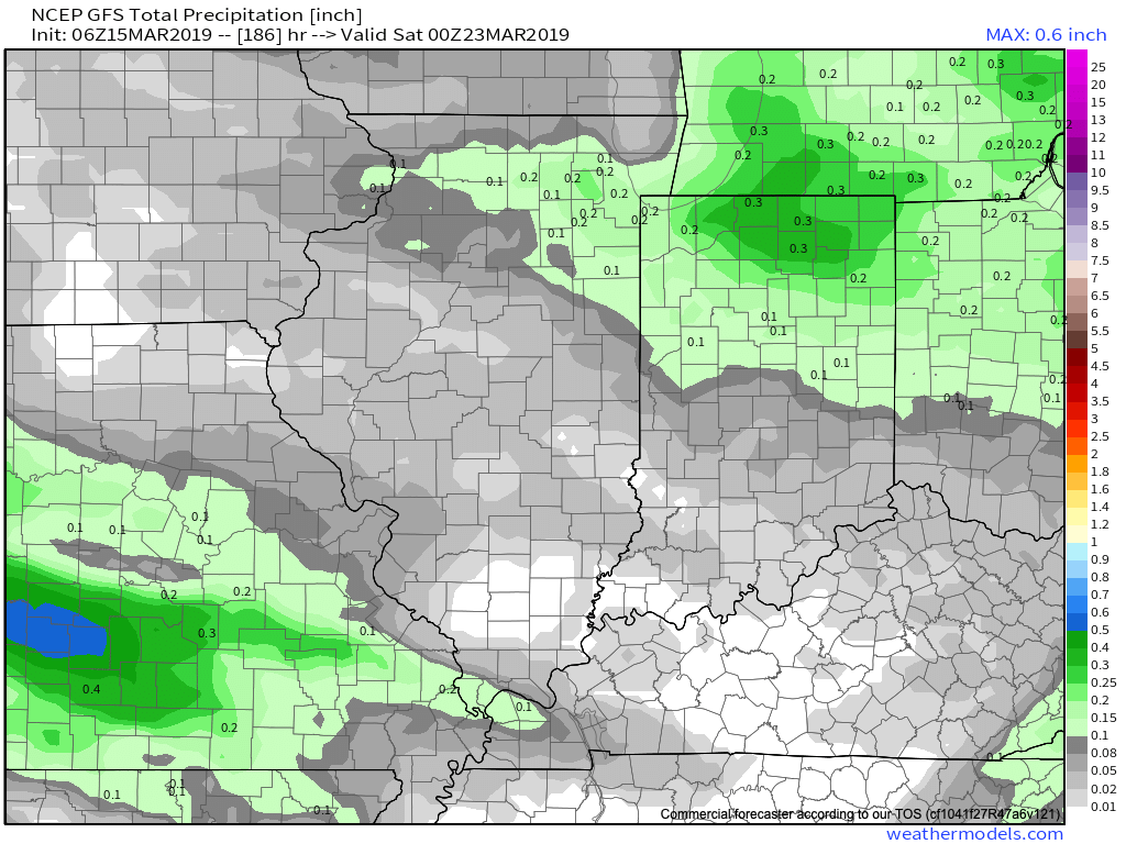
Permanent link to this article: https://indywx.com/cooler-calmer-weather-pattern-into-next-week/
Mar 14
Long Range Update: Cool “Set Back” Doesn’t Last; Looking Ahead To April…
You must be logged in to view this content. Click Here to become a member of IndyWX.com for full access. Already a member of IndyWx.com All-Access? Log-in here.
Permanent link to this article: https://indywx.com/long-range-update-cool-set-back-doesnt-last-looking-ahead-to-april/
