Thoughts On The First Couple Weeks Of The Year (And Beyond)…
Updated 12.31.23 @ 8:40a
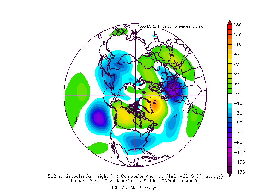
The MJO is rolling right into the notorious cold (for this time of year) phase 3 as we open up the new year.

The composite analog for phase 3 in January from an upper air and surface temperature anomaly standpoint:
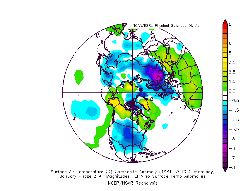
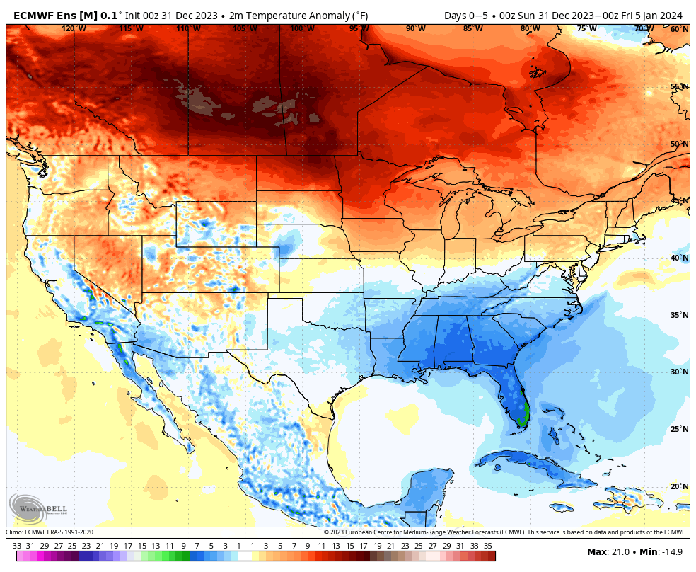
Ensemble guidance shows the widespread colder than normal temperatures overspreading the country. Like clockwork, this is almost identical to the Phase 3 analog above.
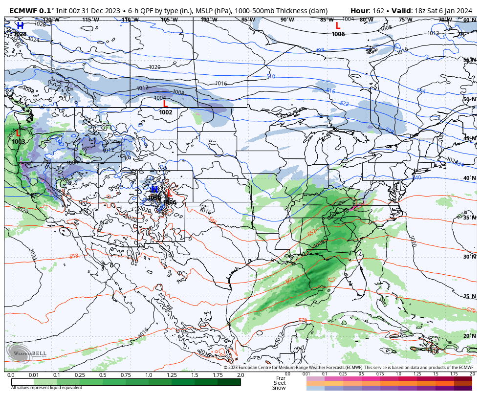
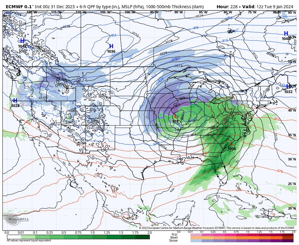
After a quiet week, we’ll watch 2 storms in the 5-10 day period. The first comes along next weekend. While still far too early to get detailed, this one does have potential to serve up some wintry mischief to the Ohio Valley, including central Indiana.
The second storm follows and it’s behind this feature that more of a truly arctic air mass will get involved in our pattern.
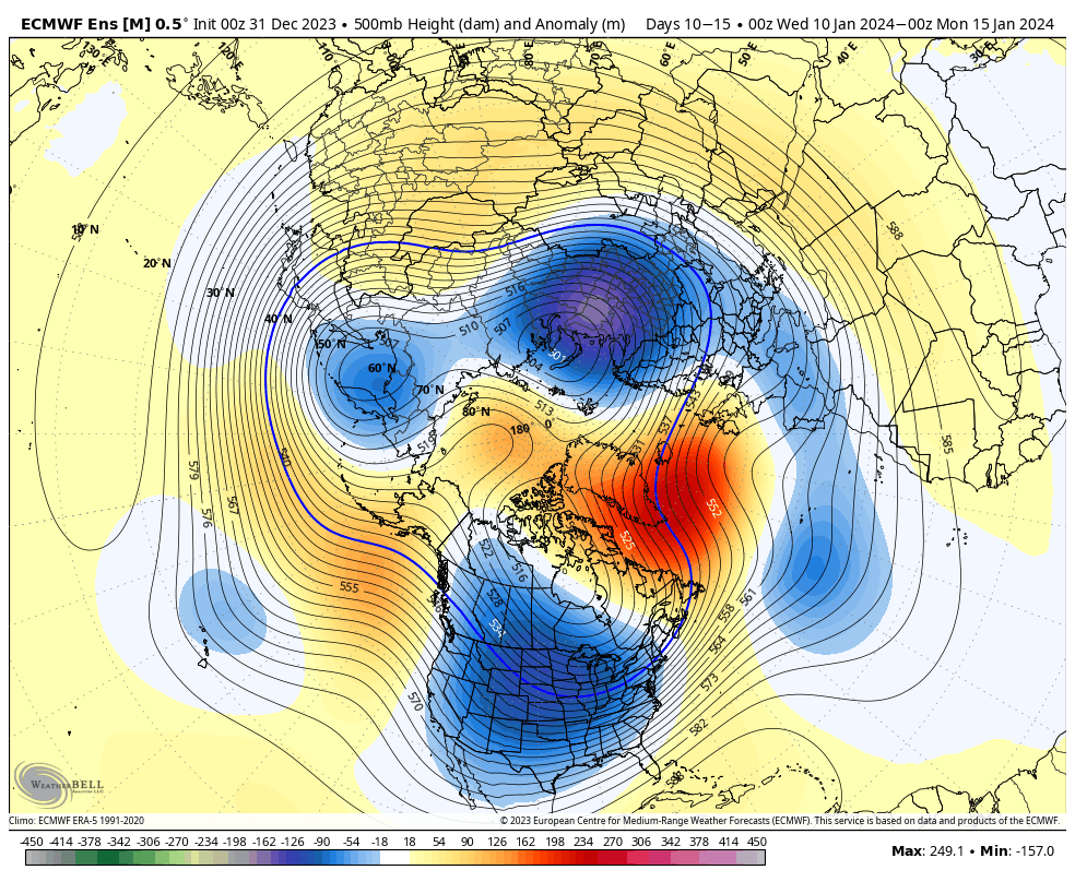
The pattern will stay busy as the arctic air presses in. At the same time, note the Greenland block beginning to form. Winter weather enthusiasts have to be chomping at the bit by that 10-15 day look. Needless to say, we can expect a rapidly expanding snow pack across the Lower 48 over the next couple weeks.
Thereafter, all eyes will remain on the MJO. Do we roll into the “null phase,” such as what the European suggests or swing through the traditionally mild/ warm phases such as the American guidance portrays? Stay tuned…