Long Range: Cold Pattern Isn’t Going Anywhere Fast…
We’ll save our short-term discussions for the severe and high-impact arctic outbreak on deck and focus our attention in this post to the upcoming several weeks. In short, we don’t expect the cold pattern to break anytime soon. Could there be a day or two of “relaxation?” Yes, but from an overall perspective, confidence is higher than normal on the colder than average pattern continuing through the month of February.
Let’s dig in to the teleconnections:
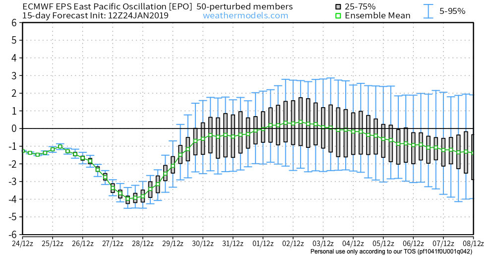
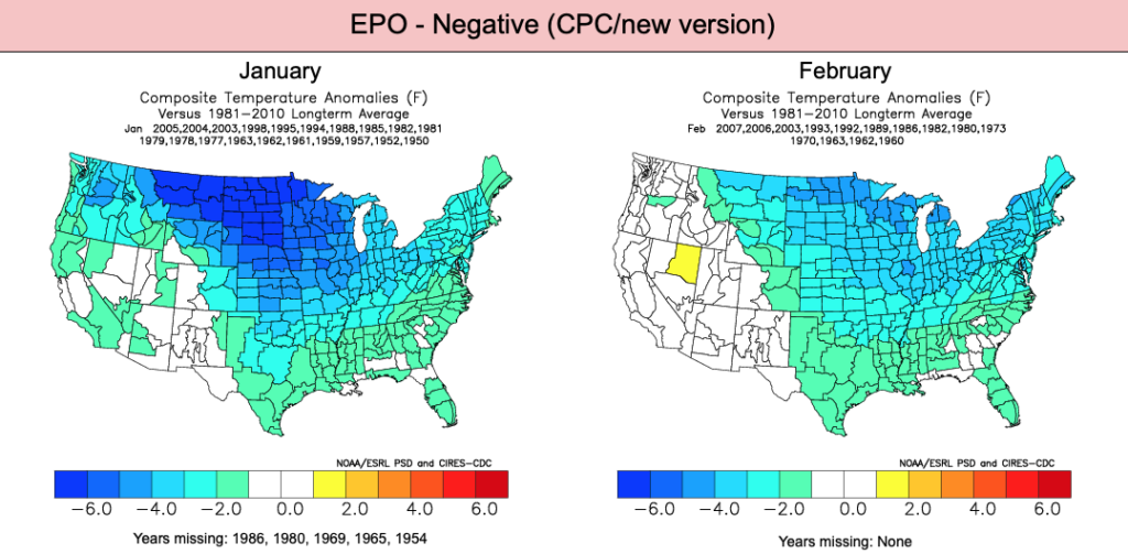
EPO
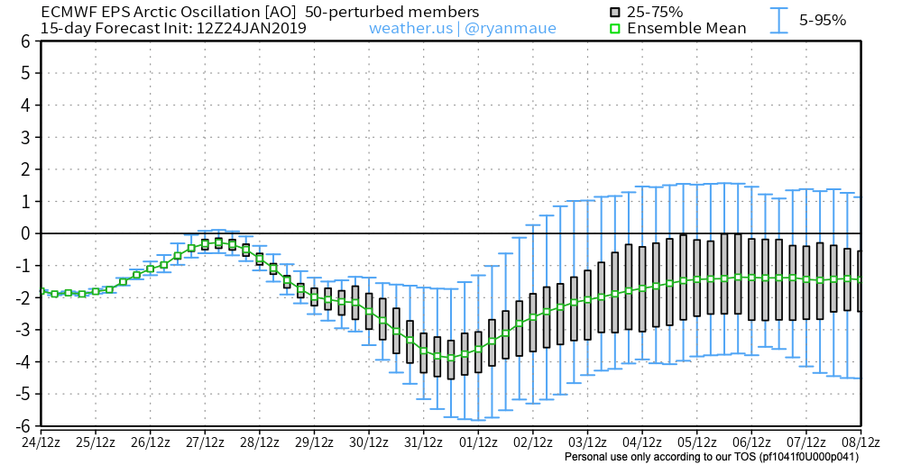
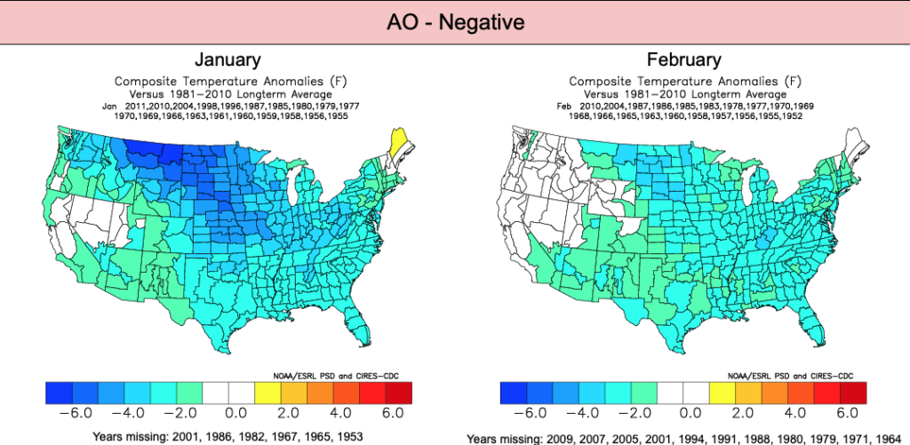
AO
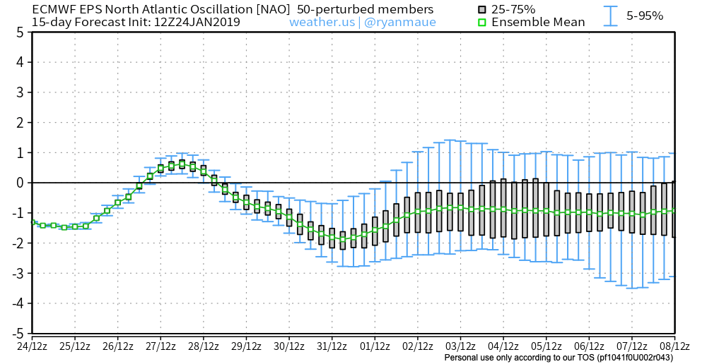
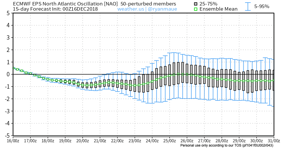
NAO

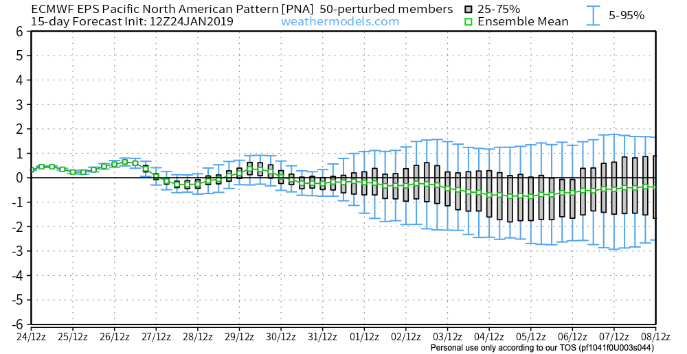
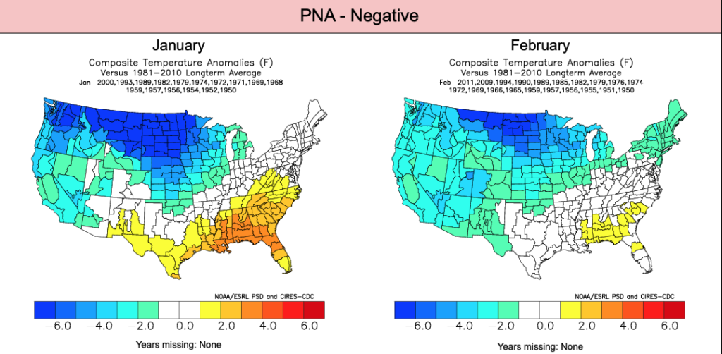
PNA
Given the teleconnections in agreement pointing towards a cold pattern, it shouldn’t come as a surprise that the majority of data is also on the cold train as we flip the page into February:
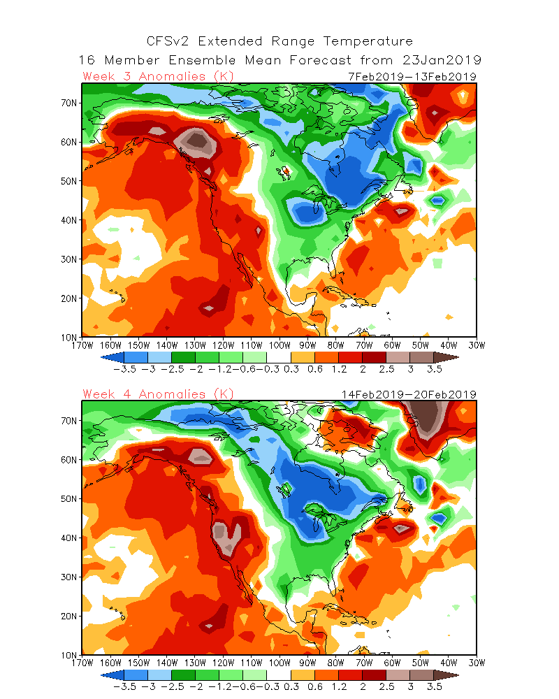
CFSv2 Weeklies
Weeks 1 & 2
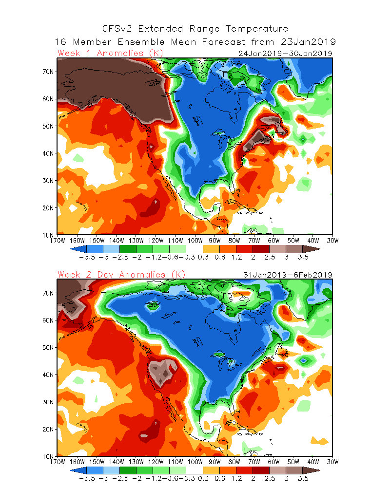
Weeks 3 & 4
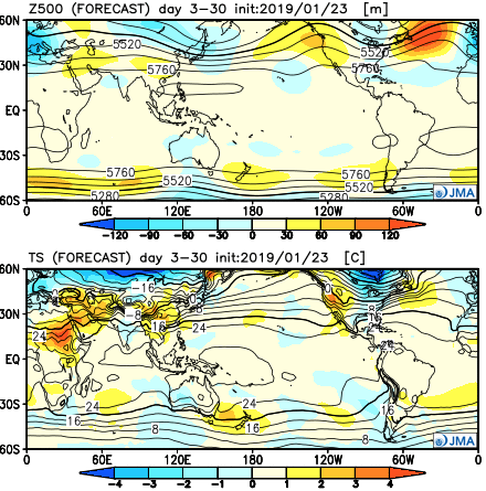
JMA Weekly
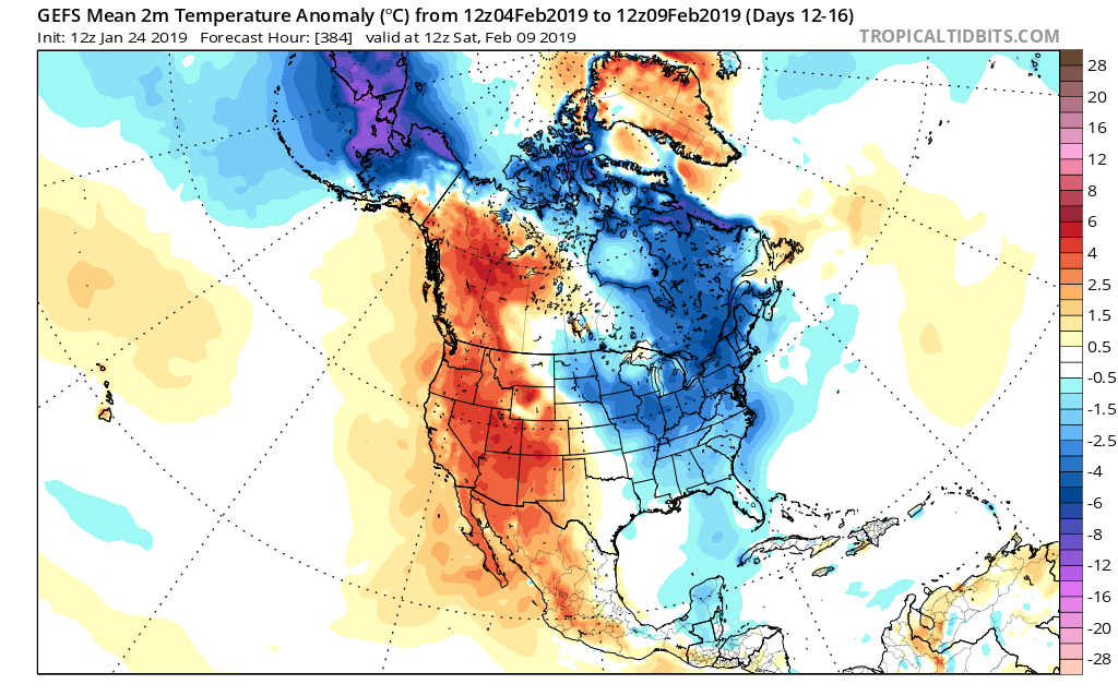
GEFS
While we aren’t licensed to show the European Weeklies, the new update runs with a cold pattern into early March. This falls in line with the overall consensus of longer range data, backed up by teleconnections.
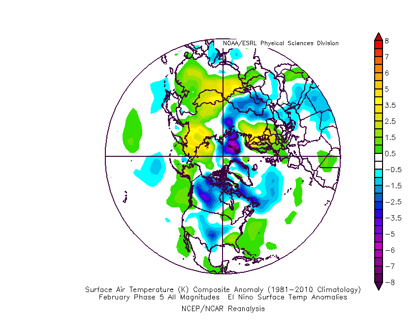
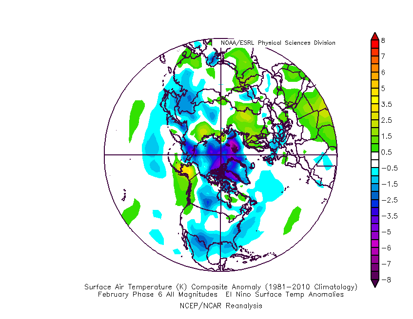
Though not nearly at the amplitude of a few weeks ago, the MJO (Madden-Julian Oscillation) is forecast to move through Phases 5 and 6 in the coming weeks before going back into the “null” phase.
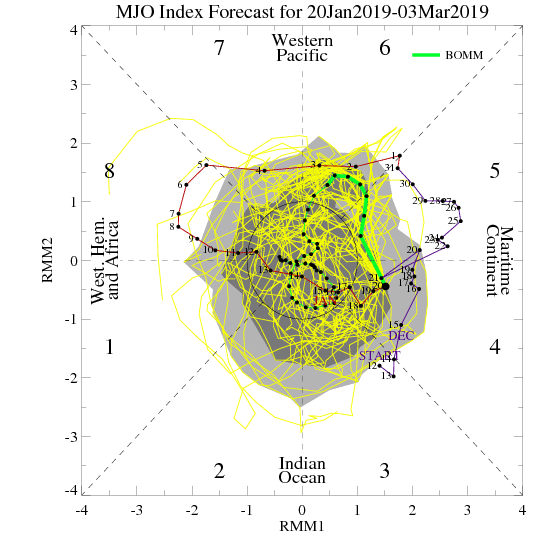
Phases 5 and 6 this time of year would suggest colder anomalies are more likely around our neck of the woods:
Given the above, we continue to think a colder than average “2nd half” of winter looms for the region. We lean heavily on the NAO, EPO, and AO state(s) this time of year and all would point towards a cold time of things moving forward, overall. The latest European Weeklies are interesting from a couple of fronts- initially very cold and then progressively stormy. The idea here is that we remain quite wintry through February and into early March before this pattern breaks. While we may not see a “repeat” visit of the Vortex, it wouldn’t surprise us to see another major arctic outbreak again this winter (after next week), but that likely comes later, and towards the end of the game before we snap into spring.
Buckle up; we think we have a long way to go this winter…


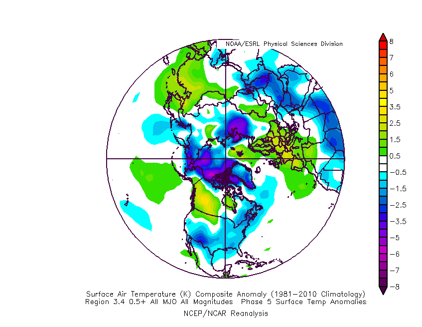
 The basis of our late-December forecast is built from the MJO, or Madden-Julian Oscillation. We note the MJO is expected to rumble through Phase 4 before heading into Phase 5 around Christmas. Phase 4 (image 2 below) is a warm phase and correlates well to what the week ahead will provide. However, Phase 5 (image 3 below) is a colder phase and could “up the ante” for the potential of wintry weather around Christmas.
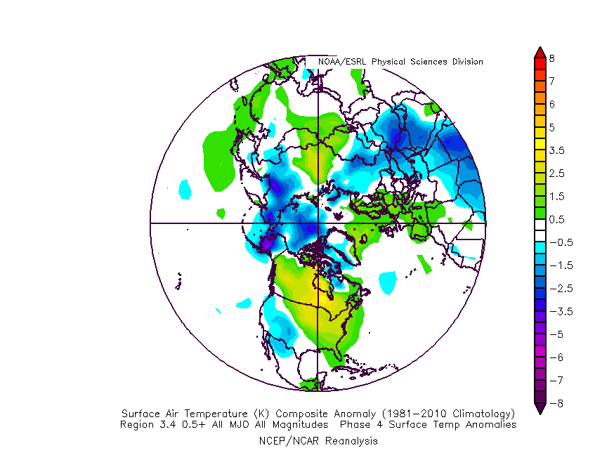
 If the MJO amplitude remains, it’ll roll into Phase 6 to close the month and open January. Here’s how that would correlate in the temperature department:
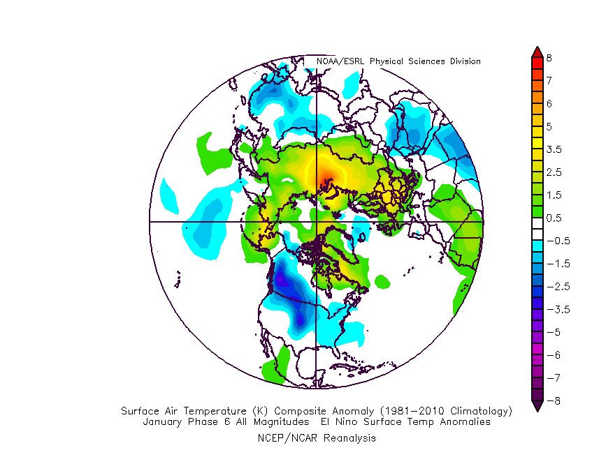 The upcoming week will run milder than normal- lining up perfectly with MJO Phase 4.
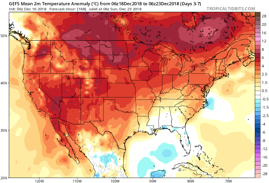 The first of our targeted holiday storm systems will come at the tail end of the warm Phase 4 and will likely deliver a wind-whipped rain in here as early as Wednesday night and Thursday morning. However, as the storm pulls northeast along the Ohio River, it’ll deepen on its journey into the eastern Great Lakes region. This will help pull colder air into the region, likely resulting in rain transitioning to snow Friday. Given the path of the storm, this doesn’t favor some sort of prolonged backlash snow event, but it could be enough to result in accumulating snow across eastern Ohio Valley sections and downwind of the snow belt regions of northern IN, OH, and MI.
 The pattern, as a whole, appears to be one of transition to close the month and open January and it’s not really until we get to mid-January where we think all of the drivers “align” to create more of a lock and hold cold pattern. With that said, a stormy late December pattern can present problems, even in the midst of relatively mild times. We’ll be here to dissect the storms as they come throughout the holiday season…
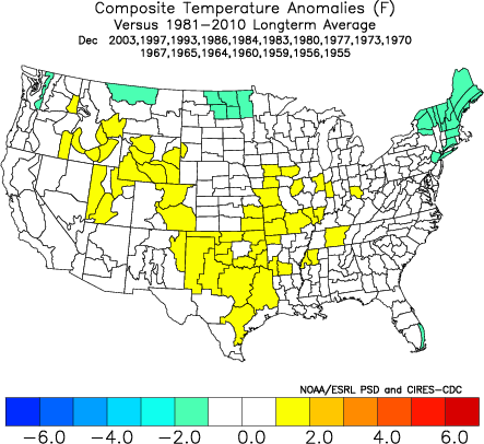
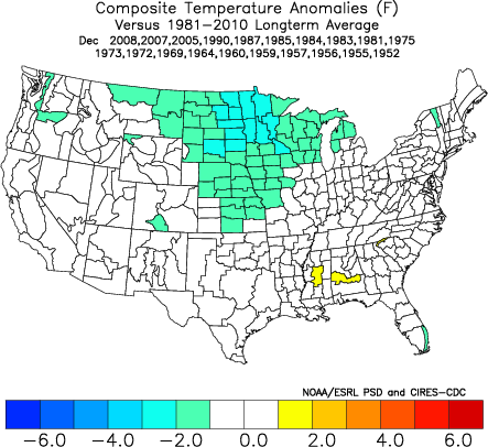
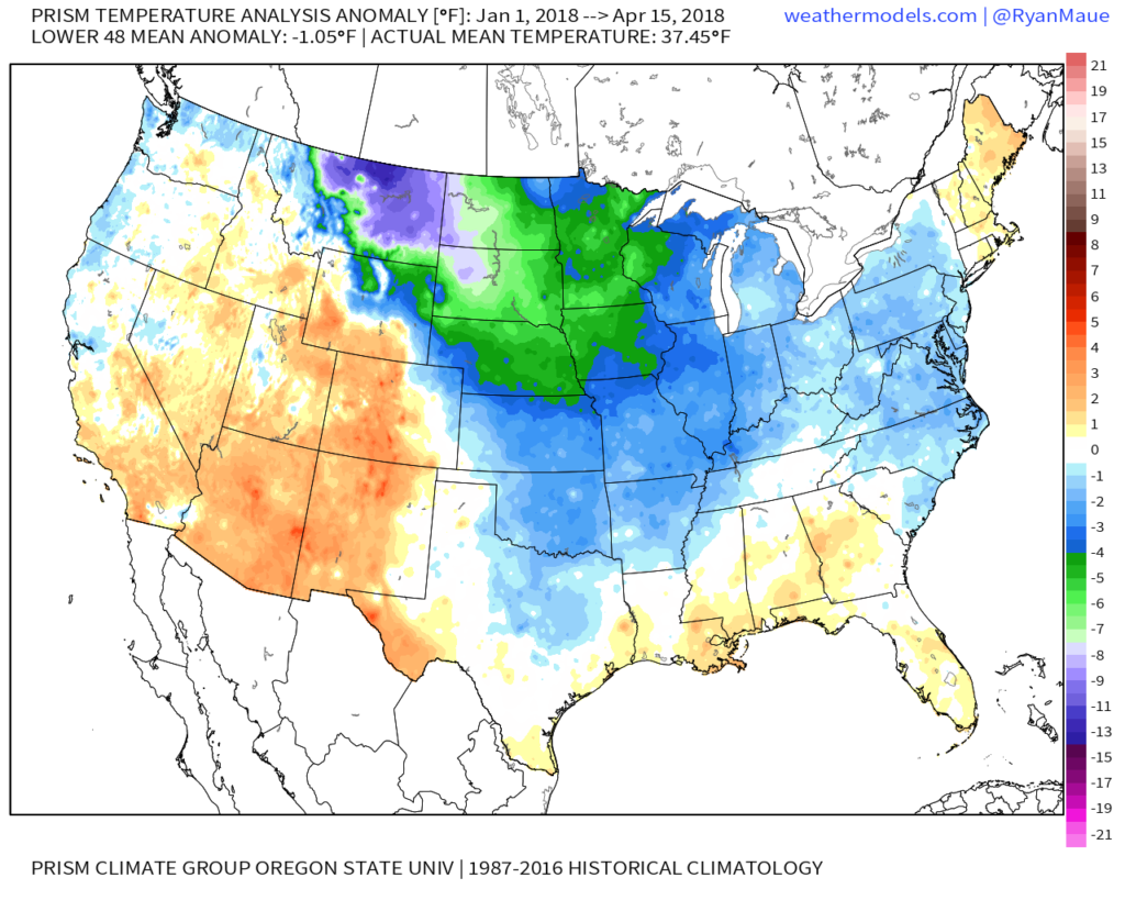 More specific to Indianapolis, here’s the monthly temperature breakdown so far for 2018:

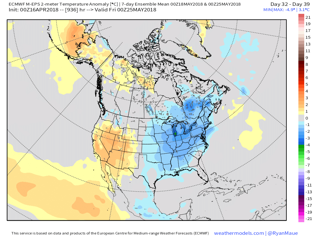 While we have conflicting temperature ideas, both suggest a drier than average month emerging:
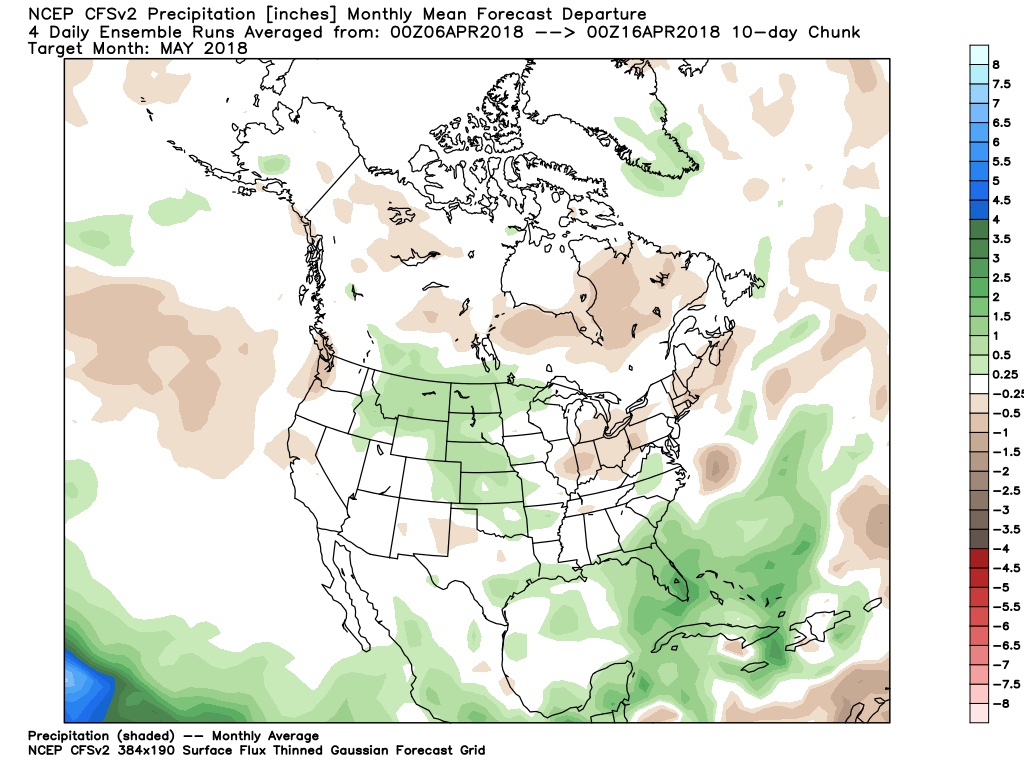
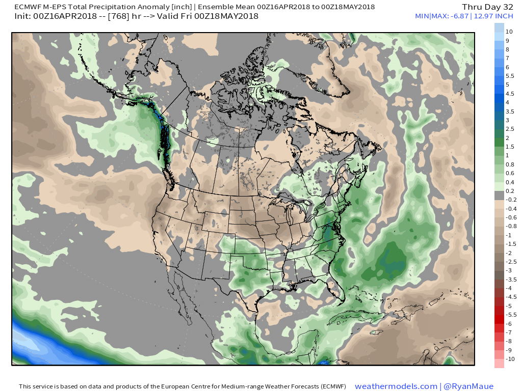
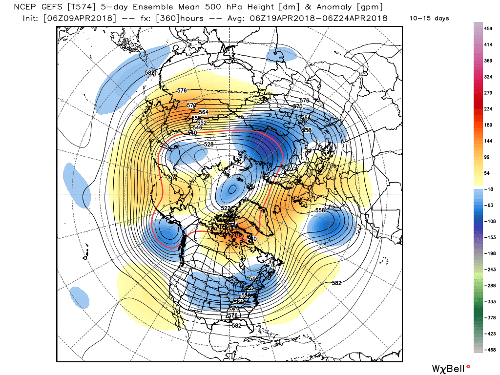
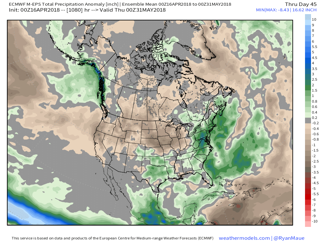 At the end of the day, our call on May’s forecast from mid-April would be for an early cooler than average start before flipping towards more of a seasonable to slightly warmer than normal regime. Our idea all along this spring has been that when this pattern flips, the potential is present to jump right to a summery feel. In the face of the new European Weeklies, we still feel this warmer idea mid and late May is on the table. We’re in agreement with the data of a drier than average month.
 As upper level energy moves overhead, mixed rain and snow showers will fall early next week.
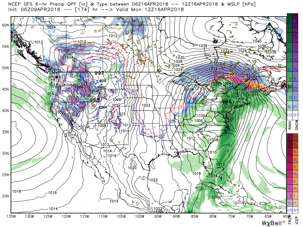 Longer term, the negative NAO will continue to lead to prolonged colder than average temperatures. At this point, we think this pattern will run at least through the remainder of April.
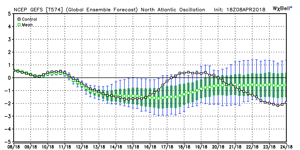 The end result? You know it: a persistent eastern trough and associated colder than average feel…