You must be logged in to view this content. Click Here to become a member of IndyWX.com for full access. Already a member of IndyWx.com All-Access? Log-in here.
The Madden Julian Oscillation (MJO) is back in the null, or neutral, phase.
That means it’s time to start leaning heavier on the teleconnection blend. This time of the year, that encompasses all, including the NAO.
As we look over the course of the upcoming 10-14 days, we note rather strong alignment between the teleconnections favoring a return of a cold pattern. That is, of course, after the taste of spring that will continue into the day Sunday (aside from one “speed bump” tomorrow).
We note the EPO, or East Pacific Oscillation, is forecast negative until around the 12th and then back towards neutral. This is a cold signal for the east, relative to average.
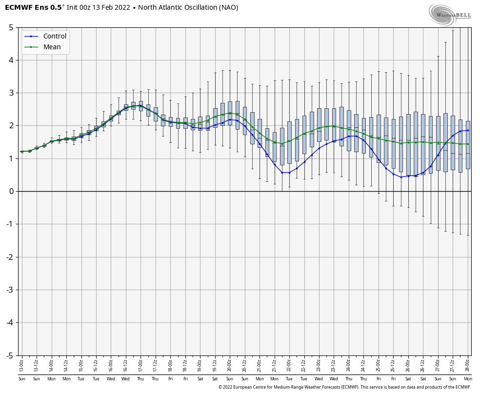
The NAO (North Atlantic Oscillation) is forecast neutral through the bulk of the upcoming couple weeks. – Likely won’t have a significant impact on the overall pattern.
The PNA (Pacific North American pattern) is forecast negative through the 13th before trending neutral. This should allow a southeastern ridge to remain in play to at least some degree which suggests a very active storm track into the Ohio Valley. As the colder air pushes east and runs up against the resistance from the southeastern ridge, late season wintry threats loom towards mid month.
Finally, the WPO (West Pacific Oscillation) is forecast strongly negative which also implies cold should try and fight east.
With all of that said above, we note the ensemble guidance (both the EPS and GEFS) brings the trough back into the central and eastern portion of the country as we move out of the Day 1-6 period and suggests it’s far too early to think about putting away those winter clothes, or even the snow removal equipment just yet…
Upper air pattern- March 3-8
Upper air pattern- March 8-13
Upper air pattern- March 12-17
Note the colder than normal temperatures spilling back into the region next week and the week beyond.
We’re likely far from finished with snow or wintry precipitation either…
Only a couple weeks “officially” remain in meteorological winter. Perhaps it’s appropriate that the pattern is hinting at a vastly different look in the 10-15 day period (much warmer), and for good reason:
Perfect alignment between the MJO and teleconnections.
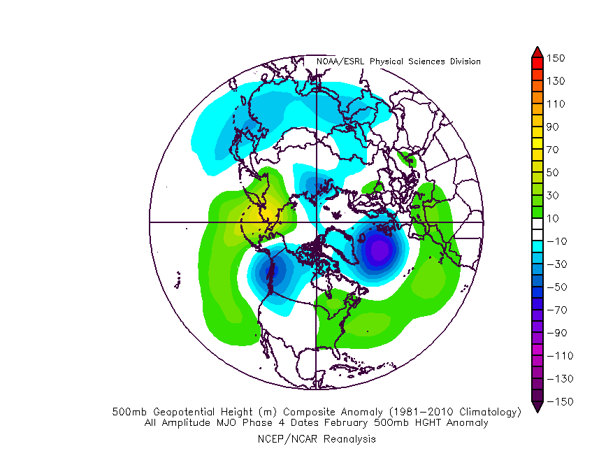
The MJO is forecast into Phase 4 as we put a wrap on February. Analogs show the eastern ridge that typically takes up residence in Phase 4.
All of the primary teleconnections (including the NAO- remember it’s now time to start keying in on the NAO) are in phases that also argue for above average temperatures.
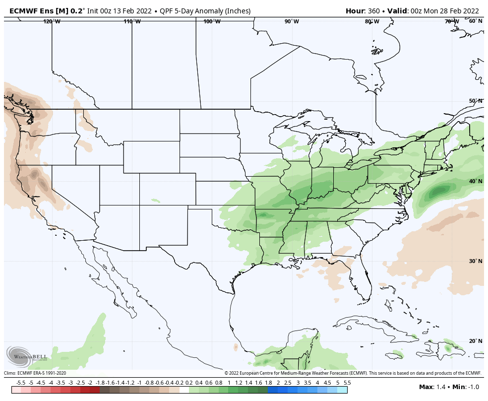
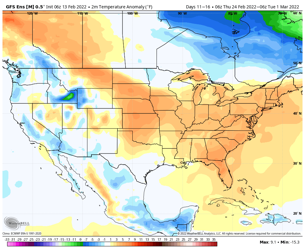
To no surprise, modeling sees a warm, wet (compared to normal, of course) stretch ahead to close February and open March.
European ensemble
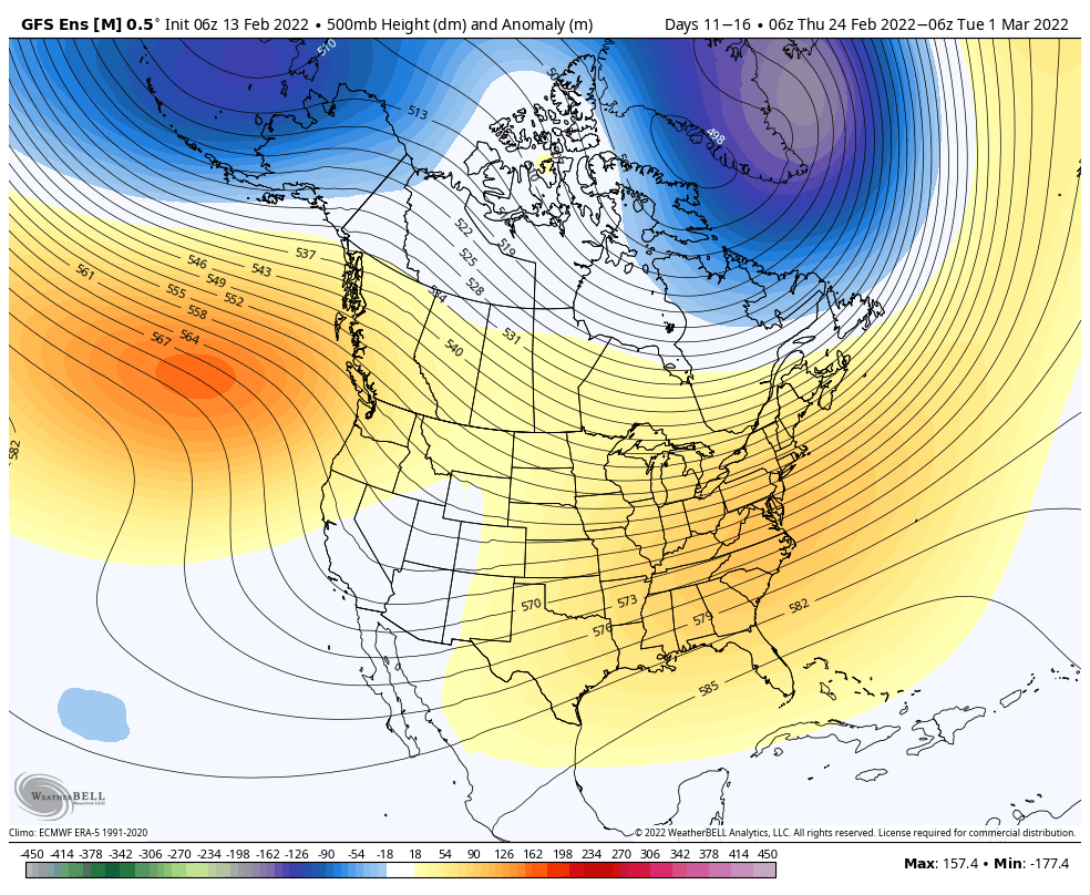
GFS ensemble
Given the blue print laid out above, I’d personally lean more towards the GFS solution (more widespread above normal conditions) over the Euro.
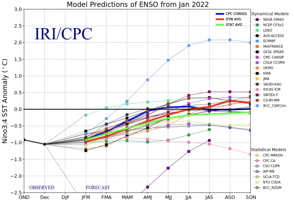
With only a few weeks left in meteorological winter, our thoughts are beginning to shift to spring. A weak La Niña is expected to persist through spring 2022.
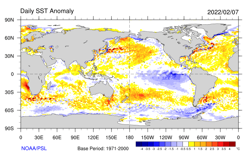
See the cooler than normal central and eastern PAC sea surface temperatures below, courtesy of NOAA’s Physical Science Laboratory.
The IRI/ CPC plume shows the idea of a weak Nina continuing March, April, and May (meteorological spring season).
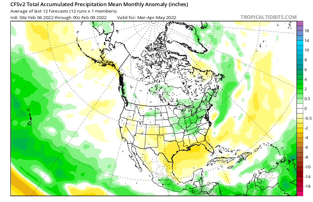
We also like to pay close attention to the SST configuration in the Gulf of Mexico. As the mean trough position pulls into the west, an active storm track is likely to emerge across the Mid West. With warmer than normal SSTs in the Gulf, these storms will be able to tap into the Gulf moisture and this could help spawn bigger rain/ severe weather episodes from the mid-south into the Ohio Valley as the season matures (don’t worry snow lovers, we aren’t finished with the white stuff just yet).
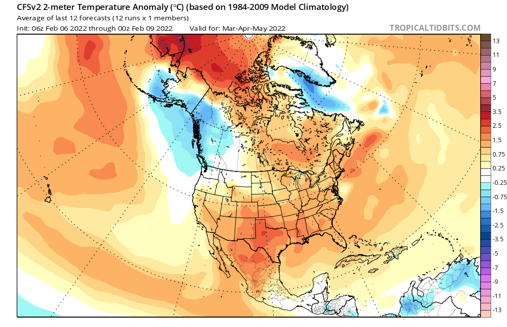
The idea here is for an active spring- complete with a busy storm track through our neck of the woods, slightly above normal temperatures, and a fast start to the severe weather season (especially given those Gulf SSTs). We don’t have any reason to disagree with the overall idea that both the American climate model and European seasonal products are displaying.
Of course the MJO and NAO will play a factor in the shorter term period as spring gets underway. We’ll most certainly monitor closely.
You must be logged in to view this content. Click Here to become a member of IndyWX.com for full access. Already a member of IndyWx.com All-Access? Log-in here.