Category: NAEFS

Sweaters Or Shorts For Christmas?

Before we get into the thinking behind our set-up for Christmas, we want to be very clear in saying the overall warm pattern will continue as we head through the holiday season and into early parts of 2016.  We do see signs of changes brewing that could (and should) lead to a dramatic flip of the coin for the second half of winter.  With a weakening Nino, it’s also likely that the cold and wintry changes last deep into spring this year, but that’s for another discussion down the road.

In the grand scheme of things, mid and long range model data strongly suggests a very warm pattern remains across the eastern half of the nation, while cold dominates the west, through the end of 2015.

CFSv2

NAEFS

GEFSJust to be clear, we’re very confident on the medium range warmth to wrap up the year (and most likely open 2016).  Contrary to how confident we are on the overall warm pattern through the mid range, we’re much less confident with the shorter term pattern that encompasses the all-important Christmas Eve – Christmas Day forecast.  Getting right to the point, the American GFS forecast model suggests we’re dealing with a FROPA (frontal passage) Christmas Eve night that sets up a blustery, colder Christmas with morning snow flurries possible.  The GFS says we make it into the lower to middle 40s for highs Christmas.  On the flip side, the European model (usually, but not always, more accurate than the GFS) says we blow into early summer-like levels with highs around 70 degrees Christmas, including a mostly dry forecast with strong southwest winds.  How does an afternoon BBQ sound Christmas with that sort of idea?!

When we get down to the dirty details, the differences all have to do with the way the models handle the eastern (Bermuda) ridge.  A snap-shot of the 8-10 day ensemble composite (that shows the Euro, GFS, and Canadian) highlights small, but significant, differences with the ridge placement.

Source: Penn State e-wall

Source: Penn State e-wall

The GFS model (and Canadian, as well) suggests we’re dealing with a more progressive pattern Christmas that results in the cold “sloshing” it’s way east much quicker than its’ European counterpart.  Meanwhile, the European model says the eastern ridge flexes it’s muscle going into the Christmas period and results in the warmer, breezy solution as opined above.

When we dig in further, experience tells us we should “raise an eyebrow” to both solutions.  How many times have we seen the biases that both models have impact the mid to long range forecast?  The GFS has an eastern (more progressive) bias while the European has a western (slower)  bias.  Hint: It’ll be important to remember that as we rumble into more active cold and wintry times come mid and late in the season.

To sum things up, while we’re supremely confident in the long term warm pattern to wrap up the year, we remain very cautious with either solution currently being portrayed by either *normally* more-trusted mid range models.  Lets give it a couple more days and see where things go.  I wish we could be more certain with that all-important Christmas forecast, but we simply can’t at this juncture.  Both solutions have been very consistent with their respected idea for the past couple days.  One thing’s for sure and that’s that we’ll be looking at a major model bust sooner rather than later…

Permanent link to this article: https://indywx.com/2015/12/16/sweaters-or-shorts-for-christmas/

Step Down Process To Cold Before The Return Of Truly Frigid Times…

The past 5-7 days have featured a common “January thaw-” something typically seen in even the coldest Januarys.  The coming 5-7 days will see a “step down” process of colder weather, interrupted by a day or two of milder southwest breezes.  In the longer range, we hold firm on the idea of more sustained cold, and potentially frigid air, setting up shop to open February.

See the GFS track the clipper through the lower lakes this weekend.  This is a mild track for central Indiana and will keep the accumulating snows over the Lakes region, extending into northern portions of the state.  Some light snow will fly here late Sunday night/ early Monday, but accumulations should be minimal.

gfs_ptype_slp_conus2_12

gfs_ptype_slp_conus2_16A brief surge of arctic air will invade early next week and may be accompanied by light snow Tuesday.

gfs_ptype_slp_conus2_21A brief southwesterly flow will allow milder air into the region by the middle of next week, but we caution this will be brief.

gfs_ptype_slp_conus2_29Much colder times loom to open February, potentially with a winter storm.  Obviously with this being in the 8-10 day period, there will be a lot of time to watch the storm potential.  Models have struggled mightily with storms this winter so far.  We’re much more confident on the cold, and potentially downright frigid air at that (still don’t think we’ve seen the coldest air of the winter yet).  Note the GFS sees the arctic highs “lining up.”

gfs_ptype_slp_conus2_41The European ensembles and operational are also keying in on the cold and wintry pattern closing January and to open February:

Geopotential32at32500hPa_North32America_216Initially the cold attacks the northeastern portions of the country, but “backs” west with time in the longer range:

Days 5-10

1Days 10-15

2The NAEFS and CFSv2 see the colder pattern returning:

2015012212_054@007_E1_north@america_I_NAEFS@TEMPERATURE_anomaly@probability@combined@week2_186

wk1.wk2_20150122.NAsfcT

We still think there’s a lot of “winter” left in the coming months.  Many folks enjoy snow Christmas into January, but begin to crave spring in February and March.  This is the type pattern that can be quite “ugly” for spring lovers as colder and snowy weather can push well into the spring months…  (Noted that we still have a lot of catch up to do in the snow department, but we’re not ready to say we won’t make up for “lost time”).

Permanent link to this article: https://indywx.com/2015/01/22/step-down-process-to-cold-before-the-return-of-truly-frigid-times/

Short-term Cold; Mid-range Warm…

There’s been a ton of conversation as of late about where this overall weather pattern is heading.  Perhaps it’s the Christmas season that brings out the conversation as everyone is hoping for that cold pattern to provide a White Christmas.

While in the short-term cold will continue to dominate, we’re becoming increasingly confident of an unseasonably mild stretch of air in the mid-range period.  That’ll take us up to the week before Christmas…

In the short-term, the positive PNA will continue to be the primary driver in our pattern.  This will ensure a colder east through the majority of week 1 (through next Friday).

pna.sprd2

A positive PNA pattern typically leads to below normal heights (trough) and associated cooler than normal pattern across the eastern region.

A positive PNA pattern typically leads to below normal heights (trough) and associated cooler than normal pattern across the eastern region.

Modeling sees the cool east in week 1 and warm west- typical of a positive PNA pattern:

gefs_t2anom_by5_conus_29

There are changes in the mid-range period that’ll have lovers of winter and cold frowning.  Many of our long-term readers know how we use the “typhoon rule” as a good indication of what we can expect across our region 6-10 days down the road.  As stated multiple times in the past (want to give credit where credit is due), we learned this from the great Joe Bastardi.  For those that are new here, I’ll describe this very briefly (you can read through the archives, if you’d like, for a longer/ more detailed description).  Typically when you have a recurving typhoon in the WPAC, that suggests a trough (colder pattern) across the central and eastern Lower 48.  On the flip side, when you have a westward moving typhoon, that’s a good indication of eastern ridging (warmer pattern).

Courtesy of the Joint Typhoon Warning Center, Super Typhoon Hagupit is forecast to move on a general westward trajectory.

wp2214

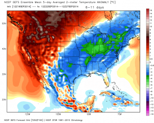
This is a very good sign of a much milder than normal period in the mid-range (days 8-12).  Modeling, in return, is going towards a warm pattern (associated ridge) week 2:

test8

The GFS ensembles and NAEFS agree on the warmth and given what we’ve discussed above, so do we:

2014120412_054@007_E1_north@america_I_NAEFS@TEMPERATURE_anomaly@probability@combined@week2_186

D12

In fact, it wouldn’t surprise us to see high temperatures in the 55-60 degree range during a day or two week 2.

Really quick and before we end- lovers of winter weather, there’s absolutely NO reason to throw in the towel.  In fact, indications in the long range suggest the trough collapses into the east during the week leading up to Christmas and that could provide for all sorts of wintry “mischief” when almost all of folks are wanting snow…

Much more on that in the days ahead.  Have a great night!

Permanent link to this article: https://indywx.com/2014/12/04/short-term-cold-mid-range-warm/

Changeable Monday; Note On Thanksgiving; Warm Open To December…

We wanted to touch on a few items of business this evening.  There’s a lot of weather going on this week…

Monday will feature drastic changes in the weather department across central Indiana:

  • Day starts mild and with lingering showers.
  • Strong and gusty winds will reach speeds of 45-50 MPH.  Batten down the hatches!
  • Temperatures crash late morning into the afternoon.  We start in the lower 50s, but fall to the freezing mark for the drive home across western parts of the state.  Eastern Indiana will see 32 degree air by 7-8 o’clock.
  • Scattered snow showers and flurries will fly across central Indiana Monday evening.

Thanksgiving Cold And Snow:

Temperatures will be much colder than average (low to mid 30s for highs and middle 20s for lows).  We’re still tracking a weak disturbance that could distribute light snow across central Indiana Thanksgiving Day.  Accumulations, if any, would fall in the dusting to less than 1″ range.

Opening December Warm:

We’ve been talking about how this exceptionally cold and wintry early season pattern would have to “relax” at some point and that appears to be the case as we open December.  The potential is there for well above normal warmth for the first week to ten days of December before we reload the pattern and introduce colder, more wintry times for mid and late month (anyone dreaming of a White Christmas)?

B3Kv8sVIEAASt_2

Permanent link to this article: https://indywx.com/2014/11/23/changeable-monday-note-on-thanksgiving-warm-open-to-december/

Weekly Outlook: Heading Straight Into Winter

November is off to a cold start, but a byproduct of the unseasonably cold pattern is a relatively dry one, as well. Brisk southwest winds are blowing this morning and…

You must be logged in to view this content. Click Here to become a member of IndyWX.com for full access.  Already a member of IndyWx.com All-Access?  Log-in here.

Permanent link to this article: https://indywx.com/2014/11/08/weekly-outlook-heading-straight-into-winter/

Quick Wednesday Evening Video Update

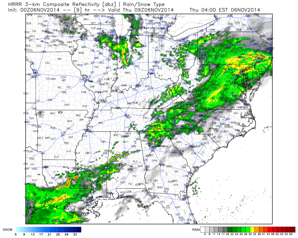
Quick Wednesday evening video update discusses the threats of rain, snow, and arctic cold in our future.

Showers will target the region along with gusty winds and colder air Thursday!

Showers will target the region along with gusty winds and colder air Thursday!

By the way, if you, or your business, can benefit from longer, more detailed video discussions and winter weather updates be sure to e-mail us about our personal and professional weather consulting services at bill@indywx.com.  Have a great evening!

Permanent link to this article: https://indywx.com/2014/11/05/quick-wednesday-evening-video-update-2/

More On The “Typhoon Rule”

Perhaps you’ve heard folks discuss the “typhoon rule” over the past few weeks. What I despise is when people take credit for certain ideas without giving credit where credit is…

You must be logged in to view this content. Click Here to become a member of IndyWX.com for full access.  Already a member of IndyWx.com All-Access?  Log-in here.

Permanent link to this article: https://indywx.com/2014/09/22/more-on-the-typhoon-rule/

Catching Up On A Tuesday Evening…

Several interesting weather items are on the docket and each will have to be dealt with as they come over the course of the upcoming 7 days.  Some of the headlines include a brief warm-up Saturday, weekend rain that could include a tropical connection Sunday, and another big shot of October-like chill next week.

While we have a few more days of below normal temperatures in front of us, we eye at least one day where temperatures will manage to climb above normal and that’s Saturday.  All indications still suggest we’ll be very close, if not a degree or two higher, than the 80 degree mark along with a nice southwest air flow in place Saturday.  All-in-all, it’ll be a great day to take care of any early-autumn yard work that’s needing to get done.

Changes brew Sunday as a cold front draws near.  This is where questions lie and they actually have to do with Tropical Storm Odile (currently all the way to our southwest over the central Baja California peninsula region).  Odilemoisture

While the GFS and European forecast models still aren’t interested in “welcoming” Odile’s moisture into the region, we note the Canadian model does suggest some tropical moisture, courtesy of Odile, gets entangled along the front Sunday.  We’ll continue to keep a close eye on things and monitor the forecast data accordingly moving forward through the back half of the work week.


The other item of interest has to do with yet another big blast of autumn air that will have things feeling very much like October around these parts come early next week.  The above average temperatures Saturday will hang around just for the day as yet another unseasonably chilly air mass moves into the area Monday into Tuesday of next week as a significant trough develops over the east with an impressive western ridge in place.  f156


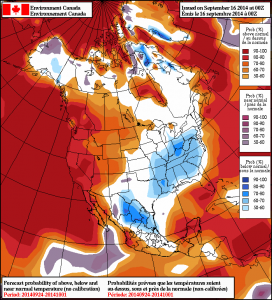
Note the GEFS and Canadian show the return of the unseasonable chill next week.  Keep those jackets handy.  Early indications would suggest this type air mass is plenty capable of highs in the upper 50s/ lower 60s and overnight lows in the upper 30s/ lower 40s during the height of the chill (most likely Tuesday).  Stay tuned…

2014091600_054@007_E1_north@america_I_NAEFS@TEMPERATURE_anomaly@probability@combined@week2_198gefs_t2anom_by5_conus_45


Permanent link to this article: https://indywx.com/2014/09/16/catching-up-on-a-tuesday-evening/

Severe Weather Threat Tuesday

Tonight’s video update highlights:

  • Tuesday severe threat
  • Big-time weekend heat
  • Cooler pattern to wrap up August

The Storm Prediction Center has outlined a risk of severe weather Tuesday across the state.

The Storm Prediction Center has outlined a risk of severe weather Tuesday across the state.

Permanent link to this article: https://indywx.com/2014/08/18/severe-weather-threat-tuesday/

Cool Close To The Work Week; Longer Range Talk…

Clouds will increase this evening and an isolated shower is possible though most will remain dry.  More on this and a look ahead to the weekend and beyond in the…

You must be logged in to view this content. Click Here to become a member of IndyWX.com for full access.  Already a member of IndyWx.com All-Access?  Log-in here.

Permanent link to this article: https://indywx.com/2014/08/13/cool-close-to-the-work-week-longer-range-talk/

IndyWx.com