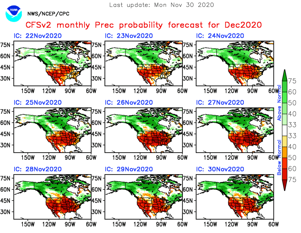
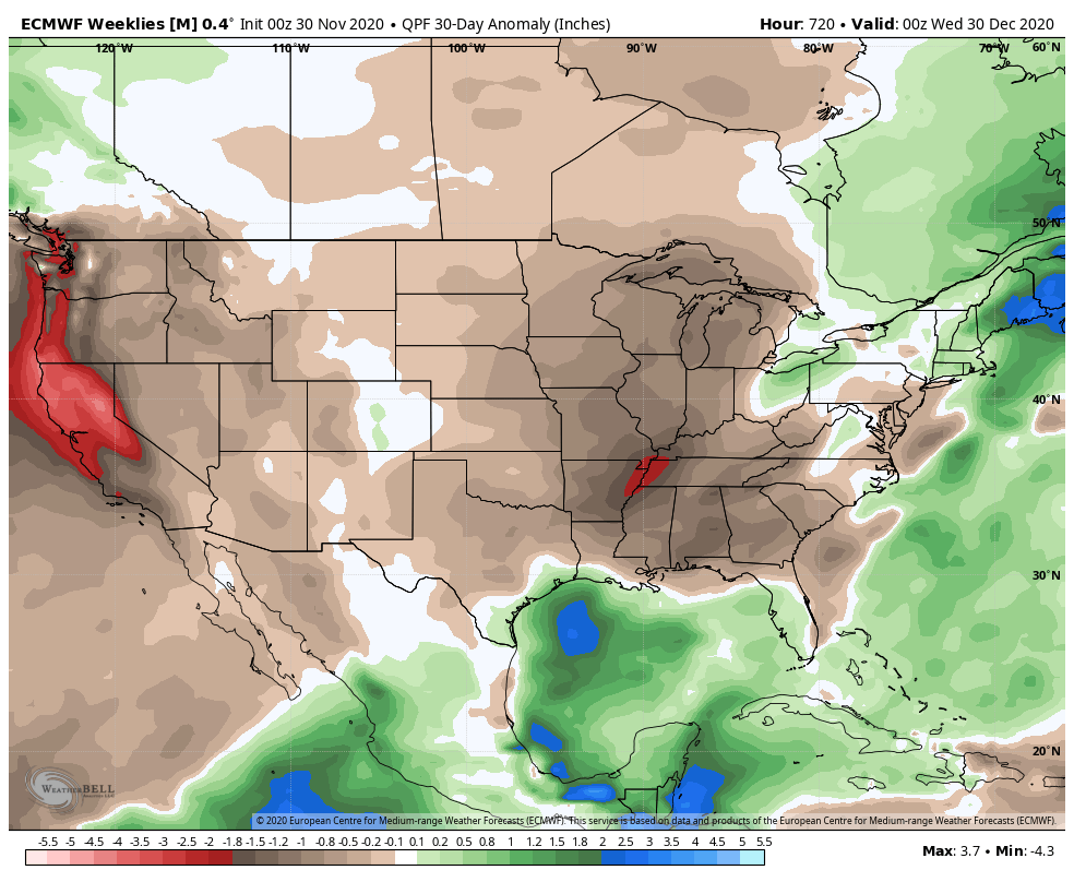
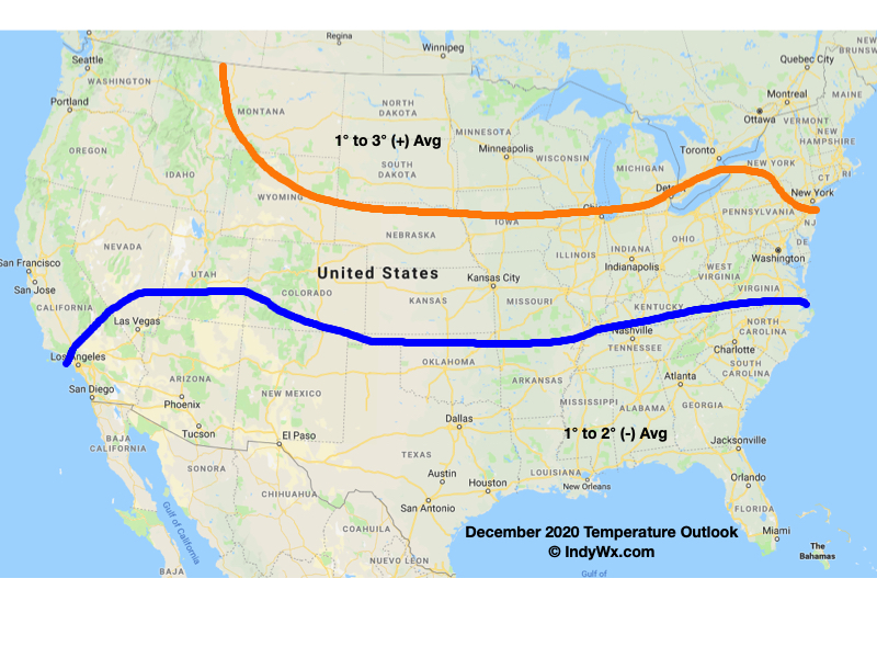
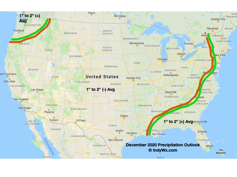
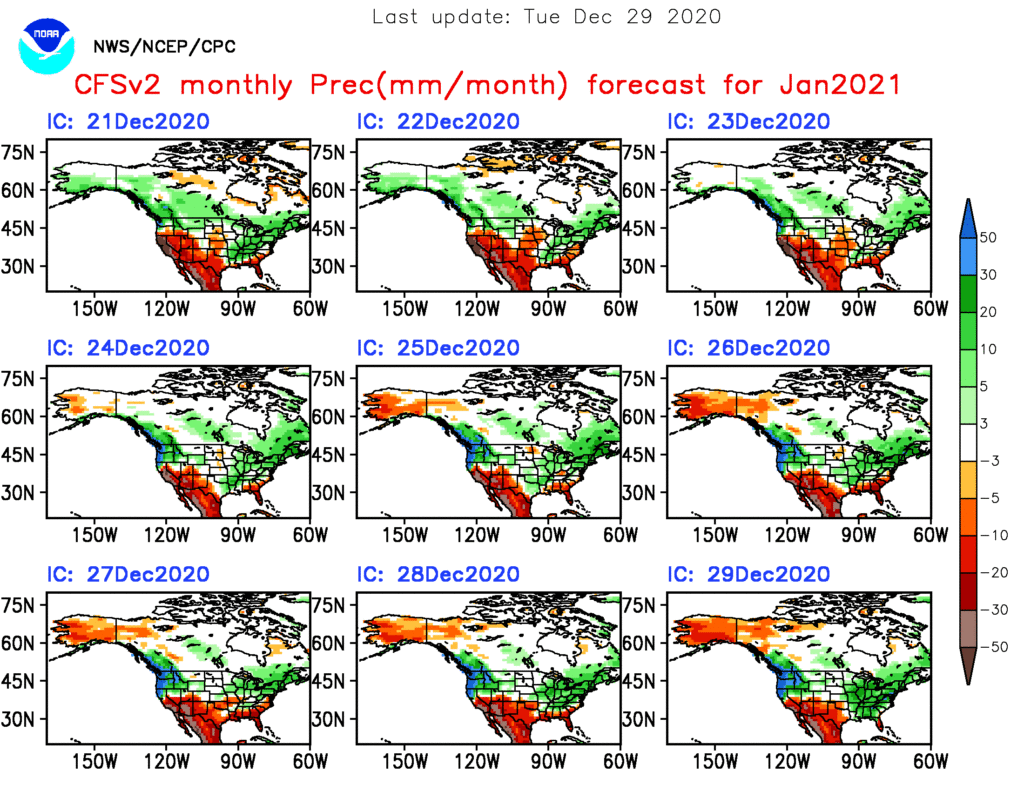
As we get set to flip the calendar to a new year, does the similar pattern that dominated in December roll over to January? Yes and no. While we anticipate the relative warmth to remain intact through the majority of the month, the storm track looks to aim itself through the Ohio Valley region for the better part of the month, helping generate above to well above average precipitation.
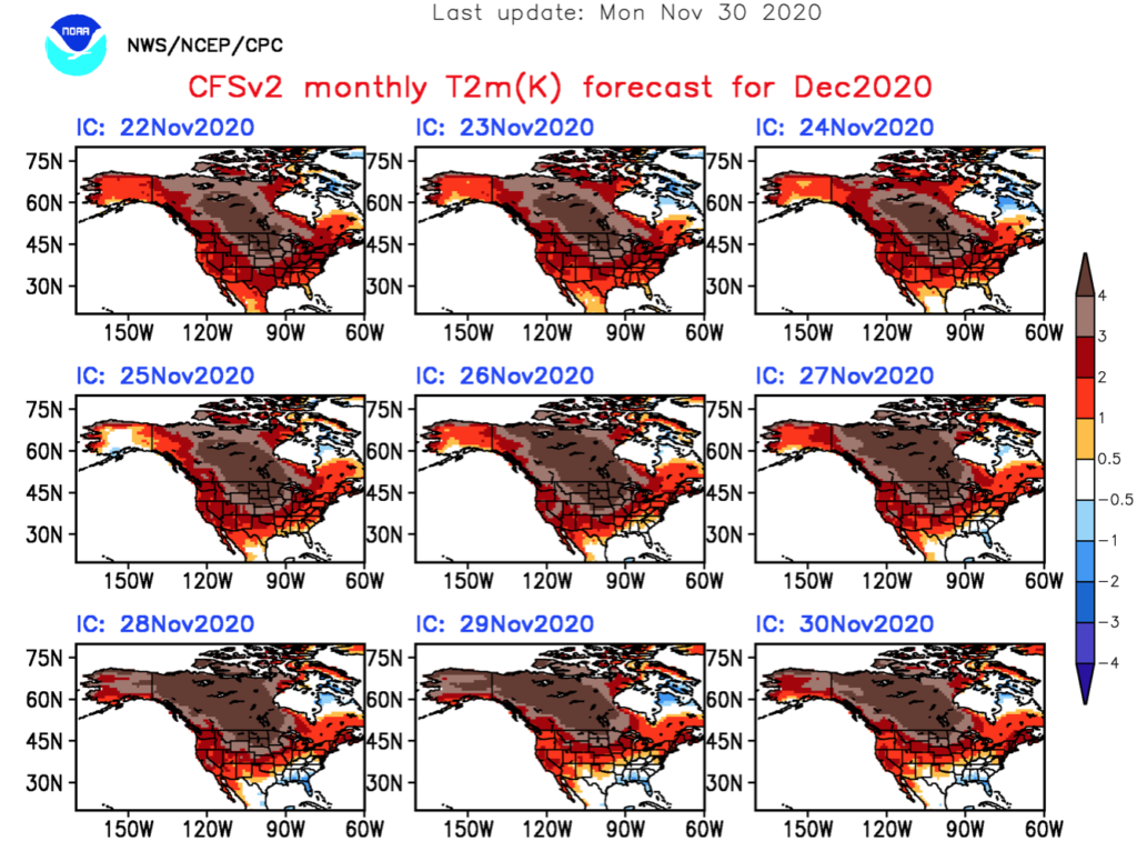
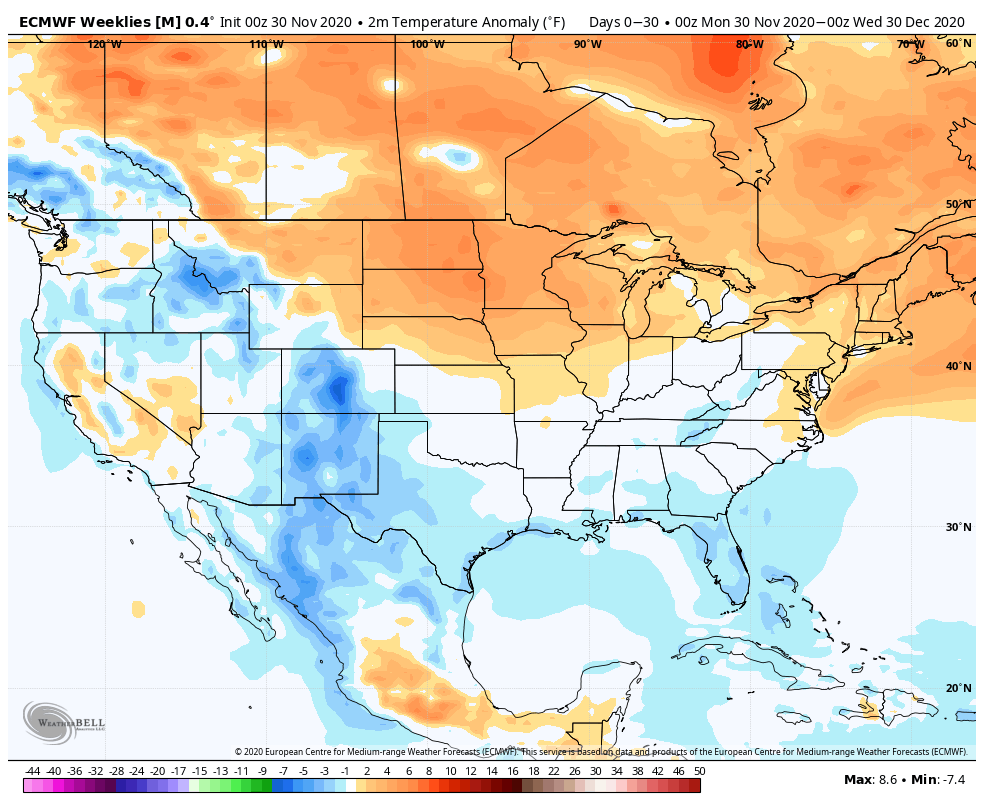
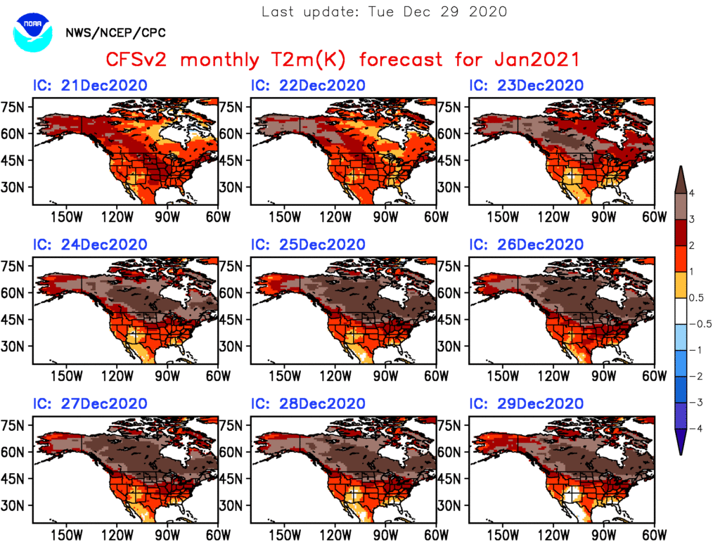
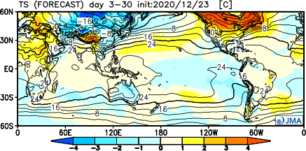
Forecast Models: Note the consensus on the warm (relative to average, of course), wet theme.
CFSv2
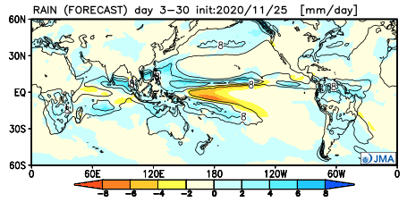
JMA

European


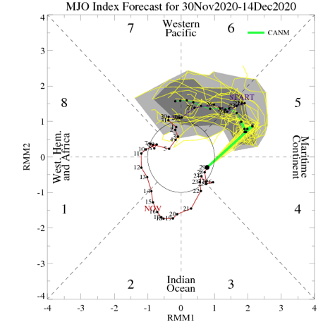
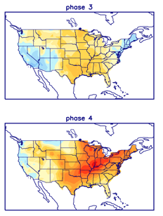
The MJO is becoming increasingly interesting. The European modeling wants to keep the MJO in the “null” phase, but the American modeling is showing the MJO get more amplified with time as we go through early-mid January.

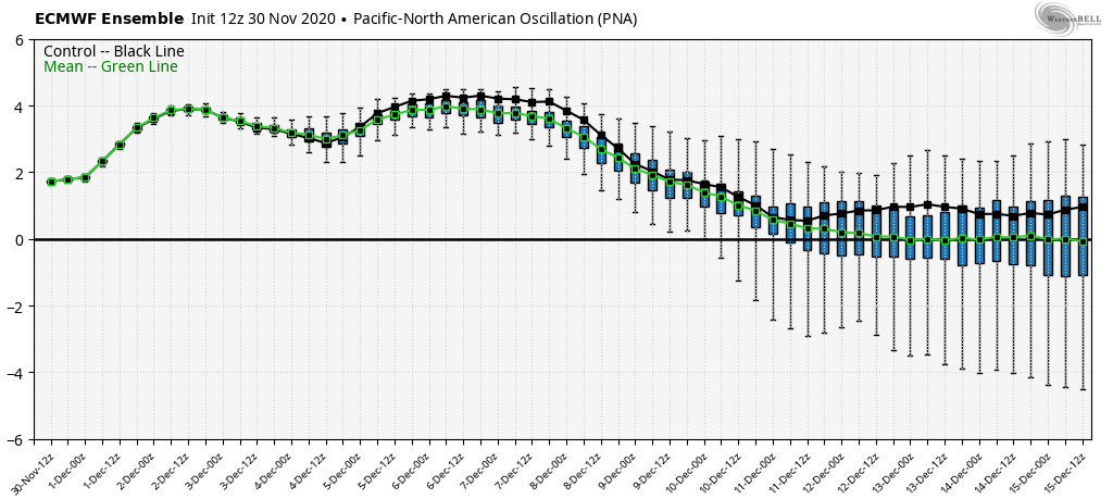
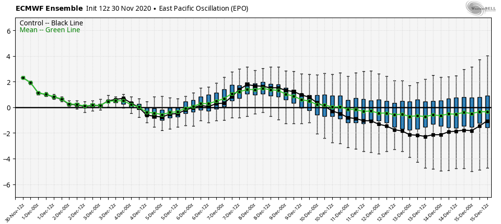
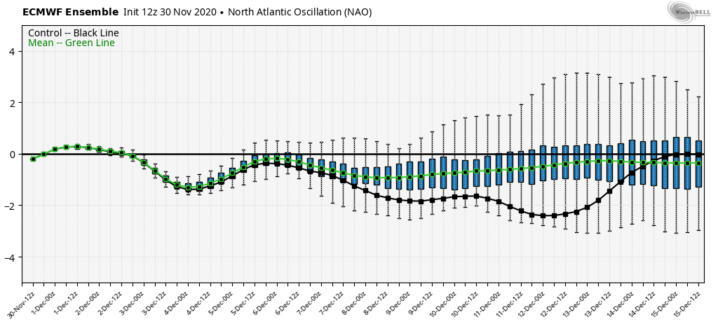
Despite favorable phases for cold (AO and NAO), the Pacific pattern (namely strongly positive EPO) is wrecking havoc on any sort of cold trying to get involved in the pattern with any sort of staying power. Unless we can get a disruption of the polar vortex (big “IF” at this point), the relative warmth should continue to dominate.

We think this will be an active month with multiple storms of significance impacting the Ohio Valley. Despite our thinking that relative warmth will dominate, remember January, climatologically speaking, is the coldest month of the year. It would only take 1 or 2 of the expected storm systems tapping into only marginally cold air to generate more meaningful wintry weather and this is something we’ll keep an eye on in the weeks ahead.