
For those that may not have had an opportunity to review our December Outlook over the busy Thanksgiving weekend, you can do so here.
This morning, we wanted to again review our forecast and provide further context behind our overall active, warmer than normal call for the month as a whole.
Before digging in to those additional details, here’s our 2019 December Forecast:


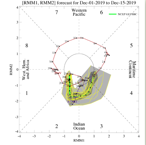
The “baseline” of this slightly-moderately milder than normal December is due to what appears to be the tendency of the MJO to run into the warmer phases (remember, Phases 3-5 this time of year argue for warmer than normal conditions across the East). The most updated MJO forecast continues to stay the course here.

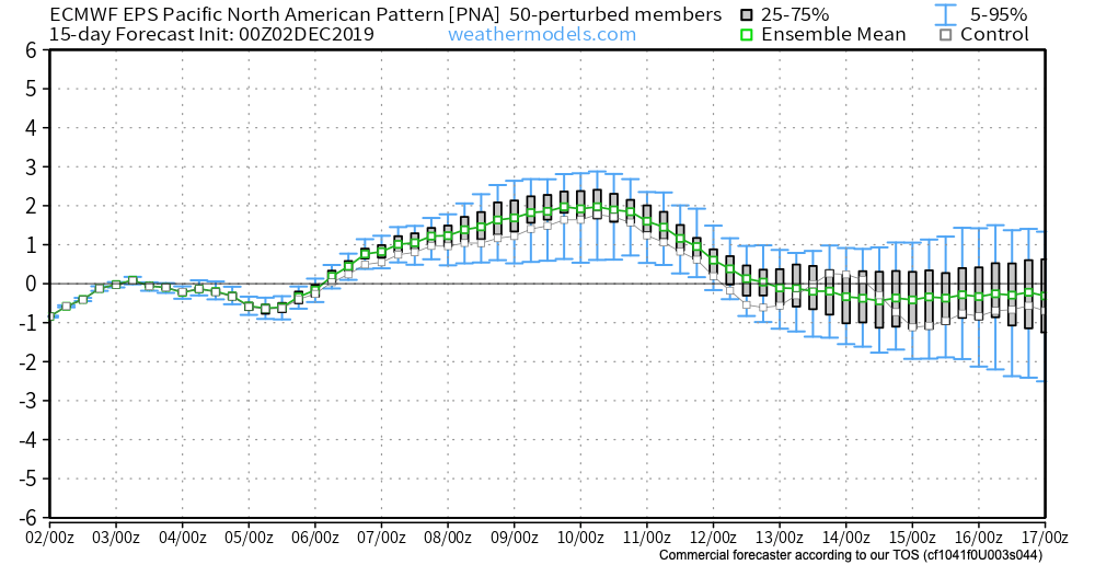
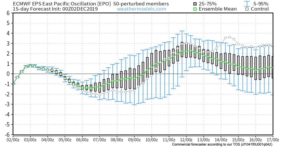
At least through mid-December, the PNA and EPO are also forecast to be in phases that would support warmer than normal conditions across our portion of the country in the overall sense.
This isn’t to say that we won’t have cold and snow to deal with at times this month. We just believe the colder, wintry conditions that may present themselves will be transitional and that warmth will win out at the end of the day.
As we look ahead, there’s reason to believe other factors will come into play that will begin to change the pattern towards one that’s more suited for prolonged cold around, or just before, Christmas. Furthermore, despite the relative warmth forecast for the month of December, we remain firm on the idea of a colder, snowier than normal winter season.